
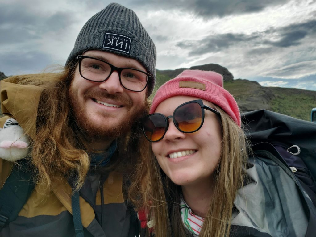
This was our longest hike that we took on. The views were incredible, the people were wonderful, and the walks were arduous. But it was a brilliant and memorable 8 days.
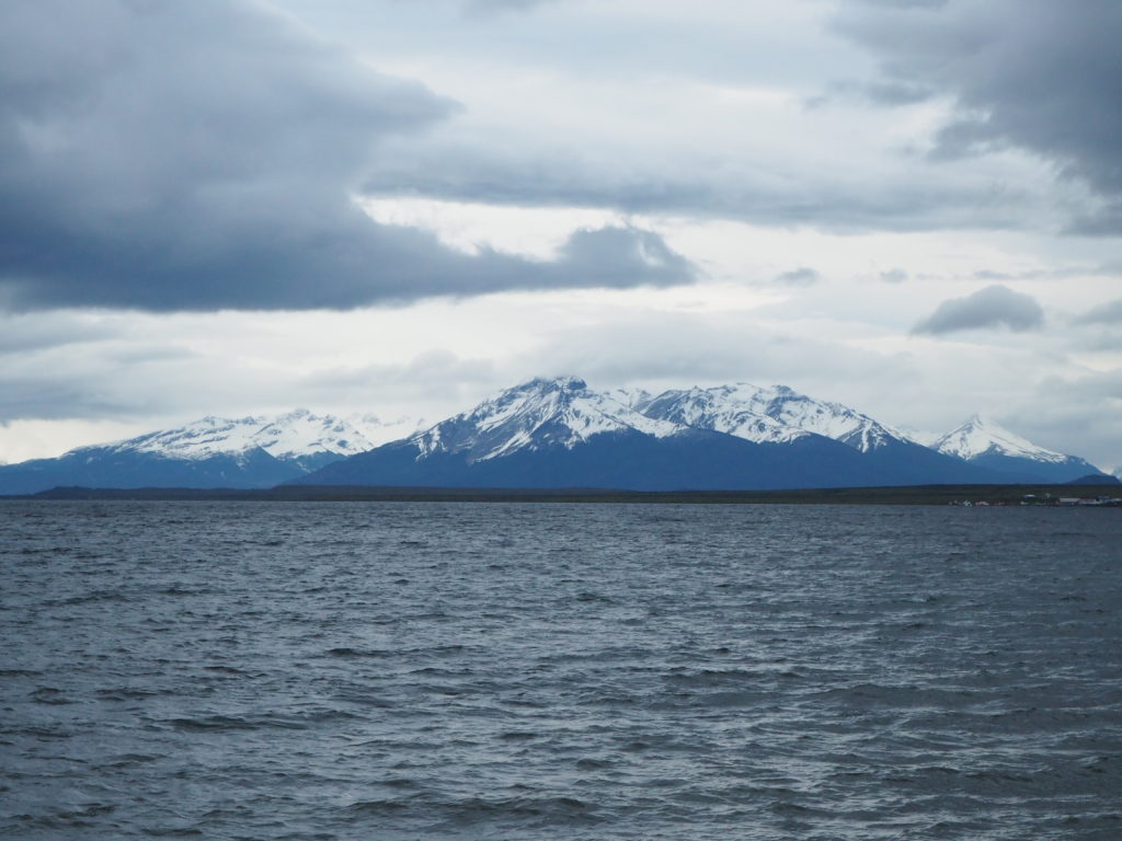
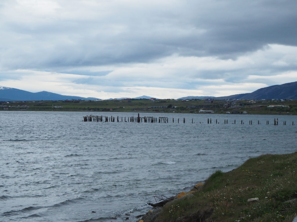
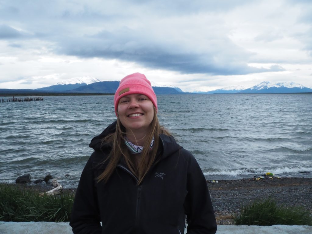
It was an easy morning bus to the port/ tourist entry town of Porto Natales. The small seaside town came into view a couple hour into the ride, but it wasn’t the ocean that we were here for. It wasn’t even Porto Natales that we wanted. Two hours by bus to the north lies the world famous Torres del Paine national park. Thousands of tourists descend to the area every southern hemisphere summer to trek to the famed mountain towers, and the surrounding area.
When you google “top hikes to do in Patagonia” the O/W trek in Torres del Paine will definitely come up. It is inarguably the most infamous hike in the entire Patagonian region. Everyone we met in the region either did the O or the W. It was something we were very excited for, and planned a large amount of our trip around.
Porto Natales was cool though. We had a really good pizza for lunch. The ocean (bay really) had some beautiful mountains on the other side of it. We packed our bags with the food we carried over from Argentina, a grand feast of oatmeal’s, dried pastas, trail mixes and soups. These would be our entire sustenance for the next 8 days. We texted our friends and family goodbye, and began the 8 day O-Trek in Torres del Paine.
Torres del Paine: O-Trek
Distance: 138.25km
Elevation: 5576m
Torres del Paine national park is located in Southern Chile, and is the international highlight area of Chilean Patagonia. The centerpiece of the park is the Torres del Paine (Towers of the Paine), three central mountain spires located in the middle of a massif. The whole park consists of many day hikes and two longer treks, among other boating and horseback expeditions.
The W-Trek is the more famous counterpart to the O. The trail is shaped like a W, with different viewpoint highlights at the end of the three points. There is the Grey Glacier, a large glacier tongue that descends from the massive Patagonia ice fields into a lake. The second middle prong is the Britannica viewpoint, a 360 lookout with mountain on three sides, and the valley and lake on the other. The final prong is the Torres del Paine lookout, towers in the back, lagoon in the front. The O encompasses the the entire W, but then adds four days on the backside of the park, walking along more lakes and over the John Gardiner pass.
We found the people on the O-Trek fit into three general categories. The first and most populous was that of Americans who travelled 24 hours just for the trek. The second was long term travelling Europeans who were capping off their South American journeys, similar to us. And the third was crazy trail runner super trekker people who were knocking the whole thing out in 5 or 6 days. We met a few of those.
Day 1: Laguna Amarga to Seron
Distance: 20.36km
Elevation: 546m
Time: 5:46
It was another early morning bus to the park. We were joined by a bunch of other sleepy trekking hopefuls. Some were going to be joining us for the O. Many were doing the W. Some had a day trek up to the Torres. Others were going horseback riding, or maybe a kayak or boat ride. But we all had the idea of a grand adventure in the wilderness.
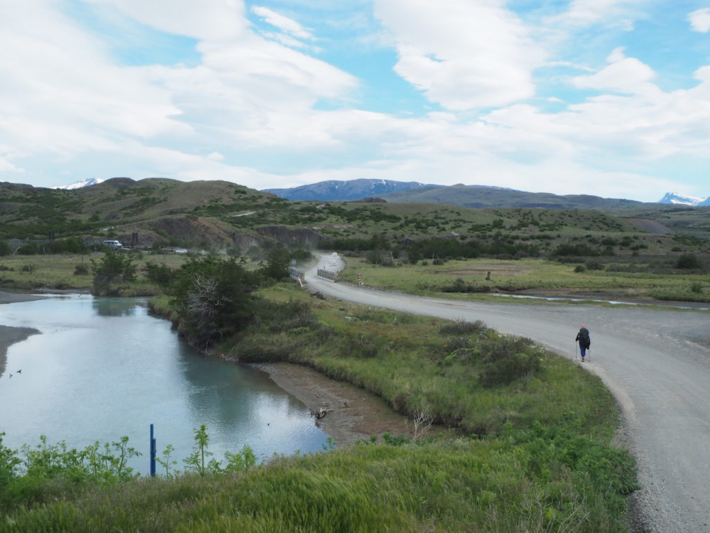
We got off at the Laguna Amarga entry point. This entrance is 7km away from the start of the O-Trek, and were not sure why the bus doesn’t just go all the way. We figured it out quick though, they want you to pay for a shuttle. Screw that! There’s a different path to the first camp just a little down the road. We met another couple, John and Sarah from Nebraska, who had the same plan. They departed before us.
The other path was closed for restoration, so we ended up walking the full 7km down the road to the welcome centre. We couldn’t swallow our pride and turn around to go back on the shuttle. So we went for a grumpy walk to the trail head instead, with a gorgeous view of the towers, and a dust cloud beside us every 5 minutes. We met John and Sarah there again, who endured the same closure fate as us. We learned that they were on their honeymoon! A three week adventure in Chile for them.
The welcome centre was some more money grabbing nonsense, similar to the shuttle. They wanted you to pay 1000 pesos for a map! What is our $50USD entrance fee going to if we have to pay for a map? For the sake of brevity, I will do all of the money grabbing ranting in this paragraph, and then leave it alone for the rest of the blogs. Chile has monetized this park to a completely unhealthy level due to its international notoriety. Each campsite was absurdly expensive. There were catered meal options that were priced at extortion rates. Those meals gave some of our friends food poisoning. We ran into volunteers, not workers that were fixing the trail at one point. Where is all our money going?
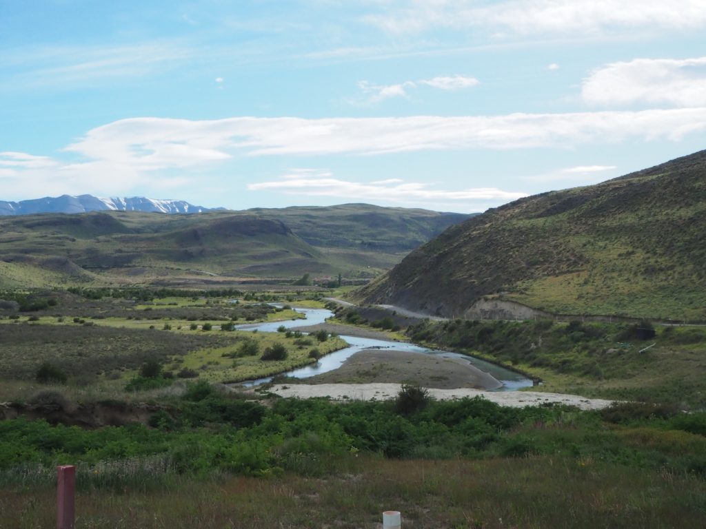
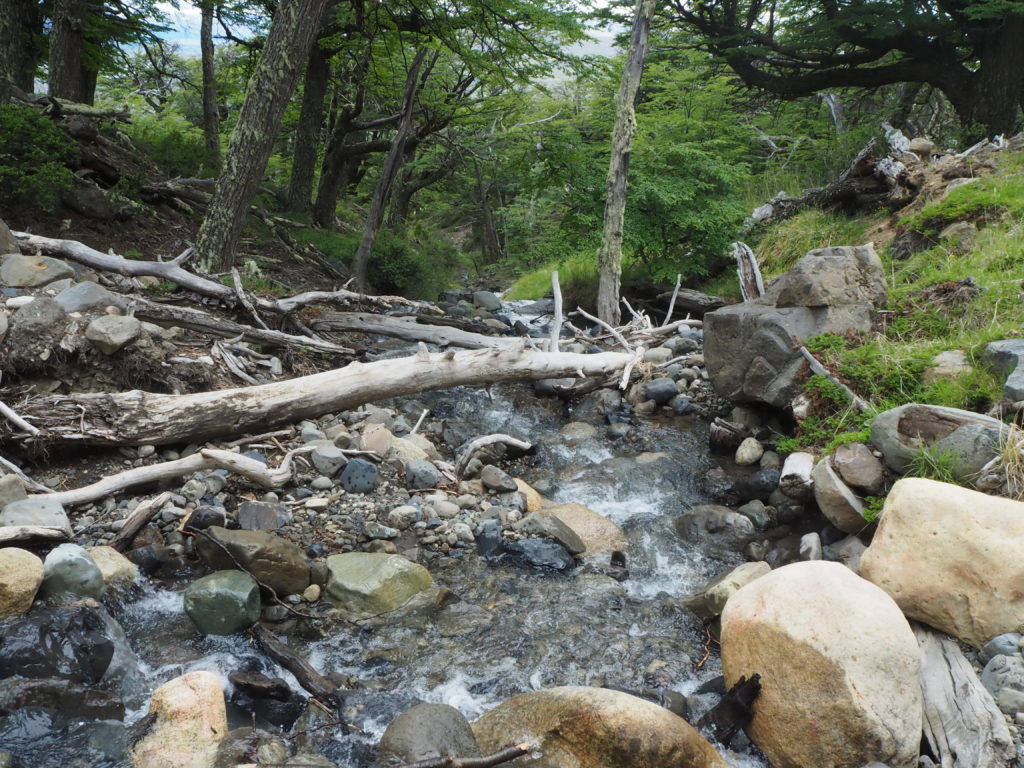
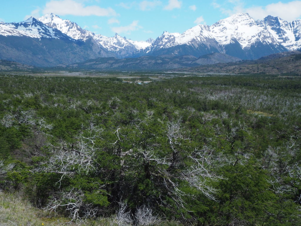
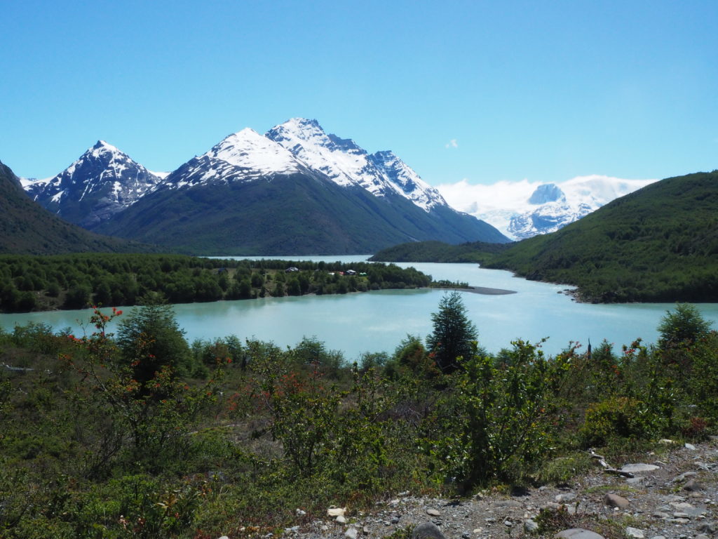
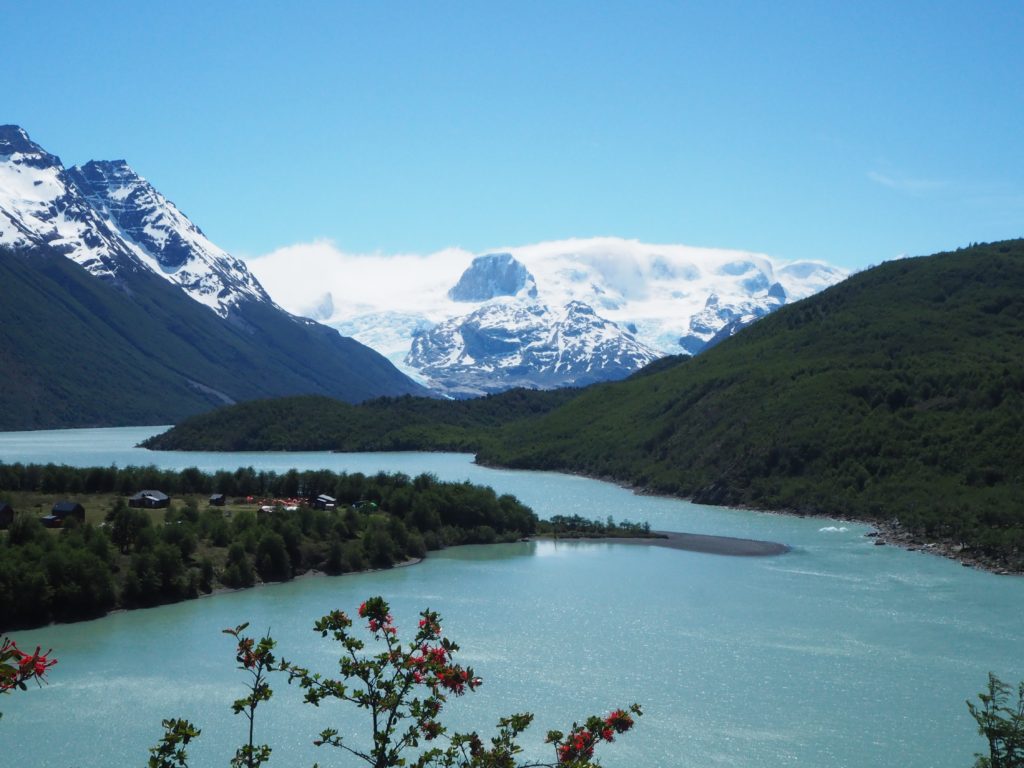
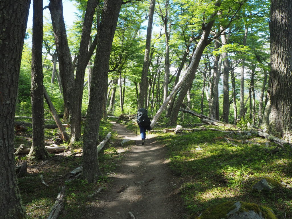
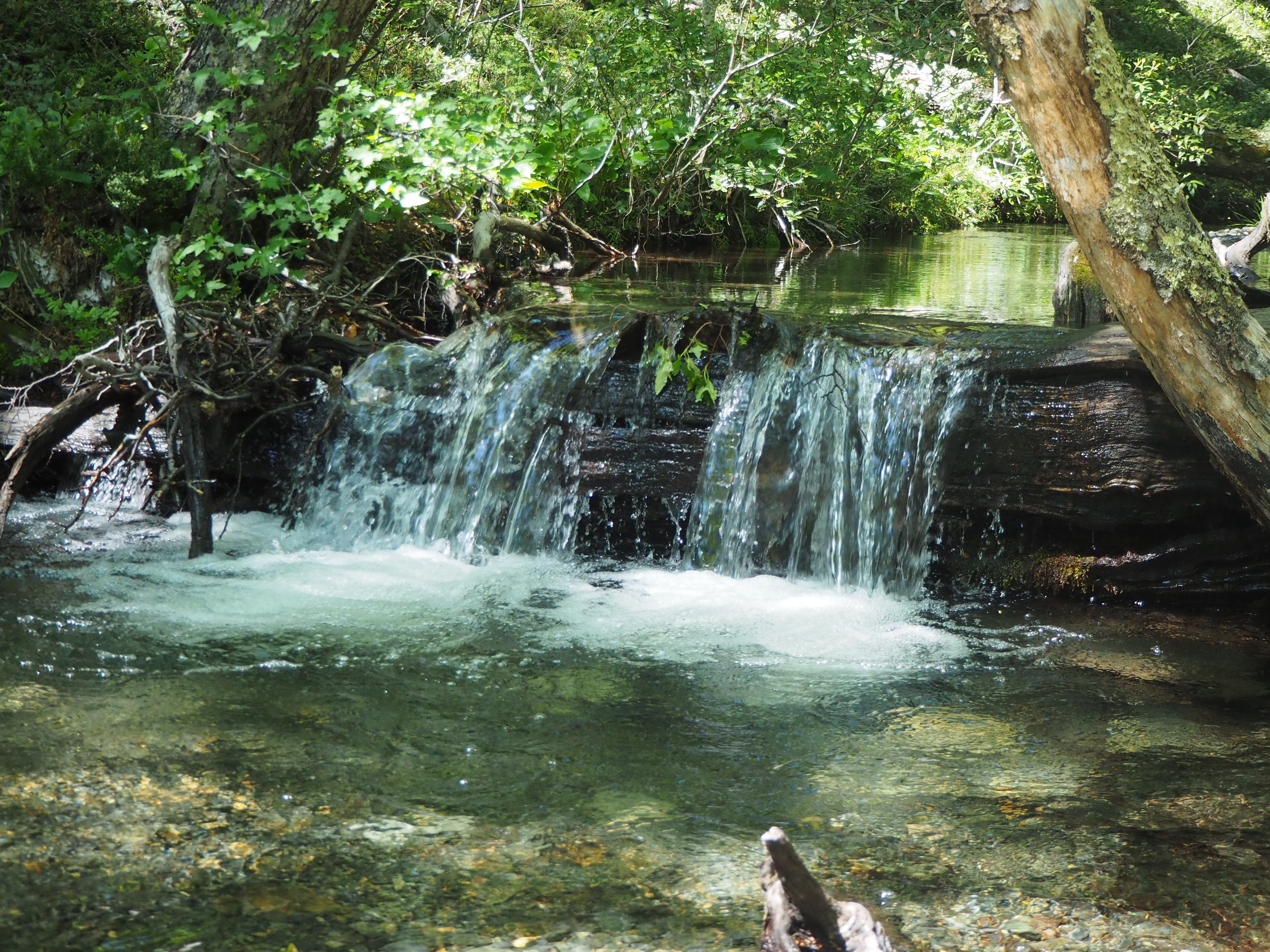
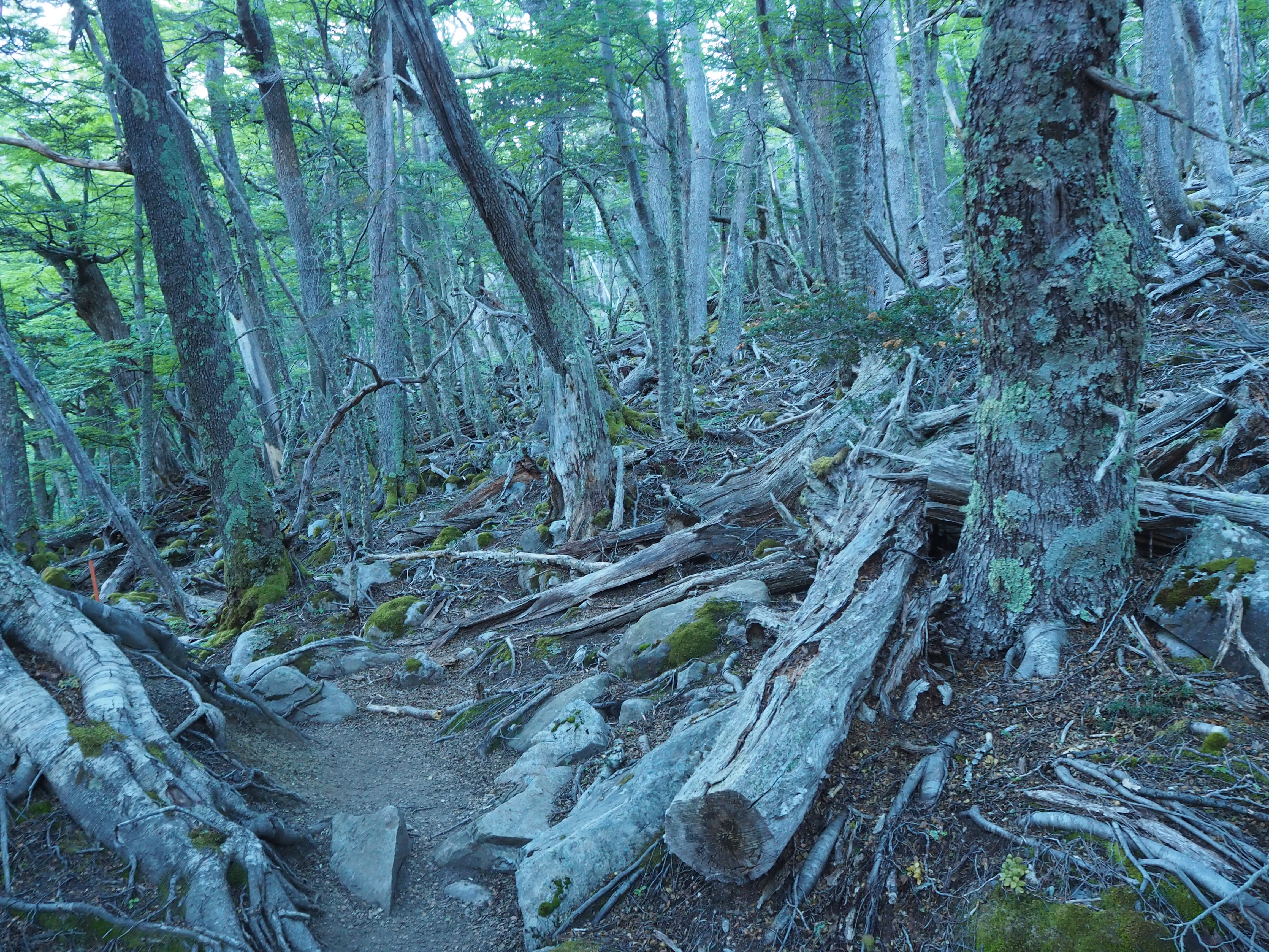
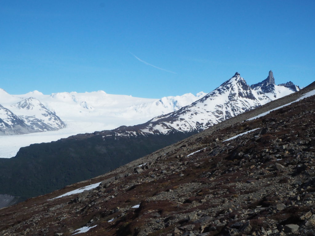
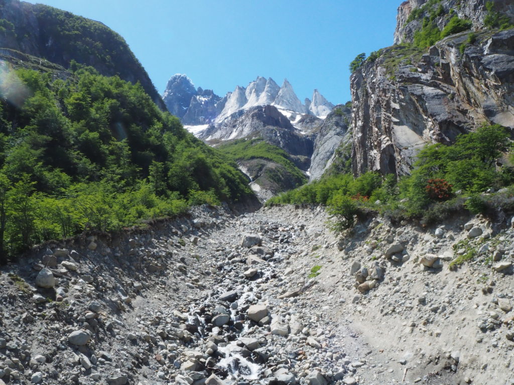
Rant over, and now officially on the O-trek. The welcome centre had some lovely views of the park, including that of the still visible Torres del Paine, which would be the highlight of our final day. After a trail mix snack, we headed out on the official trail to Seron campground. The landscape around the path initially brought us through some light forest. The trail was somewhat muddy, with small streams cutting through the path.
Day 1 ended up being, compared to the rest of the hike, a walk just for the sake of walking. There were more rolling hills than mountains in this area compared to the rest of the park. It was mostly in the trees as well, restricting the view of the surrounding nature. There were slight glimpses of the landscapes around every kilometer or so.
Camp was a bit strange. This camp, as well as all of the rest, had an area where you could pitch your own tent. It also had an area of pre-made set up tents, with a small restaurant where hikers got their pre-ordered meals. Some flushing toilets were located on site. They were always clogged cause people kept putting toilet paper down them. Wi-Fi was also available for a heavy cost.
There’s a cookhouse for us plebs to cook our own food and this is where we met most of the people we would be hiking with for the next 8 days. We had dinner with John, Sarah, and someone named Michael who was a professor from a law school in Washington. He was supposed to be grading final exams but was doing this instead. “I’ve got a week and a half before they notice that I’m gone,” he said. Everything would be handed in before the deadline.
Since we are carrying all our equipment for the hike (food, tent, sleeping bag, sleeping mat, stove, propane…) We got to eat whatever cup of noodles we found in the grocery store. The first night we had some dehydrated pasta noodles with a red sauce. We just had to add water and let it sit for 5 minutes. We added to much water so the meal wasn’t very good but we had some salami with it to try and salvage the meal. Luckily, we had 7 more nights to figure it out.
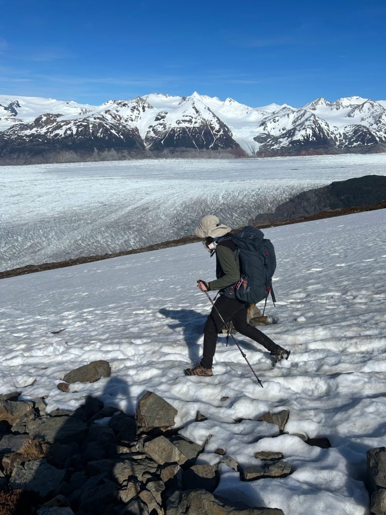
The tent set up location was a patch of grass was in the middle of an open field with no tree coverage. The night was super windy, and we didn’t get much sleep because we were scared the tent was going to blow away. Another fun fact abut Patagonia, its suppose to be one of the windiest places on earth. Our tent did not like the wind one bit. The rods kept bending a lot. We heard through the grapevine that someone’s rod snapped that night. We were expecting the windy conditions for the entire hike.
Day 2: Seron to Dickson
Distance: 18.55km
Elevation: 638m
Time: 6:18
Day 2 is where the trek really picks up. This day had views throughout, following the Rio Paine to Lago Dickson. We had our first breakfast, an enjoyable bowl of oatmeal with dulce de leche and smartie trail mix. We had this breakfast every morning, and the bowls got slightly less delightful over time. But for now, it was wonderful.
We set out in the later morning, and were quickly joined by John and Sarah for the majority of the day. They caught up to us 15 minutes into the hike. It was really nice hiking with them for the day, chatting about our respective lives and relationships, how we all met each other, plans for the future. Standard young adult stuff. They were enjoyable good hiking buddies to have around.
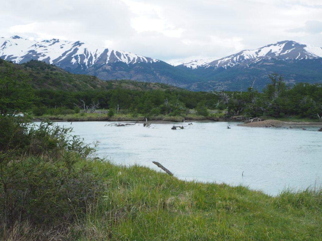
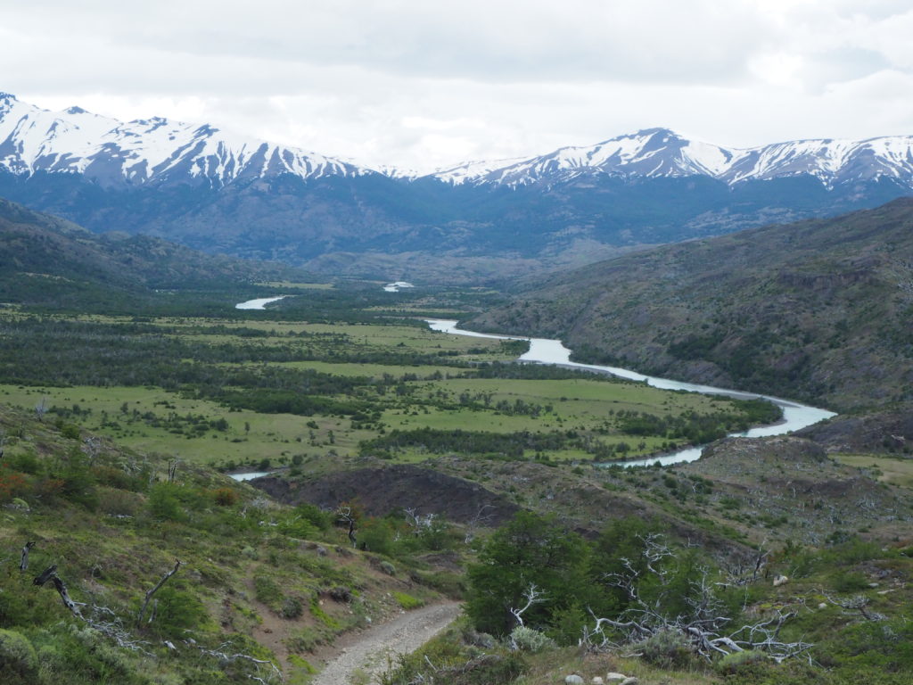
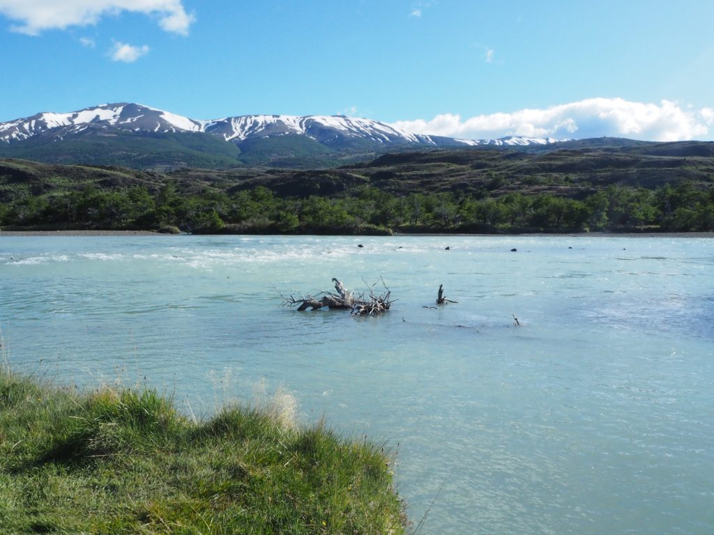
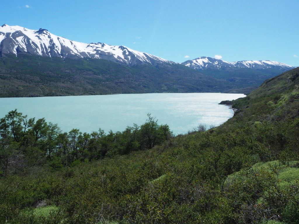
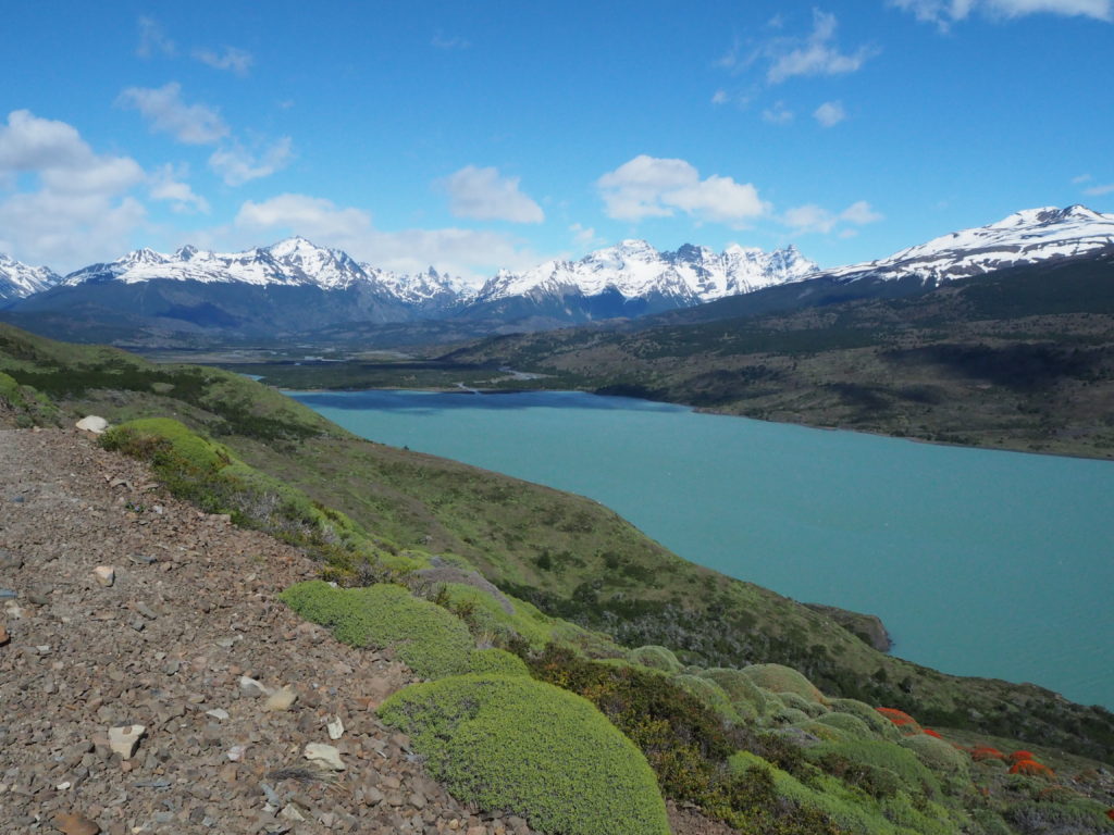
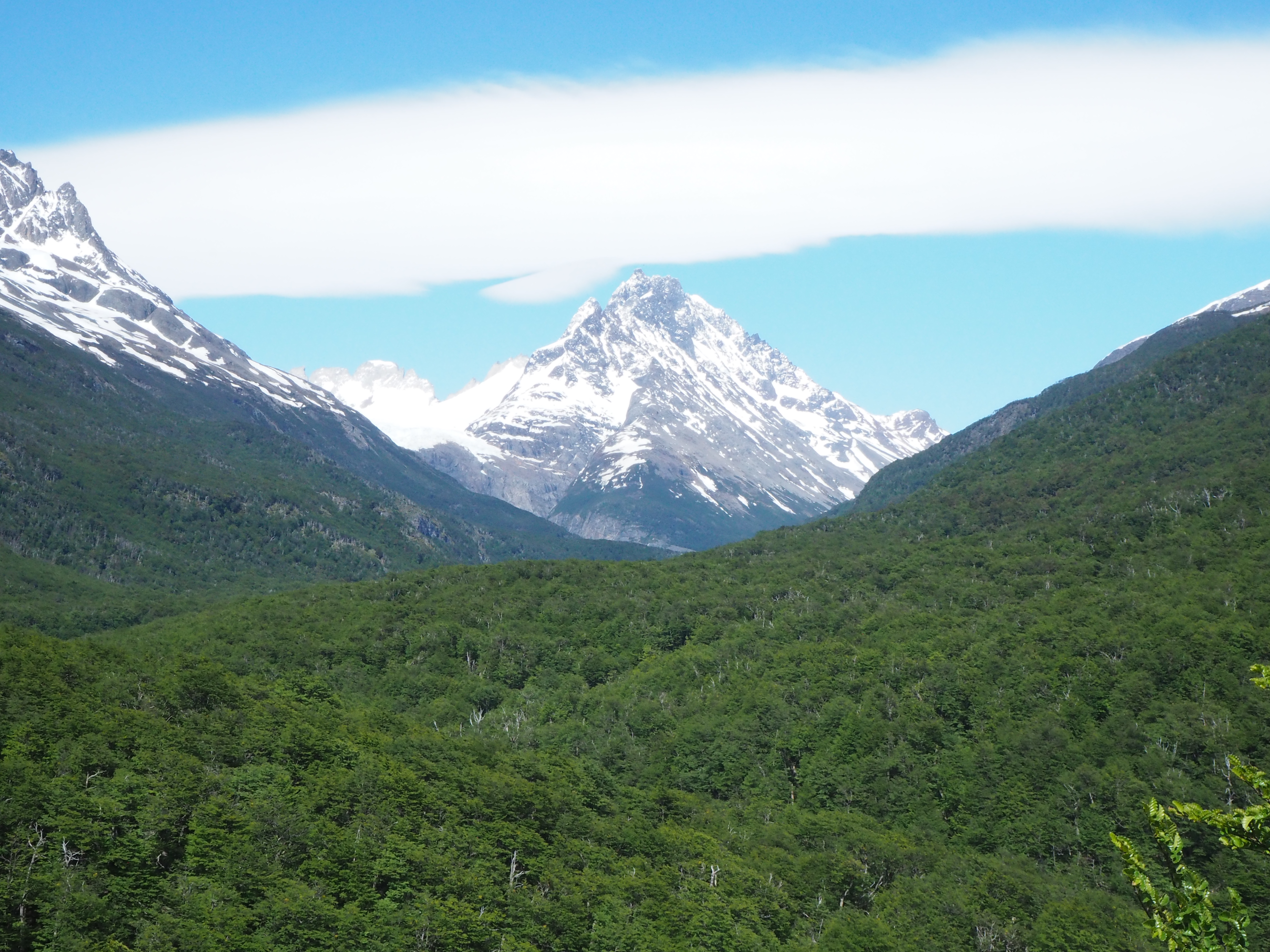
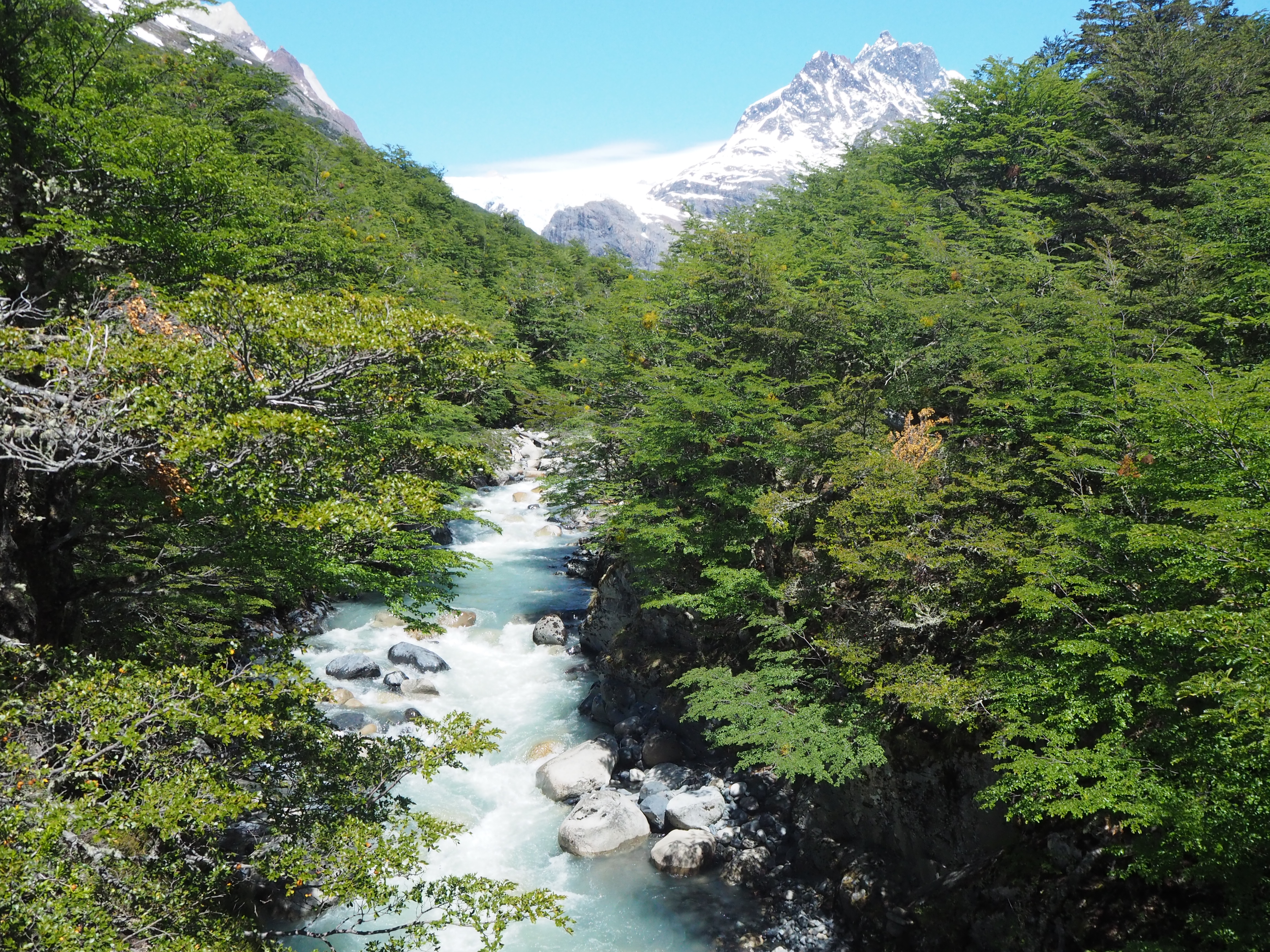
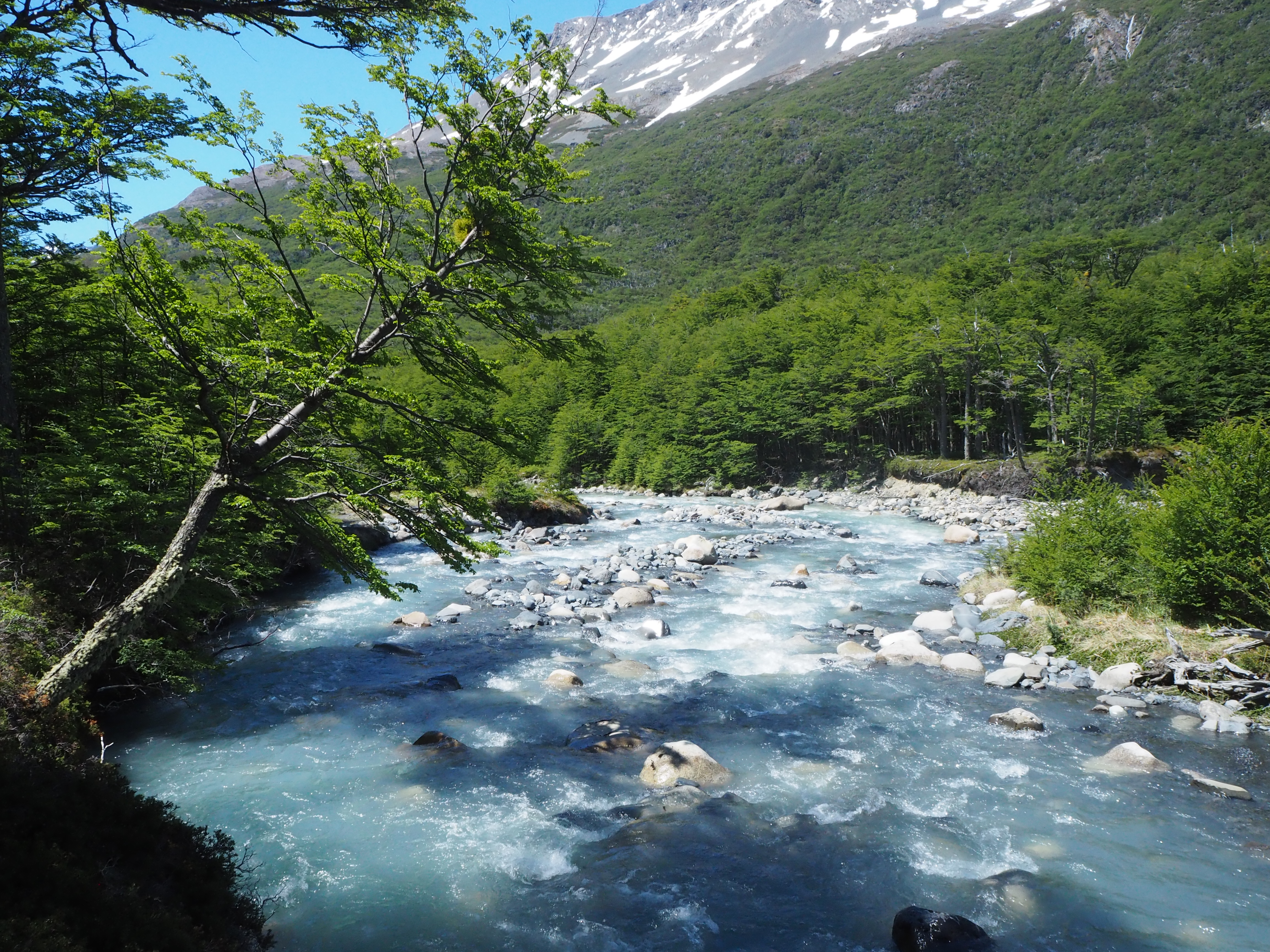
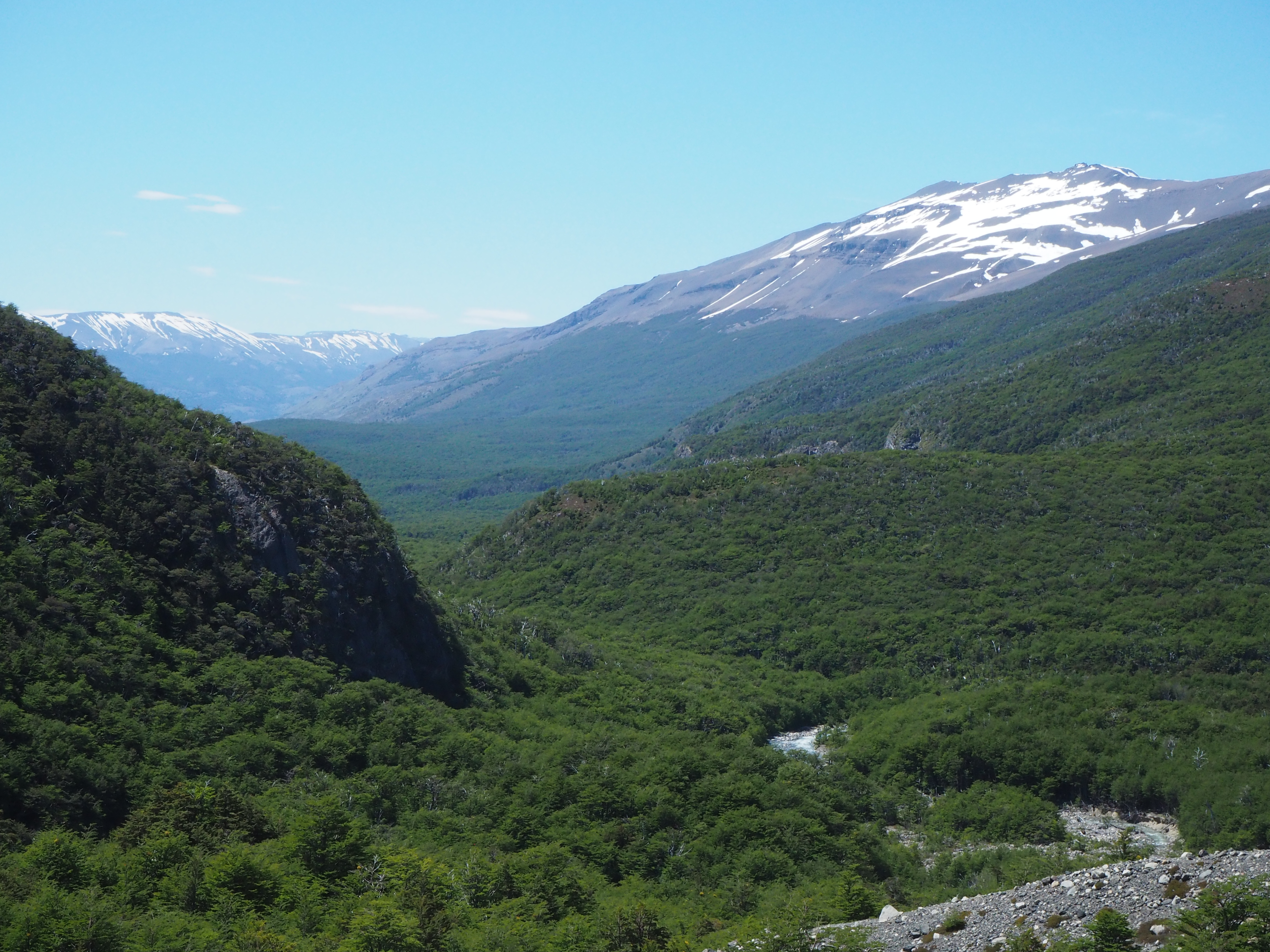
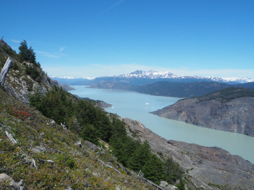
The views for the day quickly became different from the day before. Lago Paine came into view within the first few kilometers, and we knew we were in for something special. The deep blue water meshed nicely with the dark green foliage behind it, and the grey and white mountain behind it.
The path takes a left, and then the biggest uphill of the day, and the trek so far begins. This hill was a total surprise for us. Mostly cause we didn’t look at the elevation maps ahead of time. So we started going up and just… didn’t get tired. Hiking in low elevation (high point of the trek was 1200m) is so great! Why would you ever go where you couldn’t breathe, like we did in Peru and Bolivia? It was amazing just going up, never needing to stop. Our cardio has improved so much after all of our central Andean hiking. We passed so many people on the 200m ascent.
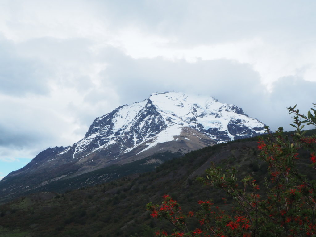
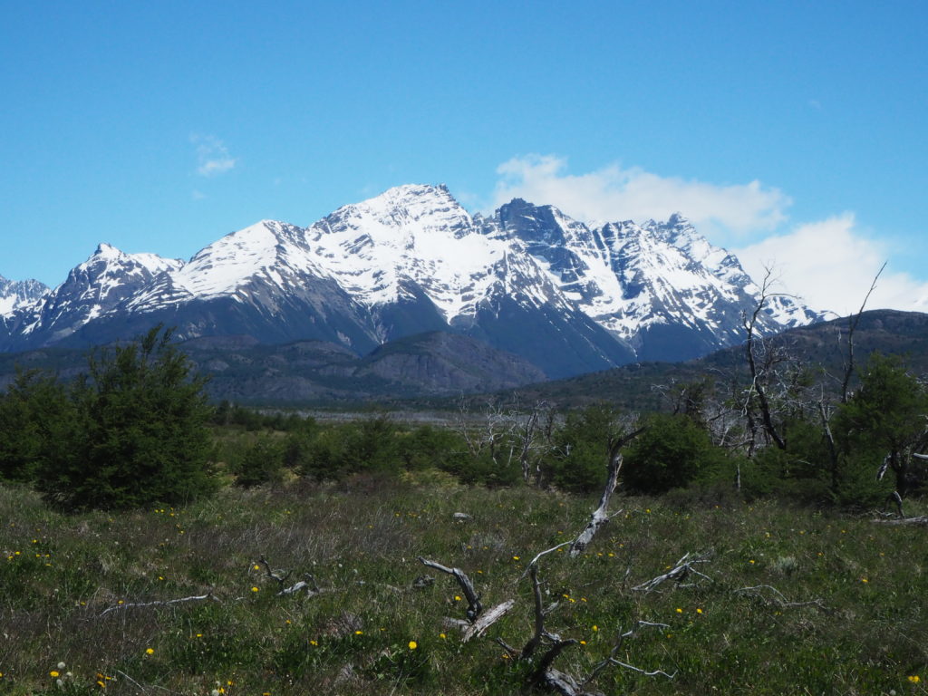
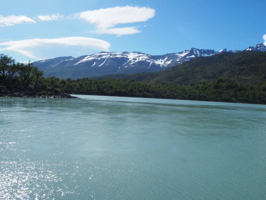
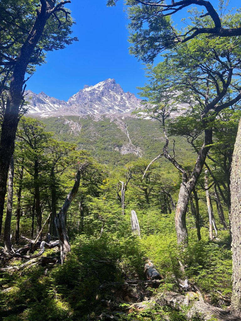
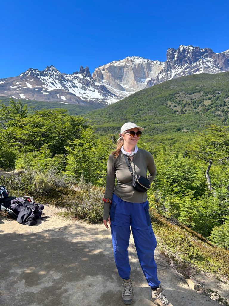
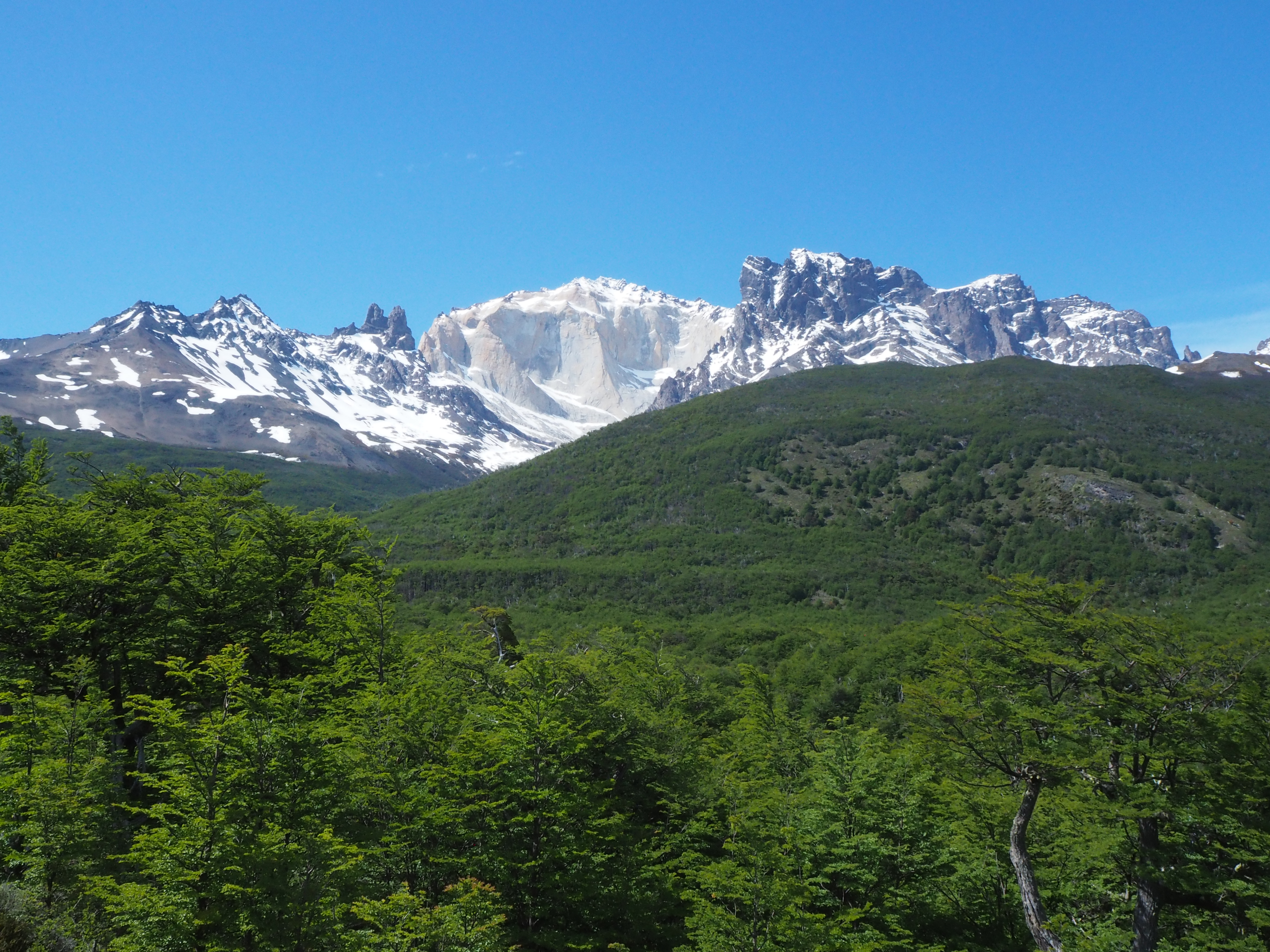
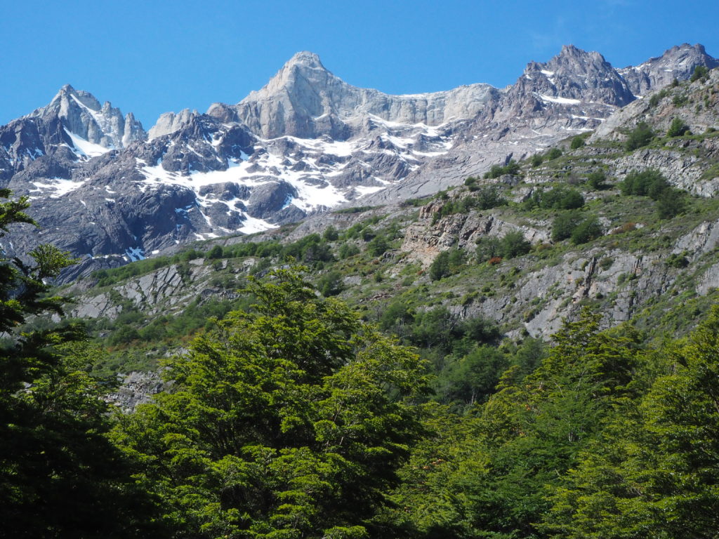
The rest was a slow gradual descent along Lago Paine, and then through the flats of the river valley. Across the valley were glacier eroded mountains, much more rounded and soft than their counterparts. On our side were multicolored mountains. Torres del Paine has its mountains consisting of two types of stone, a darker sedimentary rock from the Cretaceous period, and a much more recent (11-13 million years ago) lighter coloured granite intrusion. The combination of rocks and colours created a canvas for the glaciers, which carved out in the area creating the landscape that we saw.
Back in Ushuaia, I had hurt my knee running for a bus that we were late for (we made the bus though!), and it was this day that it first affected the hike. While coming into camp Dickson (which was beautiful), it had a lot of trouble going down, and couldn’t take much weight. As a result, the last bit of the hike ended up quite slow for us. It was also just another long day so we were both tired and sore from carrying our pack ( probably 30lbs each to start) almost 40km in two days.
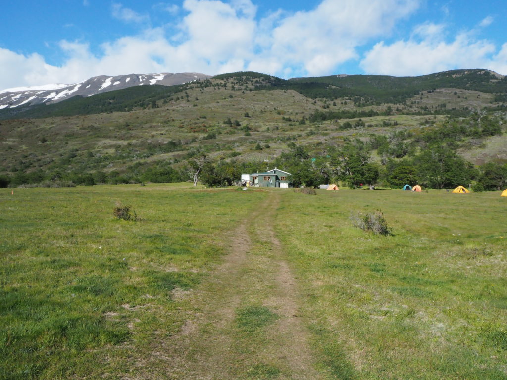
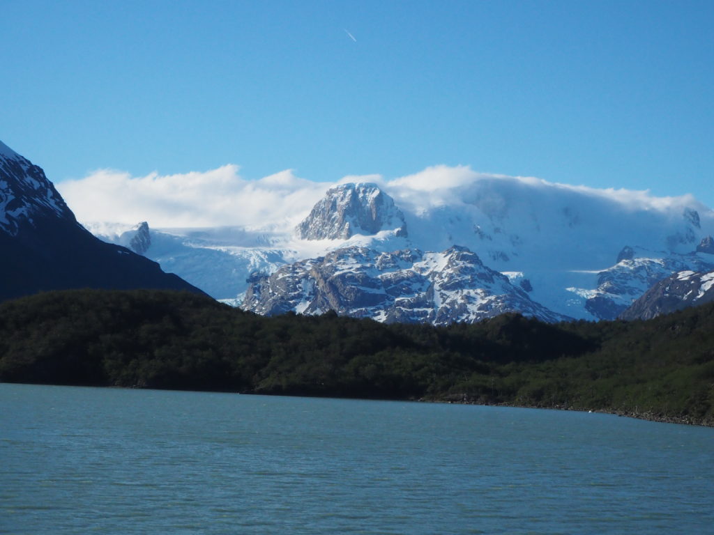
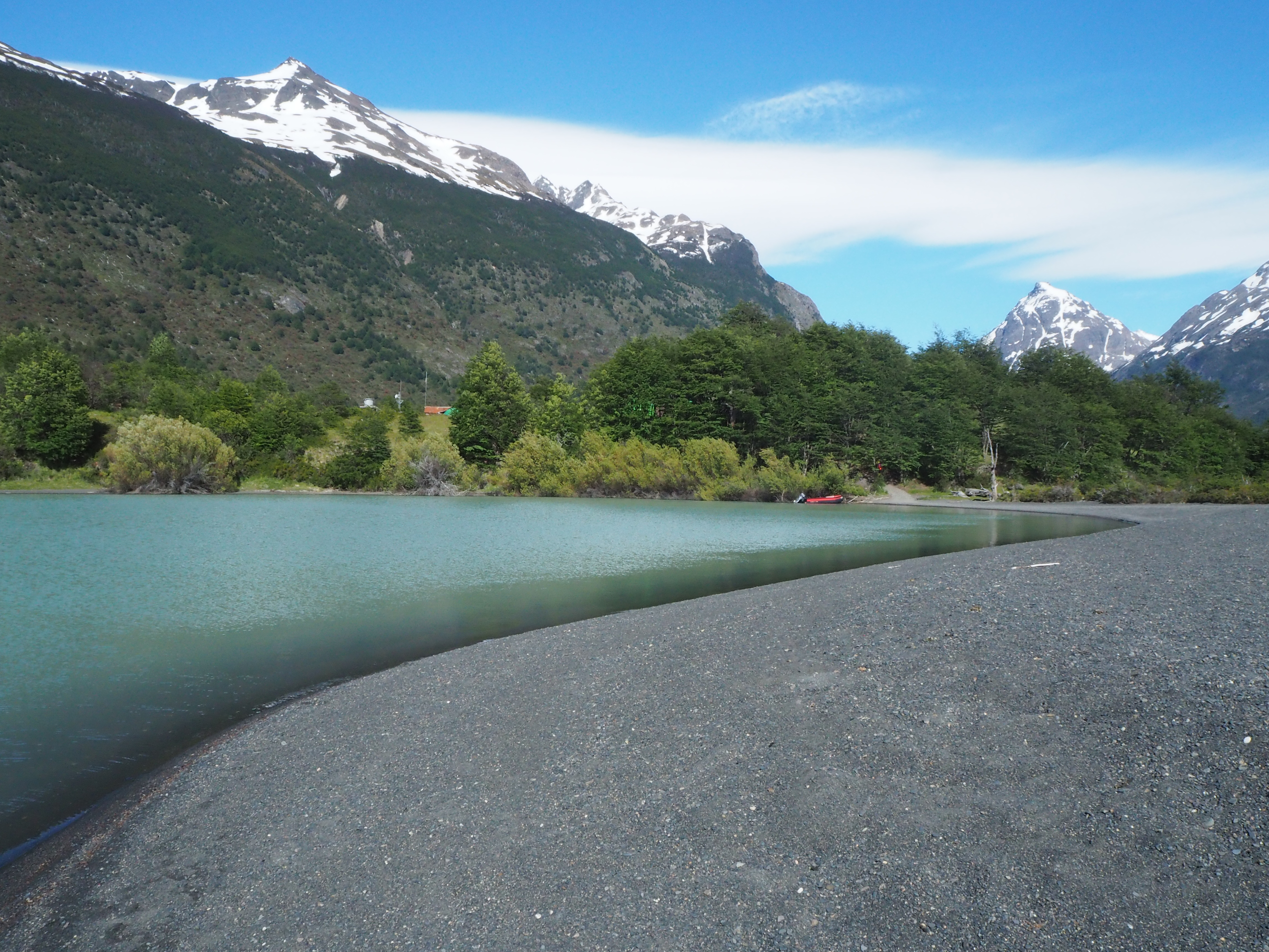
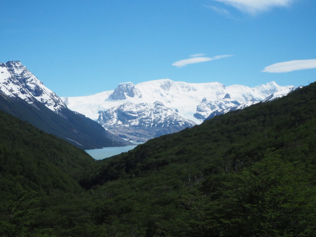
Camp Dickson was our favourite camp of the whole hike. It was nestled on a little peninsula on Lago Dickson. To the north was the Dickson glacier, with mountains both flanking the ice, and impaling the middle of it. Frosty clouds shrouded the scenery behind, creating an imposing air of mystery. The lake was nearly still when we arrived. Our tent was nicely nestled within the trees, and we did not have a repeat of the wind issues of the night before.
Day 3: Dickson to Los Perros
Distance: 12.55km
Elevation: 603m
Time: 4:31
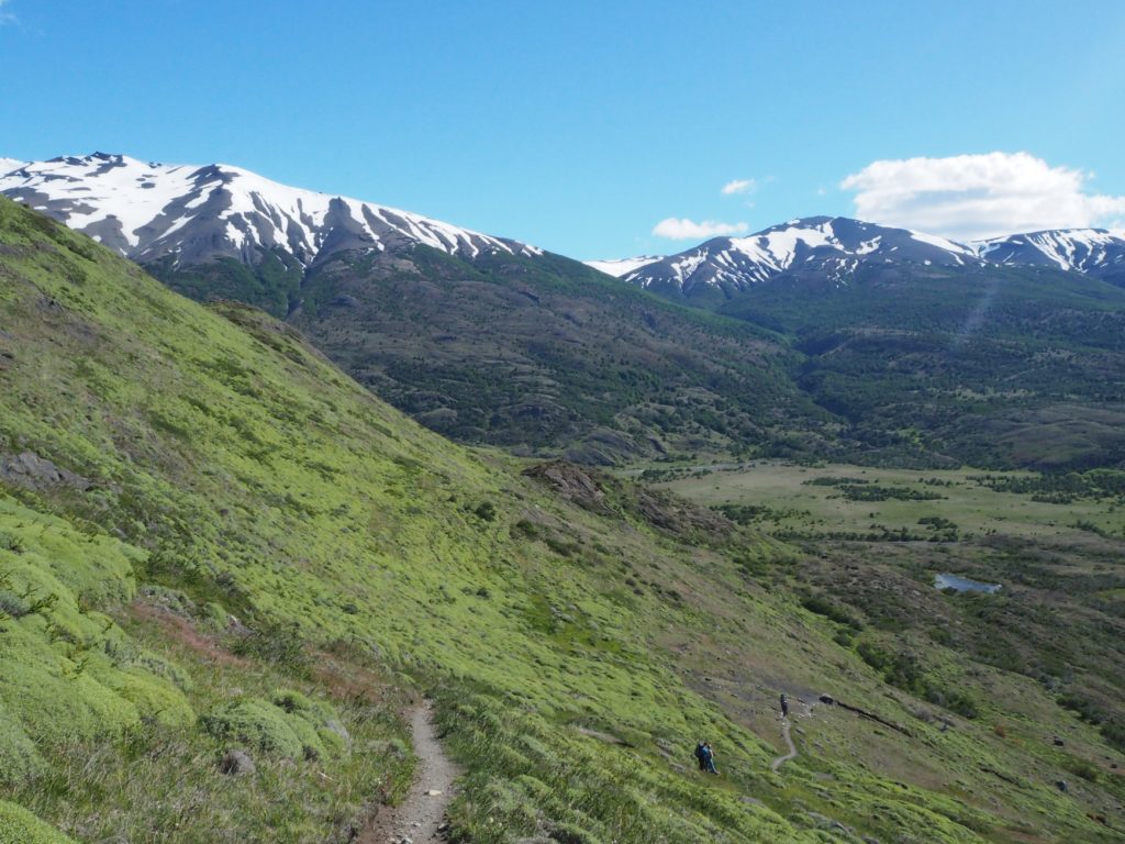
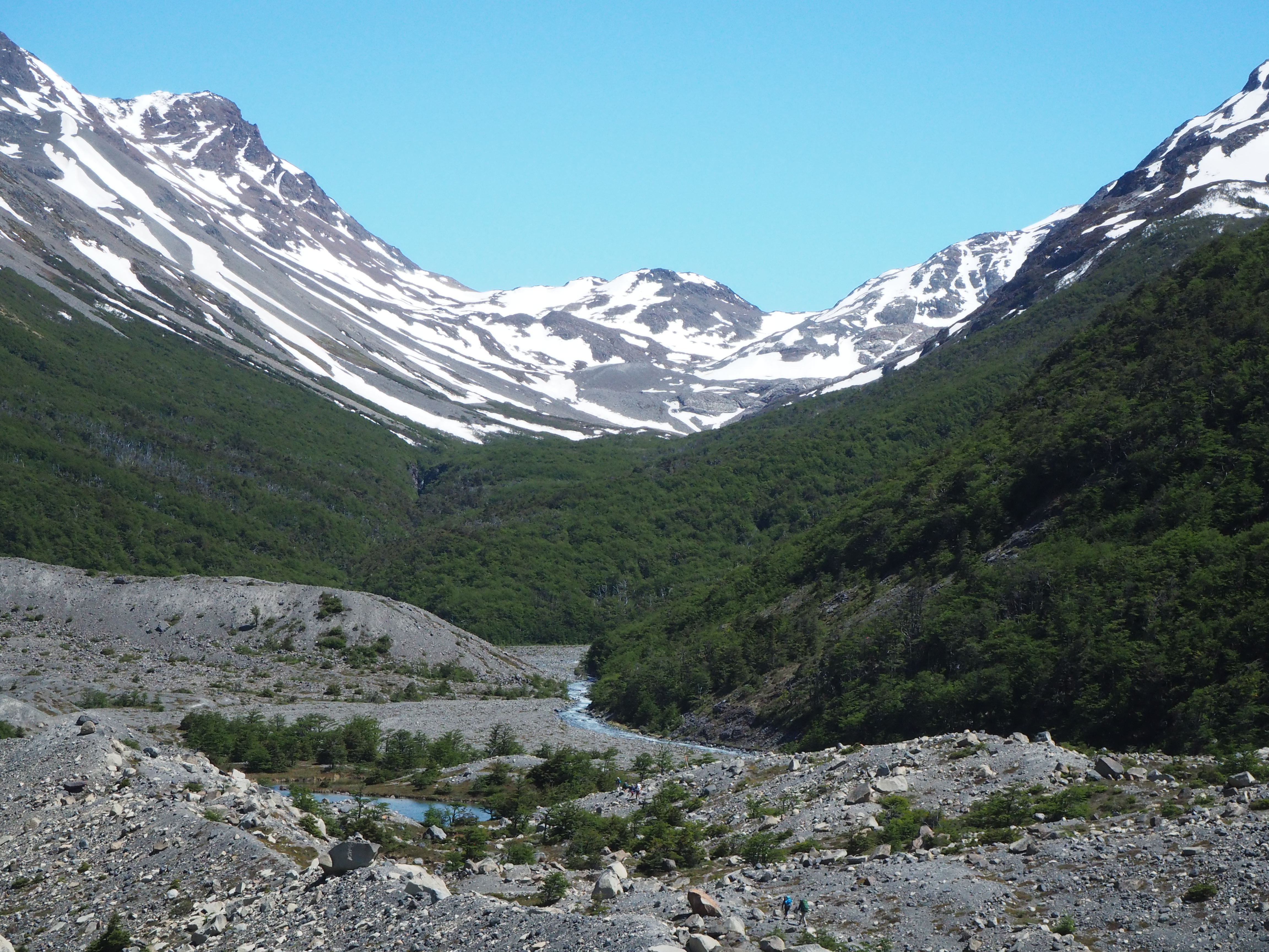
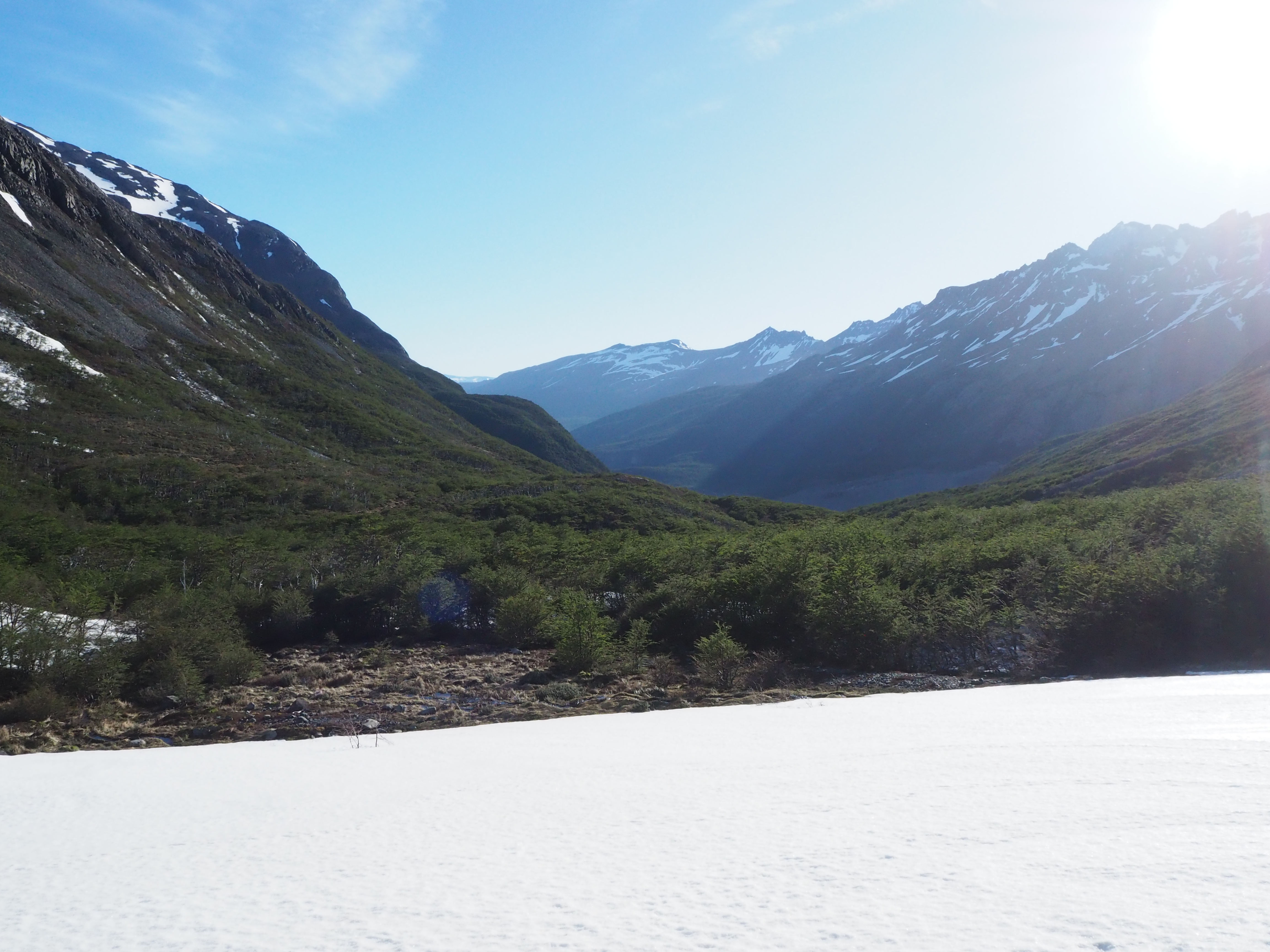
Day 3 of the trek by O-Trek standards was a nice short easy day, in preparation for the mammoth tomorrow. Day 4 consists of the John Gardiner pass, a pass that is only allowed to be crossed in the AM, preferably before 11, or the winds get too strong. So today’s build up is to get as close as possible to the pass.
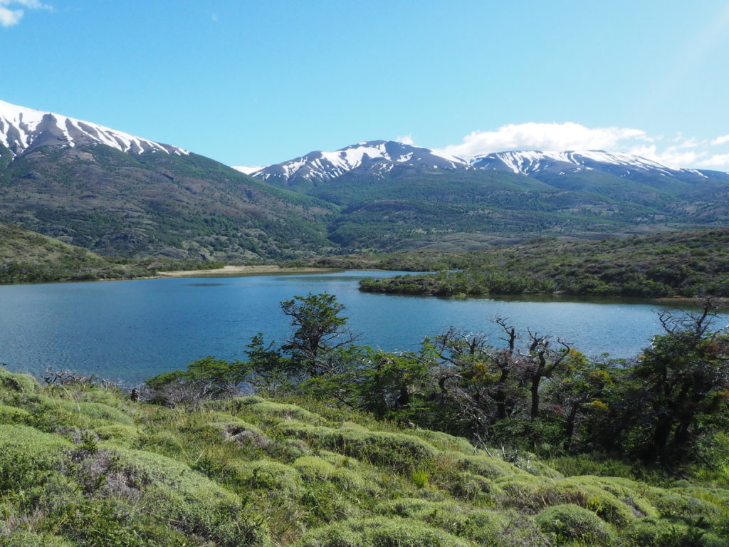
We started the hike not actually headed to Los Perros camp, but instead with a nice stroll along the stone beaches of Lago Dickson. The water was silent with movement, as if the earth had yet to wake up. The mountains brilliance was on display with the morning sun. It was a nice little excursion to lake.
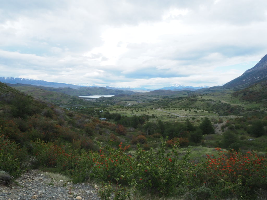
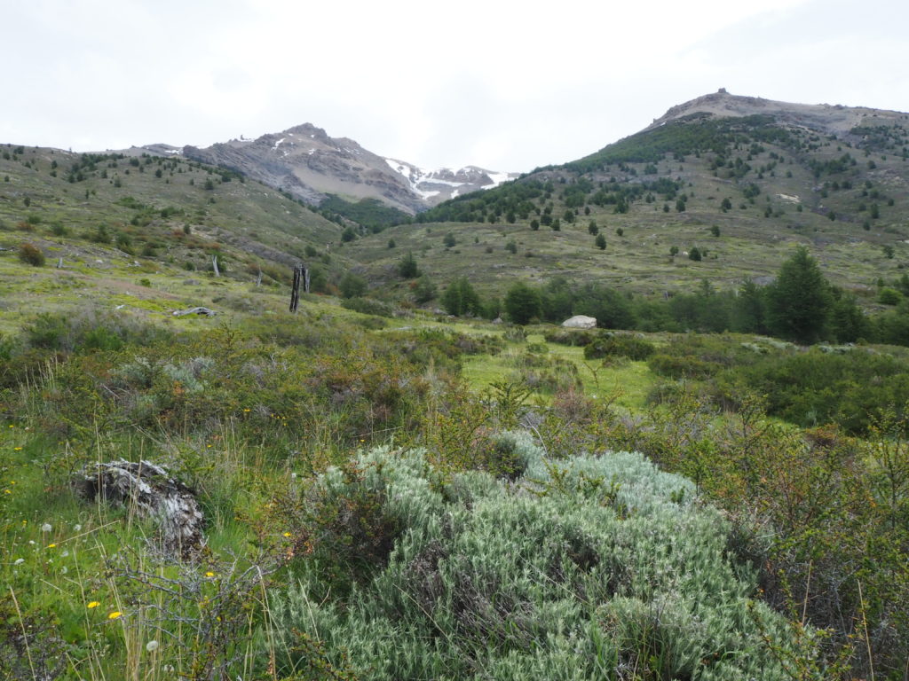
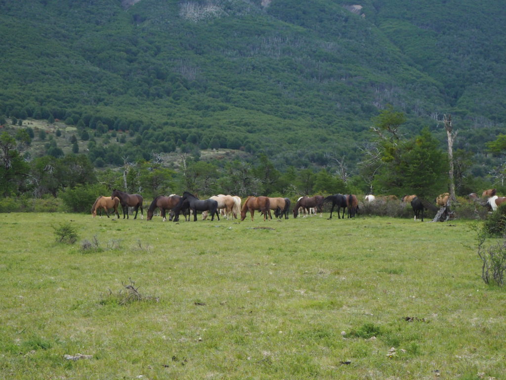
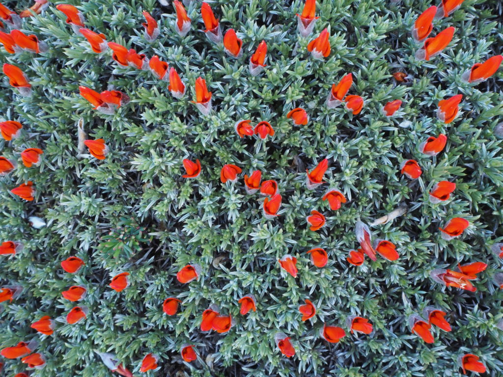
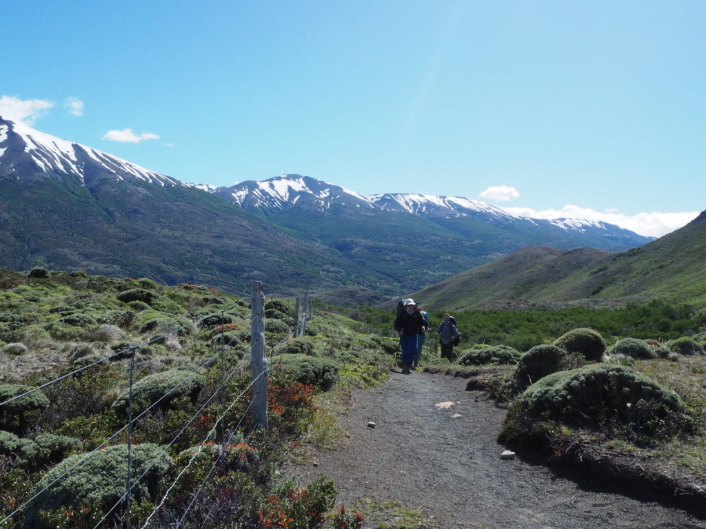
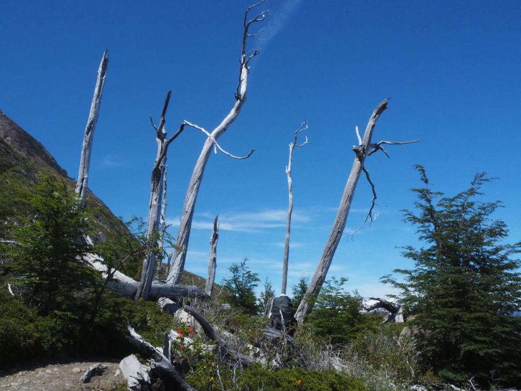
The actual hike was mostly through the forest. The flora of Torres del Paine is quite different to what we have seen before. Beech trees dominate the forests. Many shrubs take over the more open glass lands, the most notable being the calafate bushes with sweet apple tasting berries, and Chilean firebush, with a striking in bloom flower of many long red stringy petals. The pops of colour were always a welcome site in the still beautiful white/ dark grey/ forest green/ light blue colour palate of the surrounding mountains, forest and water.
While the flora is much different than that of home, the landscape is quite similar to the Canadian Rockies, especially the landscapes around Jasper. It was both Day 2 and 3 that we felt like we could be walking in Alberta somewhere instead. The only major macro difference was the lack of spruce trees on the mountainside. It was a nice reminder of home on the other side of the planet.
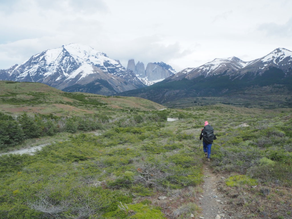
The forest was broken up with intermittent small meadows and streams, giving nice views of the mountains. The best views came a few km in at a mirador, where we had views of Lago Dickson, John Gardiner Pass, and the light Torres del Paine granite all at once.
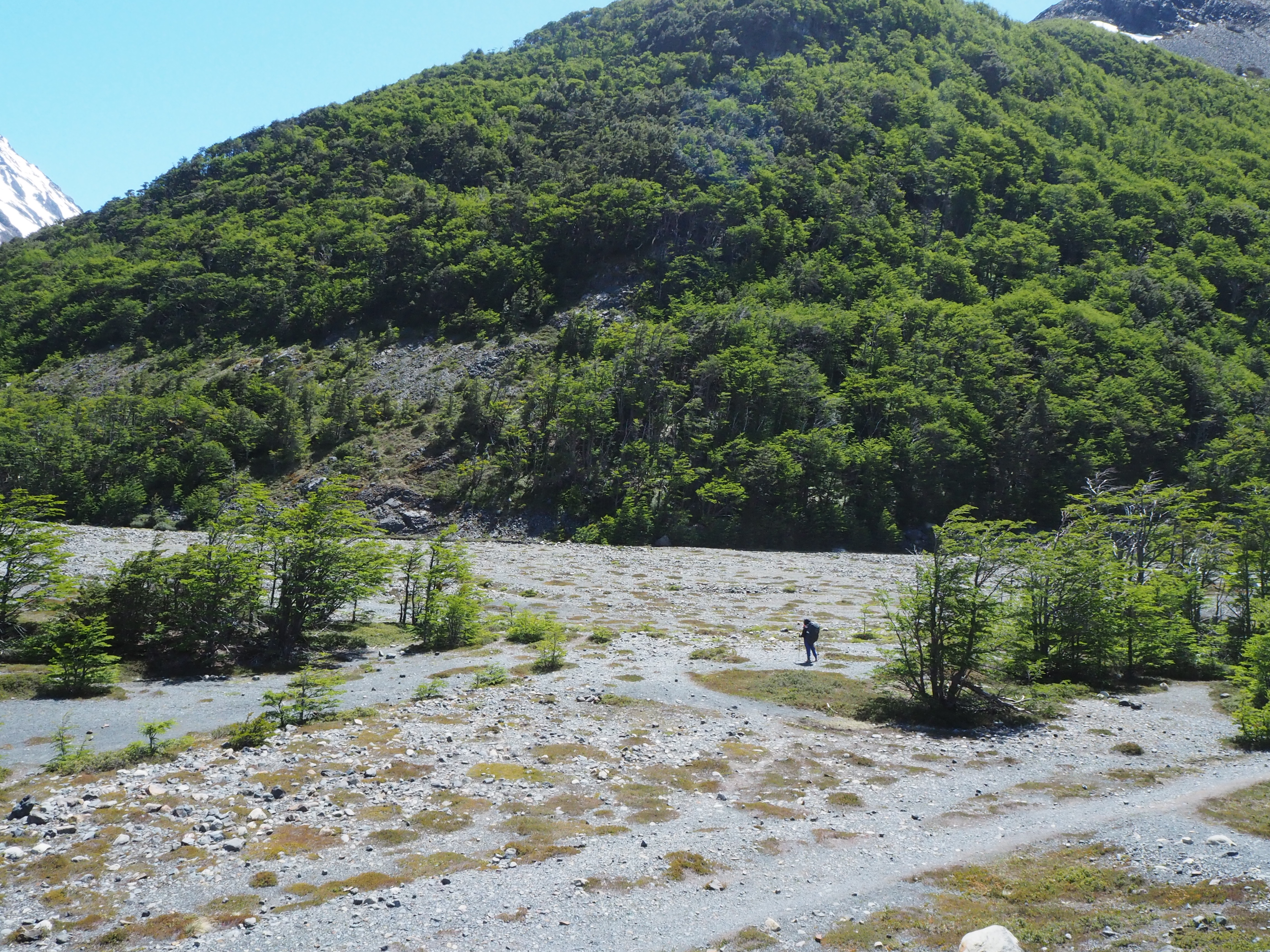
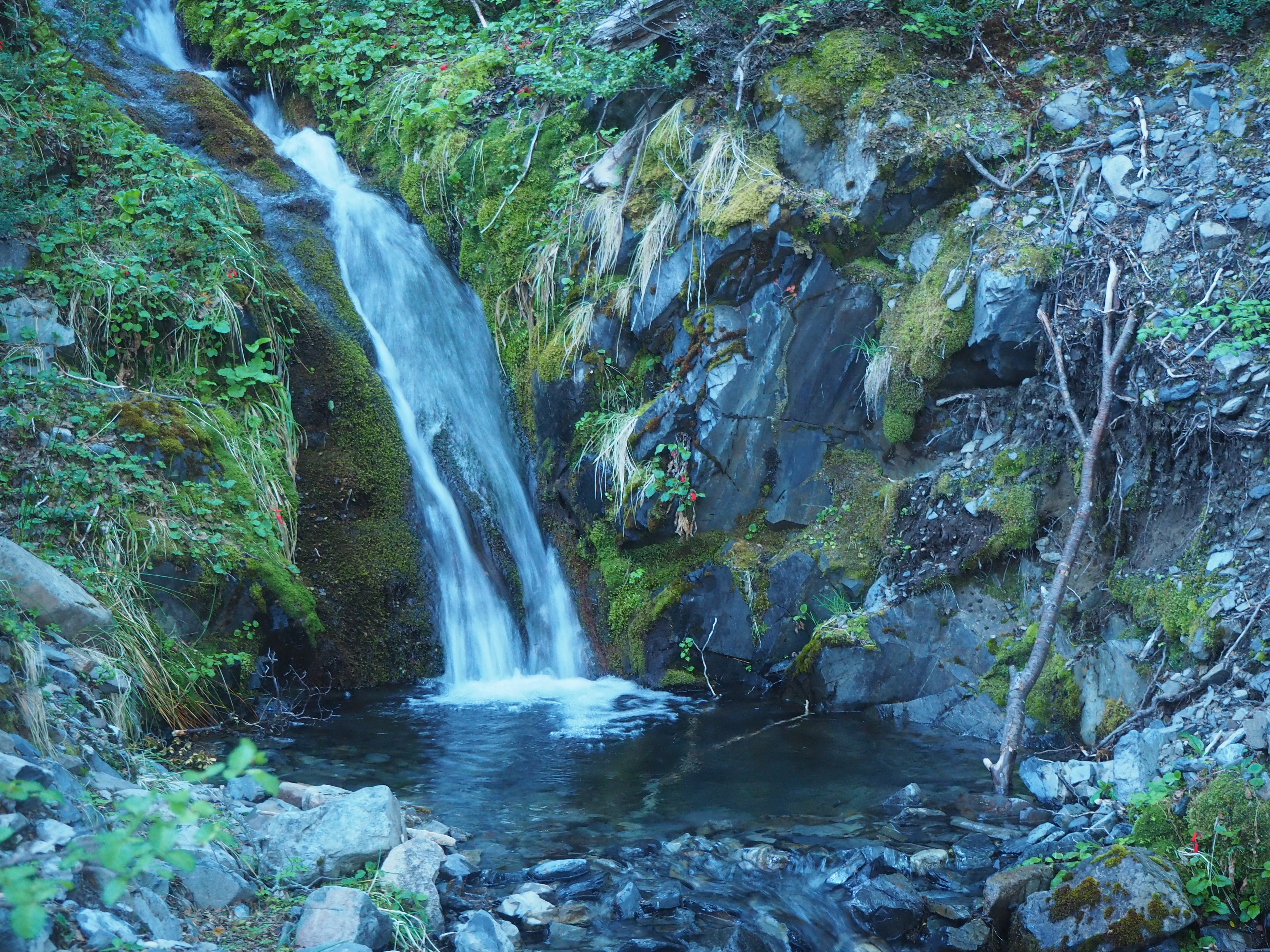
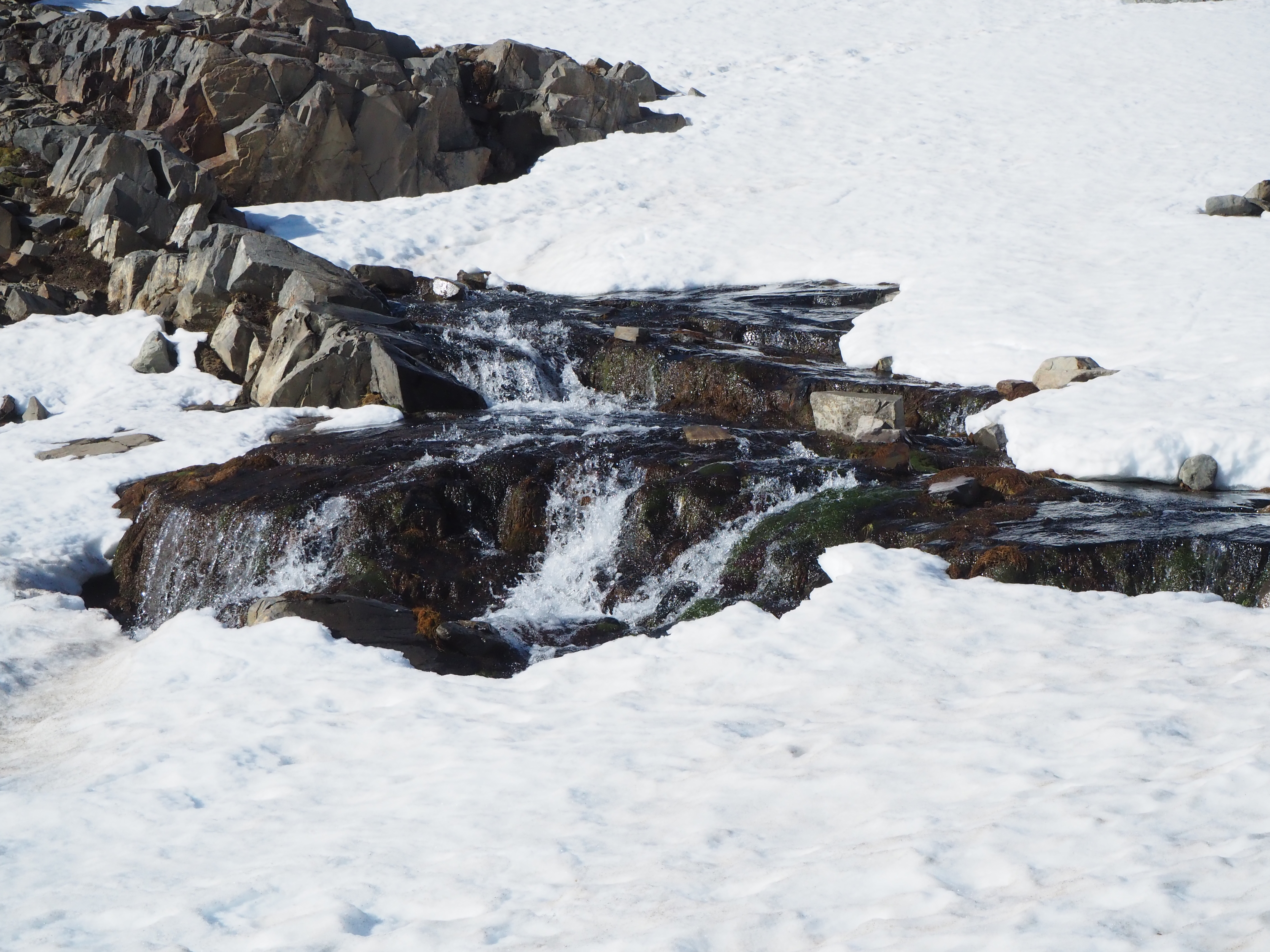
Near the end of the adventure, we broke through the trees into a massive dry stone floodplain. To our left was a glacial spoil pile. We climbed it, and hidden behind the rocks was a lovely little lagoon, being tasted by the glacial tongue of Glacier Los Perros. We had a nice extended break here, fighting the wind to sit vertically and take in the small details that the glacier provided.
Camp was especially lovely here. It was this day that we got to know a group of 13 of various hiking skill levels from the southern USA. These people were especially impressive, as they were able to coordinate the lives of 13 adults together to have two weeks to do the O-Trek as a group. I guess they do a lot of backpacking back home in Georgia and Alabama. This was their biggest challenge yet though. They had already suffered losses at this point, as one member had gotten such bad food poisoning and blisters that they needed to be trucked out of the Dickson camp back to Porto Natales for help. The O-Trek is not an easy trek, even if you are not carrying your tent and food.
My knee was better today, but that was mostly due to the short, uphill nature of the day. Everyone went to bed early, as you had to be on the trial at 7AM the next morning, to beat the heavy winds to the pass.
Day 4: Los Perros to Grey
Distance: 16.50km
Elevation: 813m
Time: 10:15
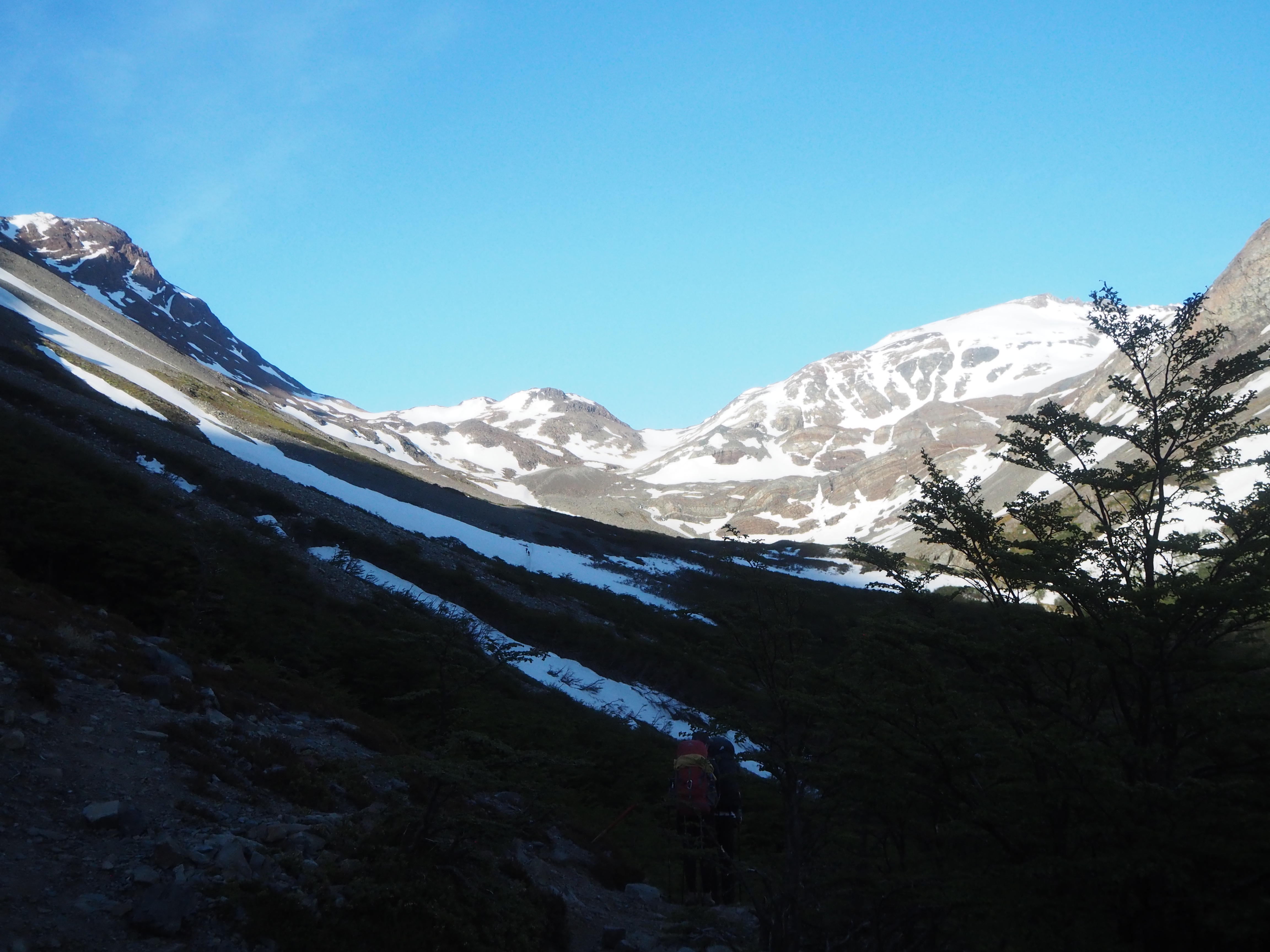
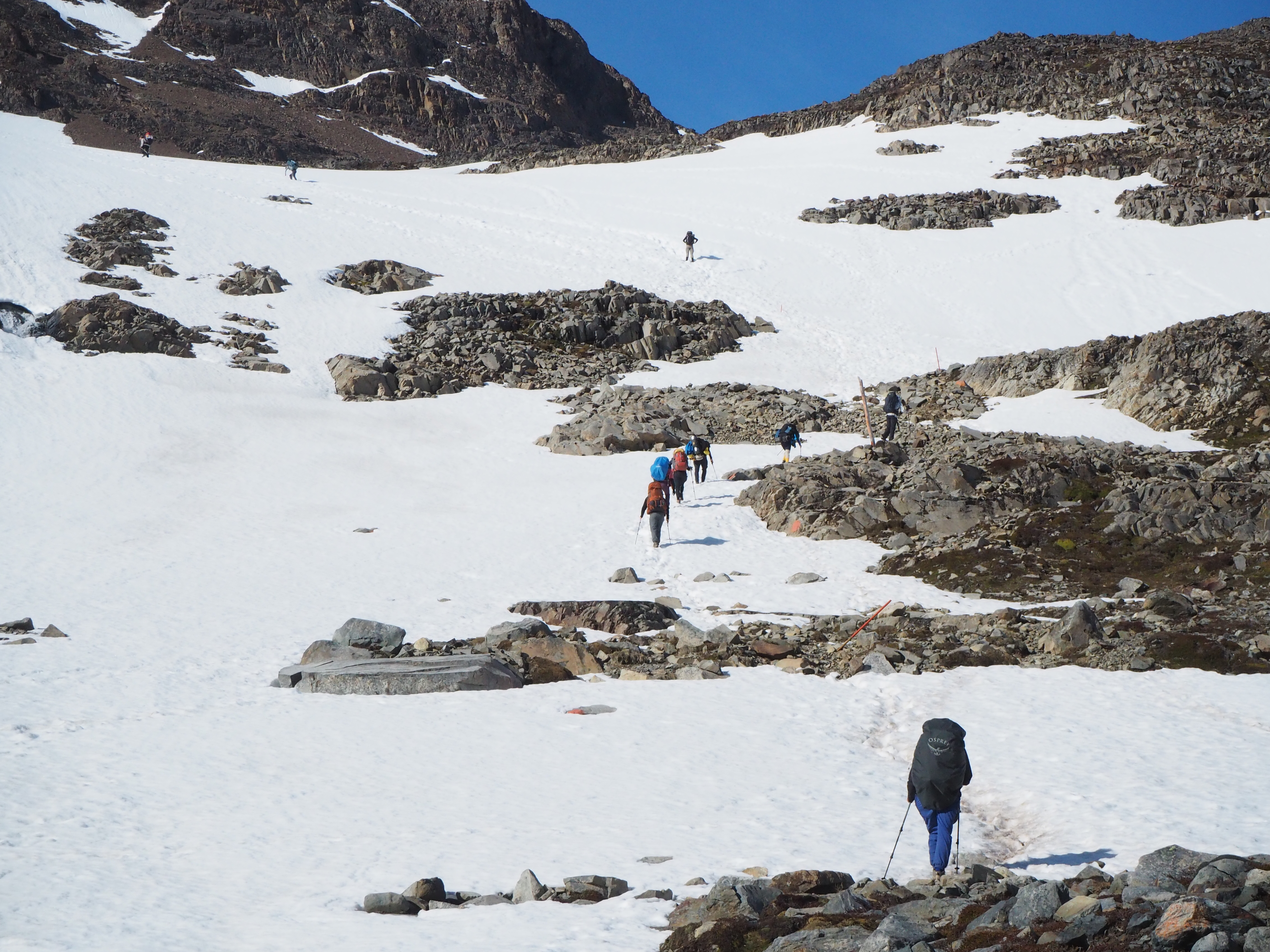
This day is commonly considered the crux of the O-Trek hike. 16km doesn’t seem long, but they tell you to budget 11 hours for the whole journey. Why? A strenuous uphill through snow, followed by arguably the most brutal downhill on any semi-famous hike in the world. And then your halfway done.
Bright and early, only 6:30 we had everything packed and ready to go. Many groups, including the US squad, had departed an hour before us.
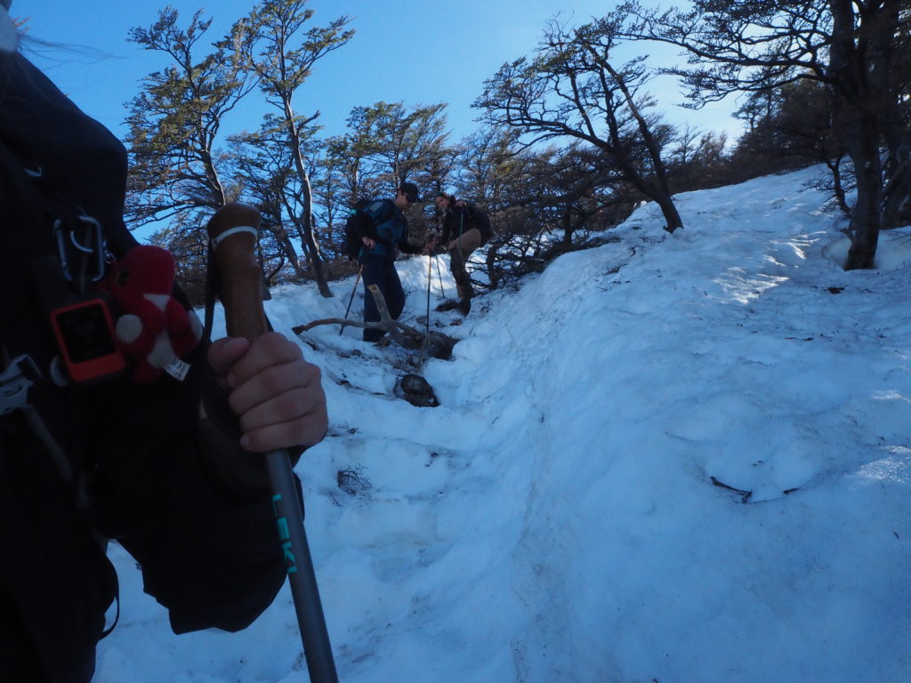
The first bit of the hike had us again through the trees, but it was no soft dirt path like the day before. We ascended through the trees, using roots and rocks as stairs. Each foot had to be carefully placed, as there was not a lot of flat ground to work with. Whenever we were not in the woods, we were traversing across open scree. This wasn’t supposed to be the difficult part of the day, and yet we were already moving slow.
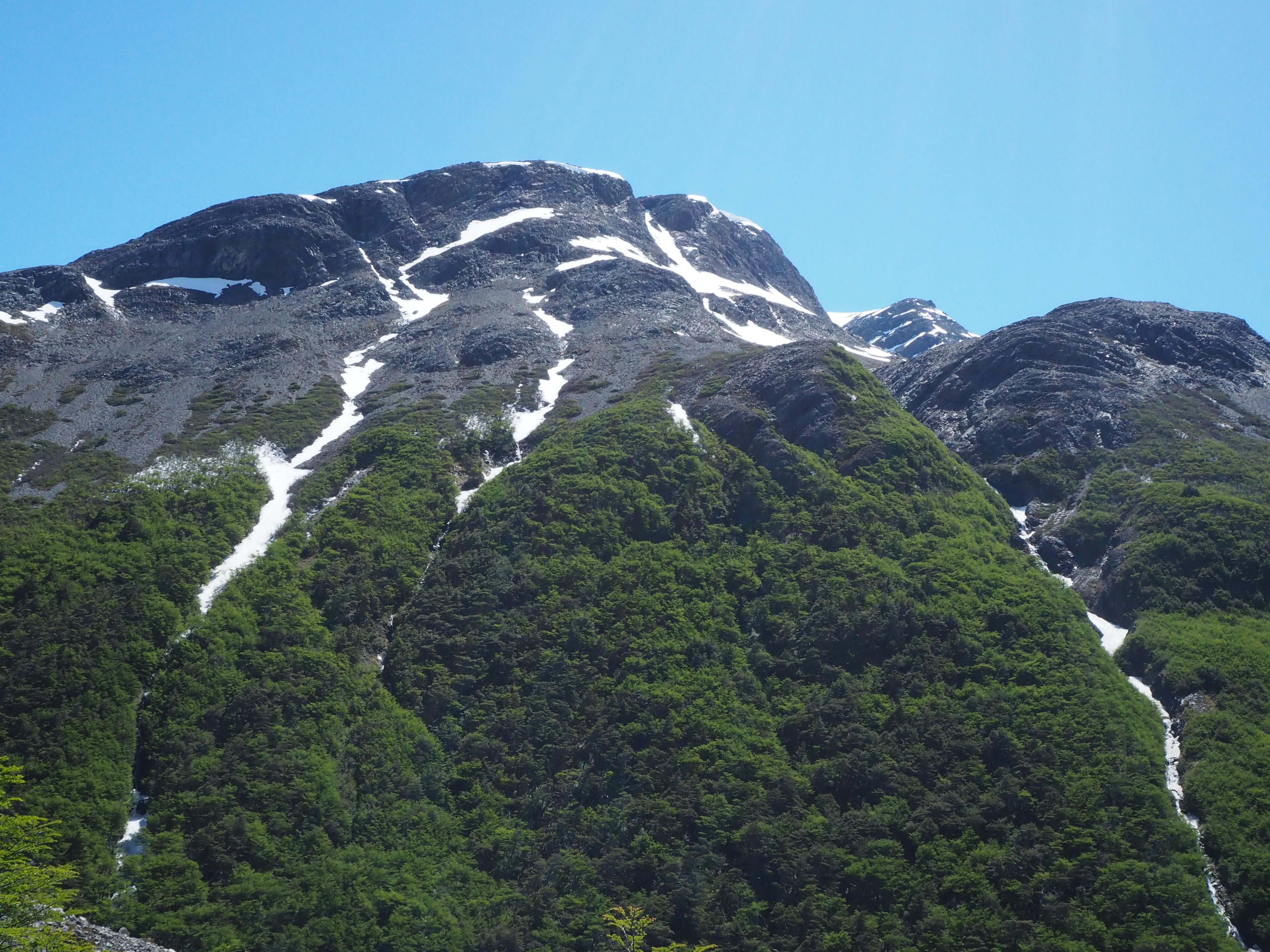
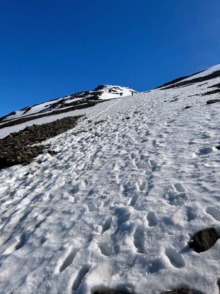
Finally the trees broke, and we found ourselves in the cradle of mercy. Or at least, we would have if not for the best and luckiest weather of the year. Unbelievably, and again, we were experiencing completely unnatural perfect weather conditions for our hike. We had no wind, no clouds in the sky, so signs of precipitation anywhere. Just the week before, it rained every day, and there was a meter of snow dumped on the pass. Some poor ranger goes our every morning to forge a path over the pass so everyone can trudge through the snow in solidarity. But not us. Sure we had snow, but is was nicely packed. If anything, it was too warm and it had melted too much, causing soaked feet at the occasional plunge down to the knee.
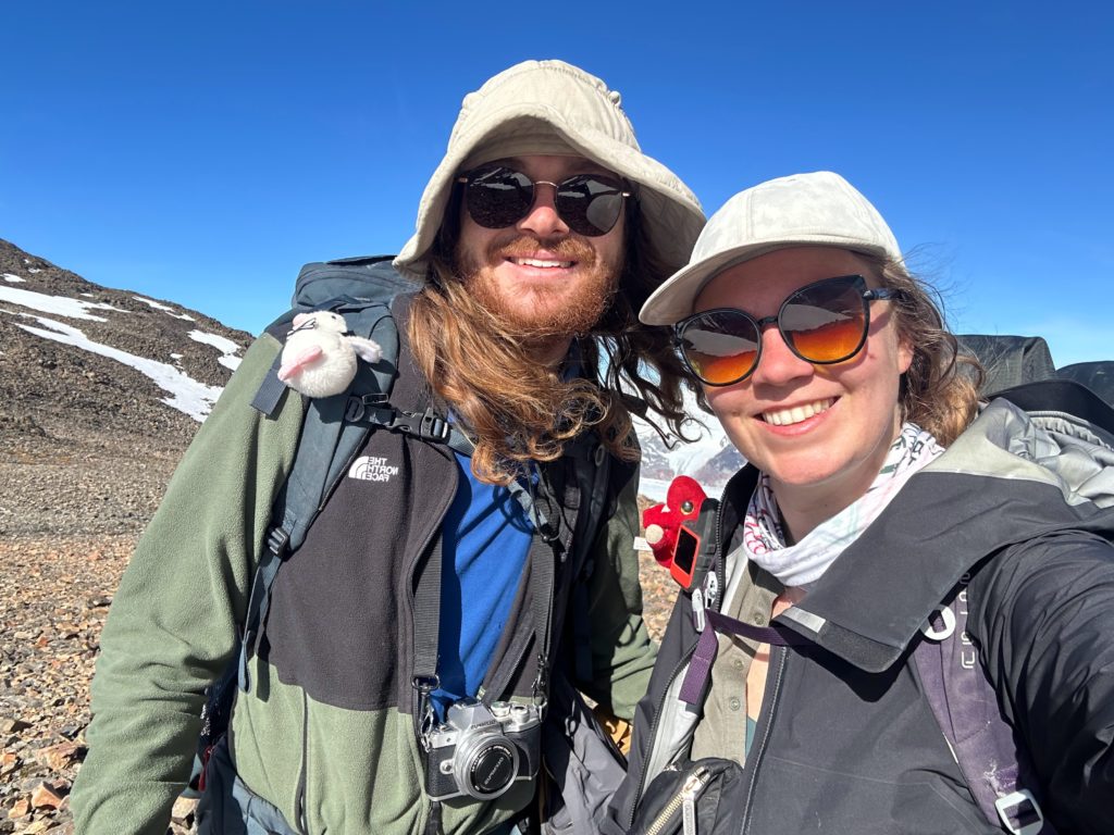
We had been passed a few times on the first forest/ scree section of the hike, but and uphill snow section was exactly where some hiking Canadians would excel. We flew past everyone, including the USA gang, who had some choice words to describe the snow. Cam and I separated a bit for this section, as she had much more of a tolerance for the snow than I. She powered through the main path, while I forged my own, using the patched of exposed rock as much as possible. The whole time, Cam had her jacket on, repeatedly claiming “The wind is coming! The wind is coming!”
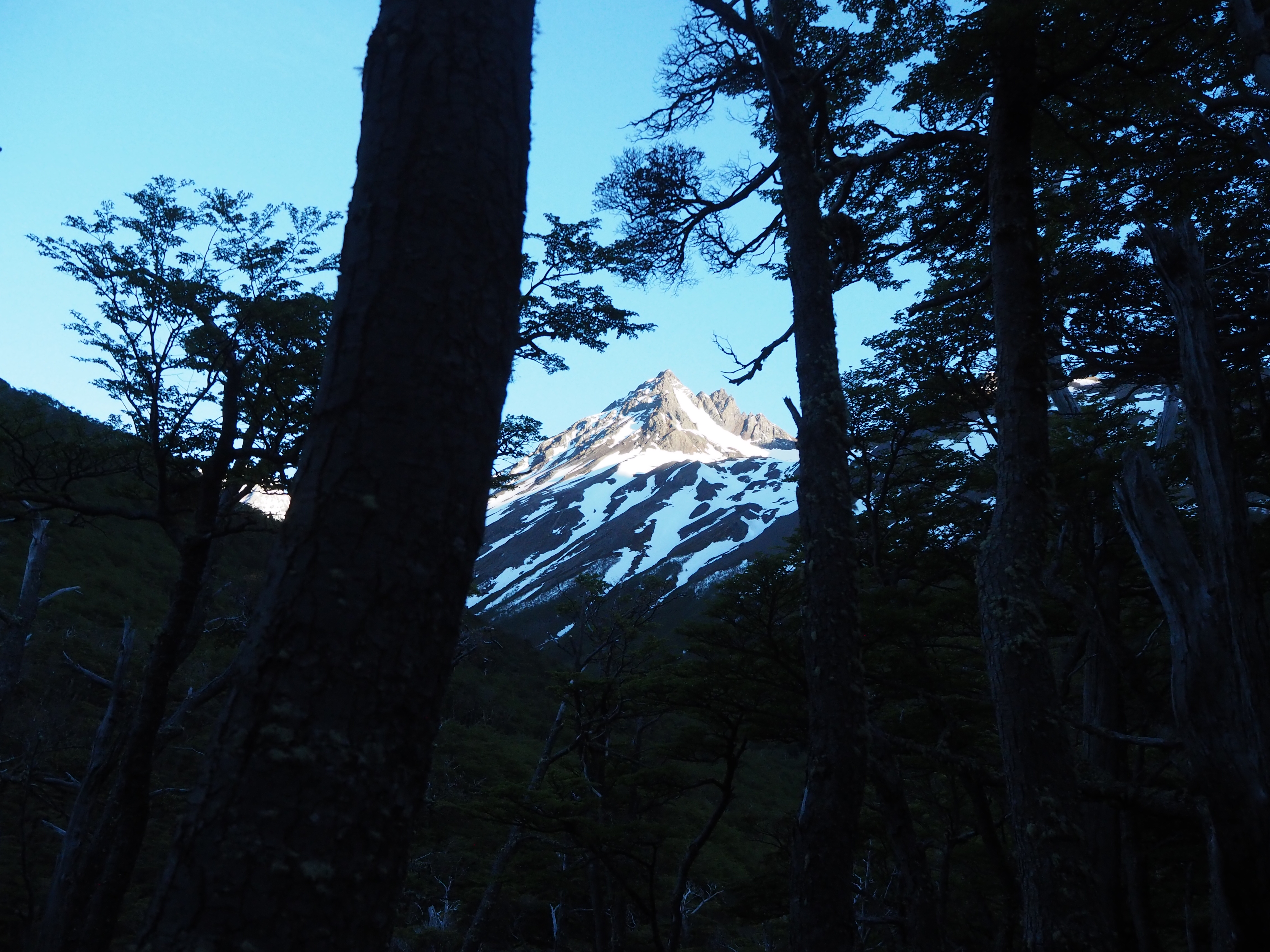
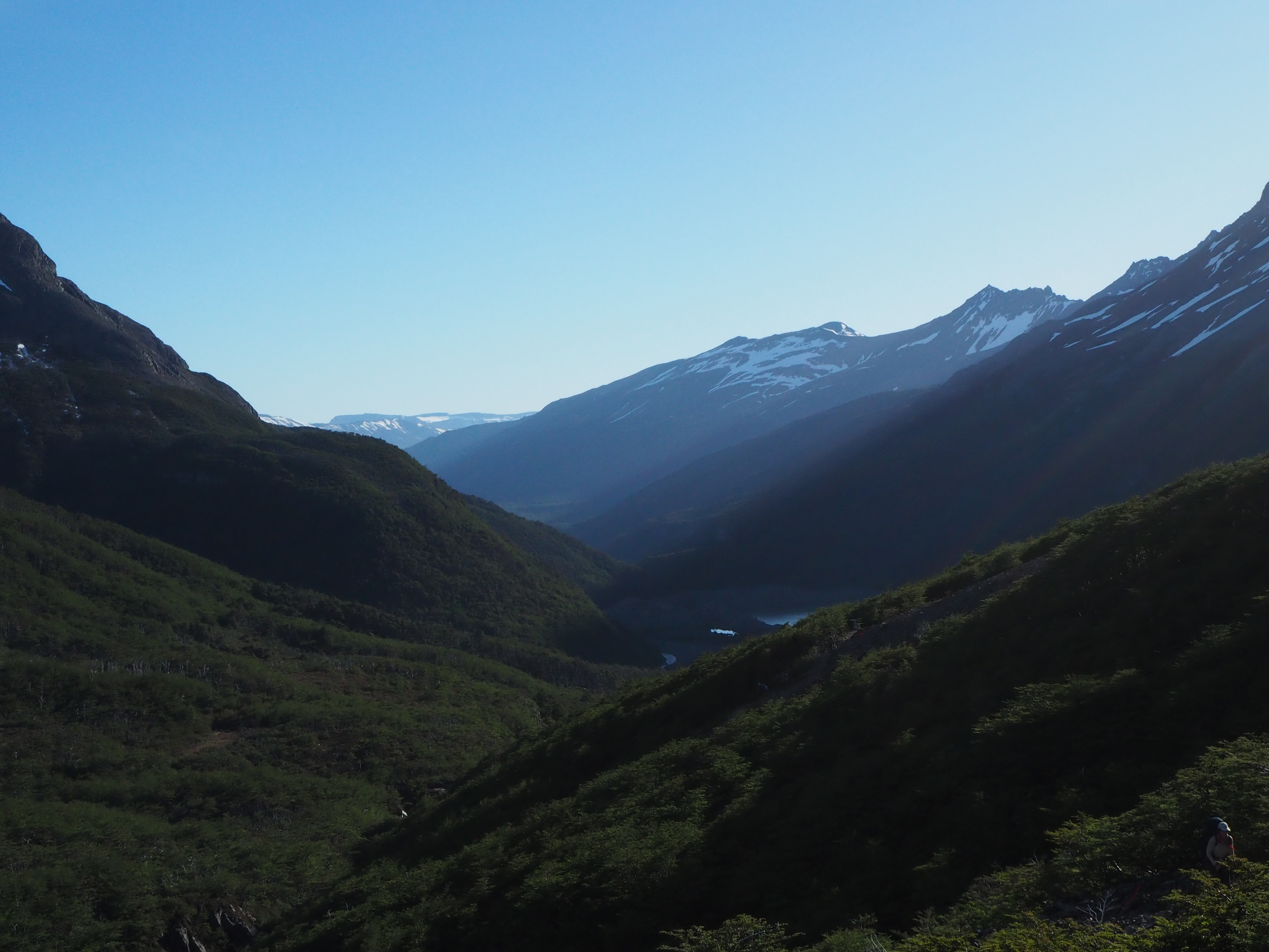
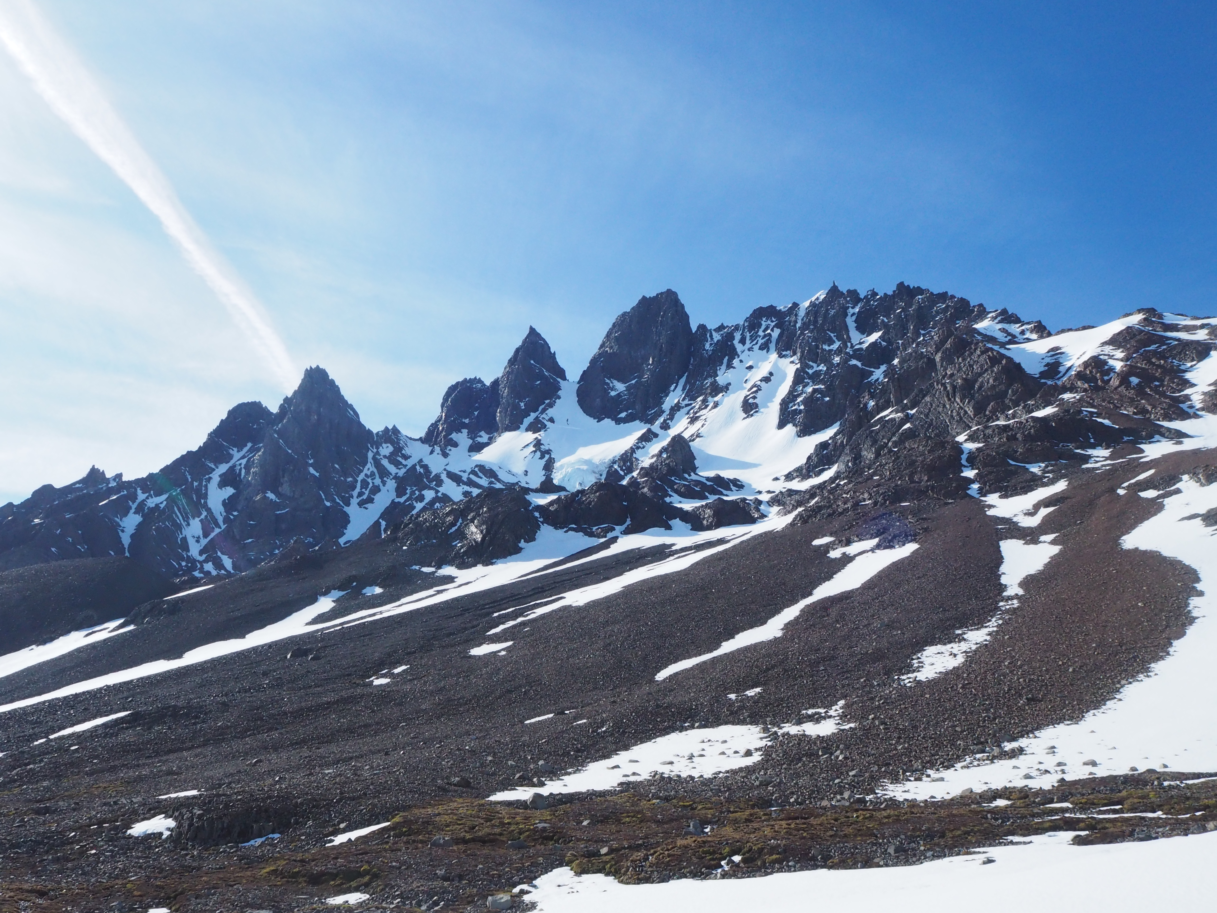
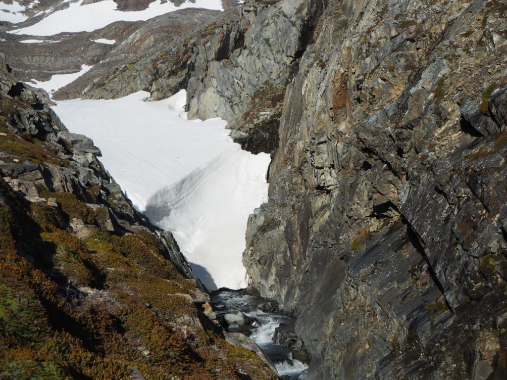
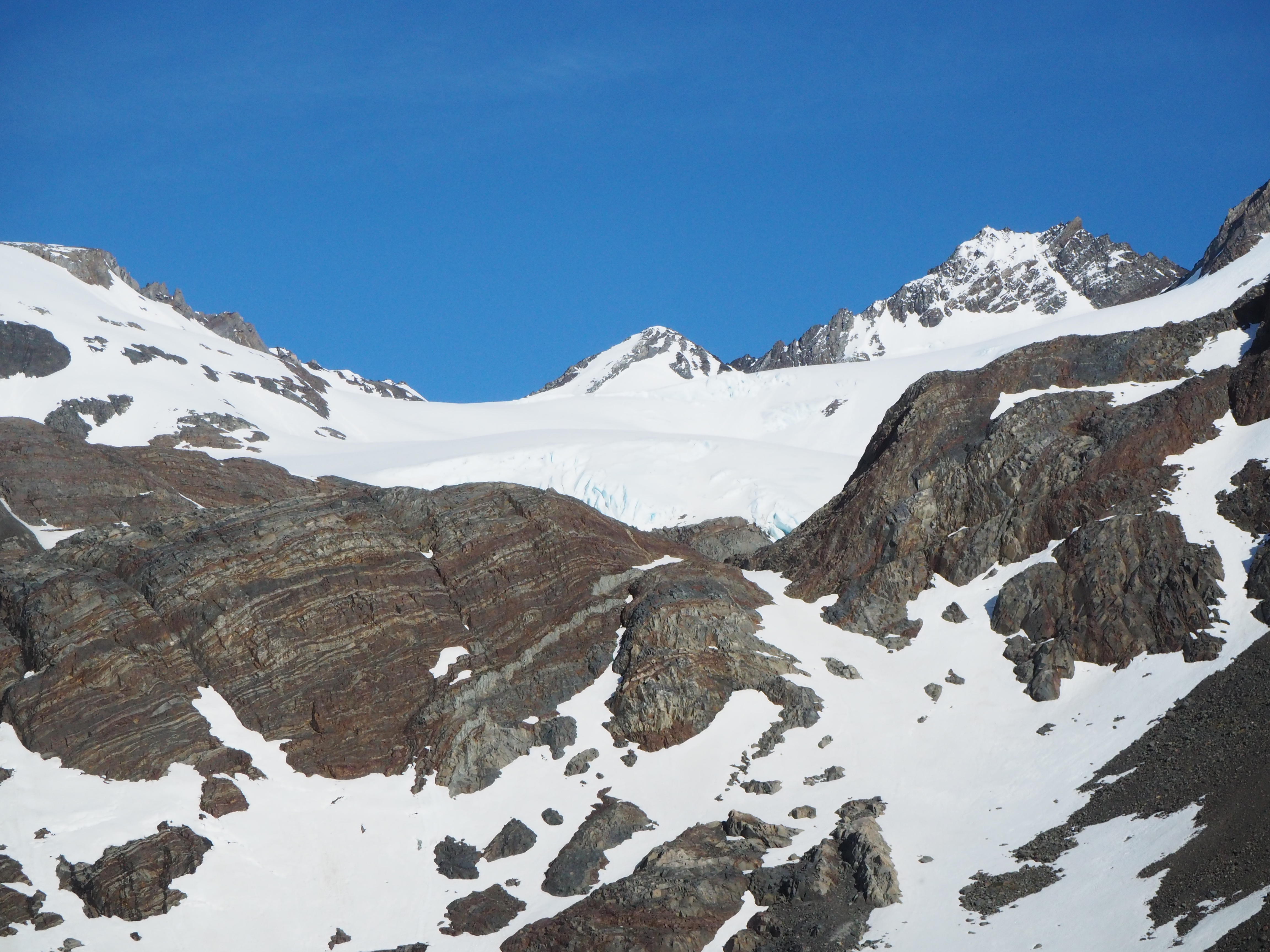
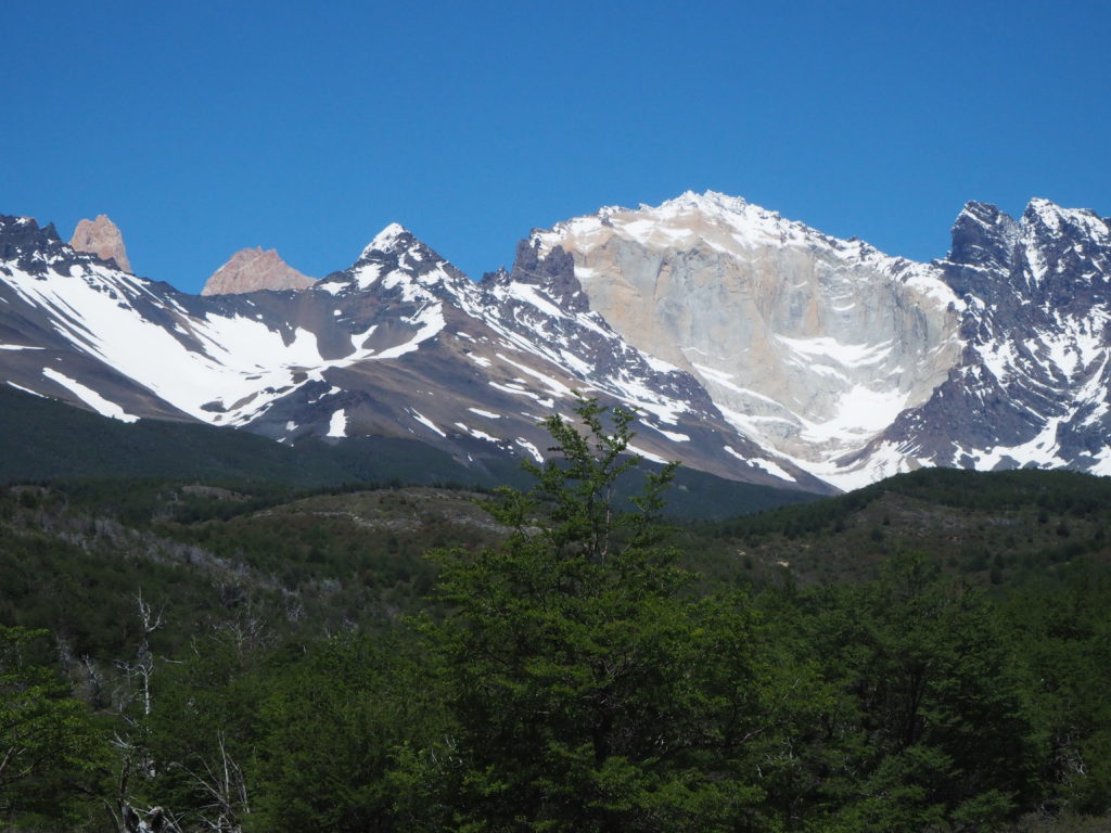
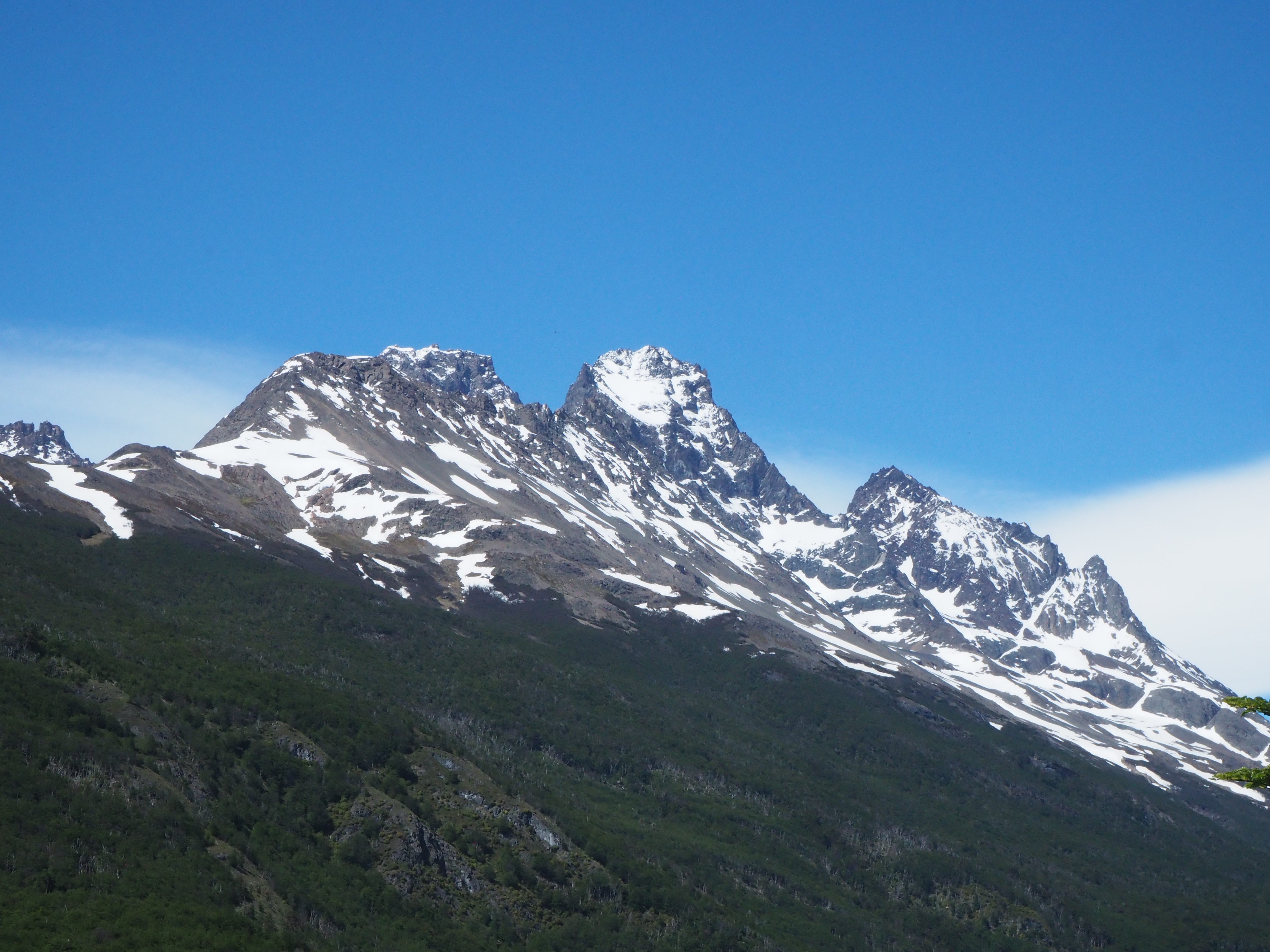
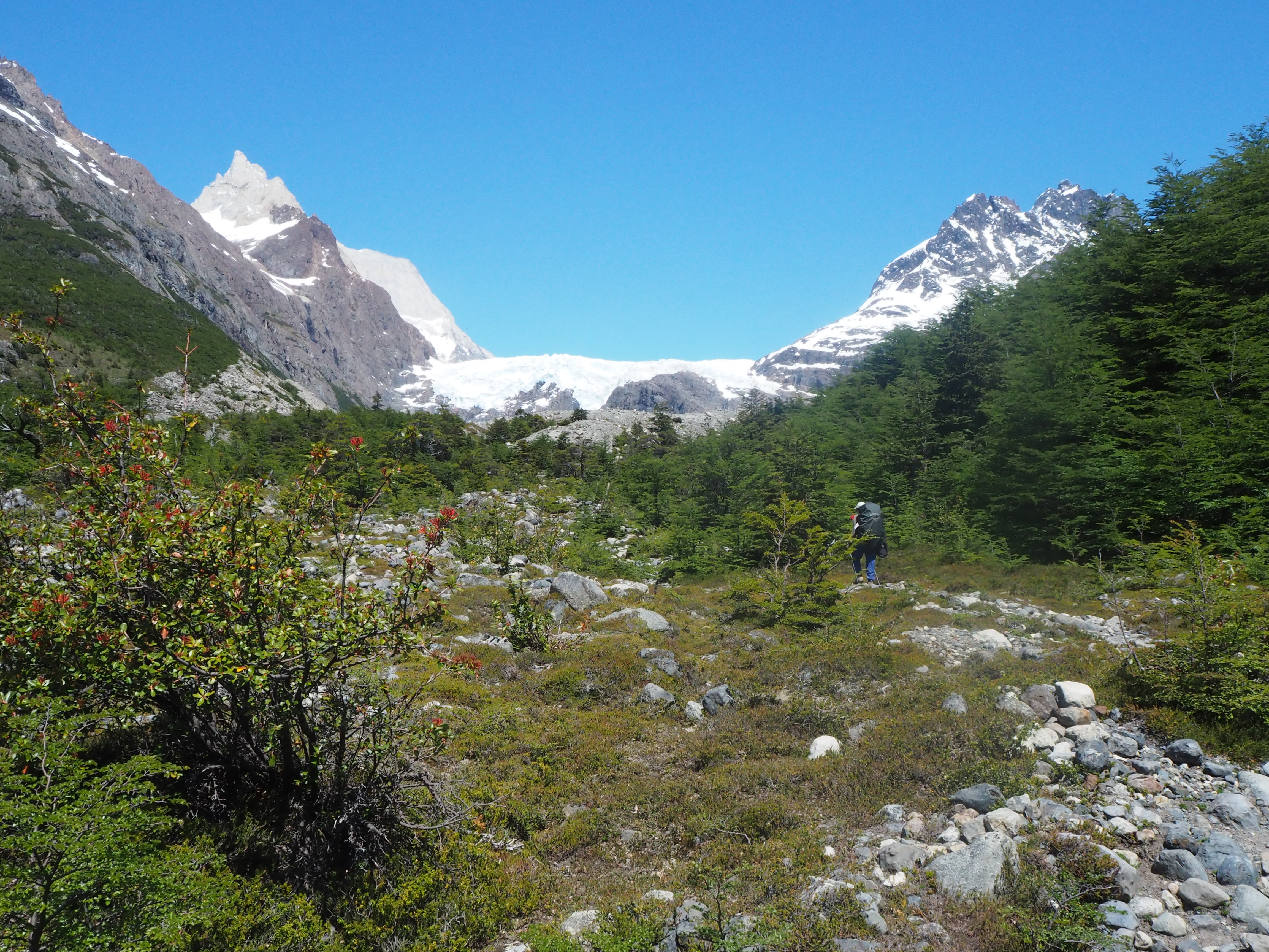
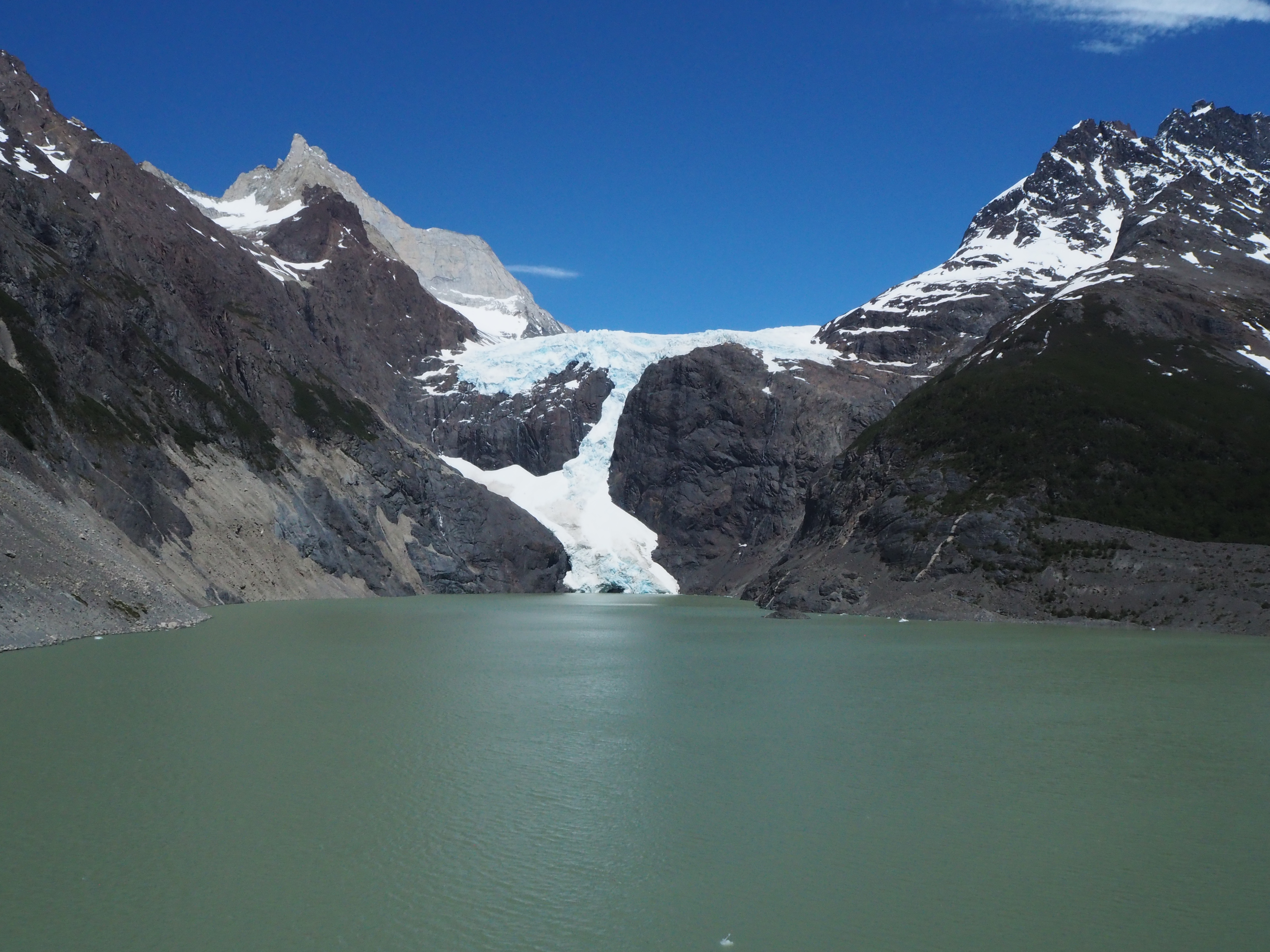
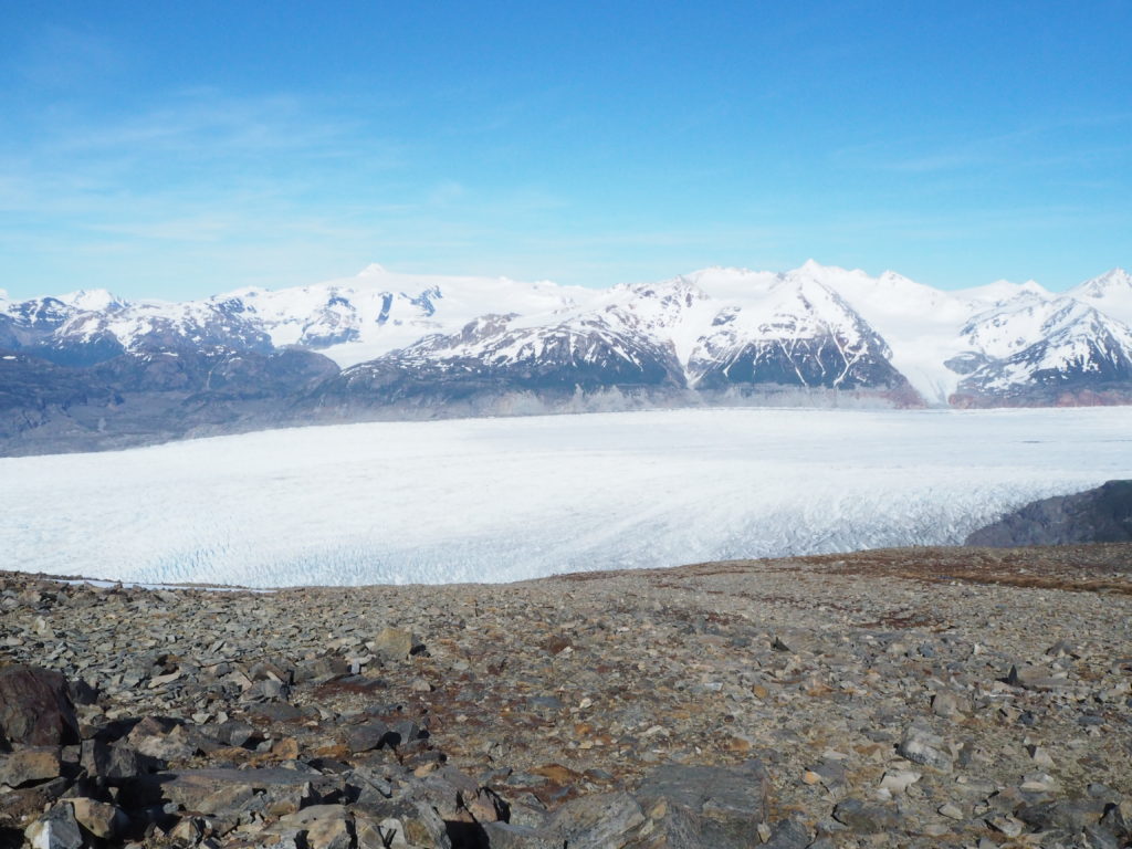
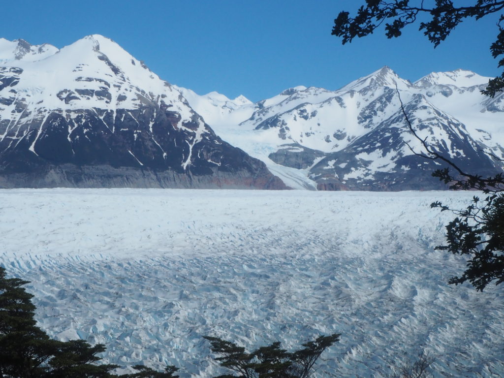
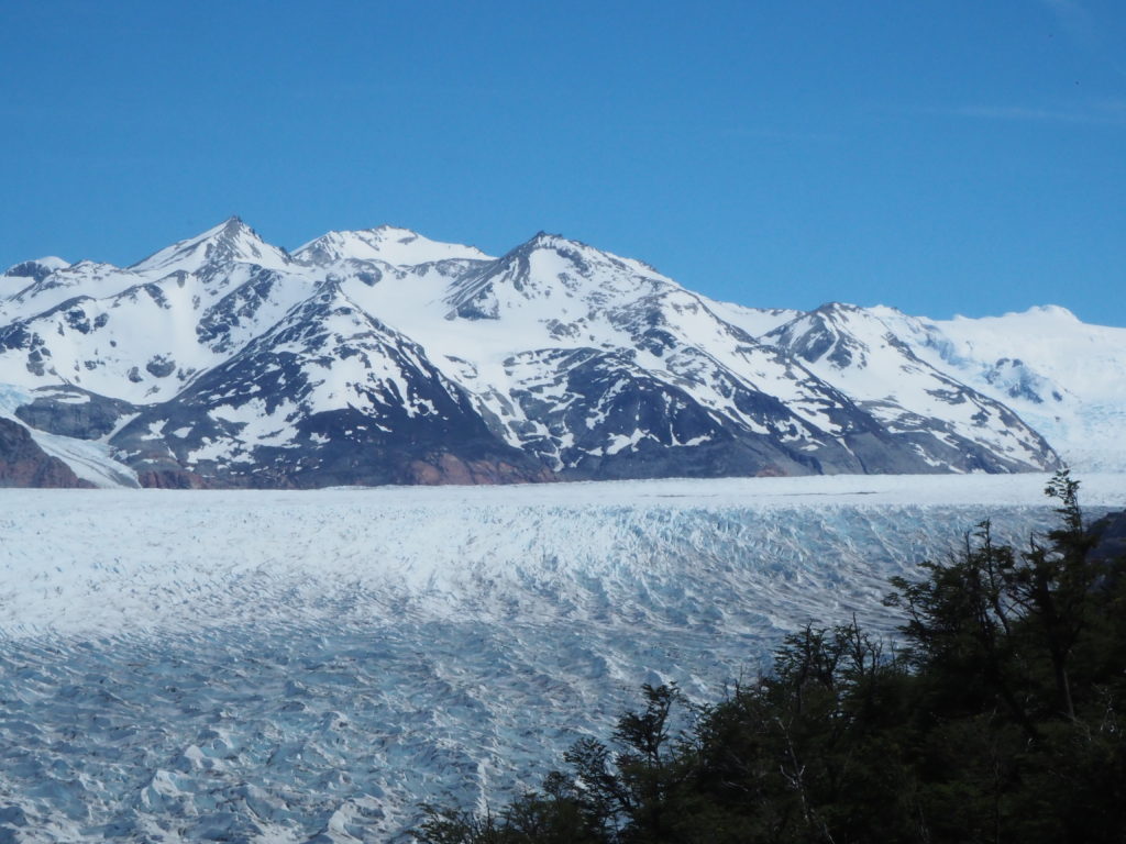
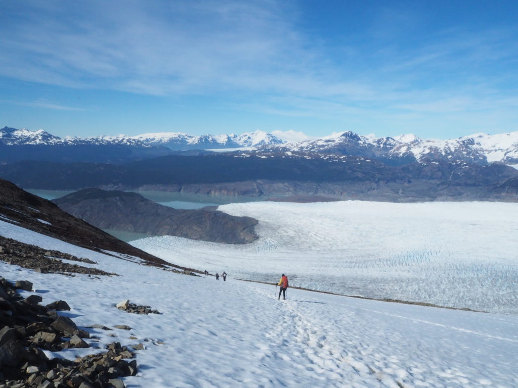
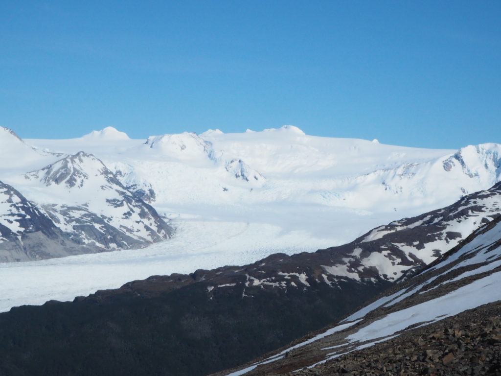
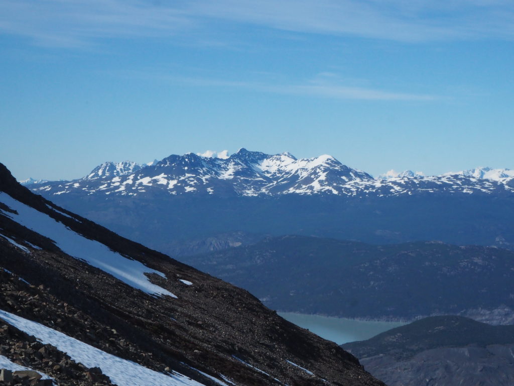
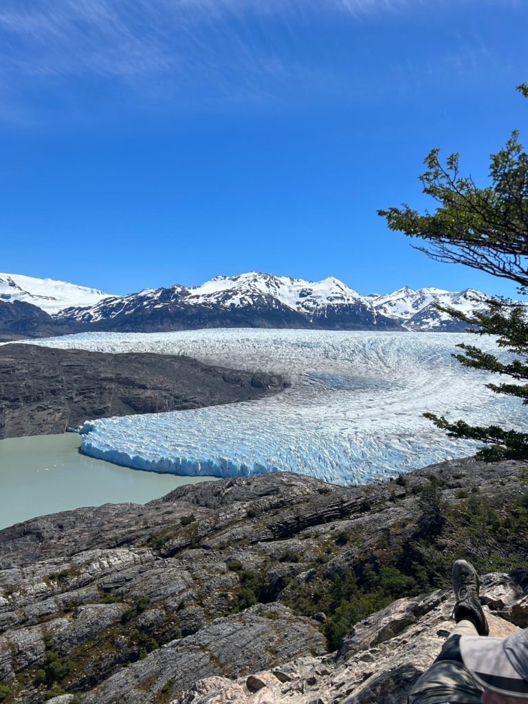
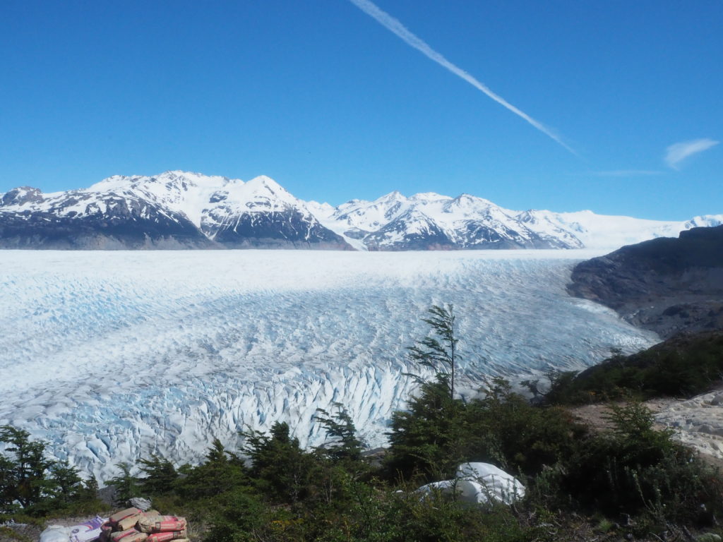
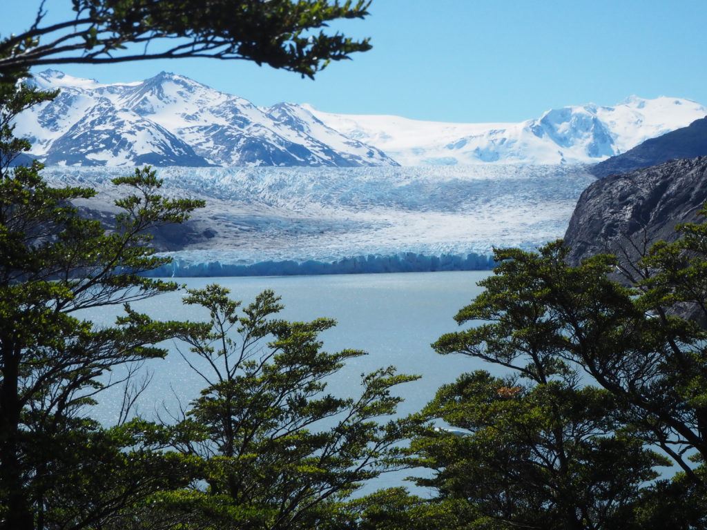
For the fourth time in the last 11 years, the wind did not come. The top of the pass was silence. Skilled early morning hikers were enjoying their snacks and the beautiful view in front of them. Lying on the other side was the massive Grey Glacier, one of many floes from the Southern Patagonia Ice Field. At home, we have the Columbia Ice Fields, we have some glaciers. But Grey was a capital G Glacier. The tongue resting in the Lago Grey, with a few icebergs resting some distance off shore. The top of the glacier was mangled in crevasse’s, pools and ice spires. And it slowly ascended the mountains across the valley from us, to be obscured by snow peaks and frosty clouds. We weren’t in Alberta anymore.
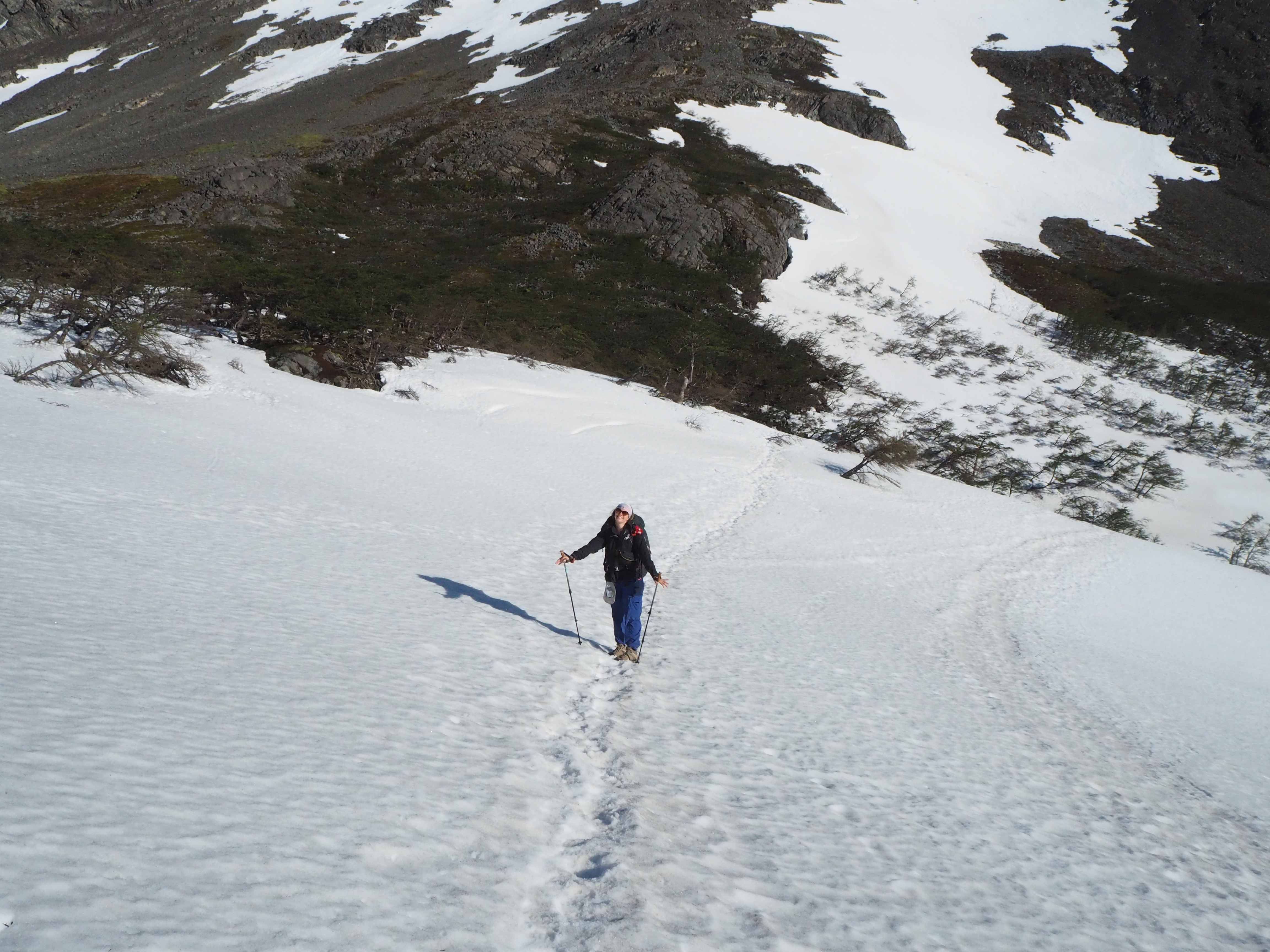
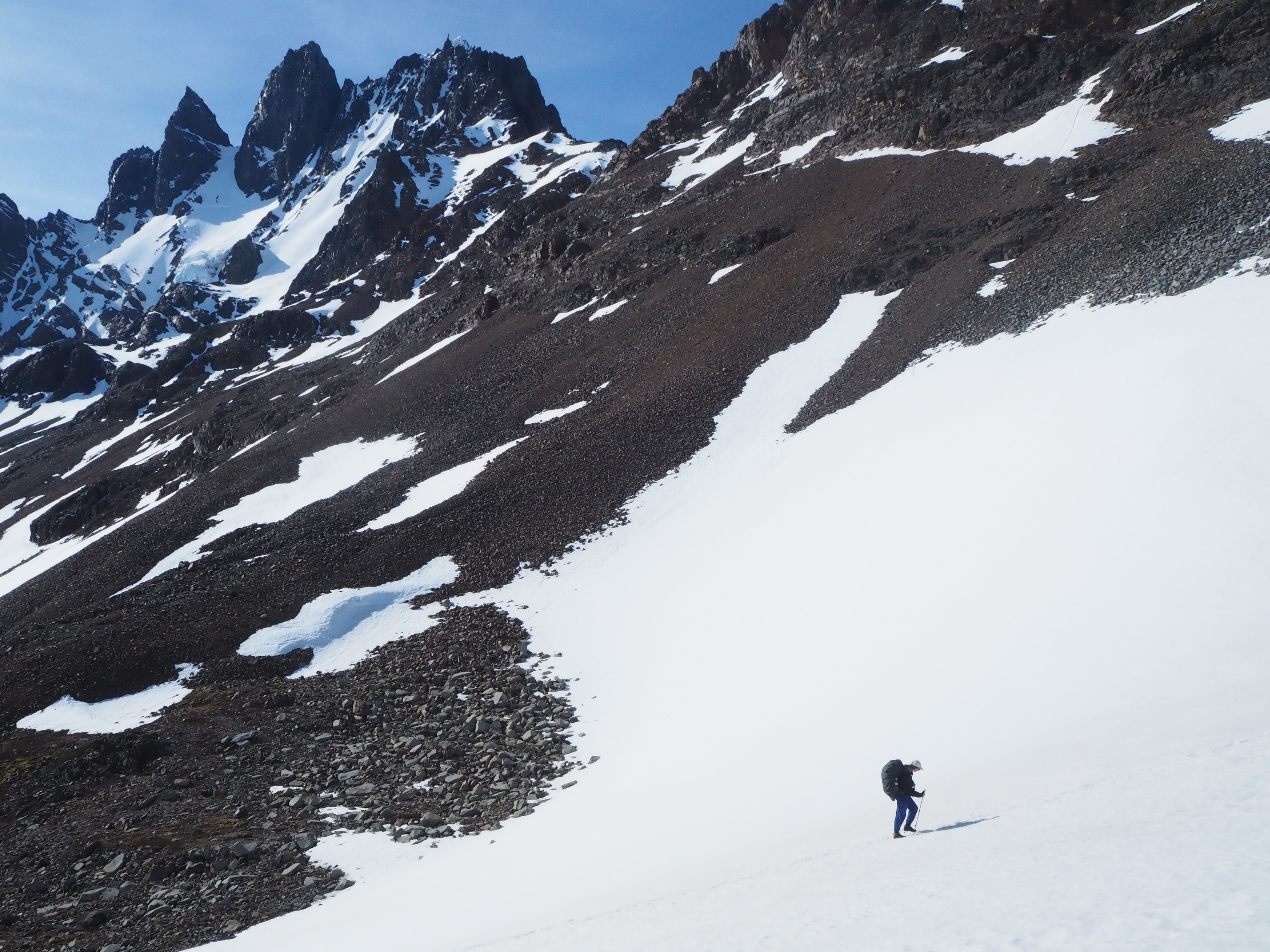
After admiration, we began our descent over the pass, with the eventual goal of having lunch at Campo Paso, the unofficial halfway point of the hike. The decent started out nicely, as it was a long snowy path that we essentially skied. You can tell who’s used to snow and whos not, especially here. Some with out experience were carefully placing each foot, being careful not to fall. We fell all the time. But its snow, its an easy landing. At least for us.
The trickiest bit came as the woods decided to meet up with the snow, creating a decently impassable stretch. The rangers carved out large stairs in the snow, each maybe half a metre in size. It is this section that is the most dangerious. One woman had apparently broken her ankle in this region the week before, and had to be helicoptered out. Someone last year broke their spine. That would have been good information for us to know before we carelessly blasted through the region. But we made it out of the snow unharmed.
The next two hours were dreadful. It was a descent of near 600m over 2km. The path was a combination of rocks, mud and tree roots that the rangers clearly tried their best on to make a somewhat passable staircase. There’s really no better place for a path on this side of the pass. The whole face is just a steep descent from the peaks to the glacier, with many frequent thundering streams coming down.
Powered by the idea of instant ramen for lunch, we threw ourselves down the mountain. According to the ranger ‘are you alive’ sign in book, we were the 8th and 9th hikers out of near 100 to make it to Campo Paso. We stayed there for an hour, and only 7 more hikers showed up. A lot of people spent an extended amount of time at the top of the pass, enjoying a view that weather doesn’t allow a lot of people to enjoy. We swapped to dry socks, which didn’t stay dry for long as our shoes were swamps. We also witnessed a couple supply drops for the ranger station via helicopter. That was cool.
Off for the second half now, and our bodies were sore. An hour of chilling allows for a lactic acid build up, and we of course were not drinking enough water. All of the water coming off the glaciers was potable, and had a really fresh flavour. But you just forget to drink when your hiking. Plus, there’s too many people on the trail to go for a non-descript frowned upon cheeky pee in the woods.
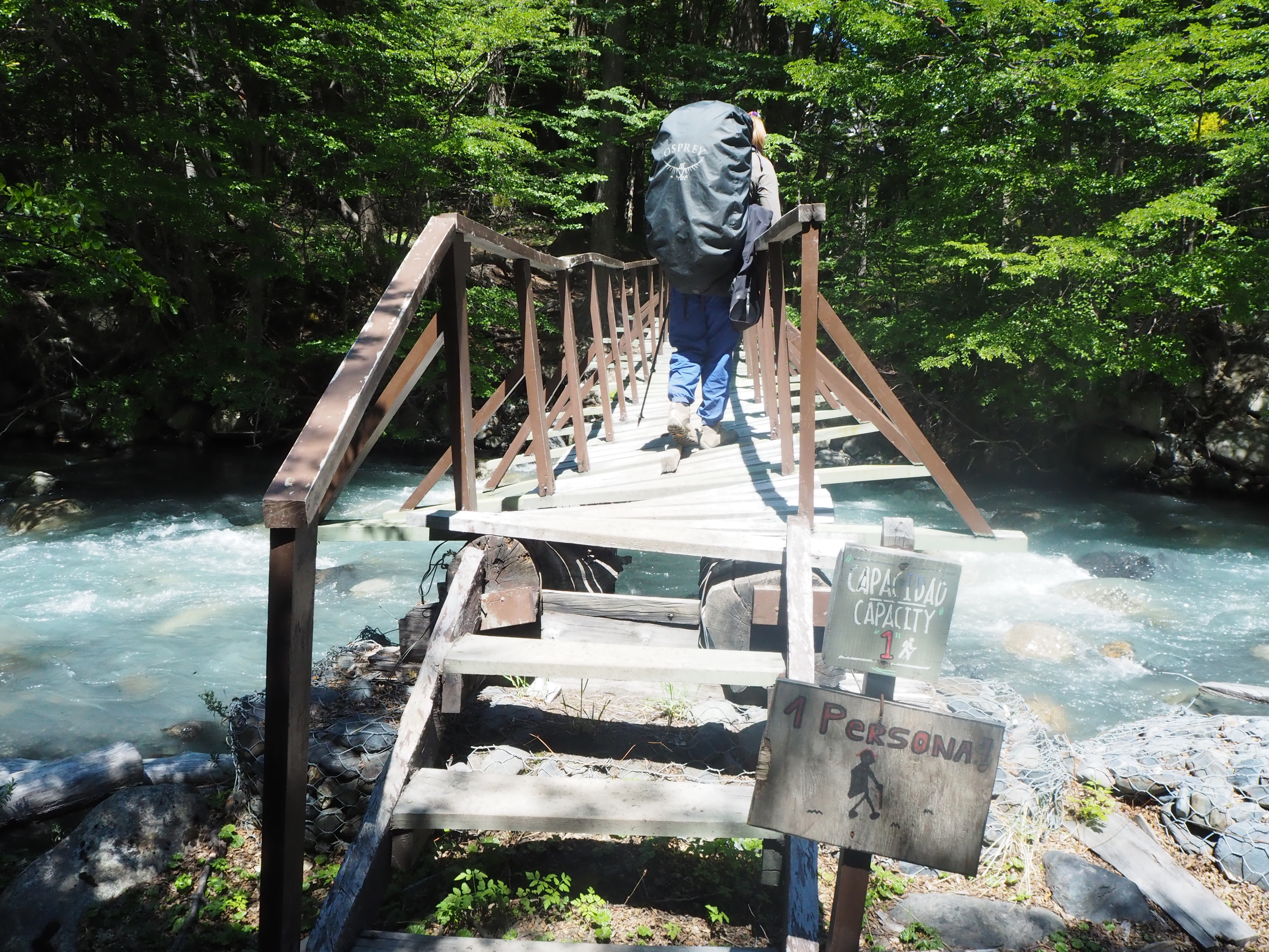
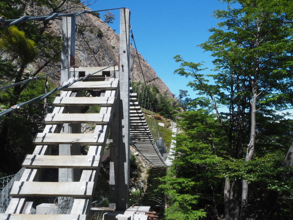
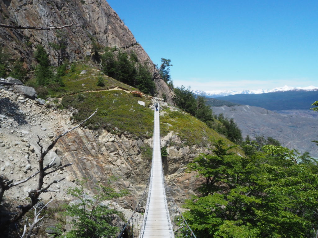
The terrain of the second half of the hike was thankfully much more forgiving than the first half. It was mostly flat, slight downhill. There was also some fun involved, as there were three large suspension bridges to cross. It was still mostly forest, but there were many great viewpoints of both the glacier and the lake below us.
Things can’t ever be easy though, and our recklessness on the downhill caught up to us. I had one odd step on flat ground, and pain shot through by my bad knee. Not anywhere close to bad enough for a helicopter, but enough were we had to sit down and reevaluate the plan to the finish line.
Hiking poles are the best investment you will ever make if you do at least one hike a year. They take so much weight off of your legs if you really rely on them. Your girlfriend also takes a lot of weight off your legs when she takes half the stuff in your backpack. The combination of the two allowed me to slowly and gingerly walk to the Grey campground. Each step had to be carefully placed, as pain would shoot through my knee at seemingly random steps to me. But each time, Cam told me exactly why that one hurt. Some steps were bigger than others, or my foot was on an angle. A different cause each time, and a brand new set of rules on how to walk without pain to learn. Suspension bridges were especially hard, as they bounced and swayed, and wood path had no cushion.
Cam was a saint for me here, and without here its probable I would not have made it through these 4km. She reminded my to stop to look at the nature, and kept spirits up even though she was carrying way more than her legs could maintain. She felt it at the end of the day. But we made it to camp in one piece. We picked up a hot water bottle at our hostel before the hike, and it came in total clutch here.
Talking to all of our friends, we were far from the only ones with troubles. By all accounts, we had a chill easy day. The USA gang nearly lost a member to a knee. Our friends Casey and Karen came inn looking like they ran a marathon, just wrecked, but in good spirits. They always had good spirits.
The campground here was swanky too. It’s a campground on the much more visited W-Trek, and came with things like a restaurant, and a hotel. There was also a dock a not so short walk away that is used for kayak excursions to the glacier. We came close to going to the restaurant for a pizza, but it honestly didn’t look good. Our dehydrated pasta was good enough for us.
The O side of the trek is like a novel. Lots of rising action with many exciting point in between, all building to a wonderful climax in the fourth day. Now we were on the W side. With more people, more km, and the iconic viewpoints of Britannica, Torres del Paine, and Patagonia as a whole ahead of us.
Overall, we are not sure if the O side was worth all the hype it got online. It was an amazing stretch of terrain, but (and maybe its cause we are Albertan), it was very similar to home, so it’s a long way to go for similar views. The weather was great and the view of the glacier on day 4 was spectacular, nothing like we have ever seen before. But that being said, you could walk to a view point from the W side to see it. We are happy we completed this section, but we I ever returned, I think we would just do the W. We will tell you why next blog.
Cam is a hero, trusted partner on the trek pulling more than her own weight, well done. Bummer about the knee, safety first. Nice to not be the only ones on the trek, can be in a balance vs too many shleppers, sounds like yourselves had it right. Great pics, great experience, pat yourselves on the back. Eager to read about the W trek!
Good job G and C. And Great Job C for supporting G and helping him out… your turn will come! That’s team work!
Can’t wait to see the W trek.
But more importantly… can’t wait to see you both in a week! xo Mom
What a strong woman! You are a great partner Camryn. Graham, it is no wonder you are a song writer! Your writing is wonderful!! Isn’t is wonderful that you had no wind at the summit – that is a gift. Thank you for sharing your journey with us.