
We set our alarms for 3:45AM. But we were up at 3:30. It was going to be a long five days ahead of us, as we had planned over 70km of independent hiking. We met up with our friends, found a colectivo, and started what ended up becoming one of the most arduous and rewarding journeys that we have taken on.
The adventure started the day before. We arrived in Cusco, the ancient capital of the Inca empire, via a night bus. Our taxi driver was very excited to give us recommendations for activities in the area, but we had our sights set on just one. The Salkantay trek to Maccu Picchu. We had one afternoon to gather all needed food and supplies, and coordinate transportation and all other logistics before we left the next morning. And we were just coming off of our Colca Canyon hike. There was no time for rest.
When we arrived at our hostel, we quickly discovered our day would get a lot easier. We saw our friend from Ecuador, Kevin, who is a avid, much more hardcore hiker than us. He summited seven volcanos while in Ecuador. He was leaving for Salkantay the next day as well! And had figured out every logistical problem we needed to solve. That’s half of our list checked off right away. He directed us to a camping supplies store too, where we could rent everything else we needed.
We picked up food for the journey, and we were all set to depart the next morning. We spent the afternoon trying to recover as much as possible, before our early morning wakeup.
Salkantay Trek
5 days
70km
3400m elevation
The Salkantay trek is the backpackers alternative to the famous Inca Trail. The trail starts near Lago Humantay, and ends at the front gates of Maccu Picchu. The path takes you beside the Salkantay mountain, over a pass, and then follows the Rio Santa Theresa before going over the Llactapacta ridge, and finally following the Urubamba river upstream to Maccu Picchu. It can be done via a tour, or independently. There are many private campsites and lodgings along the route, and many little shops in the middle of nowhere to buy water and snacks, making the day to day logistics of the hike easy. That was a wonderful thing to figure out the day before.
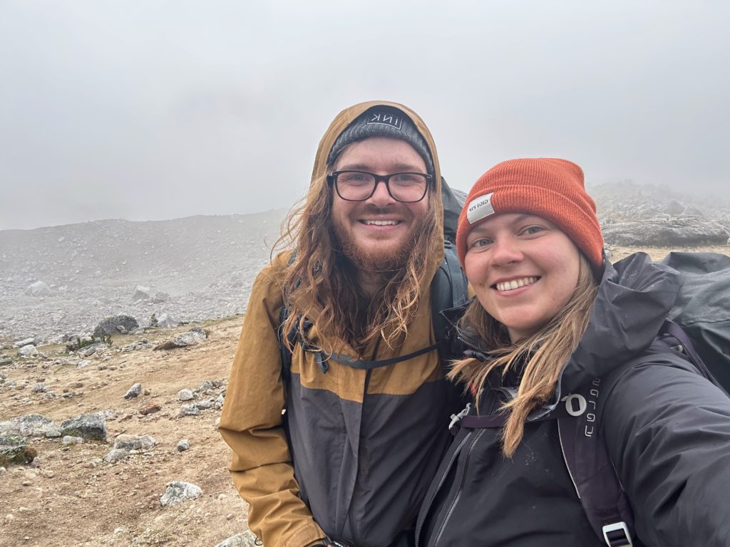
Our journey started early in the morning. Kevin had wrangled together a group of six, including us, for the journey. We got a colectivo at 4:30AM for the 2.5h ride to Mollepata, a pit stop in the journey to the trailhead.
The colectivo was long and hard to sleep on. But by 7AM, we made it to the unspectacular mountain town. From here, it was a cab ride further up the mountain to the trailhead. One girl in our group loved to negotiate, and negotiated for all six of us to take the one Toyota Corolla up the mountain for 70/S. Two were in the trunk for the journey.
The other four in our group got off at Kallecancha. We decided to stay in the cab until
Soraypampa, a little further up the trail. We had heavy ambitions of heading over the pass on the first day, and needed every KM we could get. At least that was the excuse. The truth is, we were still tired from Colca Canyon, and our bags weight a lot, as most other independent hikers stay at hostels along the route, and purchase food along we way. We were carrying both our room and board on our backs.
When we got to Soraypampa, our taxi driver tried to get more money out of us. We weren’t sure if our negotiator misinterpreted, so we left off with a fair deal that made no-one happy. We then finally started our hike to Maccu Picchu.
Day 1
21.18km
962m of elevation
6h, 28min
The first stop on this hike is a short detour to Lago Humantay. We decided to skip it, as we wanted to cover distance and get over the pass on the first day, something that doesn’t usually happen. Between this skip and the extra taxi ride, we shaved off 8km of the official trail before we even started.
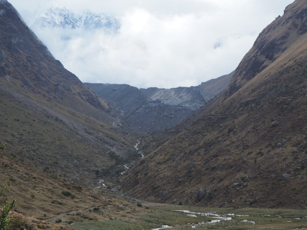
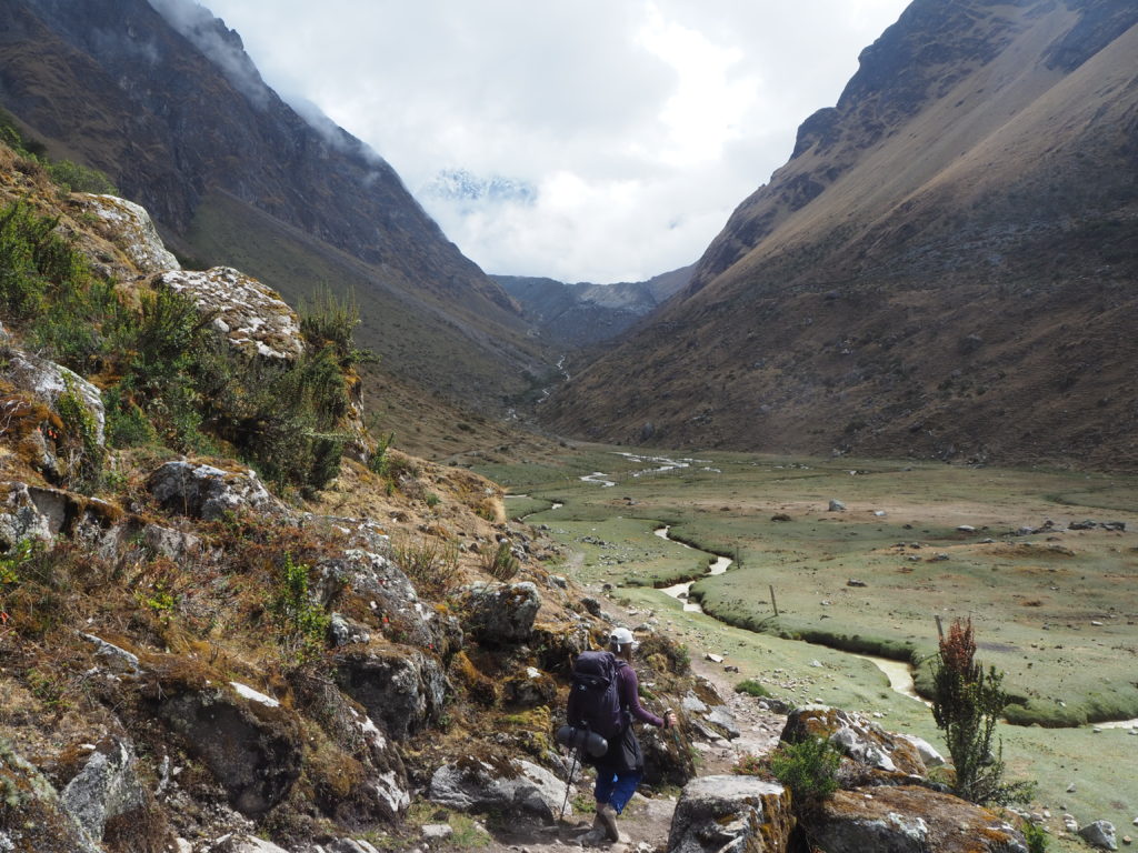
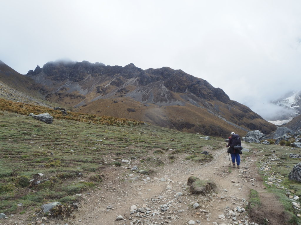
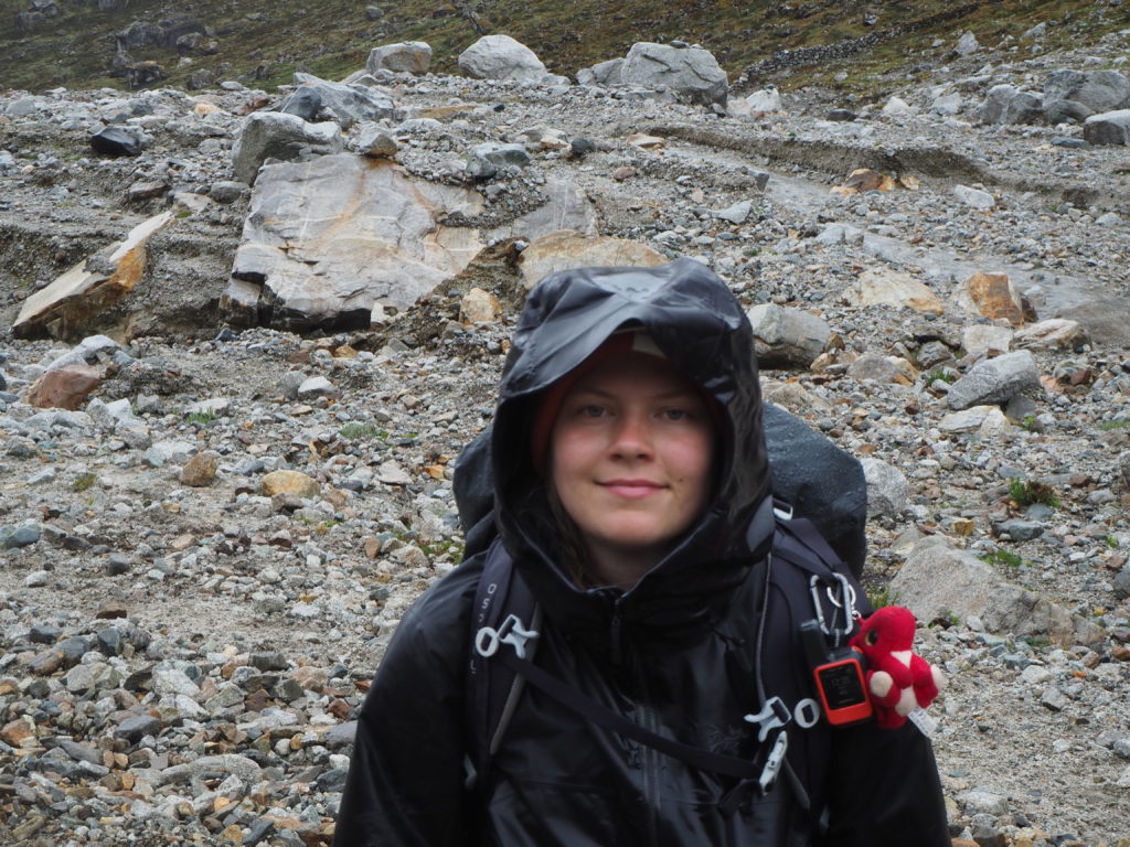
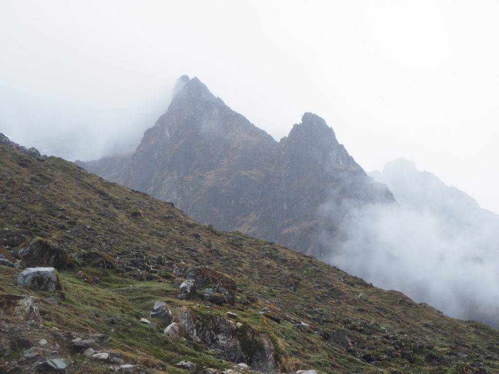
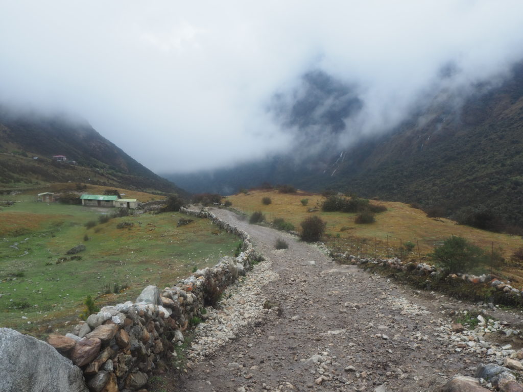
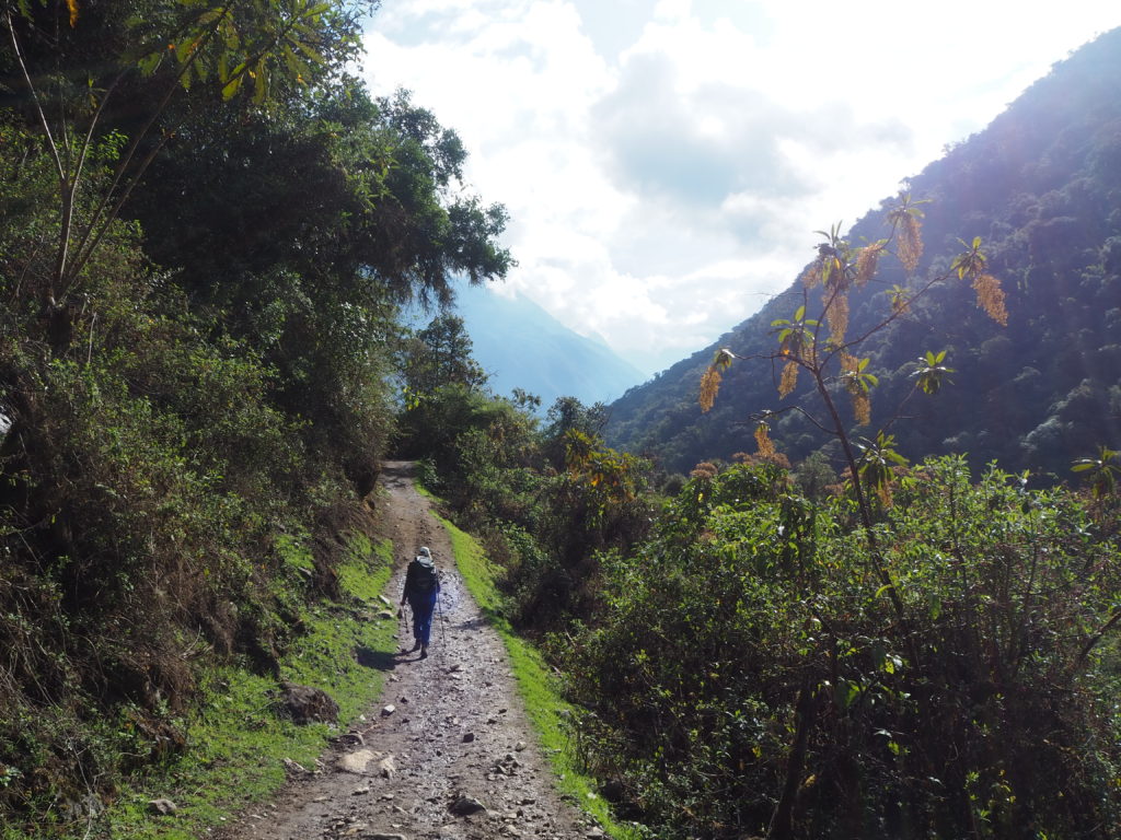
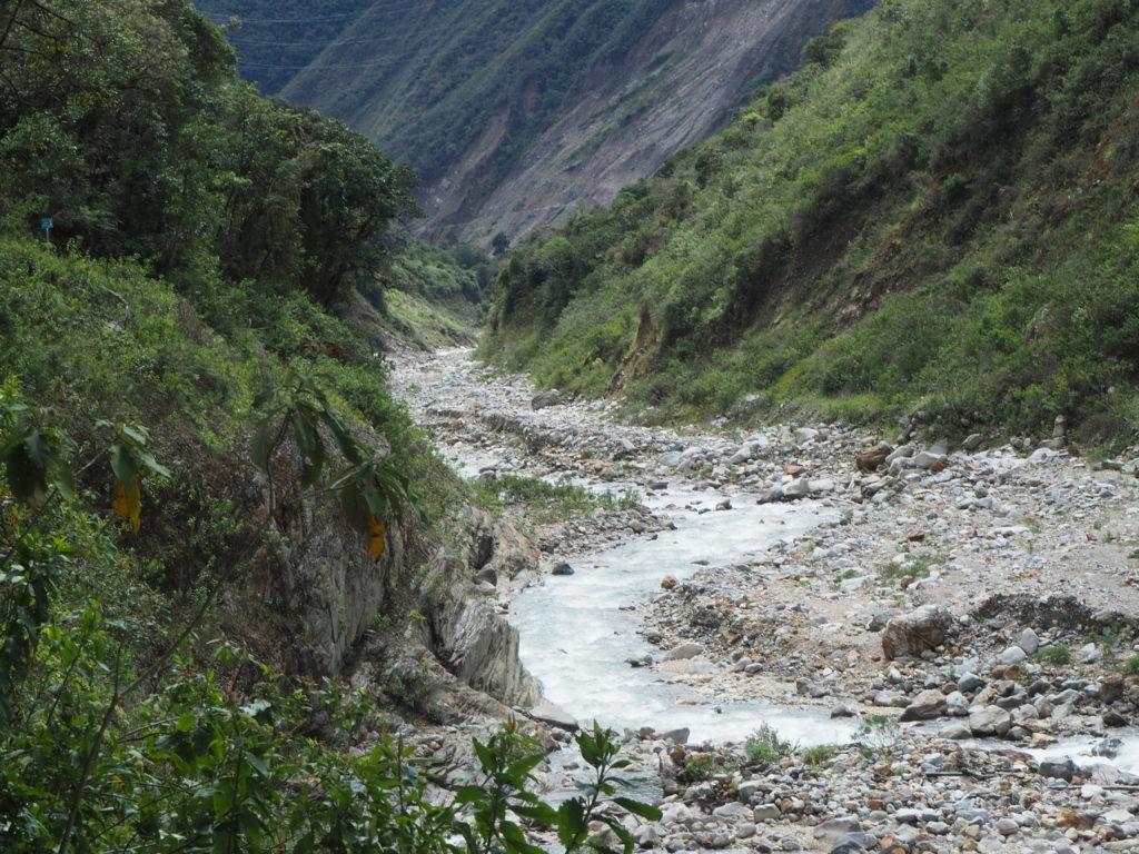
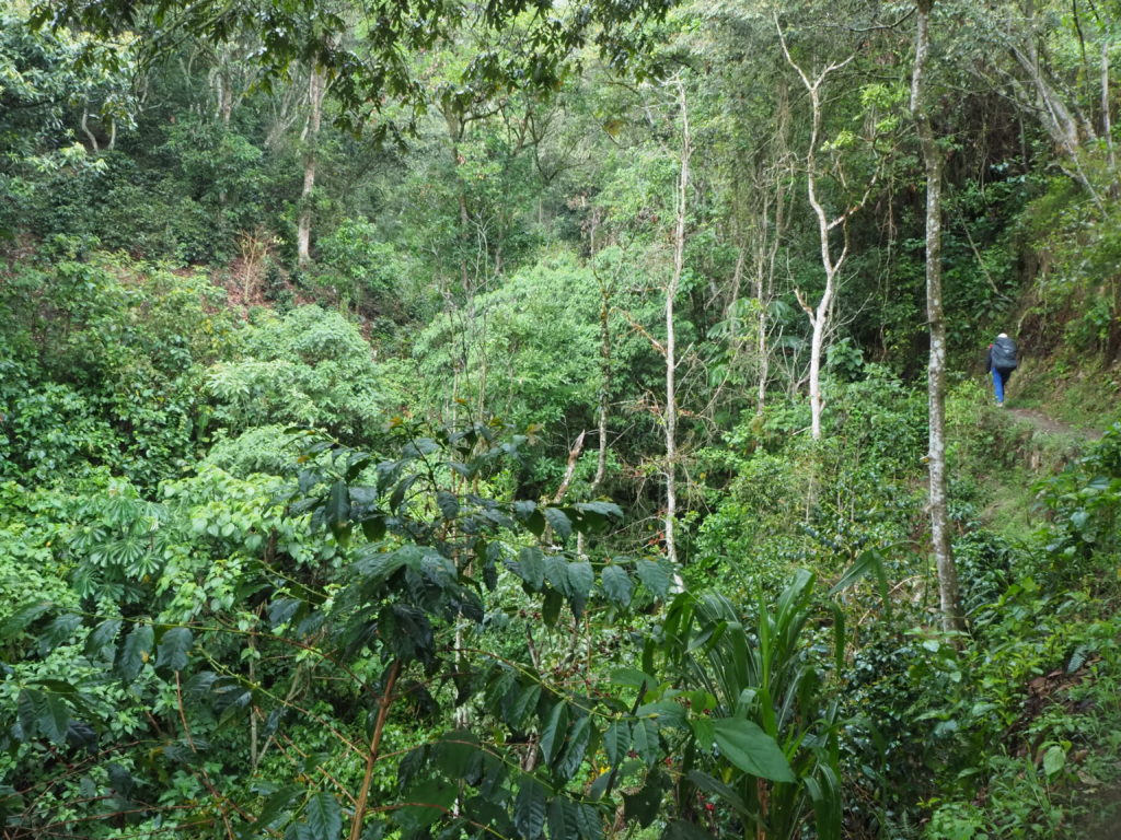
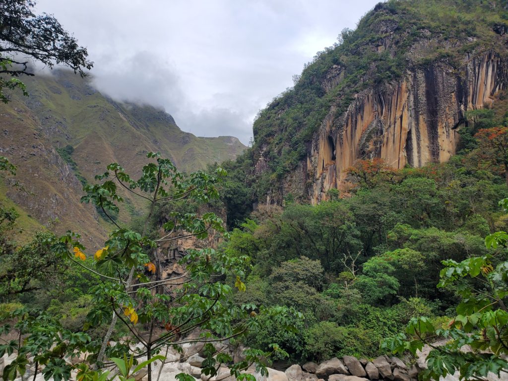
The trail starts by alternating semi-steep uphill sections with flat floodplains, flanked by steep rocky valley walls. The weather started out pleasant, a sharp cool morning. Within the first hour though, fog started rolling up the valley. The fog created a unique atmosphere for hiking, one of isolation and serene remoteness. The isolation was also increased by the fact that we passed the standard Night 1 camp 4km into our journey. Meaning the only other people we saw on the trail were local donkey shepherds, and tour cooks setting up for a tours days end, or hikers going the other way. It was a nice change of pace compared to the overcrowded Colca Canyon.
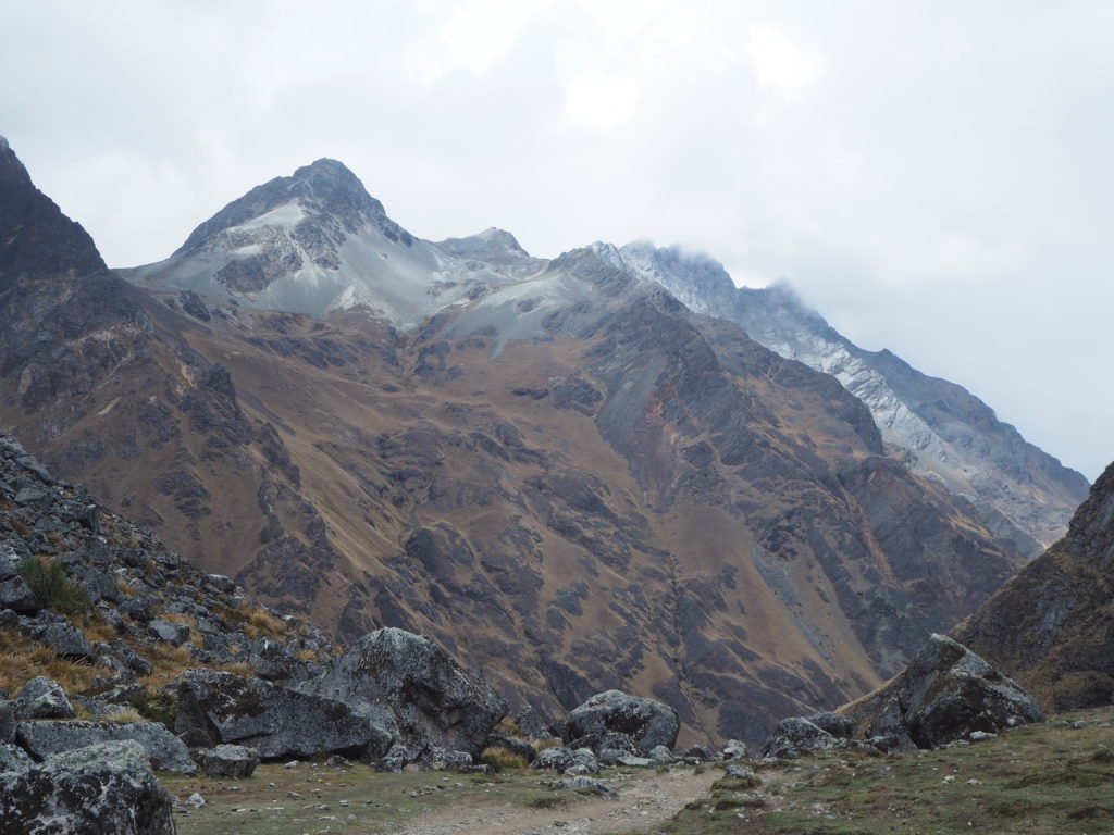
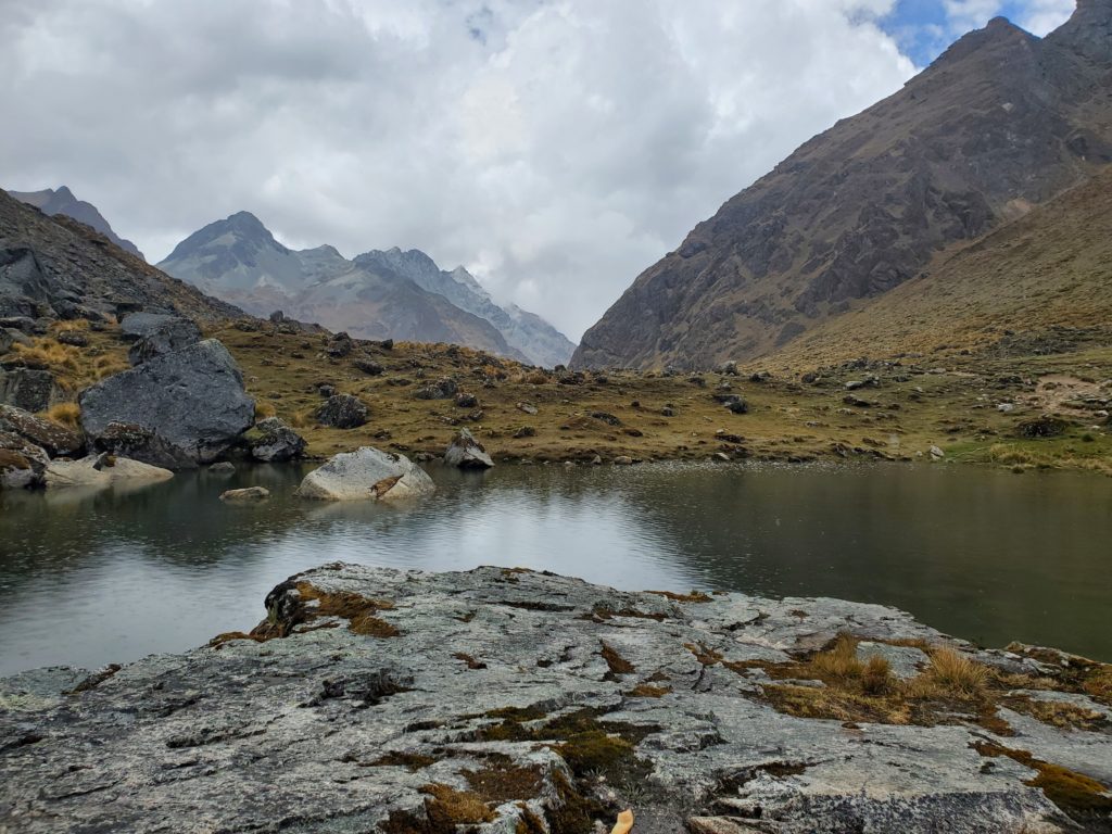
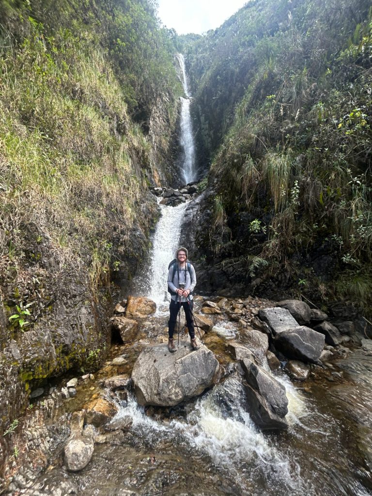
We set up for lunch beside a small mountain lagoon, sitting on a large rock. We had a pleasant view of the campsite around us, which was a partially flat piece of land with a bathroom. It had begun to rain at this point, and the clouds restricted any views. Every once in a while, the massive Salkantay mountain and its glacier would peek through the clouds. But that image would never last long.
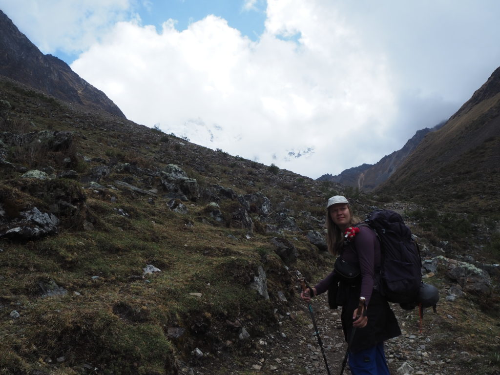
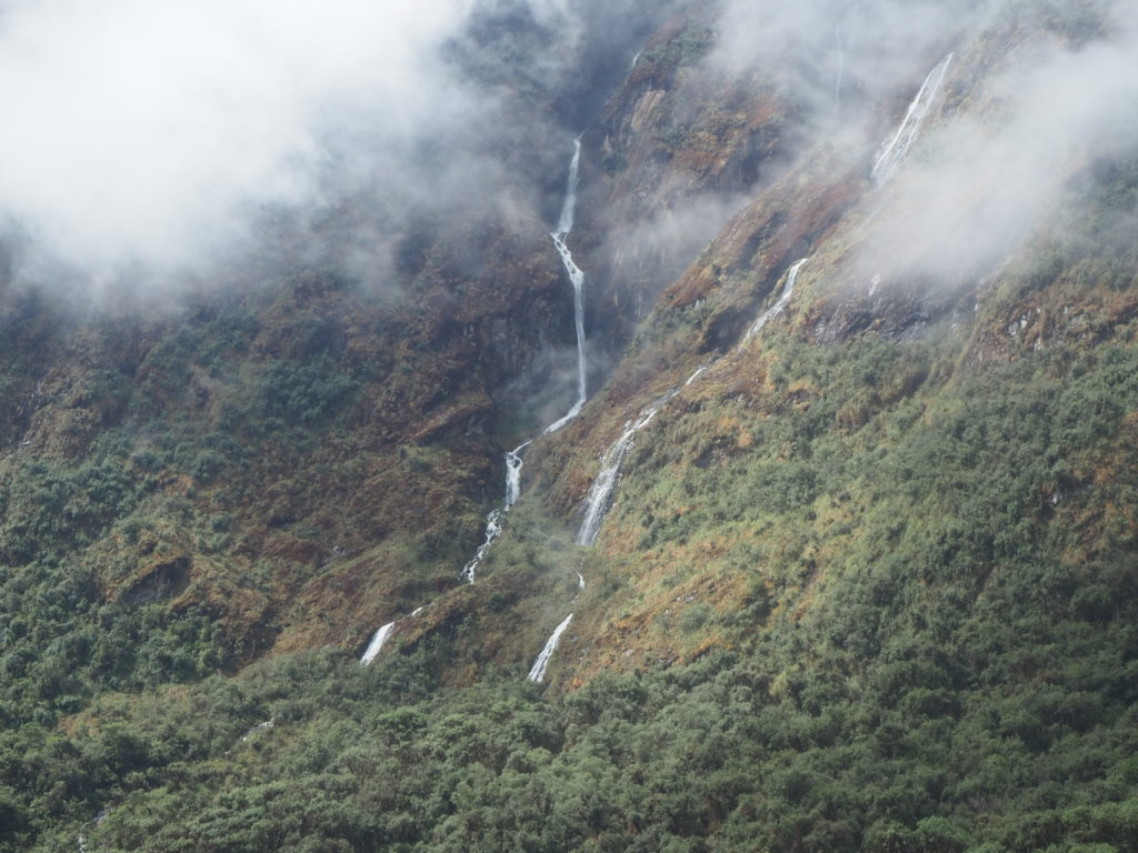
With nowhere to go but up, we continued towards the 4600m Salkantay pass. The high terrain had now shifted into a glaciated valley, with large boulders dotting the landscape for as far as we could see. These boulders would have been dragged from the mountains by glaciers thousands of years ago, and our path weaved between them all.
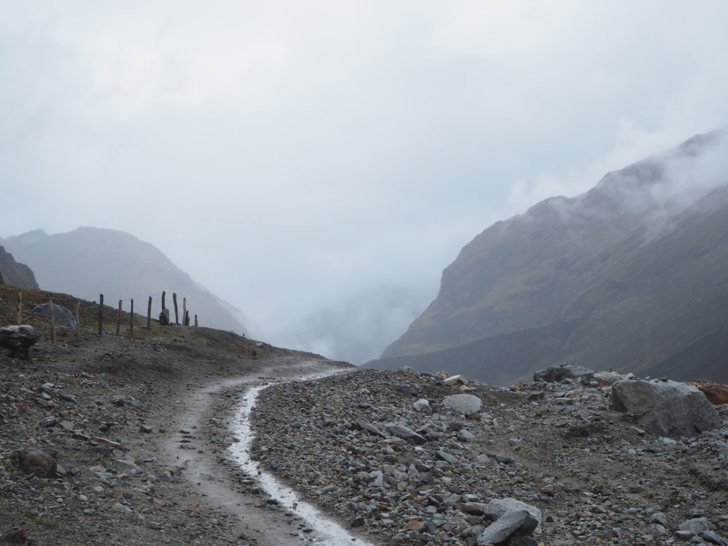
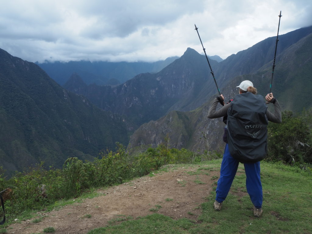
Finally we reached the summit of the pass, and the high point of our hike. It was fully raining at this point, and we could not see the massive glacier we were supposed to see, and we were drenched from the rain. But you have to take these moments in stride. So what we could not see the mountain. We had a wholly unique landscape and atmosphere around us. Our world was a field of boulders, with a grey background. While the description may not sound exciting, it really was.
The decent in the fog and the rain was great fun. We learned from our ultra-runner friend in Colca how to easily descend hills and mountains (Let gravity do the work for you. Don’t try and slow yourself down. Look 2-3 steps ahead, not where your feet are going to go next), so we flew down the mountain. The gentle slope of this downhill led to an easy training course, with very few loose stones. There are parts where gravity will set you running, but as long as you keep going, you make ground very quickly.
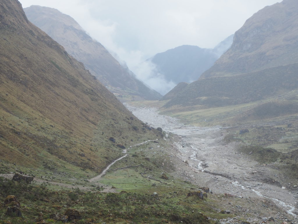
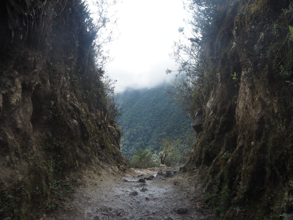
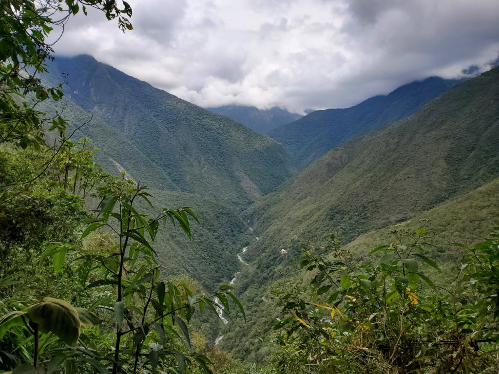
As we descended into the valley, we ended up below the clouds and the rain. The landscape had rapidly changed into a lush stream valley. Trees lined the hills, and we plunged into the forest. Boldened by our quick decent and enjoyment, we made the decision to go an extra 8km from the originally planned camp to the next one, to try and shave km’s off of our final days.
The forest was a full on rainforest. Steam was coming off of the muddy path from the hot sun. Bugs were everywhere. The crashing sound of a young creek was below us. But the downhill was again reasonable for us to take on. There were no falls (technique has improved since Huayhuash). We made it to our campsite, Chaullay, around 4:30PM, filled with adrenaline and lactic acid. We crashed quickly.
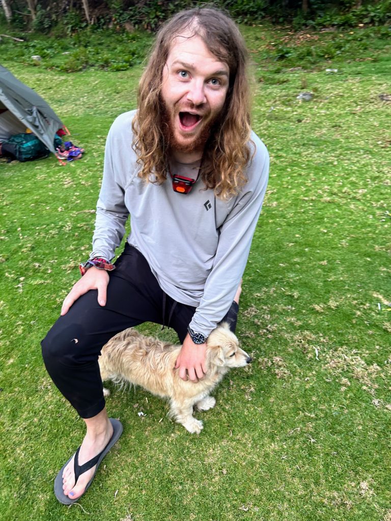
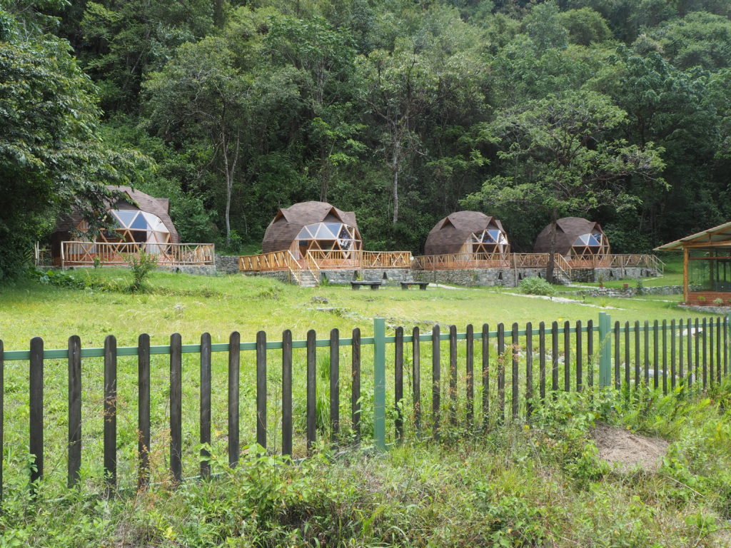
The campsite was lovely. Chaullay, we later learned, is the normal Day 2 rest point for tours, and some independent hikers. There are still over 40km left in the hike, and considering Day 4 rest is generally a few km away from Maccu Picchu, there is a lot of hiking left for anyone who stopped here. We just stayed on the front lawn of a hostel. Bathrooms were accessible, and the dogs here were quiet and adorable.
Day 2
18.99km
332m elevation
4h, 27min
We slept in according to our hiking standards, not getting up until 6:30AM. We didn’t leave until 8:00AM, after a breakfast of questionable tasting oatmeal. The route today would follow the Santa Theresa river valley, ideally ending in the coffee plantations of Lucmabamba.
The day was hot. At the lower elevations (2000-3000m), the fact that you are quite close to the equator becomes very apparent. Being so far away from the ocean doesn’t help with temperature regulation at all. We still opted to wear long sleeves and pants due to the sun and bugs.
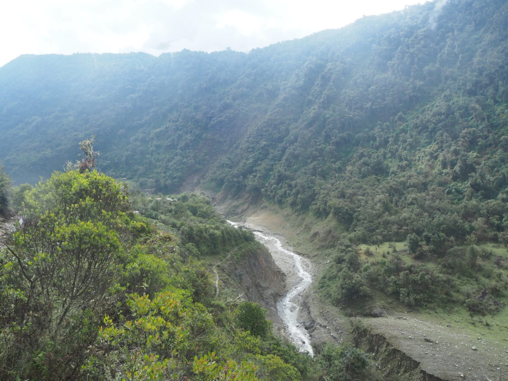
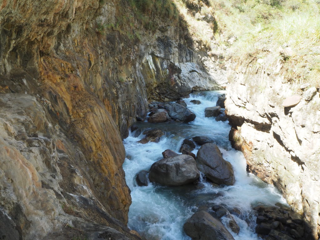
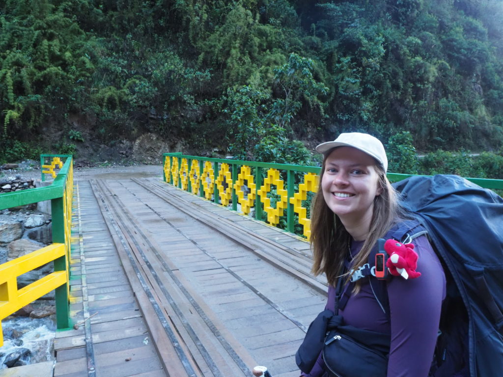
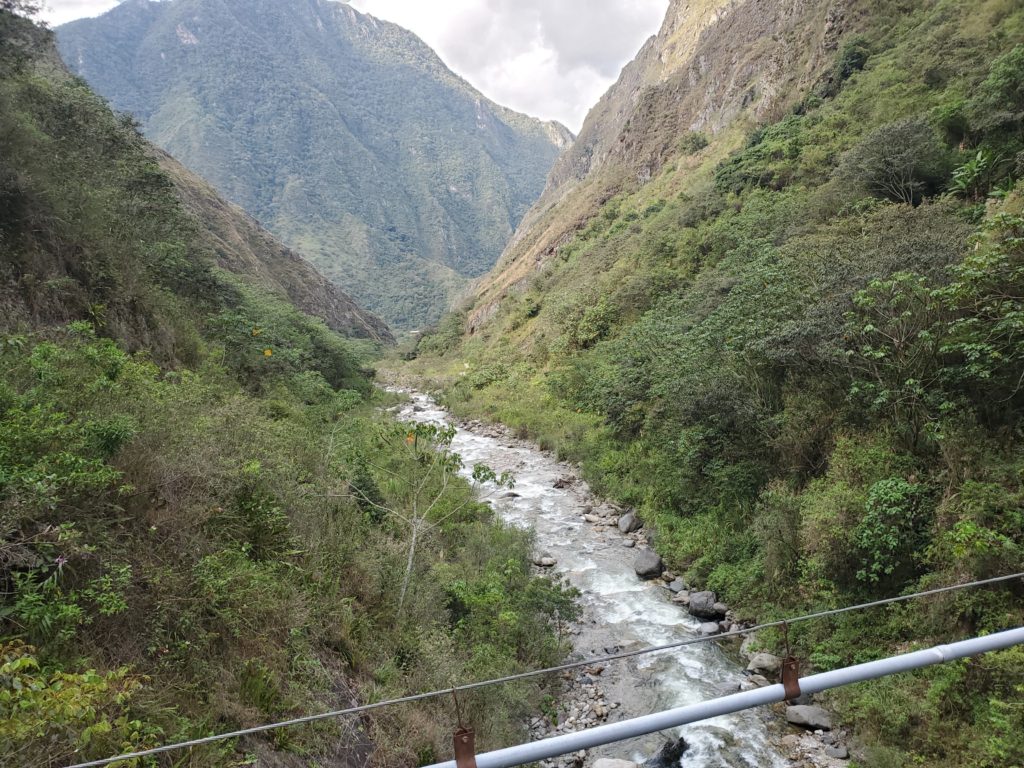
The trail started with a bridge over some proper canyons, with mountain streams from different glaciers all coming together to form the Rio Santa Theresa. We quickly caught up with some other independent hikers, and a couple tour groups. The tour group people all had some sort of paint on their face in warrior patterns. I guess there was some sort of culture lesson. We passed them, asking their guide for camping information.
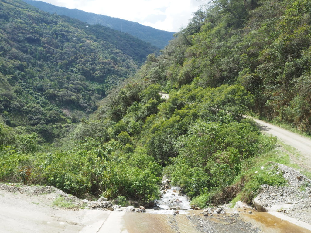
The path today was very one-note. It was in general, a gradual rainforest descent. There were some steep ups and downs in there, but nothing really out of the ordinary. We would frequently pass small shops and other camping sites or lodgings for other travelers. It is very easy in Salkantay at this point to gain or lose a few km depending on how your day is going.
We did get jealous at one stop though. A tour group came behind us, and the guide announced that they had 5-7 minutes of hiking left, then a colectivo would take them to a coffee plantation to learn about the harvesting. We had 8 or so km ahead of us, all on the road the colectivo was going to skip for the group. That’s the answer as to how these tour groups go through all of the distance so quickly. They drive it.
Walking along roads is never fun, but these roads are hardly used. Apart from the tour colectivo, we were only passed by one other vehicle for the rest of the day. We lumbered through a village looking for lunch, but nothing seemed appealing or sanitary. We are still suspicious of more sick bellies.
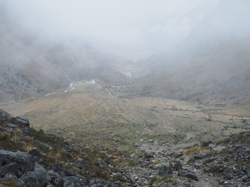
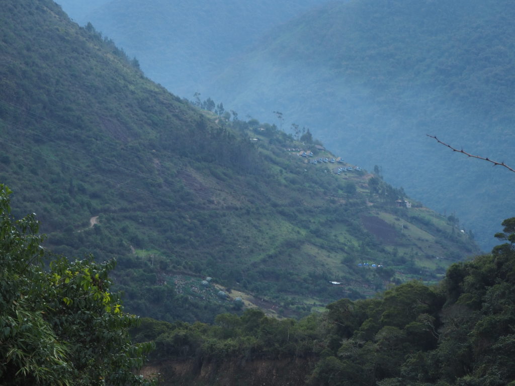
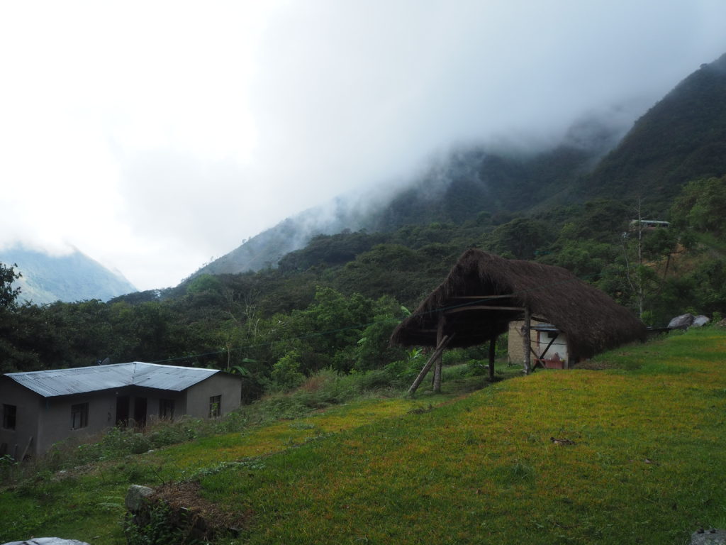
Eventually we arrived to Lucmabamba, and decided to call it a day. It was a major ascent ahead of us, and we didn’t have the energy to start it at all. We were the only ones at our campsite, as many other independent hikers passed us. Keep in mind, we are essentially a full day ahead of everyone else, so they needed to gain some ground, or else their 2nd last day would be a brutal 25km stretch to the Maccu Picchu camps.
Day 3.
13.87km
897m of elevation
4h, 44min
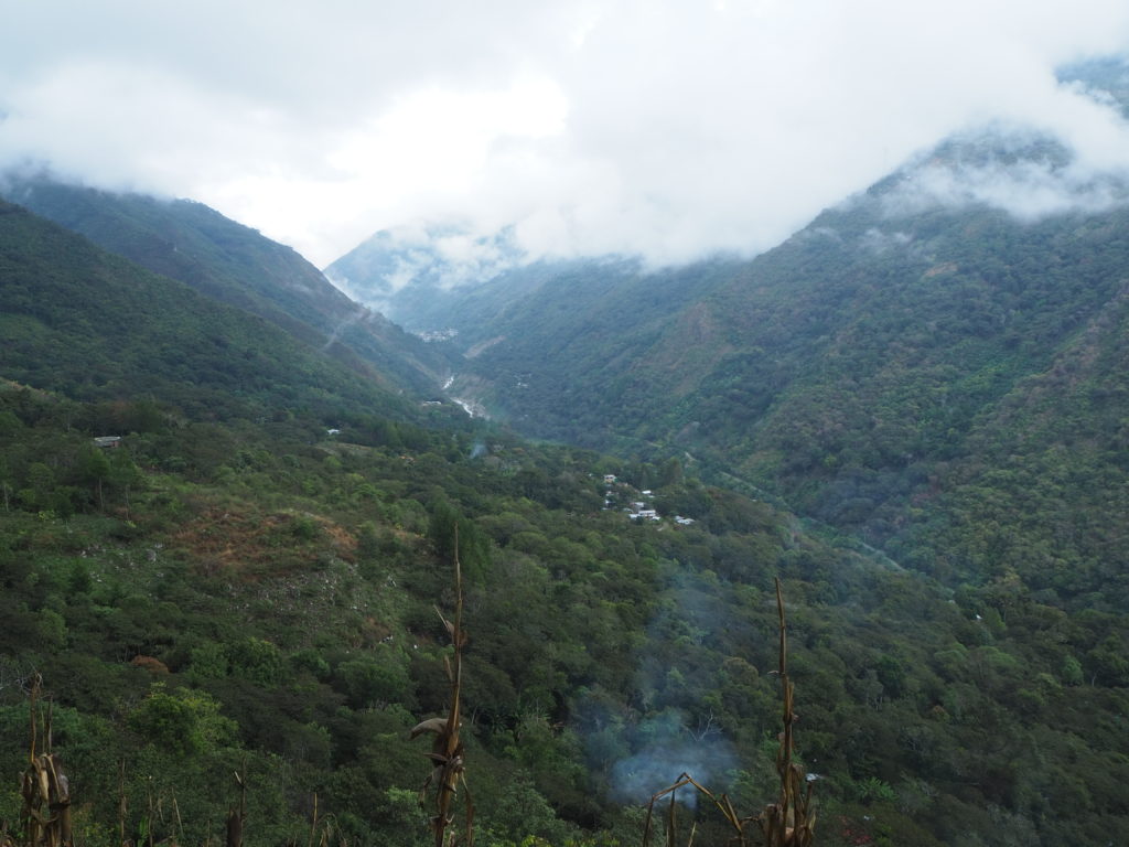
Day 3 did not start off well. I (Graham) threw up all of my breakfast within the first hour, and wouldn’t have anything else to eat until the end of the day. We thikn this was a mix of the humidity, heat, and intense uphill. We had a large ascent to a viewpoint of Maccu Picchu ahead of us, opting for the shorter route of over the mountain, rather than around it. The uphill was very slow. Our packs were heavy, our legs were starting to get exhausted, and one of us had no calories.
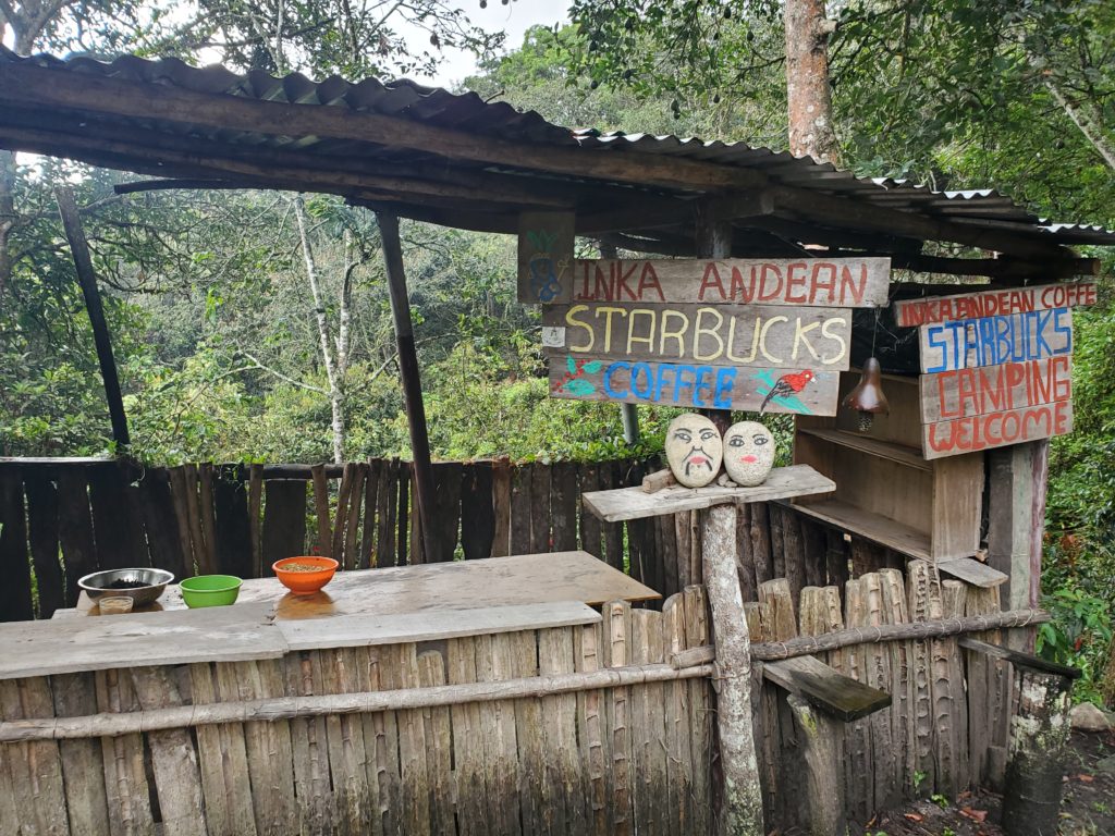
Along the pathway up, you walk through jungles of coffee plants. The beans are growing out in the open along the path. They are guarded by stewards of jungle chickens that roam free along these hillsides. (Predators don’t seem to be a thing anywhere in the Andes). Every 500m or so there’s another wooden booth that will serve you coffee. All of these little stops were small goals that kept us going. We knew the top was supposed to be something special, we just had to get there.
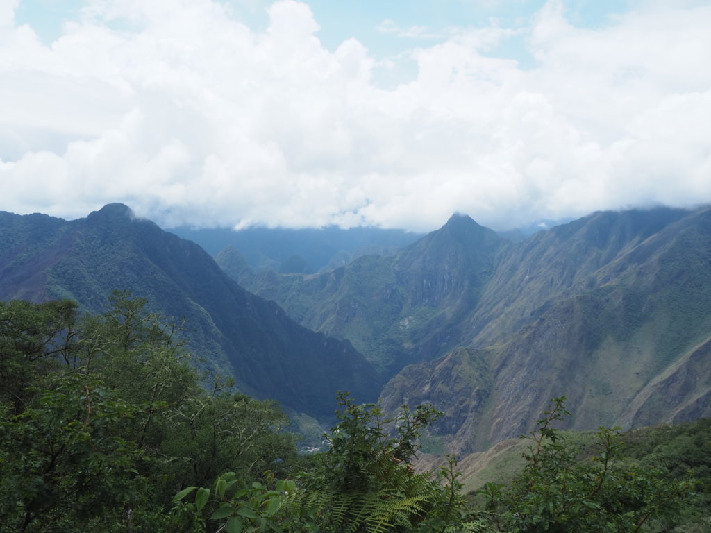
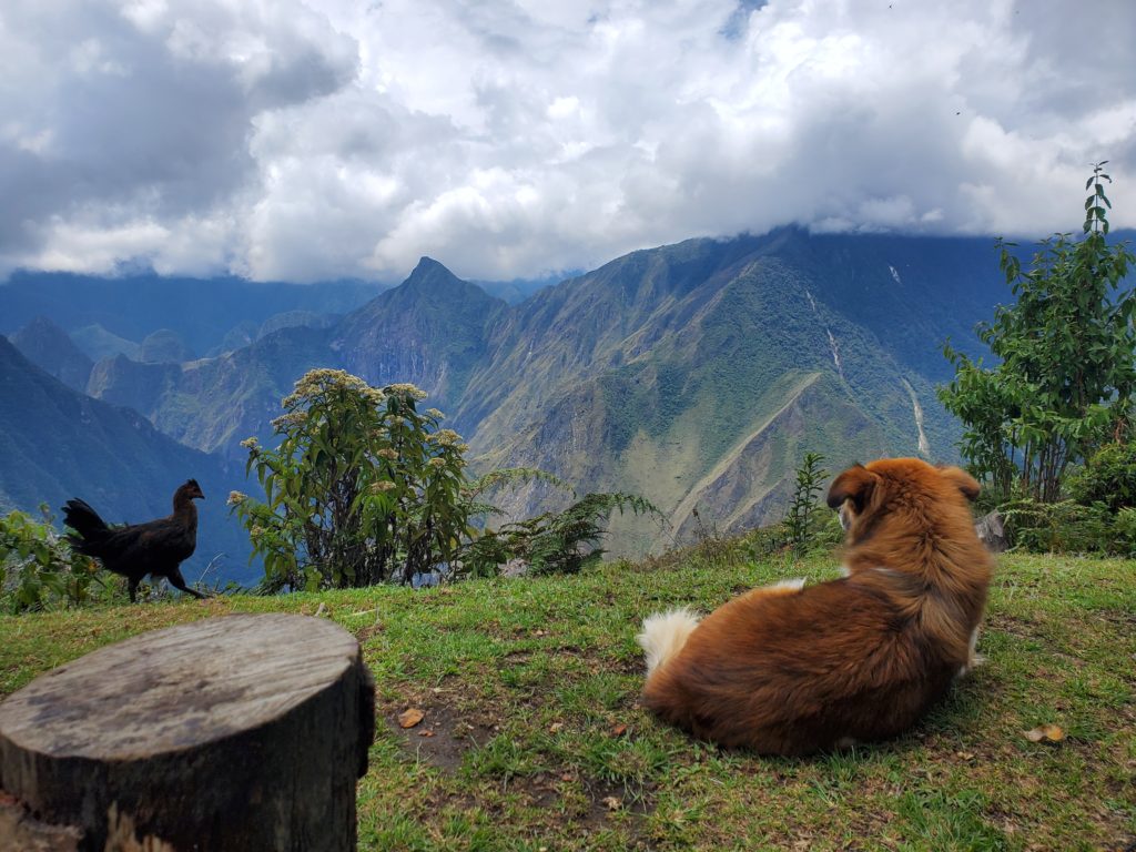
The view at the top was incredible. You could see across the Urubamba river valley the west side of Maccu Picchu. This doesn’t include the Sun Temple or anything of the sort, but agricultural terraces and the ruins at the end of the Inca trail were visible. We spent near an hour at the top, just enjoying the view we knew we would likely never see again.
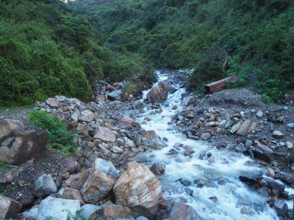
The descent off of the mountain was tricky. It was no longer a nice gentle river valley. This was steep and intricate. Not to mention muddy. We had to take our time with careful foot placements, as to not fall. We slipped a lot. We passed a lodge that we considered staying at, but decided to press on to Hidroelectrica. We later learned Kevin and his group would have stayed at that lodge that night.
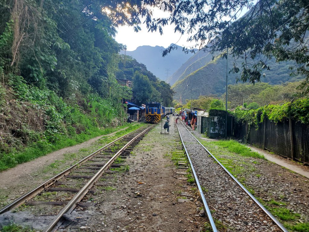
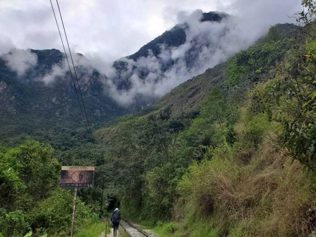
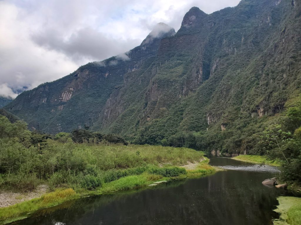
Once we were off of the mountain, we followed another gentle river valley towards the small town of Hidroelectrica. This town is essentially the end of the train line from Cusco to Maccu Picchu, and for tourists serves as the cheap and very long way to return to Cusco, via bus. We arrived, found a clean looking restaurant, and had the best frozen burger we have ever had. It wasn’t ramen.
Finding camp in Hidroelectrica was interesting. Our restaurant had suggested a site about a km behind us. We opted to press on towards Maccu Picchu, and hope we would see a sign along the way. It took about 15 minutes to do so. We met some other hikers who wanted to make it to Aguas Calientes that night. That was over 10km away, and it was 4:30! We can only hope that they succeeded. This camp was very noisy due to the dogs. Again, we were the only tent.
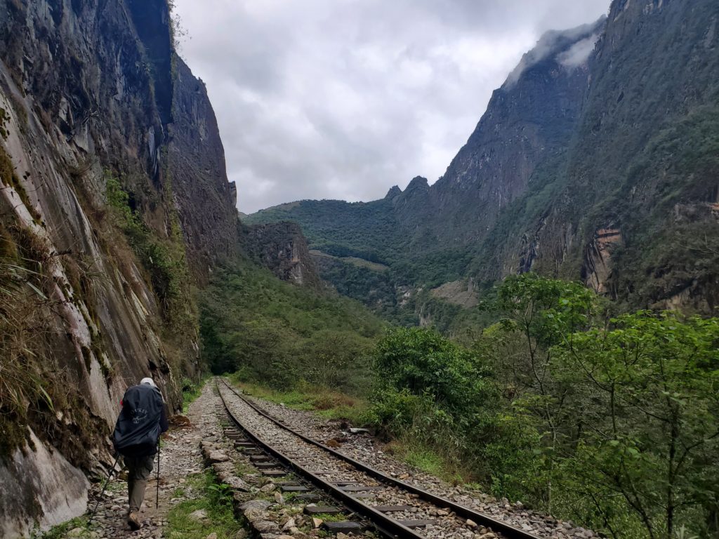
Day 4
10.14km
470m elevation
2h, 7min
This was an easy day. We got up, and decided to skip our oatmeal, as neither of us were feeling it at all. We crushed a few granola bars, and got on our way. This would be a slight uphill climb closely following the Urubamba river, until we got to the town of Aguas Calientes, where we had a hotel booked for the night. The trail just followed the railroad tracks. We got passed by a few trains, but this section was mostly walking for the sake of walking. Cam was having a bad morning. Her bag filled up with ants as they found the leftover oatmeal and we saw a huge spider and a scorpion so we wanted to leave. Didn’t help that there are these little black bugs, midges, that bite and leave you very itchy and we were covered in bites around the ankles so hiking was unpleasant.
Going the other way were many tourists opting for the much cheaper alternative of a bus back to Cusco. There is no road access to Aguas Calientes, or Maccu Picchu. This area is isolated by the narrow canyons of the Urubamba river. Those canyons were really lovely though.
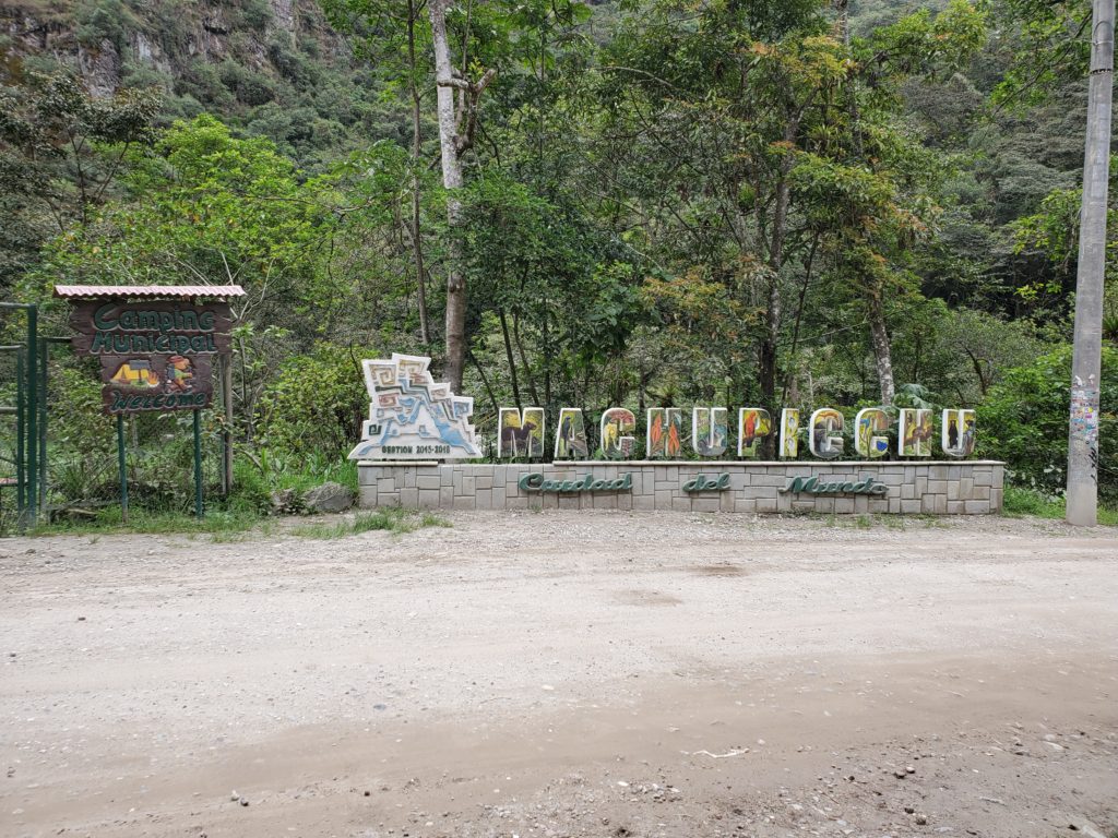
We arrived in Aguas Calientes at around 10AM. Cam had a restaurant picked out, so we darted to Chullo’s for the best post-hike meal we will ever have. We got gnocchi’s, pizza, and a nice chicken pasta. Good safe food. Delicious too. Expensive, but this was a splurge that we desperately needed.
We checked into our hotel, and spent the majority of the afternoon just resting. Dinner was had at Chullo’s again, though we opted for much cheaper sandwiches this time. We went to bed early, as there was still one more day in the hike. We still had to make it to Maccu Picchu. But our tickets were for 6:00AM. So, another early morning tomorrow.
Maccu Picchu was a total event, and worthy of its own blog. We will see you there!
These are incredible hikes. The views ….. the hike along the tracks …. the photos!!!! The photo with the pero and the pollo is award winning. You both are really blowing the roof off of adventure. Way to go!!
Your photos and stories are amazing! You two are amazing. What an adventure!
Did you expect to experience some of what you are going through – like ants and scorpions and itchy bug bites? Hope you carry needed repellent with you. You are true warriors and I admire you a lot – way to go!!
Well done, be proud of your internal fortitude & determination, outstanding. bummer about the foggy weather, however it can have it’s own charm as you discover. Making friends w all the animals, so so very organic.
I don’t how to related to all that. What a story and adventure.
Did you get any coffee beans from Lucmabamba to share?
That would be fun to try