
The Quilatoa Crater Loop is a three day, 35km hike up through farming villages and valleys to the Quilatoa volcano crater, which the goal of the hike, on the final day. Now, you can take a bus there, but what’s the fun in that.
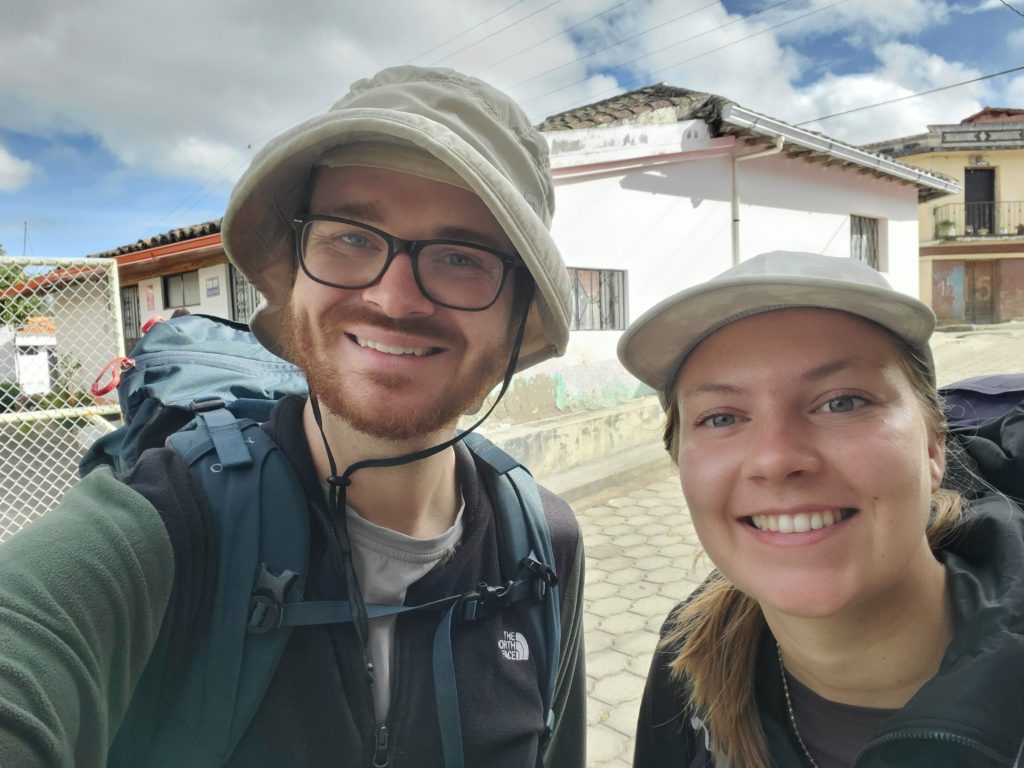
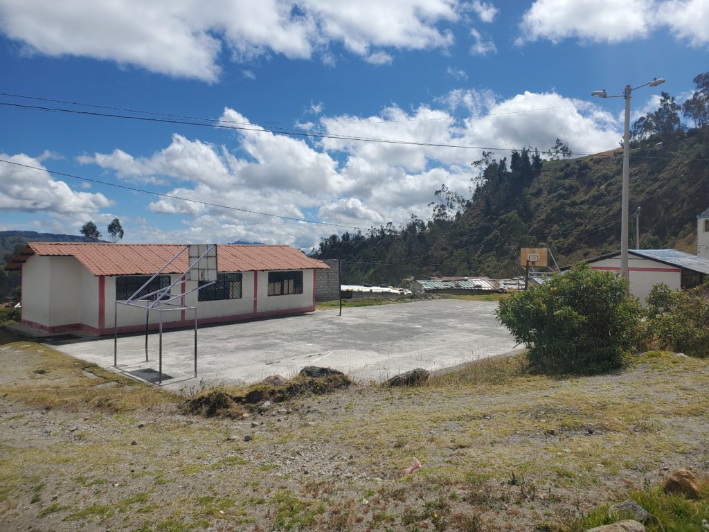
We started our journey by arriving in the start and finish city of Latacunga to drop off our bags at the hostel and spend a night resting before our three day adventure. The hostel was alright, but this night was essentially one of recharging and preparing. The real excitement started the next morning. We wanted to make the 8AM bus to Sigchos, where we would start our journey.
7:34. We start our 13 minute walk according to google maps to the bus terminal.
7:45. We make it across the river. The bus station lays across the road (we think). There’s some buses to the north. Our bus needs to go north. We head to those buses.
7:52. We arrive at the buses parked facing north. They do not have drivers. We ask a local where the bus to Sigchos is. They point south. We cross the road and head south
7:57. We ask another local where the terminal is. Still south. We see some buses parked a few blocks down from us, facing south. We start running
8:00. We pull into the bus terminal just as these buses pull away. Dejected, we walk into the terminal to figure out when the next bus is.
8:01. Sigchos! Sigchos! There’s a back to the terminal! The bus hasn’t left! We hustle onto a bus, see our friends from the hostel, and it pulls away. Some good adrenaline for the morning to start the adventure.
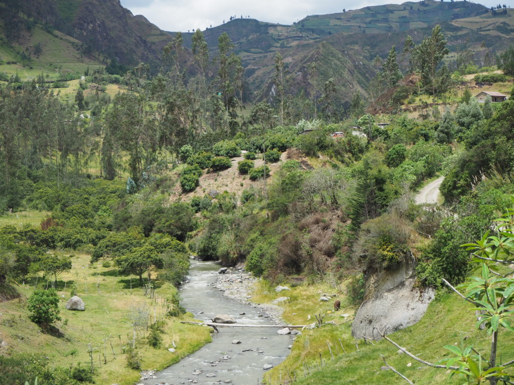
The rest of the bus ride was pretty chill, some nice views.
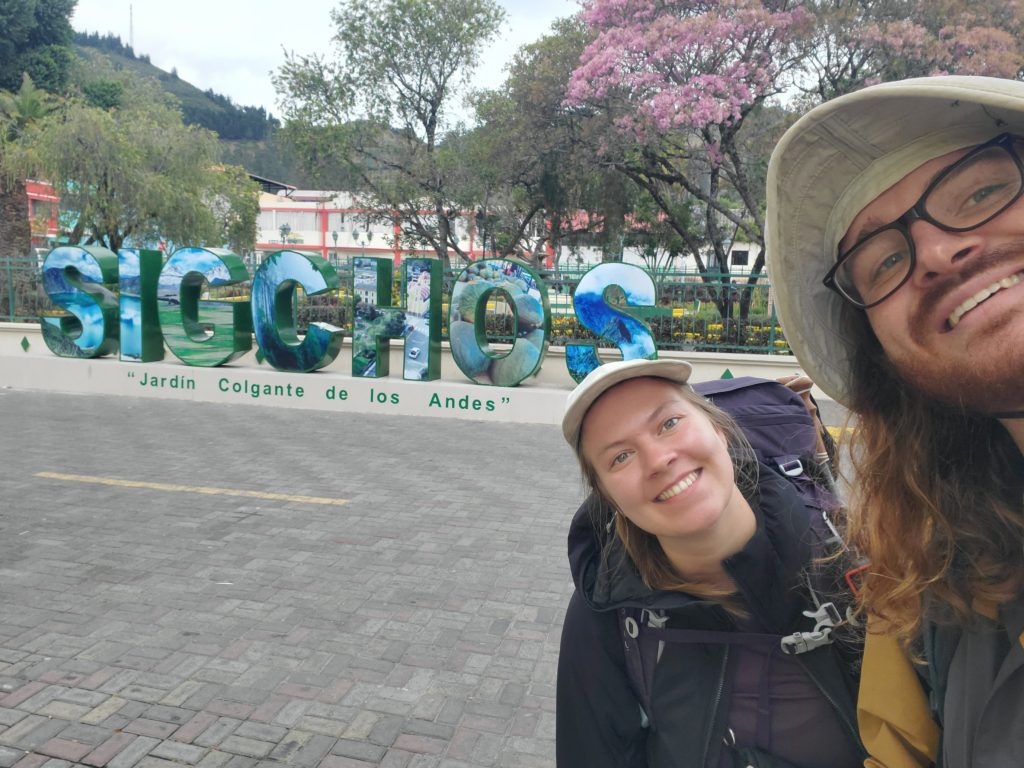
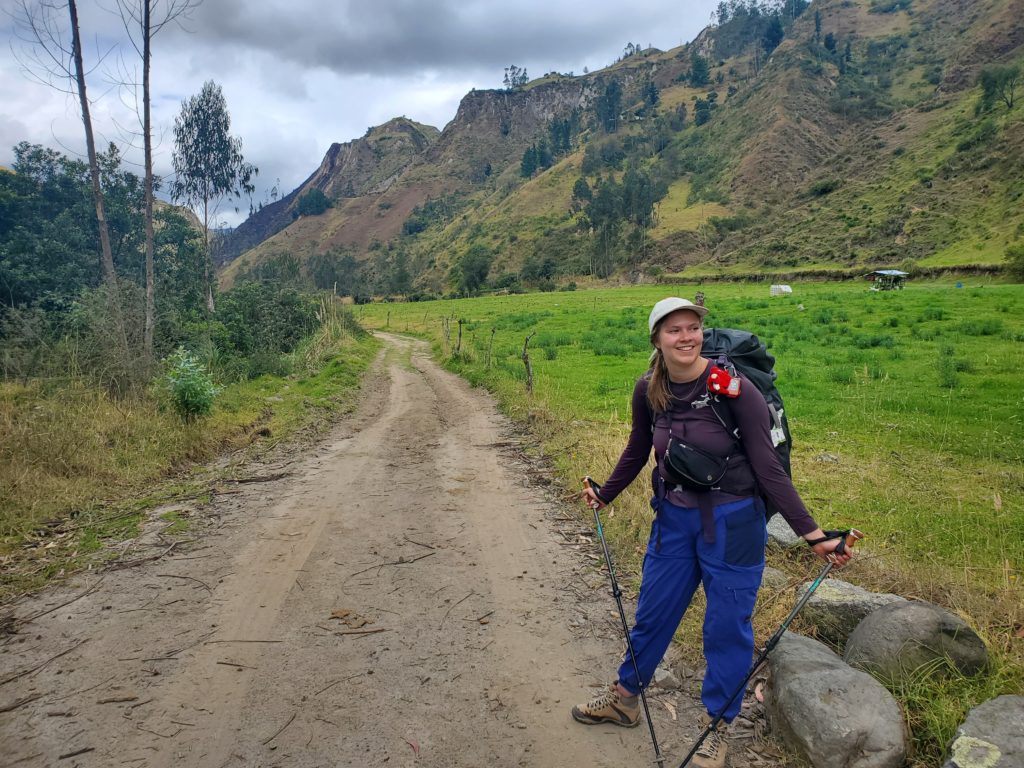
Day 1: Sigchos to Insilivi
12km, 579m elevation, 4 hours, 23 minutes.
The trail officially starts at the Sigchos main square, but we started walking from the bus terminal. The town was pretty unremarkable, though the scenery was lovely. It was nestled upon a plateau, with agriculture surrounding it to the edges of the valleys. We took a road out of the town, and started our slow descent into a long creek valley with steep tilled slopes along either side. We would eventually cross a stream and climb out the other side.
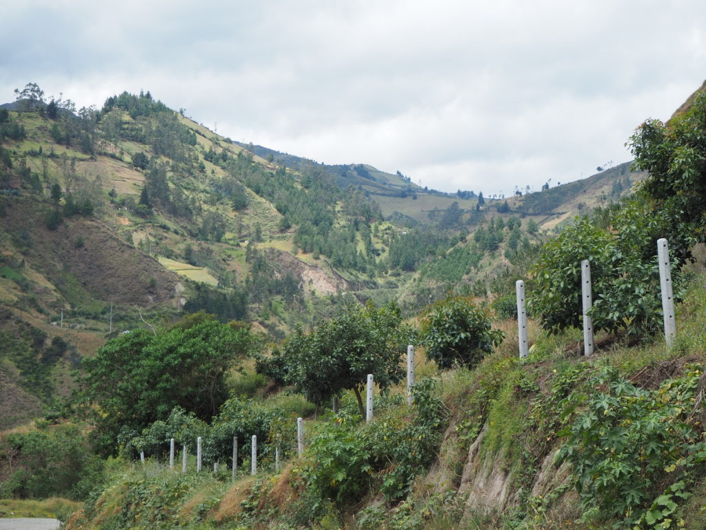
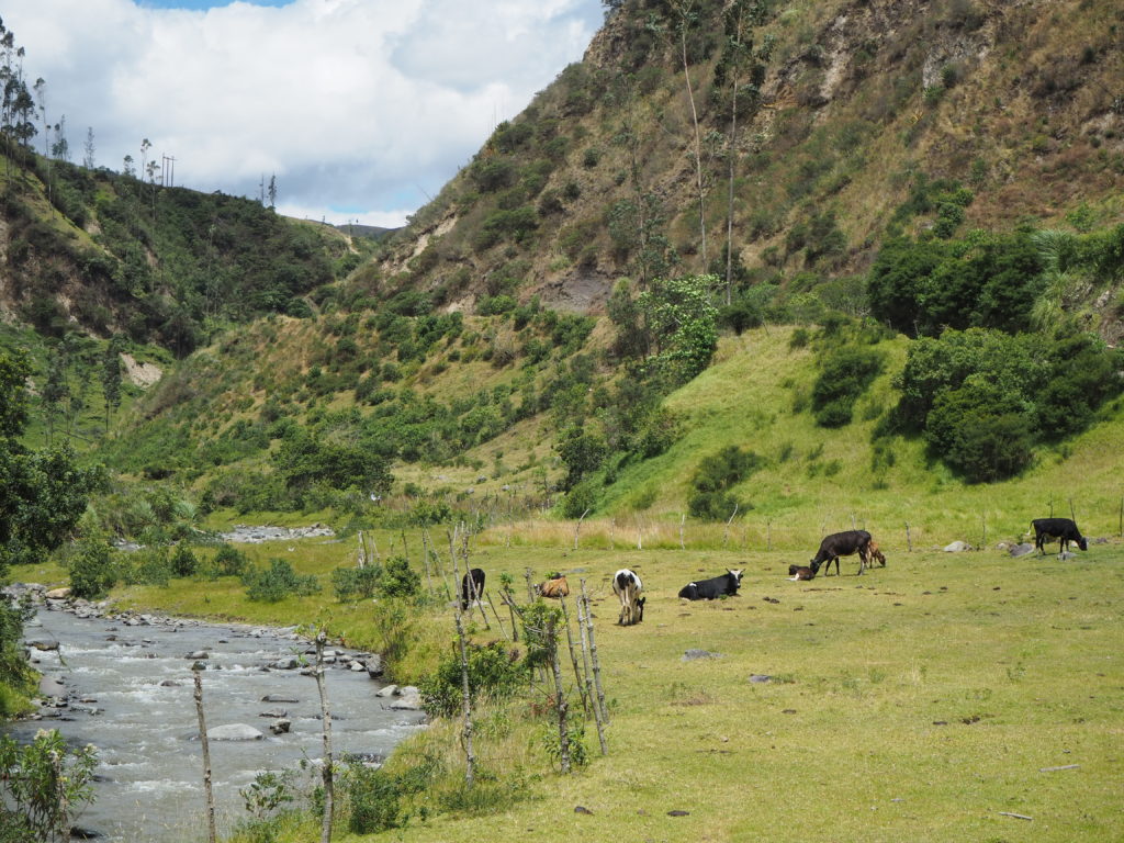
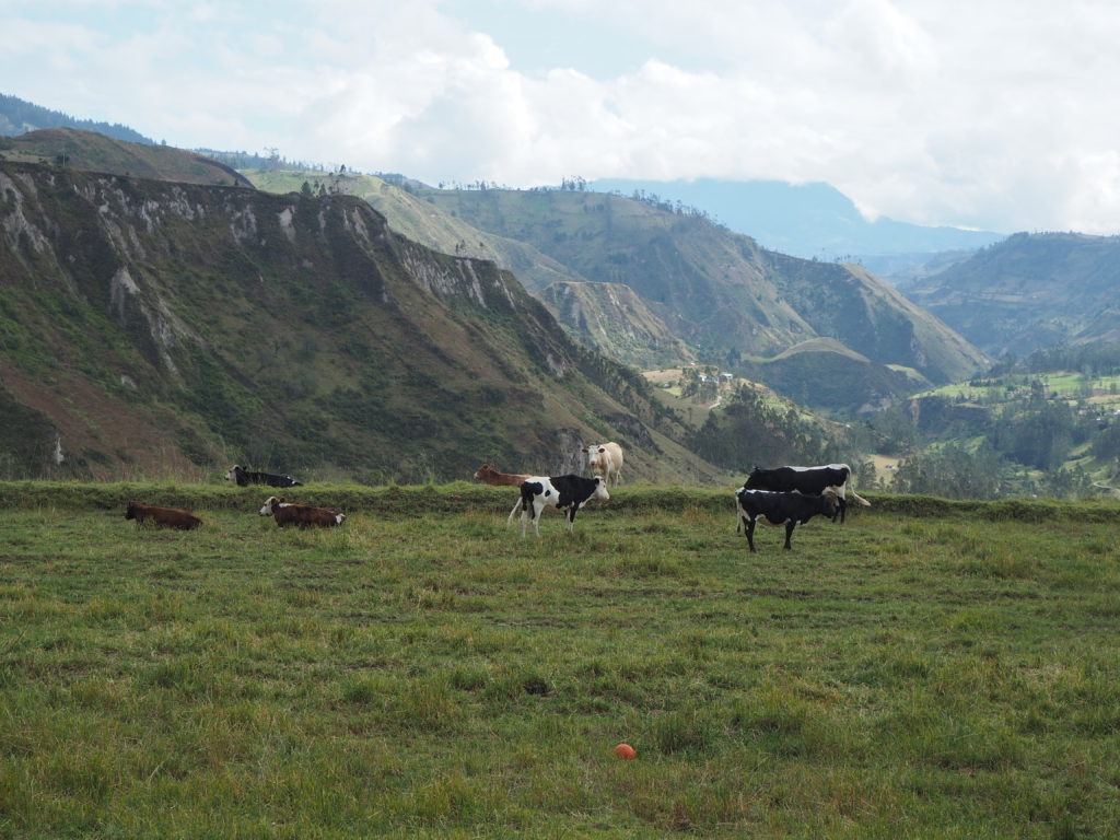
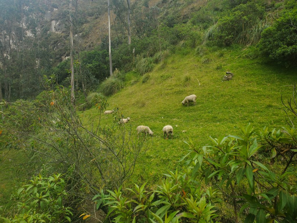
The scenery of the first day was a lot less remote than anticipated. Maybe it’s cause were used to hiking in the Rocky Mountains, but this entire leg felt like it could have been a bus ride. It can be, but that bus comes once a day. We were following rarely used farming roads between crops and pasturelands, with the occasional walking path shortcut. We walked through a few flocks of livestock on our journey. There are a lot sheep and cows in the valley. Some pigs too. Everywhere though, was a wonderful view of the valley that we were headed down.
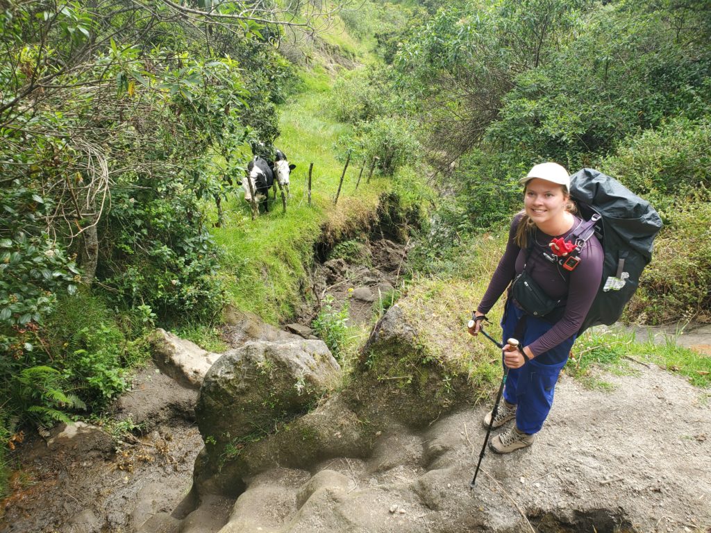
As soon as we crossed the creek, an absolute power hour occurred. 300m of elevation in 1km. We passed a few fellow backpackers on this steep incline, which was a nice reassurance that we could make it through the hike, or we would all die together. We ended with a nice walk with a Scottish couple, chatting about our adventures as we followed the road to town.
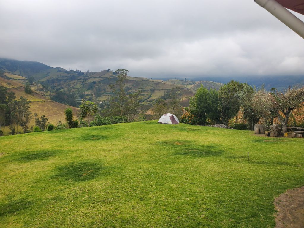
Insilivi is barely a town. We propped our tent up on a hostel yard, and got to sleep with a lovely view. We had Dorito pasta for dinner, as any sort of food in the town was a rarity. You have to make do with what you got. We went to bed early, only woken up by a dog barking at the tent, and the roosters in the morning.

Day 2: Insilivi to Chugchilan
13.5km 815m elevation 5h 11min
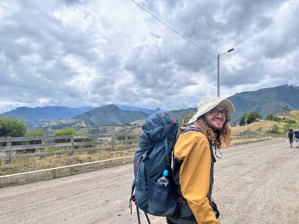
Day 2 was lovely. This hike took us on trails you could only walk on. While Day 1 mostly served as a training day, Day 2 is where this journey really takes off.
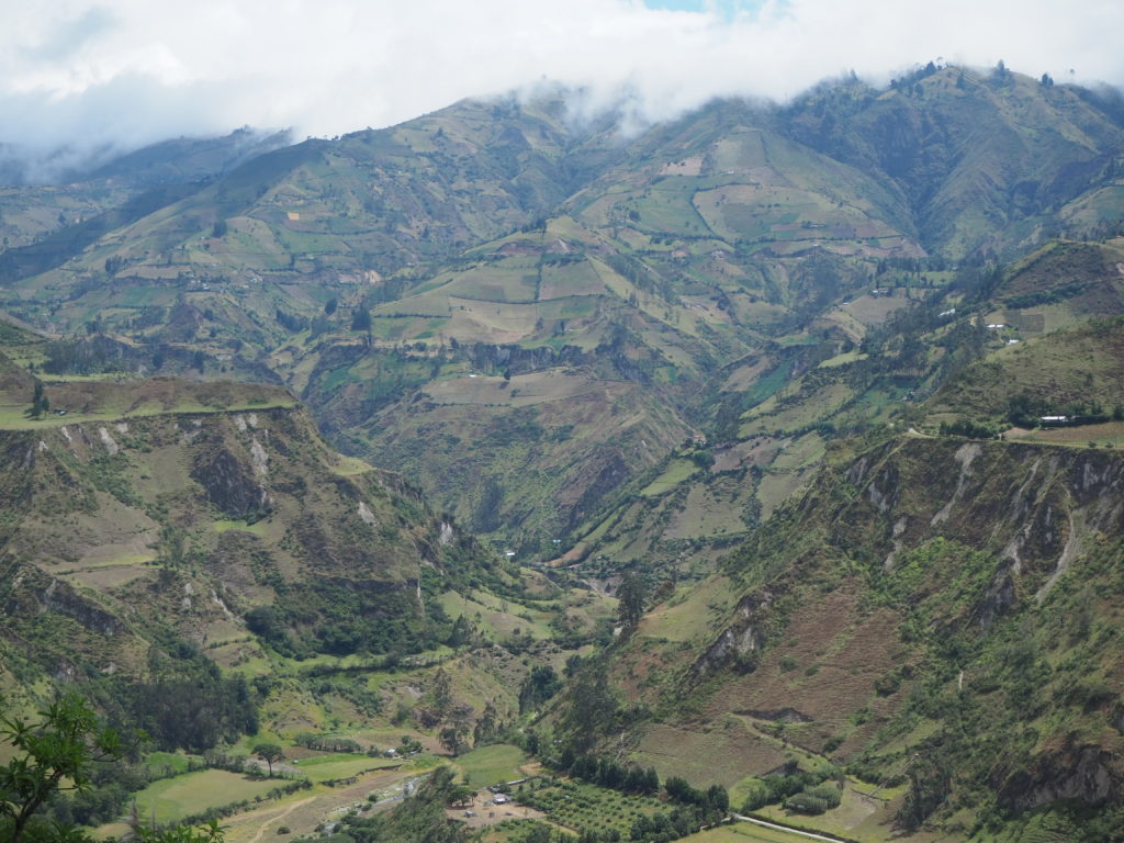
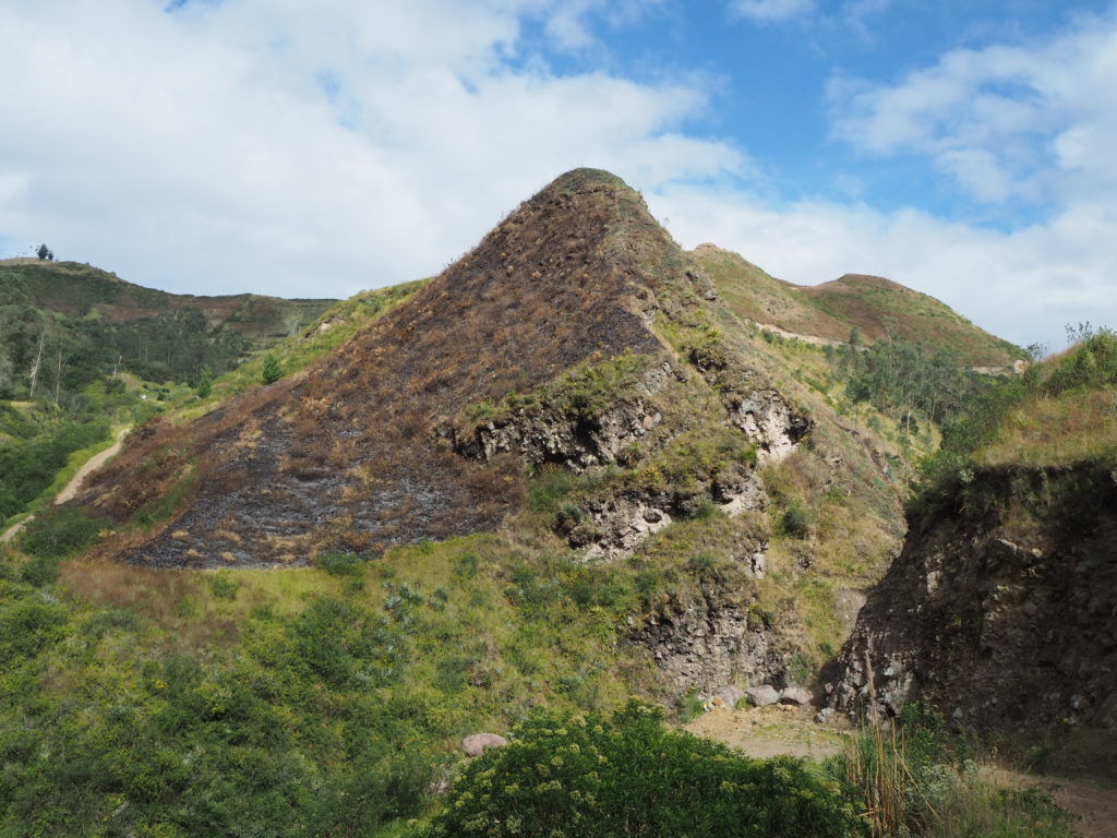
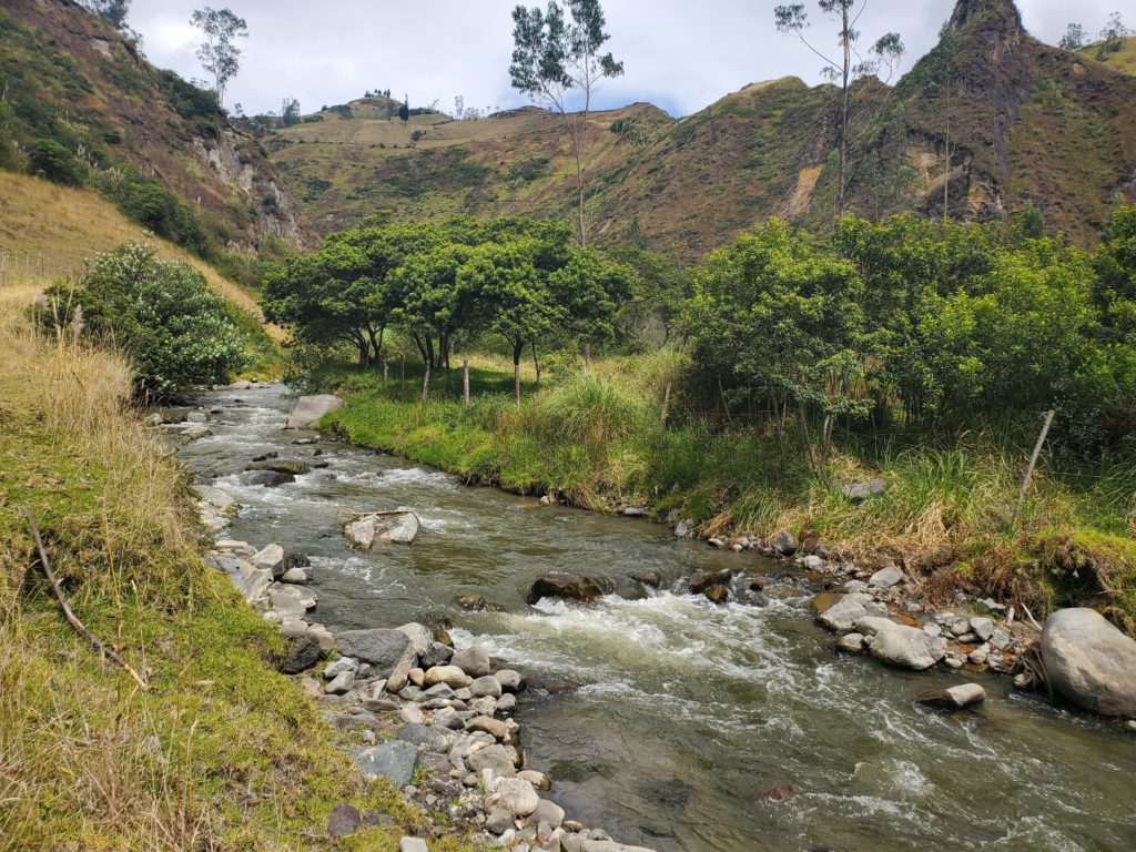
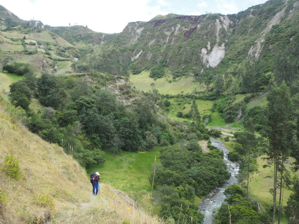
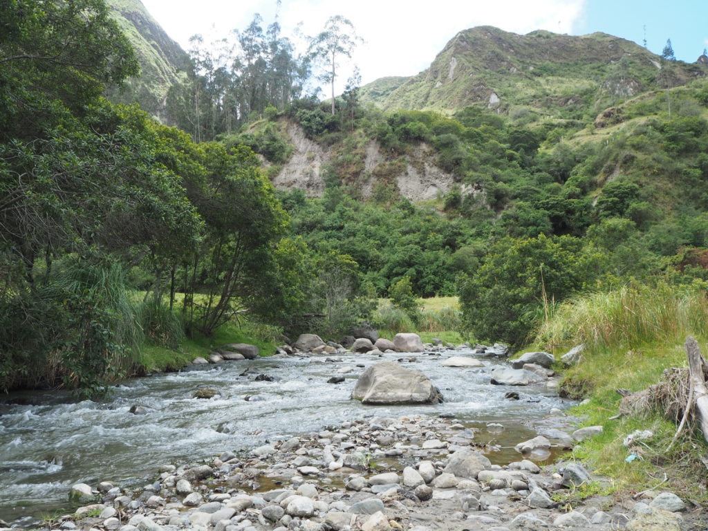
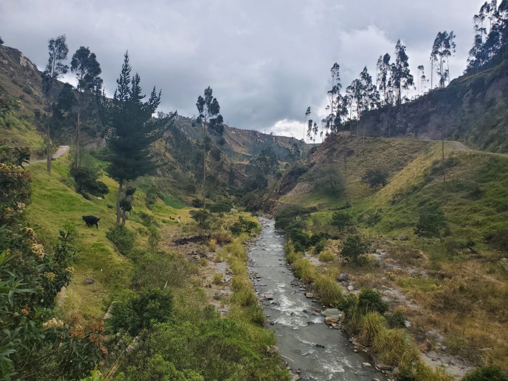
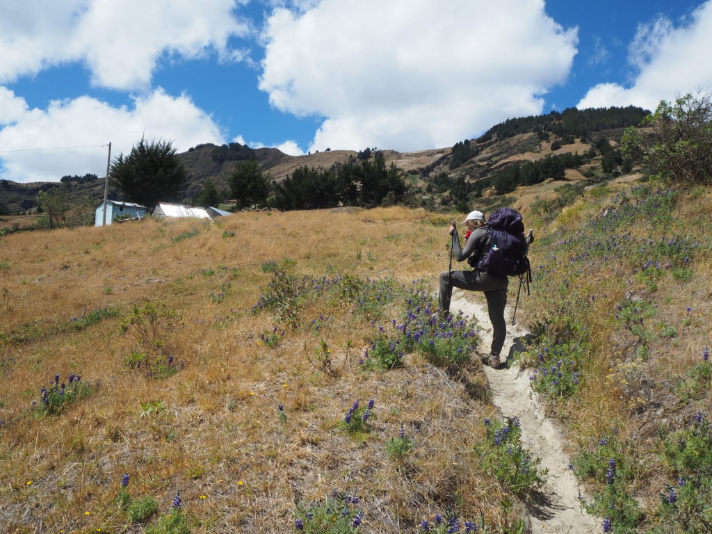
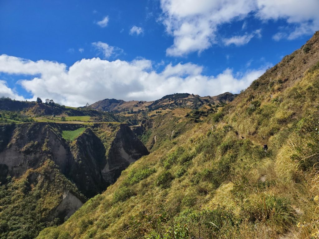
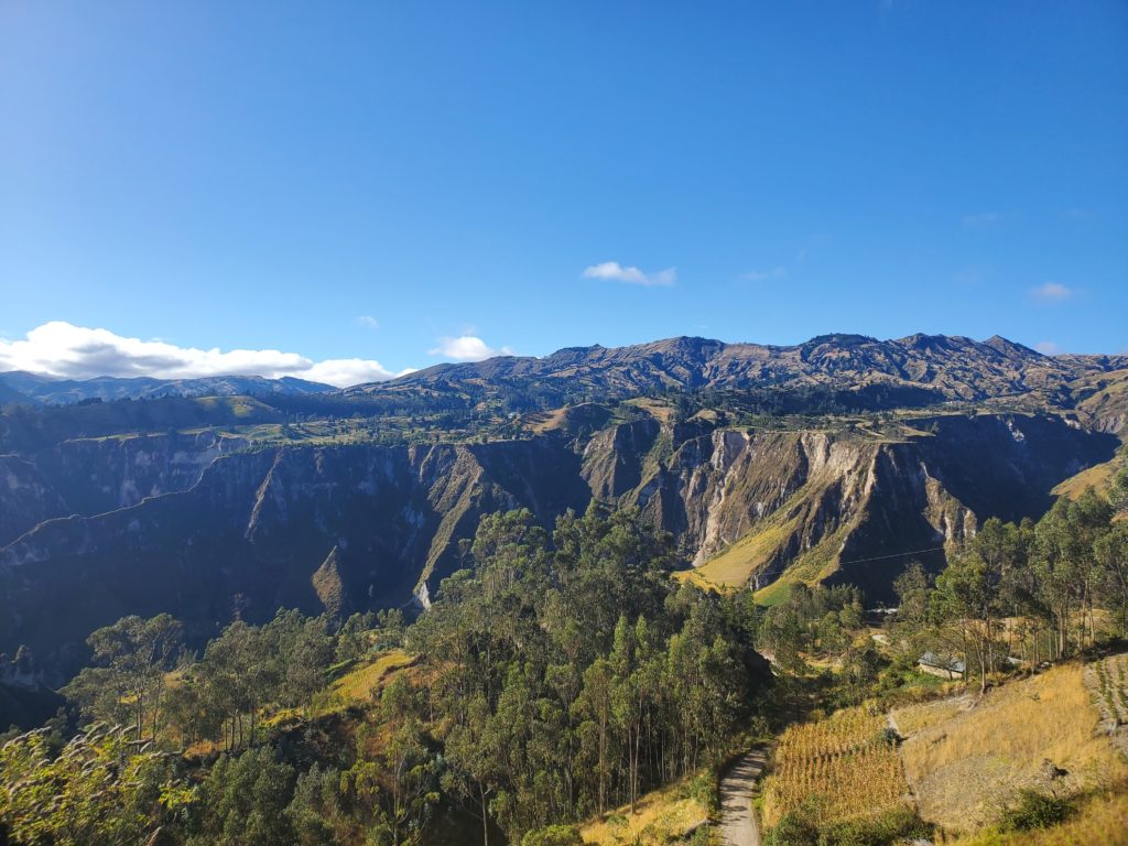
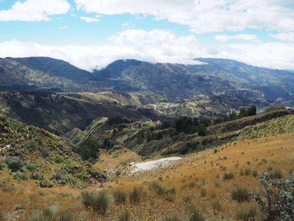
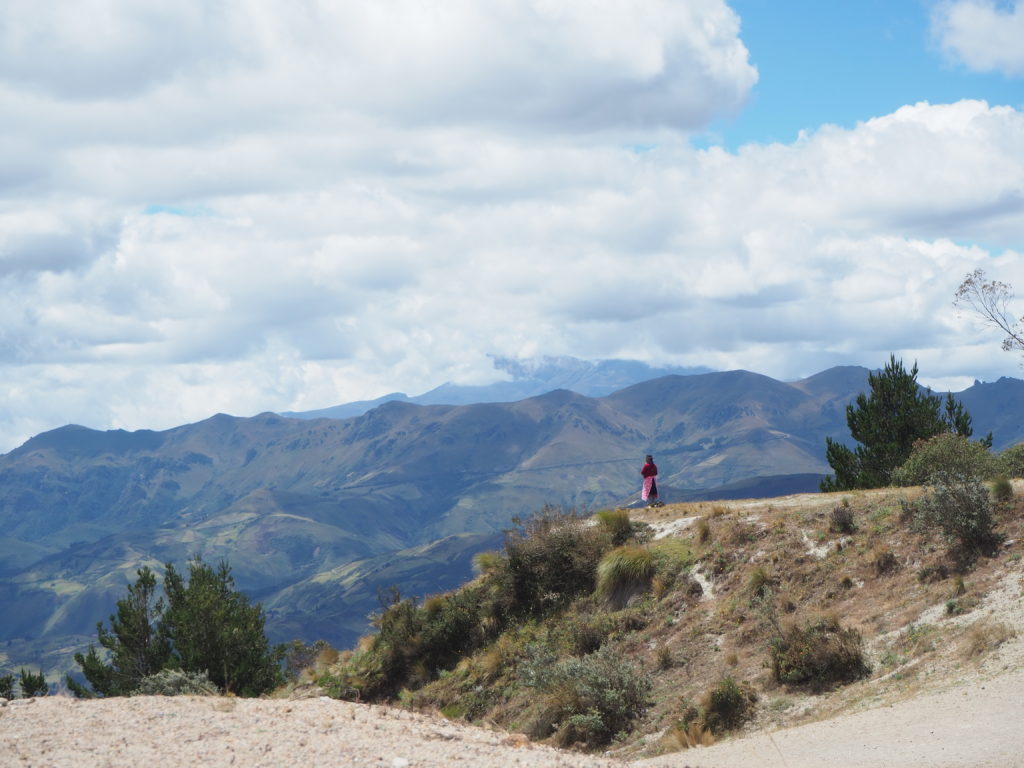
The hike is split into two halves. The first follows you along the side of a small valley, slowly descending into a creek, before crossing it and following it to a halfway point town. There were a couple muddy bits and steep descents, but it wasn’t too hard to deal with. We picked up some roadside bread on the way to munch on too. Lots of scorched ground patched either sides of the trails, which was an unexpected landscape. Throughout Ecuador, we have seen lots of hillside fires, but these ones seemed to have escaped slightly more than anticipated. There were also many isolated pastures, with livestock each tied to stakes in the ground, just seemingly on some half flat ground in the middle of nowhere.
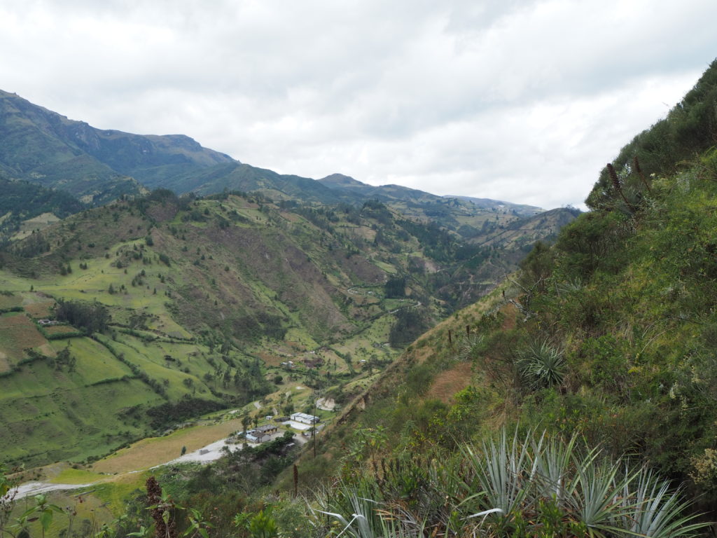
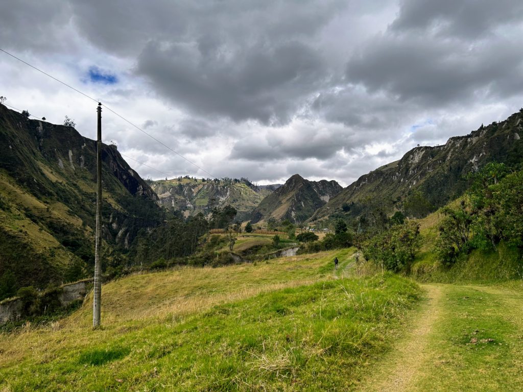
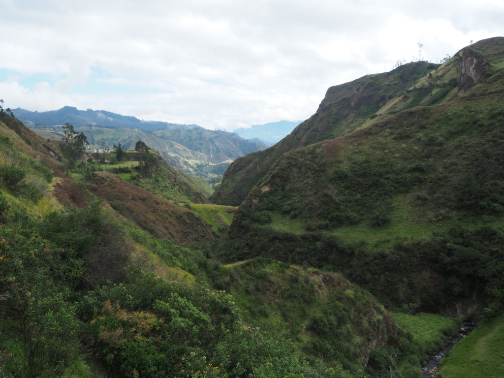
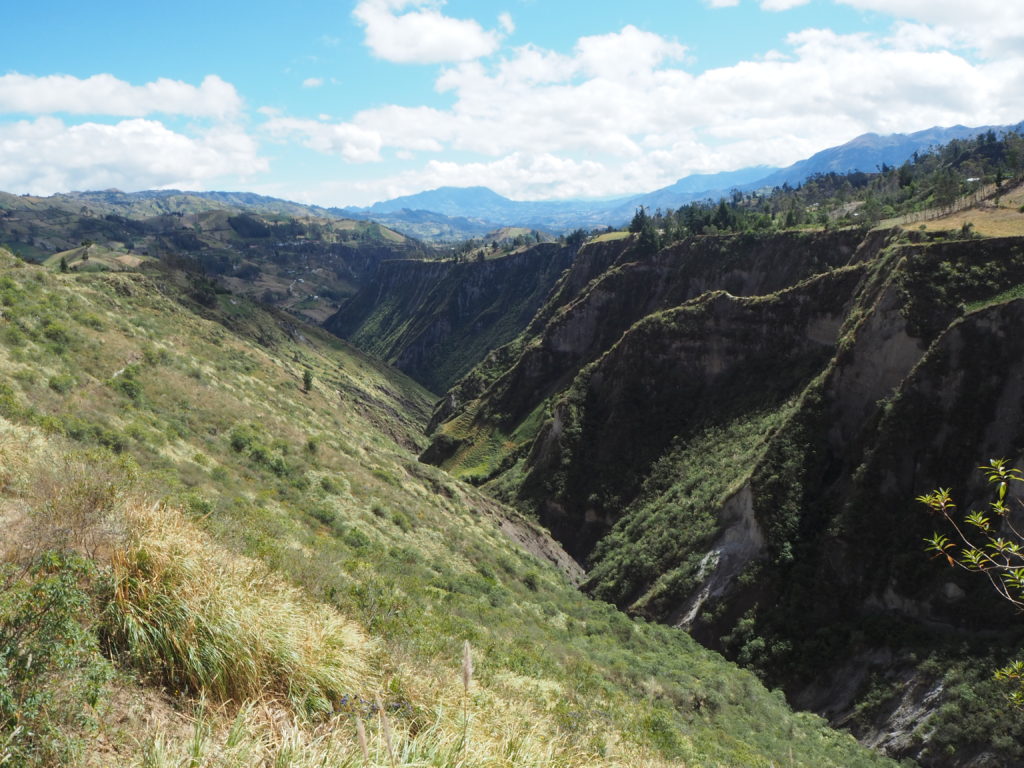
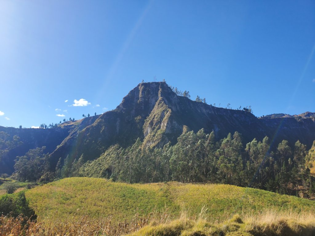
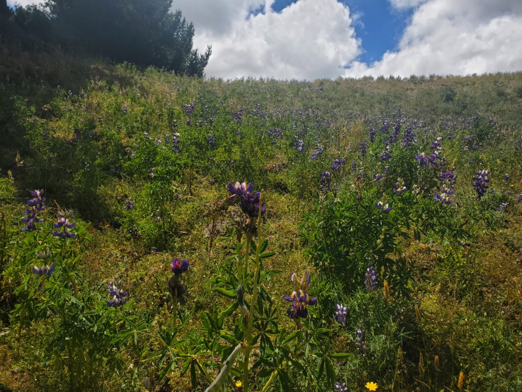
The second half was spectacular. We climbed out of the valley we got ourselves in, ascending higher and higher as we followed a tributary valley towards a pass. The patchwork of dark green trees, lighter green pastures and grey rocks that covered the sides of the valley were incredible in person. The overcast mist that lay around us added to the atmosphere. The hike up was grueling, and there were a few points where you didn’t want to look down. We generally waited until the path passed to the outside of a large rock, and took a rest there. After the pass was a hidden valley with a small creek and other tied up livestock feeding. We then settled in Chugchilan, where we got lunch, and a private room for the night.


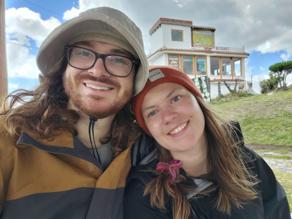
Day 3: Chugchilan to Quilatoa
14km. 1058m elevation, 6h 5min.
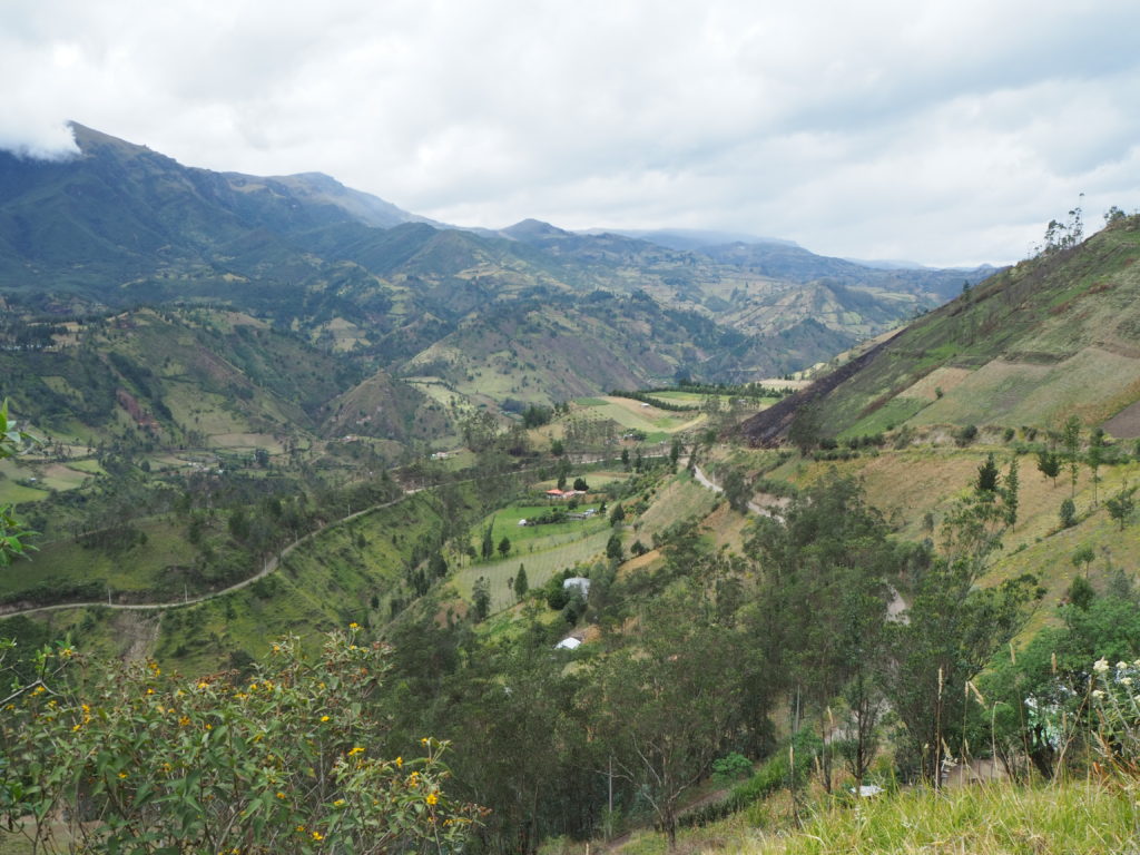
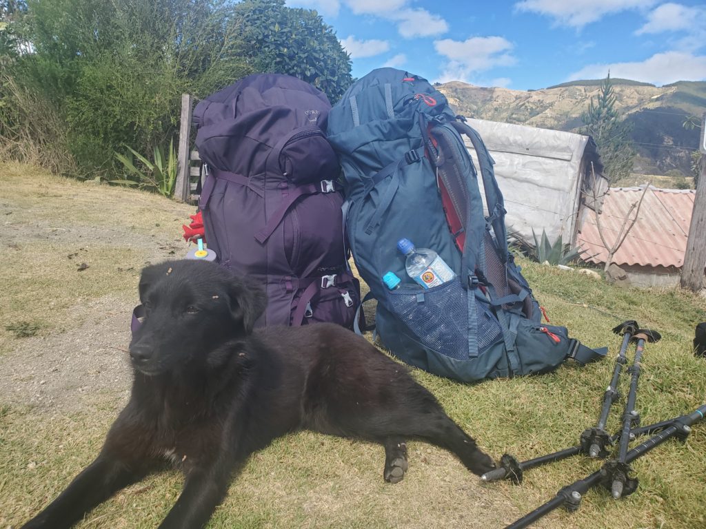
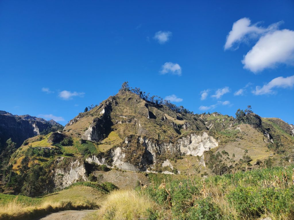
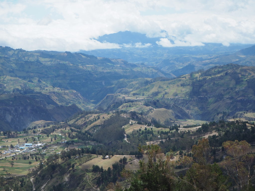
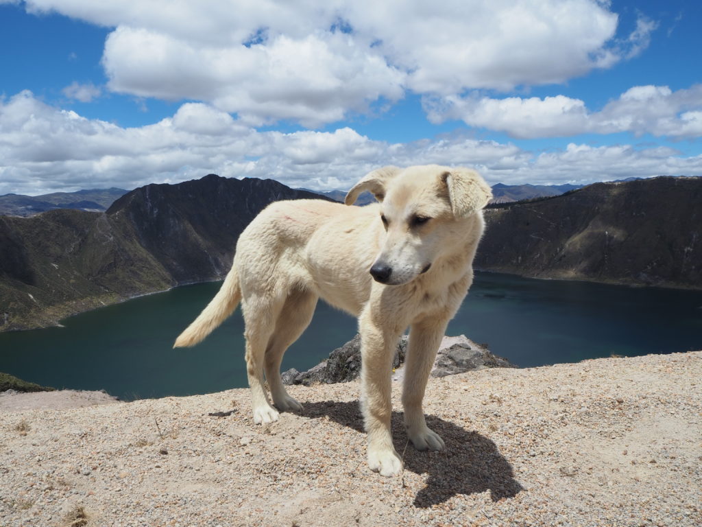
This day was spectacular. We started early, walking our way down a valley to the creek, before we would start our massive ascent up to the volcano crater. We gained a friend for the journey, pupita, a black dog that picked us up near the start of the hike.
This hike had three phases to it, the approach to the crater, the climb, and the crater itself. The first bit was a slow incline to another remote town, somehow nestled up at 3500m. We had a couple rests, one at a little cabana near a waterfall, and made sure pupita had enough energy to continue with us.
Phase two was short in distance, but it felt like forever. We left the little town, and could see our final switchbacks in the distance on the crater rim. Pupita was always checking on us, making sure that we were coming along, and leading us as if she knew where we were going. We encountered a 6 year old boy with a rope as a road block, and our tired butts lost the negotiation to pass, so we paid $10 for a “park entrance fee,” to pass. At least that’s how we justify it.
We took a break at one point, and got passed by a solo hiker. We acknowledged each other, and then out of nowhere, pupita starts following him. No goodbye, no explanation. No look back. Just carried along like we just didn’t spend two snack meals and three hours together. Morale was low without the third musketeer, and it was switchbacks from this point to the top of the crater.
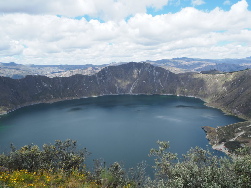
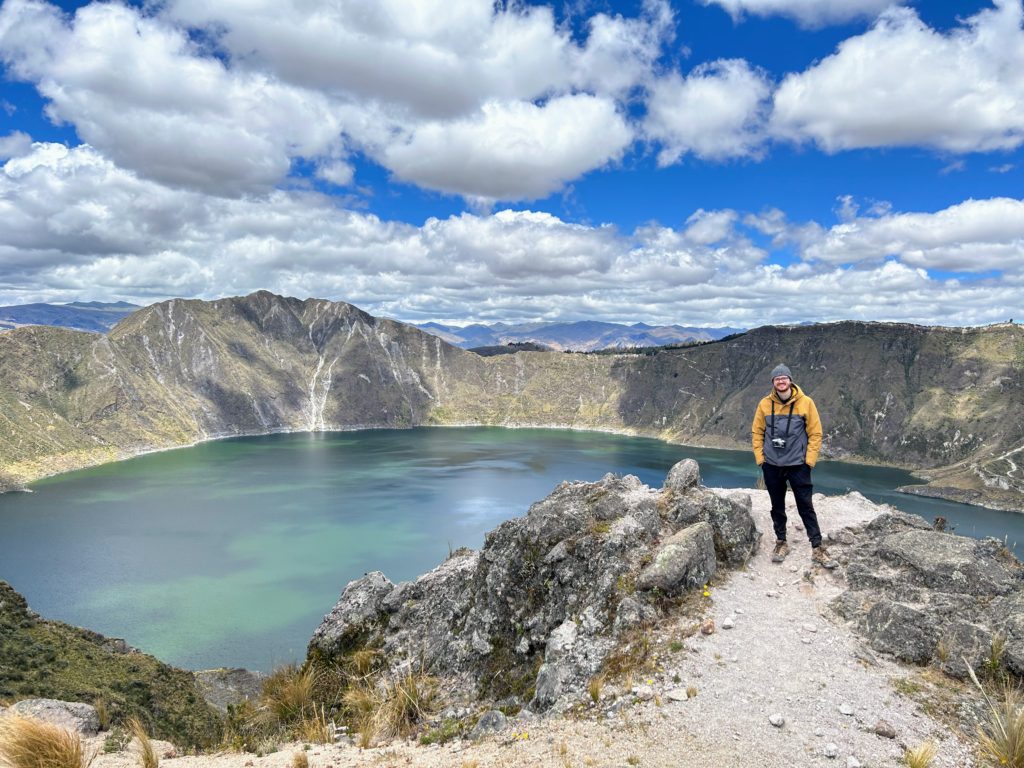
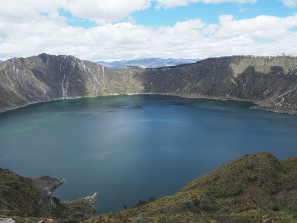
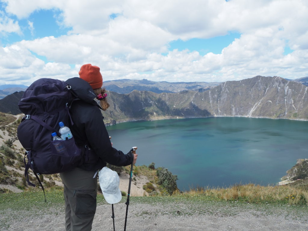
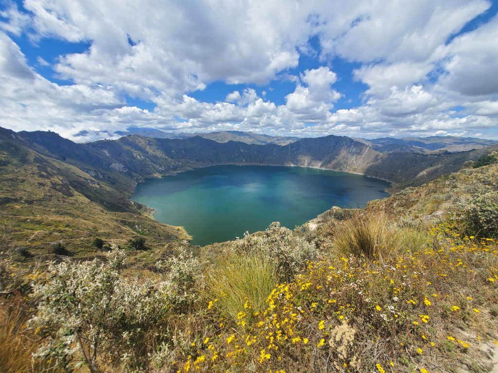
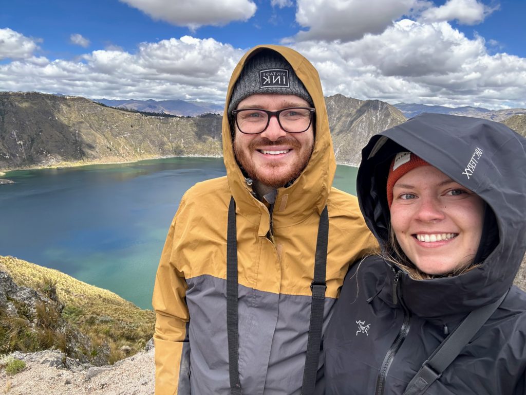
The crater. When you finally crest and can see it for the first time, your slow exhausted steps pick up in pace as you race for the ideal view. We made it up the switchbacks in a decent time, and essentially collapsed at the top. The view on either side of us was perfection, but we were just staring at the endless valleys to the north on our way up. It was the craters time to shine.
We enjoyed our lunch, and after 40 minutes or so, got cold and started our hike around the crater rim to the small town of Quilatoa on the other side. This entire portion, you could look the left and see the massive Quilatoa crater, and look the right and see the endless valleys that extend from this high point. The walk was stunning, but we were tired. Eventually we made it to the town and rested.
We bought some soda, downed it, and tried to figure out how to bus back to Latacunga. A Spanish trilingual tourist essentially adopted us, put on us a shuttle to another town, dropped us off and got us on the bus back to Latacunga before we even know what happened. Thank you stranger for that. We got back to town and slept. What a journey.
Overall, the hike was a worthy but arduous adventure. It would have been easier if we didn’t bring our camping stuff, as the weight would have been a lot lighter, but we really enjoyed staying in the tent. No regrets. The first day was a training day compared to the other two, but it was necessary given the difficulty increased day by day. The views were magnificent along the way, and we saw remote valleys that you can’t find anywhere else. We really enjoyed it, but you have to be quite fit to do this. Poor Marie, a friend of ours along for the journey, was really struggling with every uphill. We never figured out how she handled the final climb up, but it wouldn’t have been easy.
Back to the forest now! It’s waterfall time! And a farm stay, that’s the plan. We will see you there!
Isn’t that how it is – two sides to a bus terminal and we find ourselves on the other side! Reminds me of a Masala Masala bus ride. Didn’t Joni Mitchell write a song …. I’ve looked at bus terminals from both sides now …. Okay, enough.
What a wonderful hike – a great adventure – you two are quite something!
WOW! I’m worn out just reading it. More power to you!! And having to stake your livestock. Interesting to say the least. Is there much population settled in those areas? (Preparing to go to Trevor and Jessica’s wedding on Saturday in Edmonton. Forest Fires cancelled the Kelowna plans.)
Pupita perro, fickle traveling buddy, easy come easy go. Great photos, well done. Finding the right bus can be a challenge which you seem to have handled well.
Still always best to see the smiles.
p/s … a lot of family at Trevor’s wedding this weekend said they ready and very much like your blogs even though they don’t leave a comment
“Dad” is correct. Love seeing your smiles and hearing your stories.
PS – We are part of the “lots of family at Trevor’s wedding” group. (we had puffed wheat squares and pie Sunday afternoon) Your names did come up often. I enjoy following your blog. Well Documented. Love the reflection comments, and the photos.