
Day 8: Gho to Gumba Lumdeng
Length: 6.97km
Elevation: 1120m
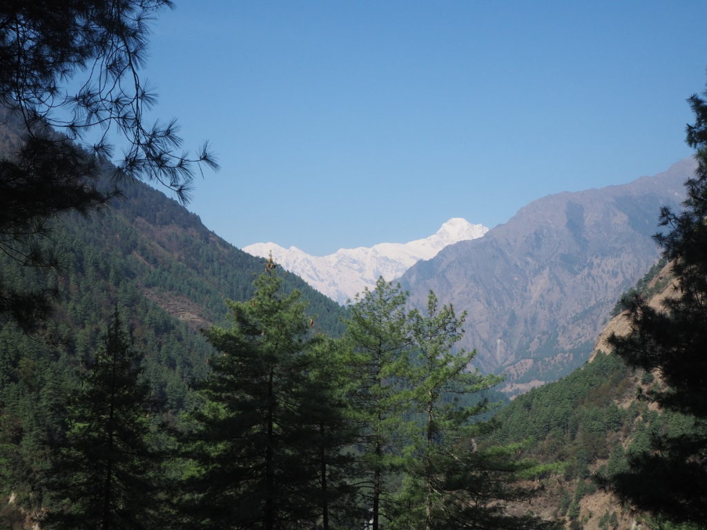
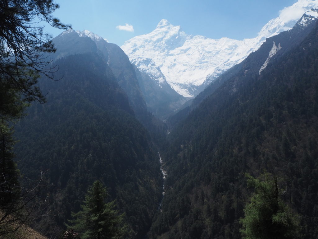
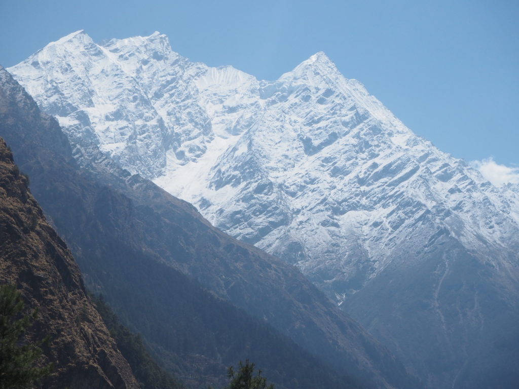
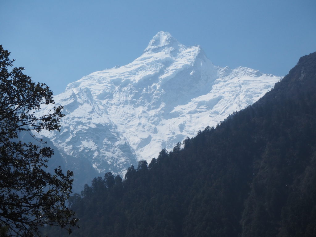
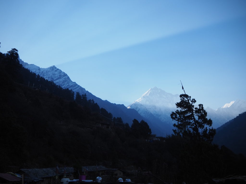
We started a little later this morning, for no real reason in particular. Due to the thunderstorm the night before, there was no humidity in the sky. Our sightlines of the mountains, and our destination, were incredible.
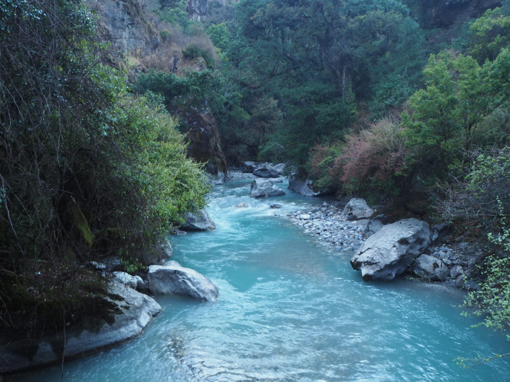
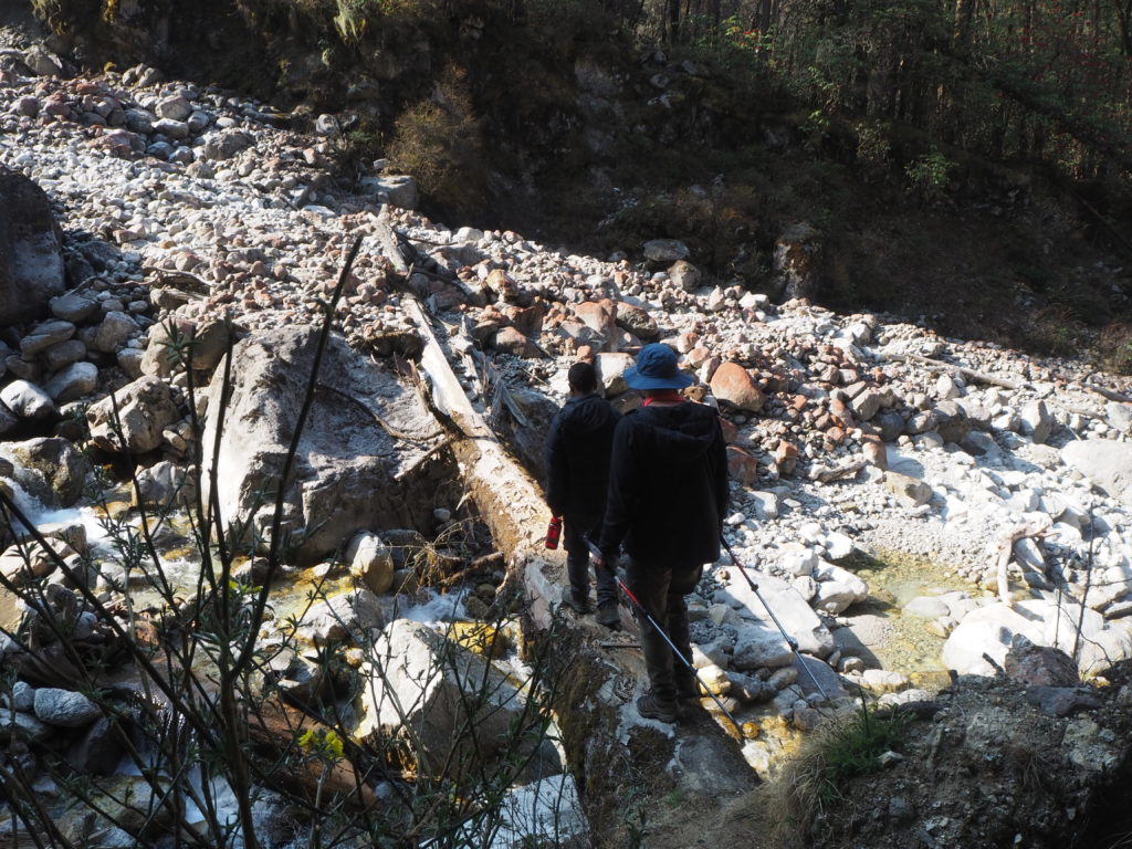
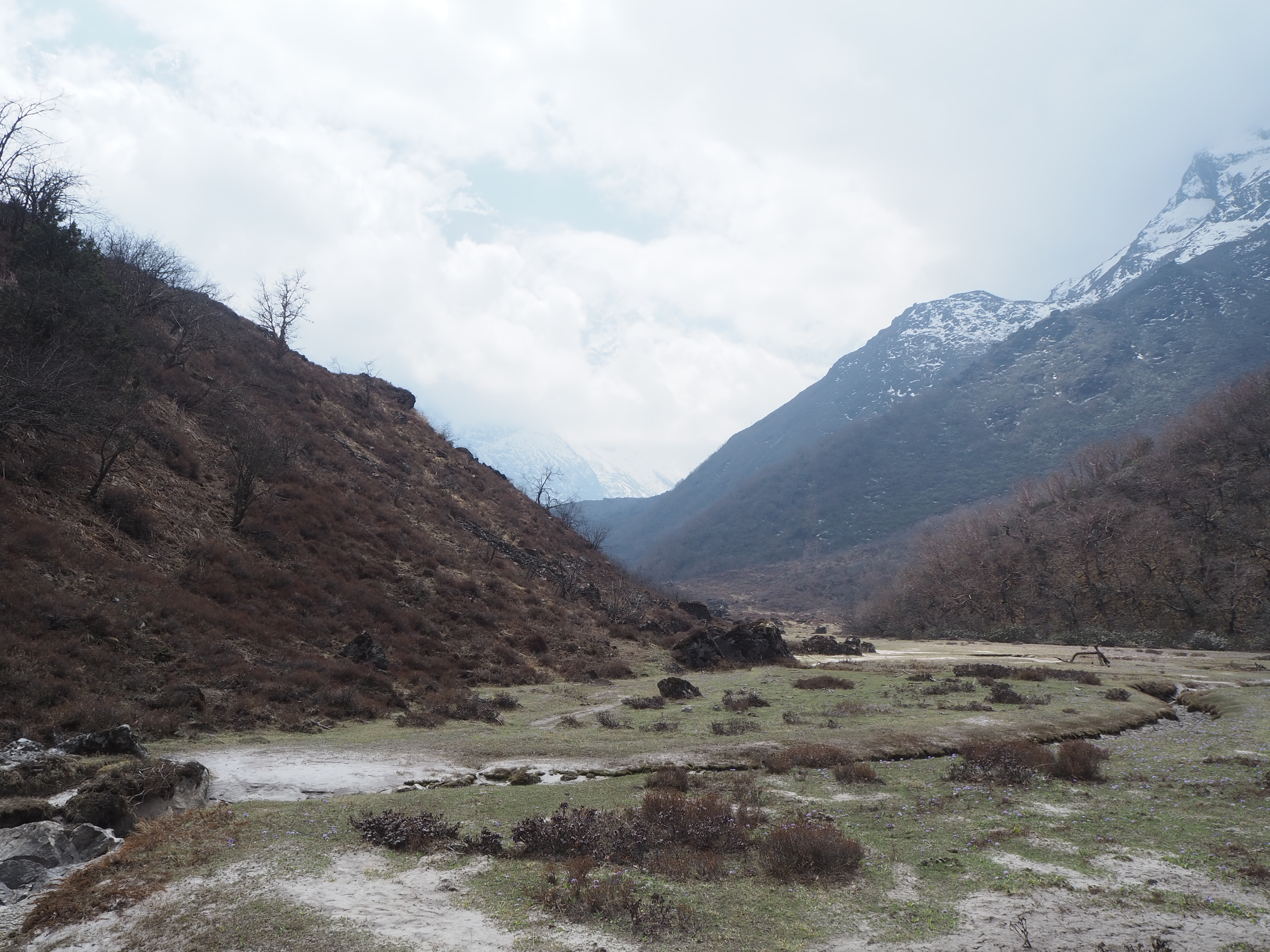
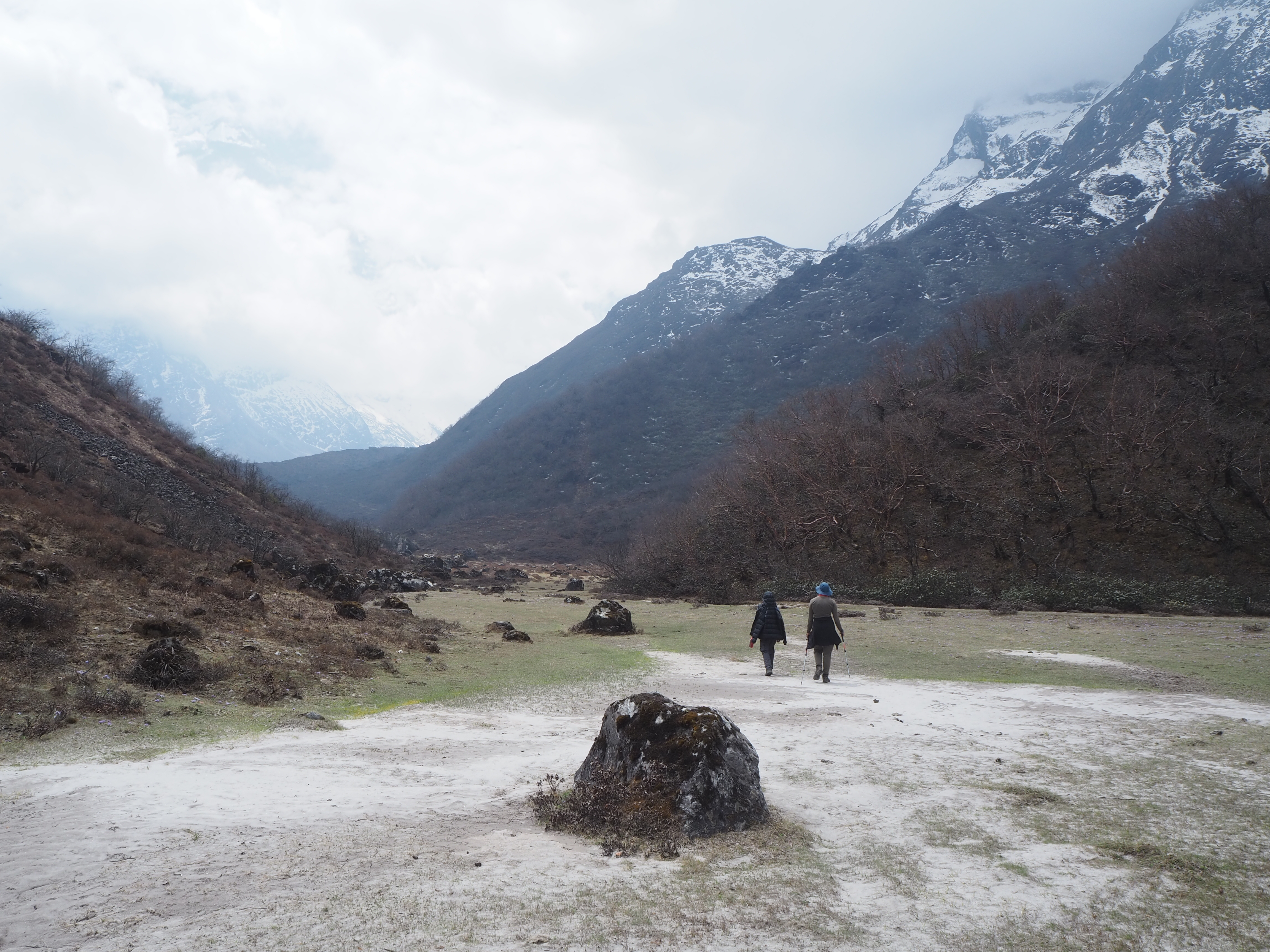
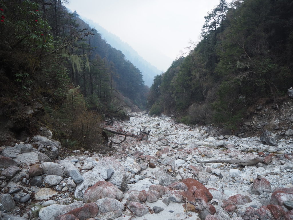
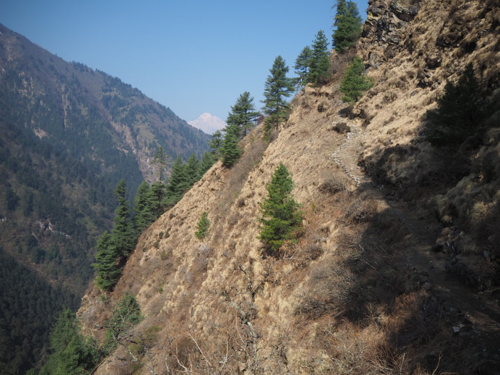
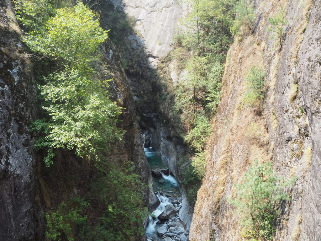
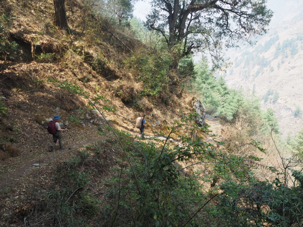
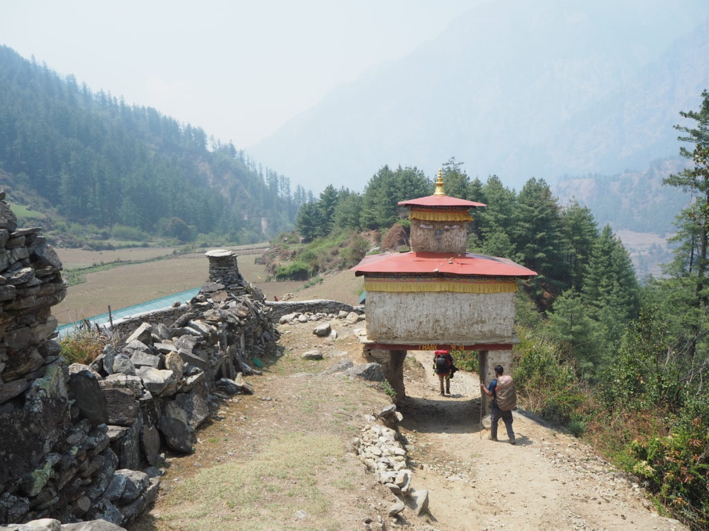
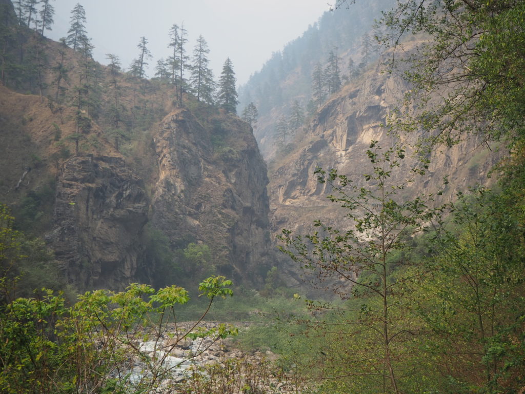
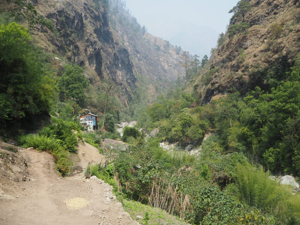
The trail today started with a steep descent to the Shyar Khola river, and a nice crossing over a natural swimming pool, which we have to imagine is freezing. From there it was a sharp ascent up to Gumba Lumdeng, a remote nunnery deep in the Ganesh Valley, an offshoot of the Tsum. We had over 1000m of natural elevation to climb.
We didn’t get off to our best start on the far side of the river, and we got somewhat lost. We followed the river for a couple hundred metres, when we should have gone up the hill right after the bridge. Hari figured out the issue pretty quick, scouted it out, and we were back on our way.
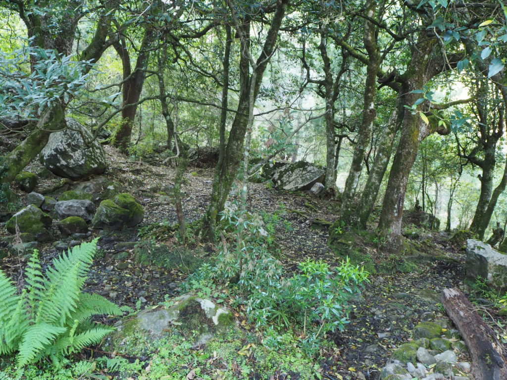
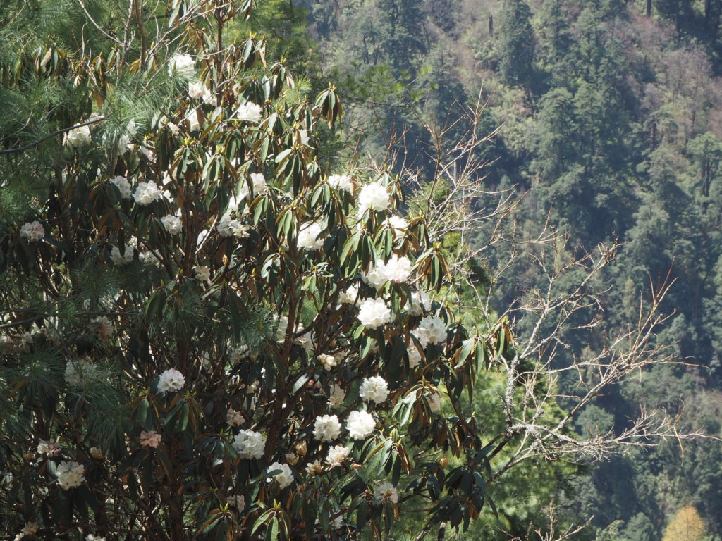
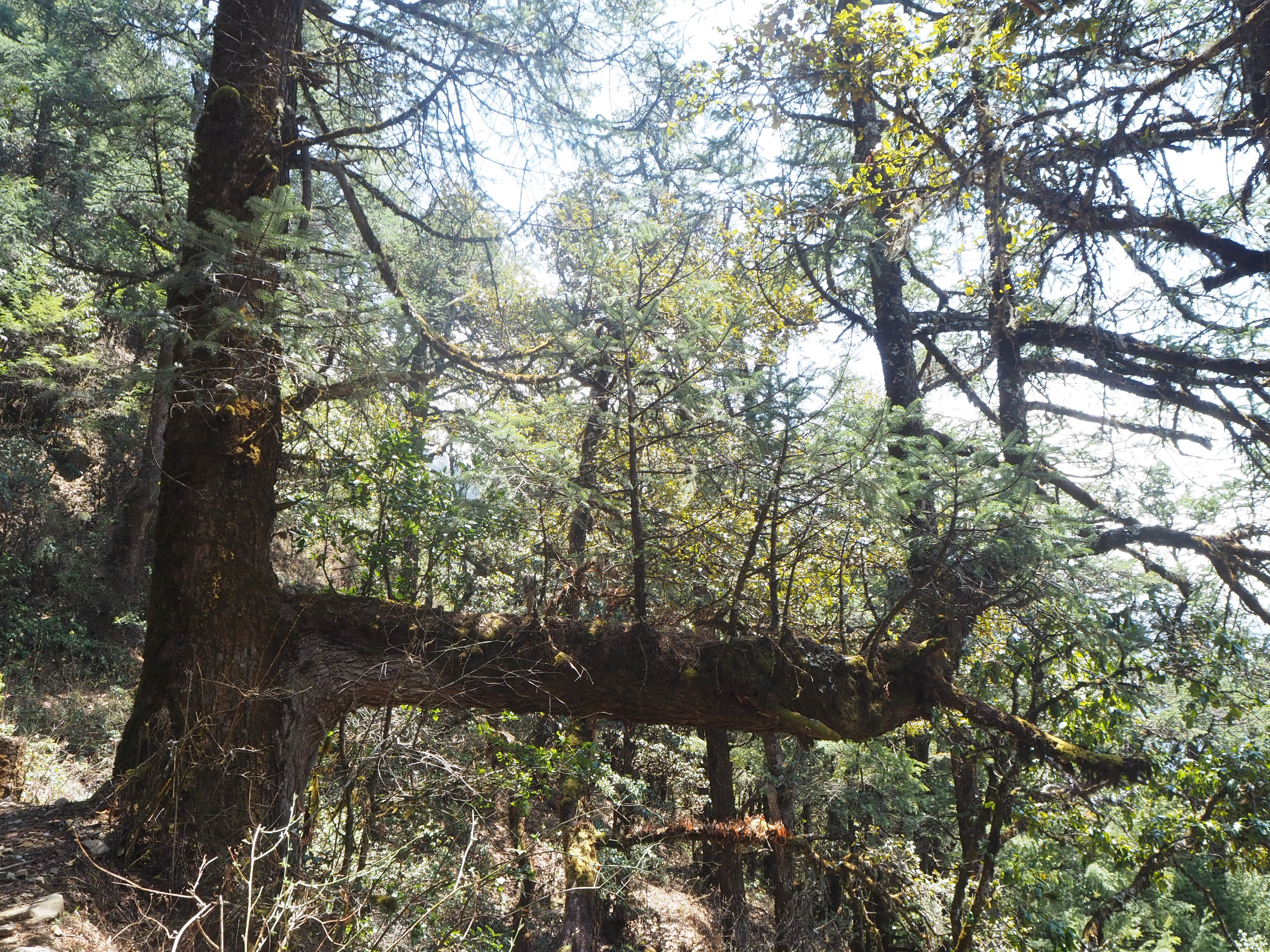
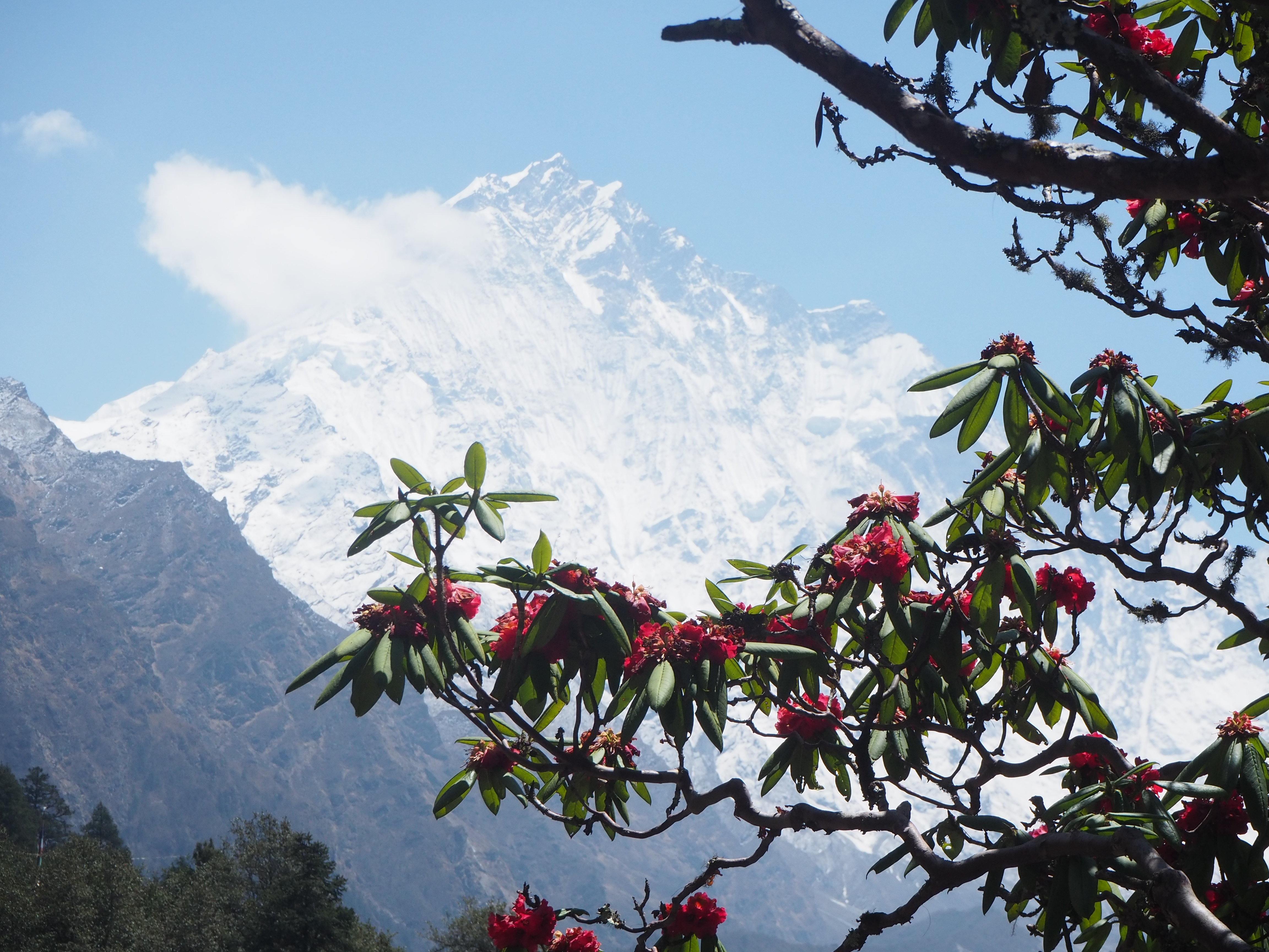
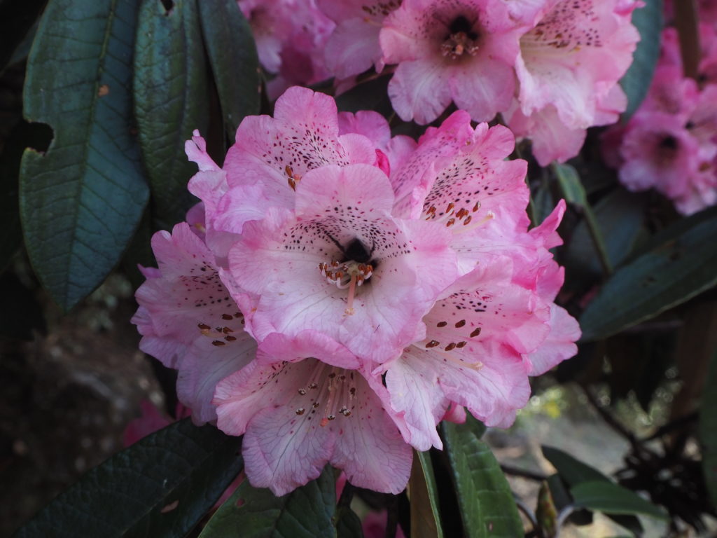
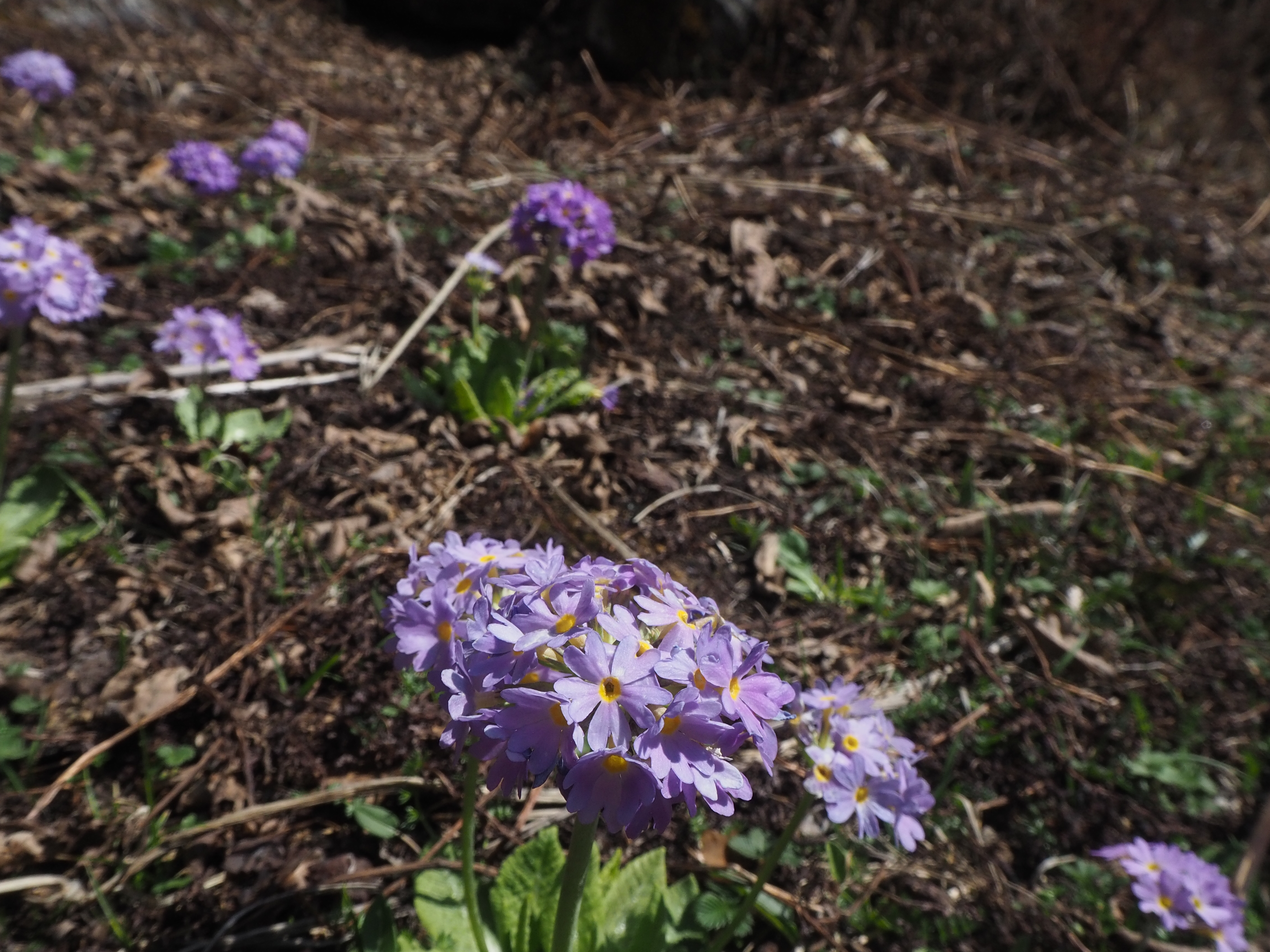
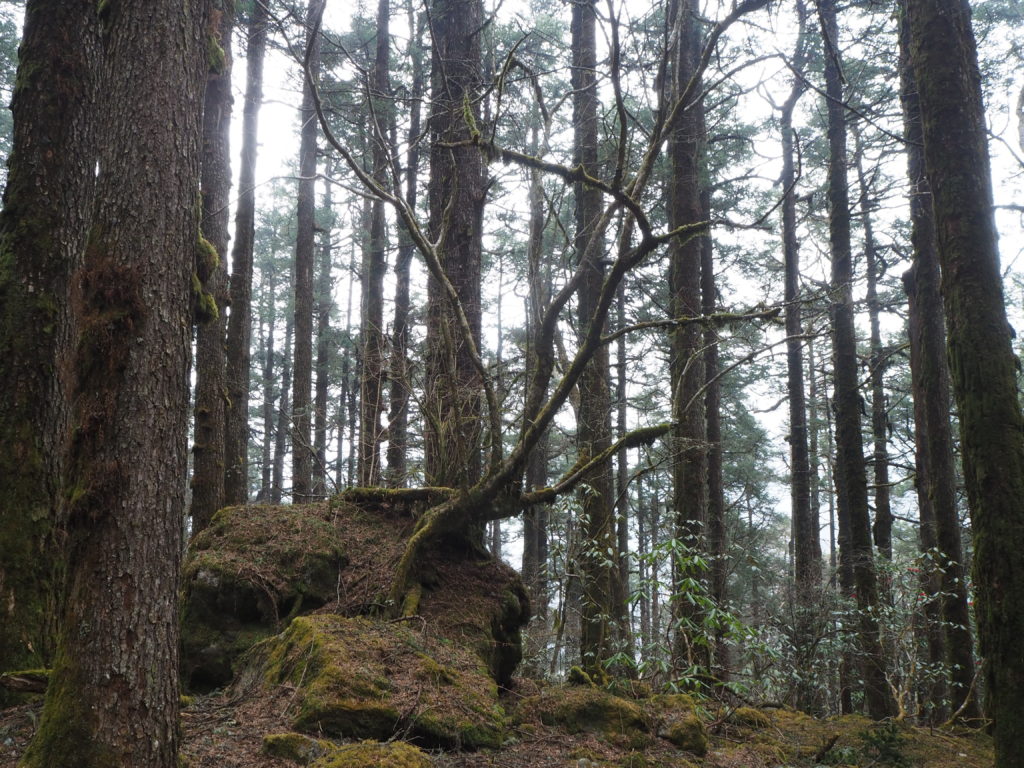
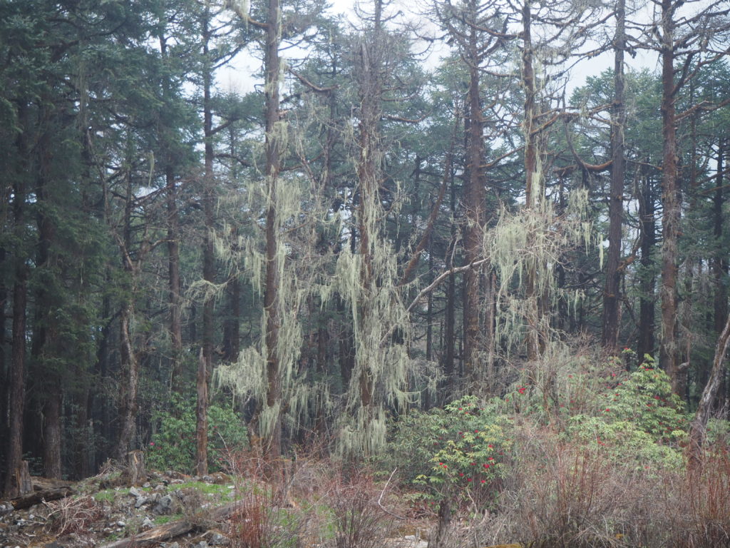
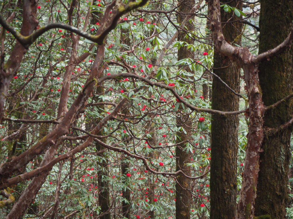
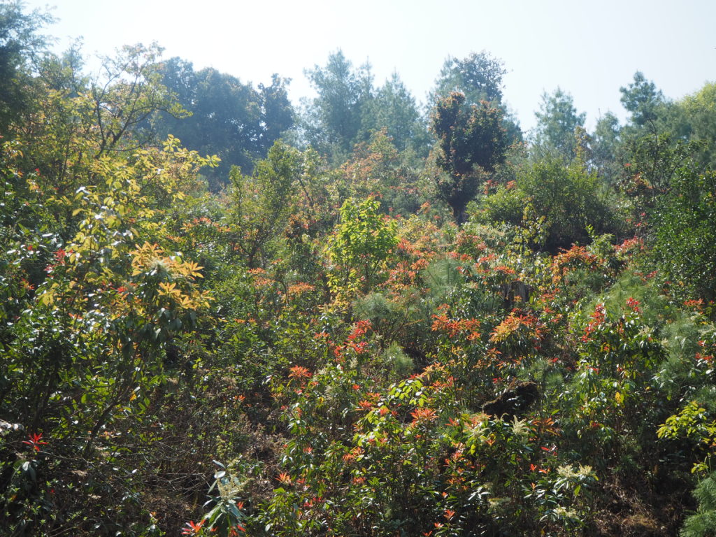
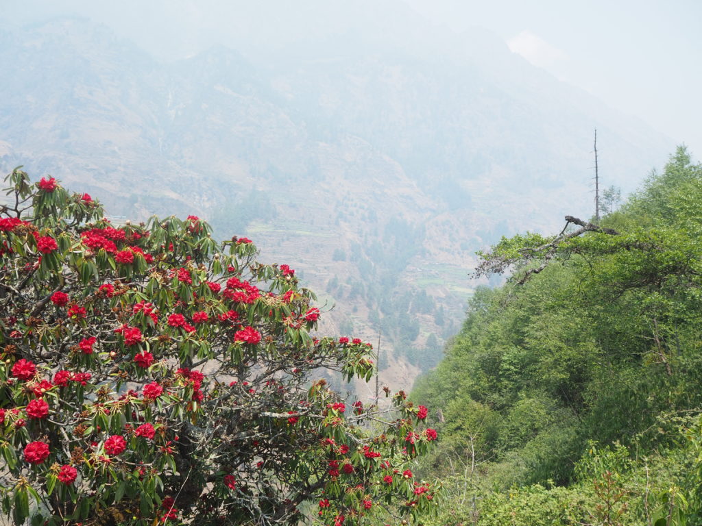
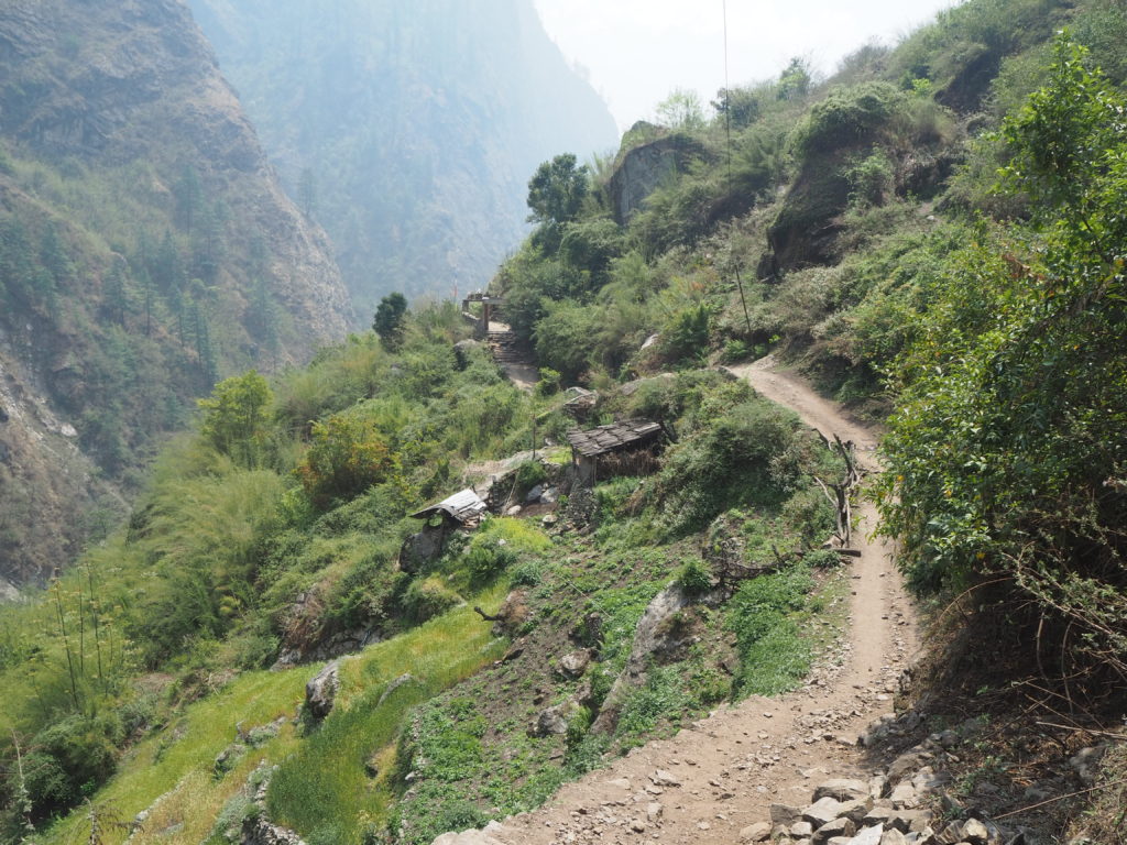
The paths here are not outlined well on our online maps, so we really had no idea what to expect from the path. It turns out, most of it was switchbacks through forest. The forest was really nice. Full of blue and boat pines. Nestled between the tall trees were swaths of rhododendron’s filling in all the gaps. We saw some white and pink rhododendrons, along with the already familiar red all in full bloom.
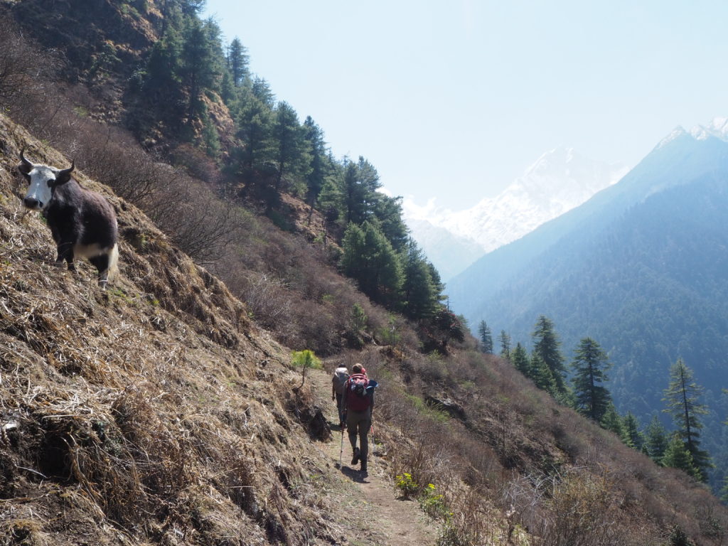
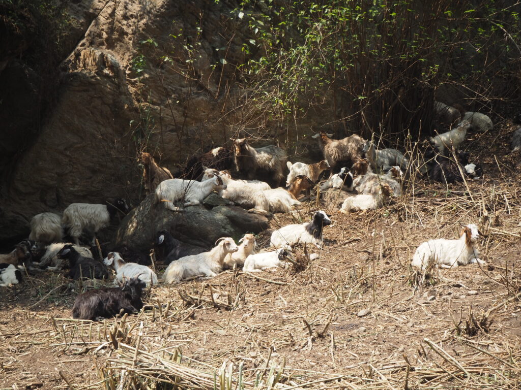
At one point on our journey up the valley, a bunch of unattended cows walking down passed us by. They were quite polite, and would step off the path to walk by us. There were three leaders, and then 10-15 more stragglers, all spaced up to a minute behind. Quite independent. They all seemed to know where they were going, whatever destination that may be for them. But we could not figure out why they were just cruising on their own.
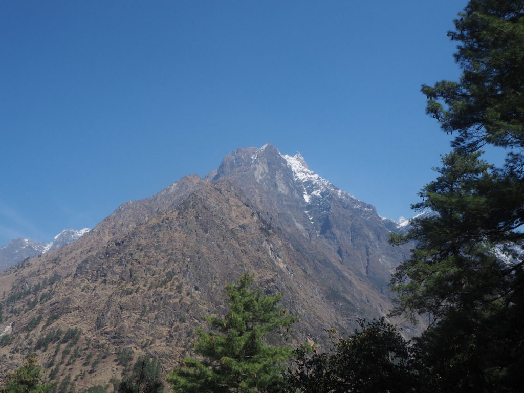
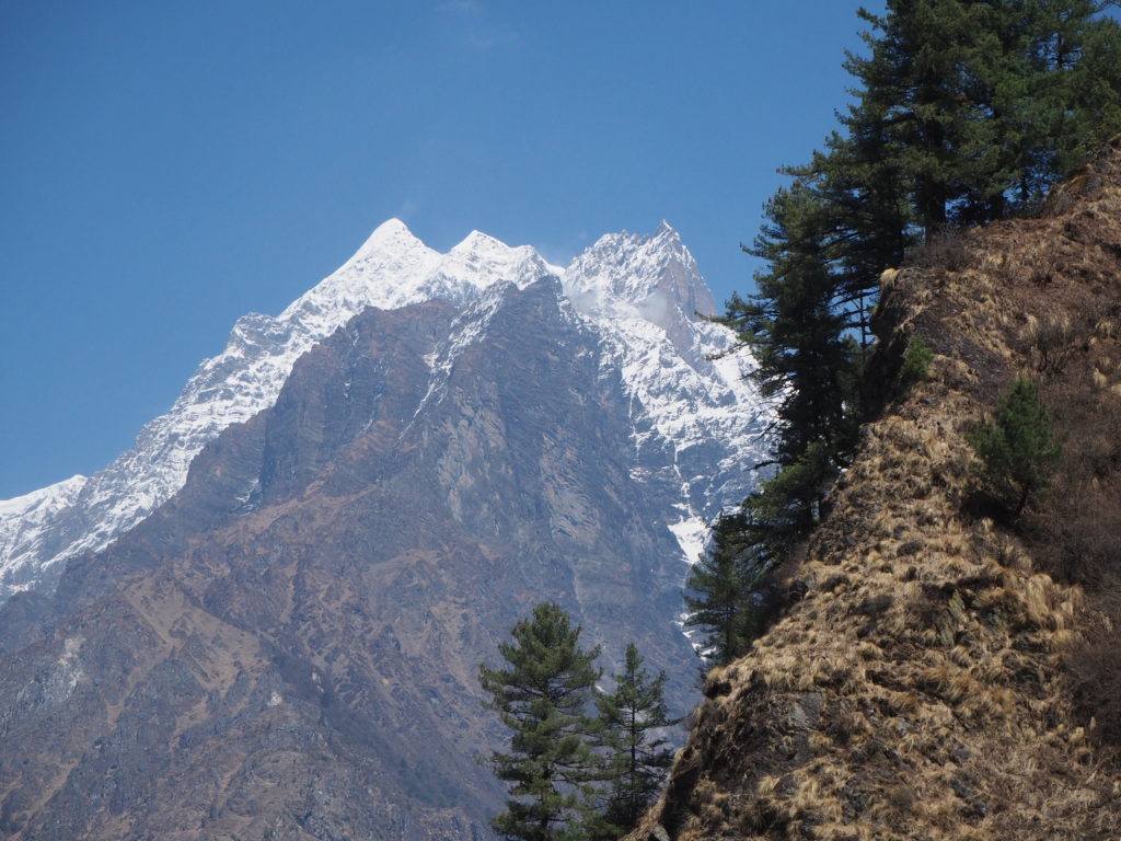
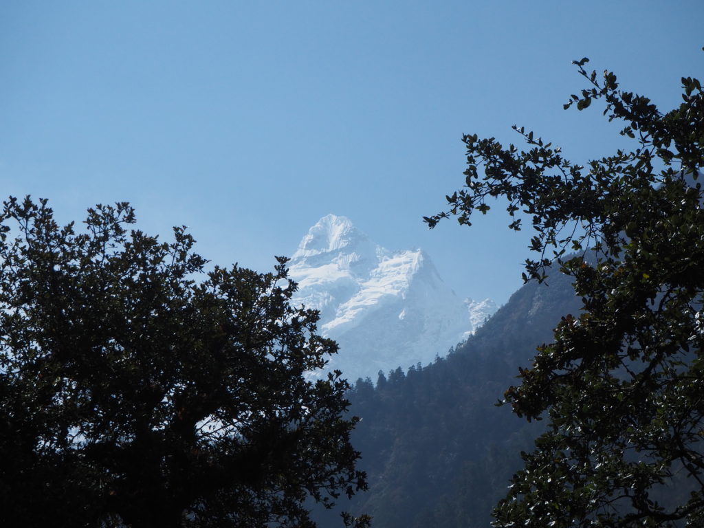
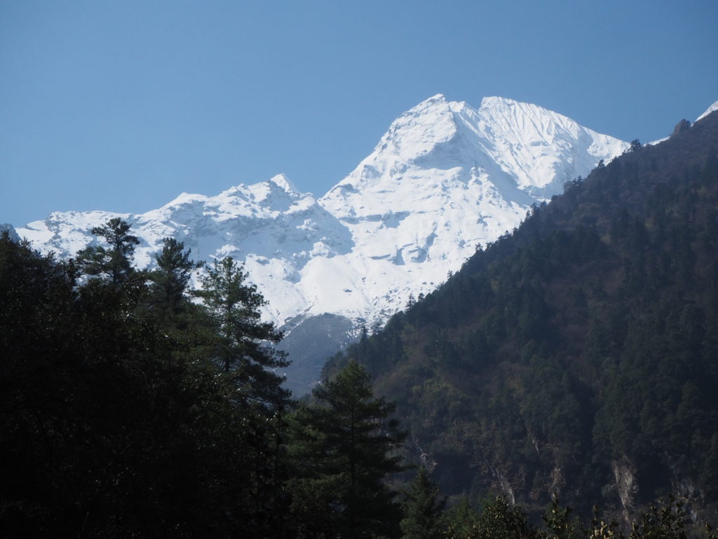
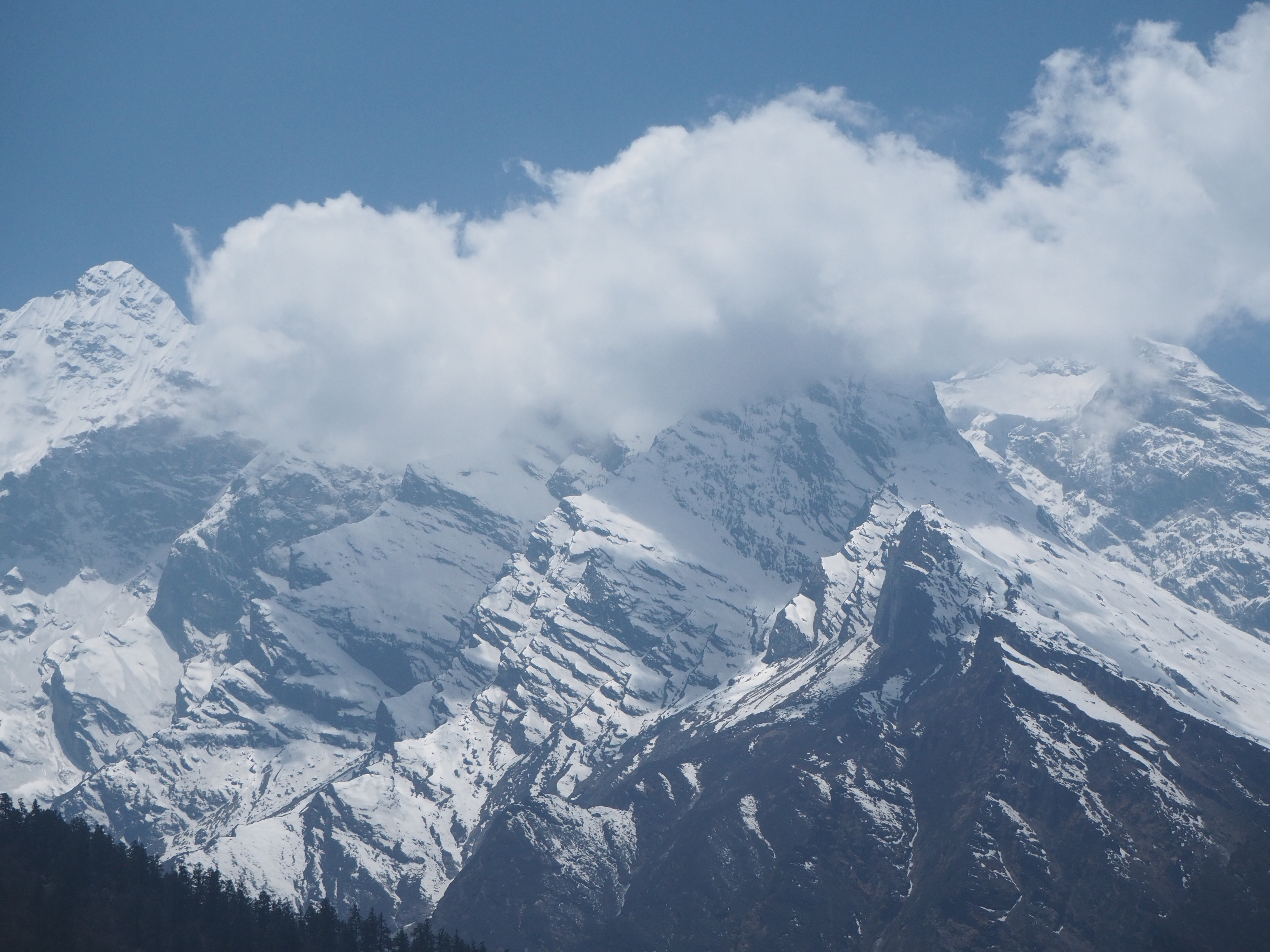
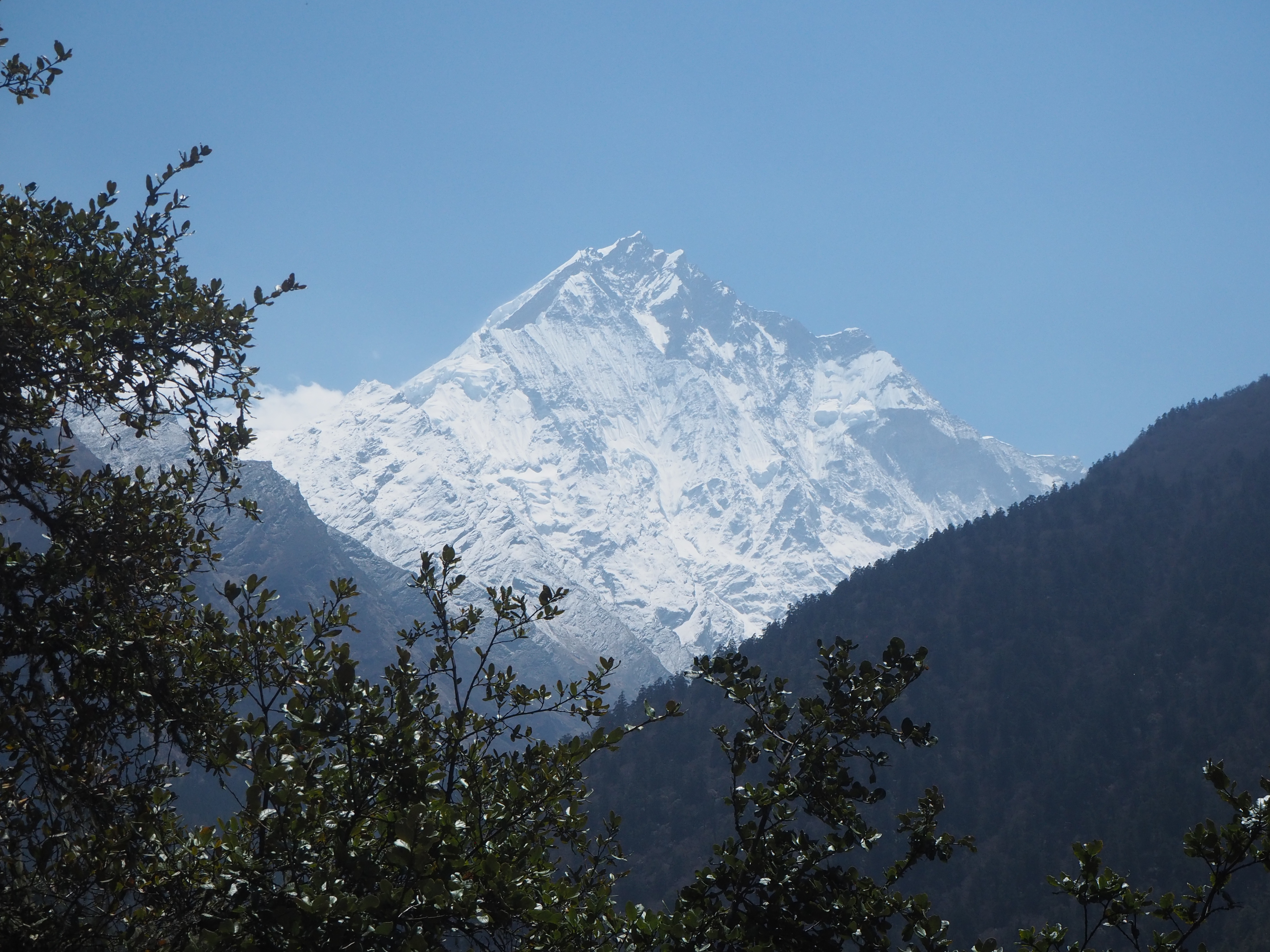
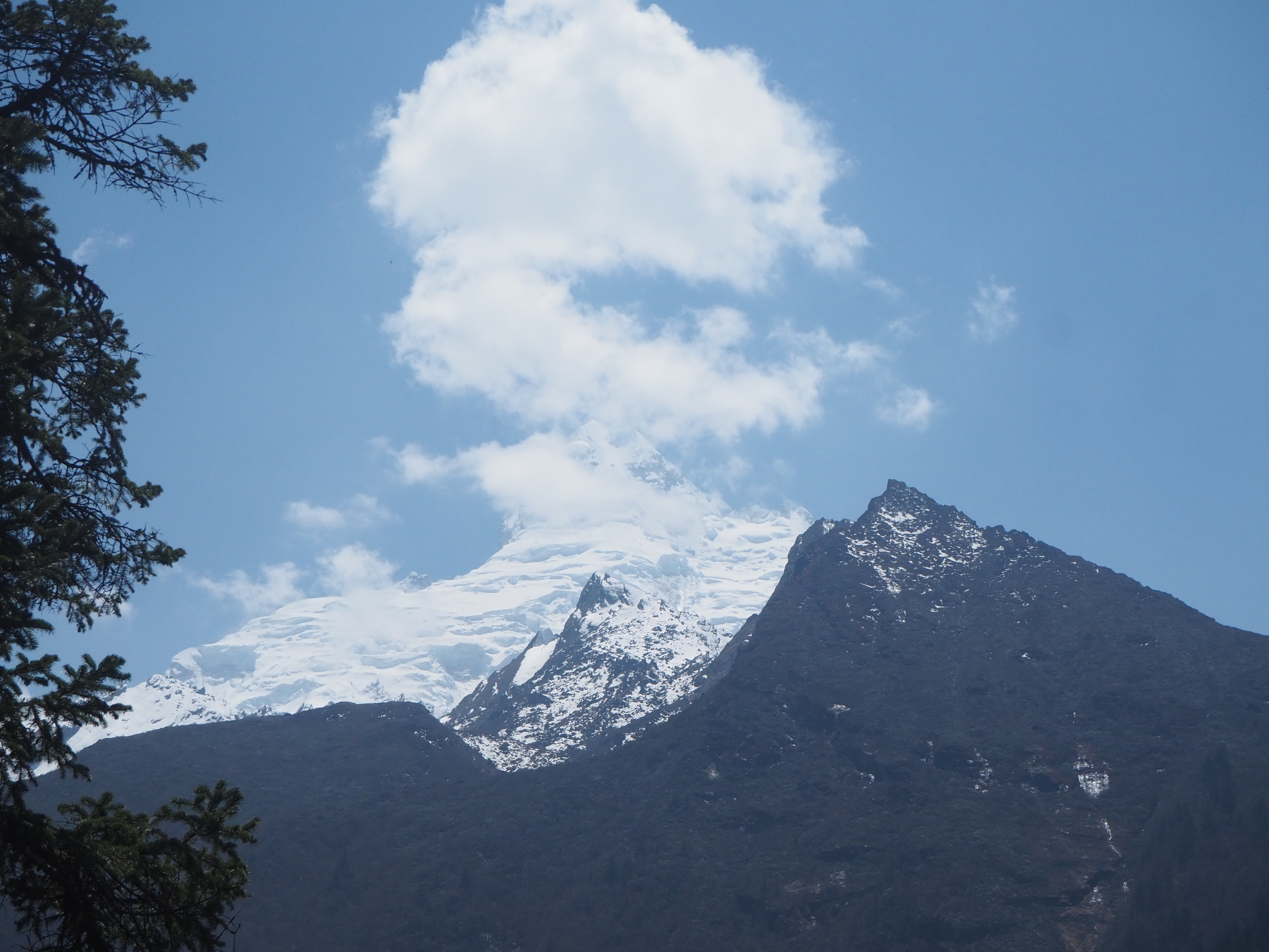
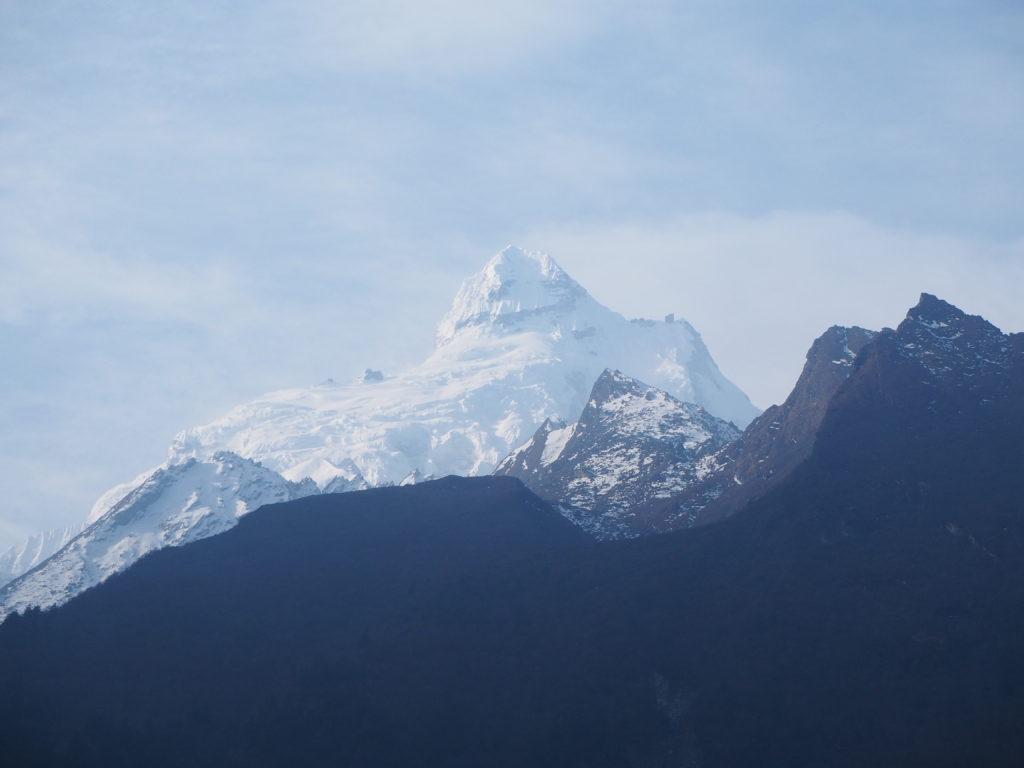
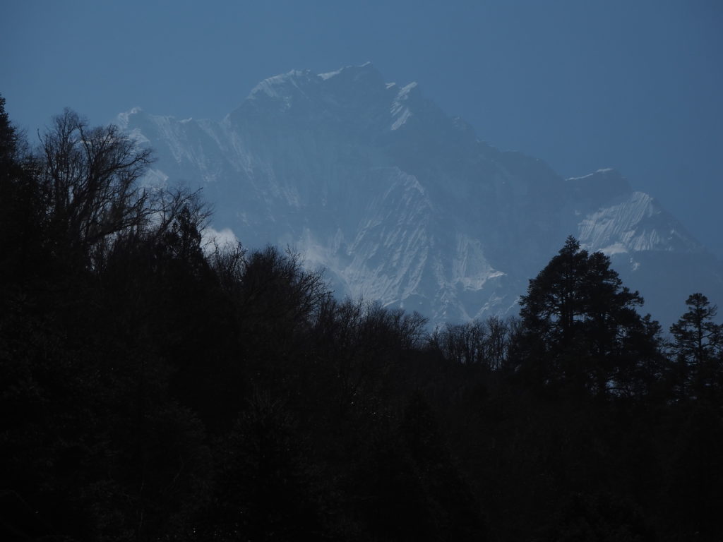
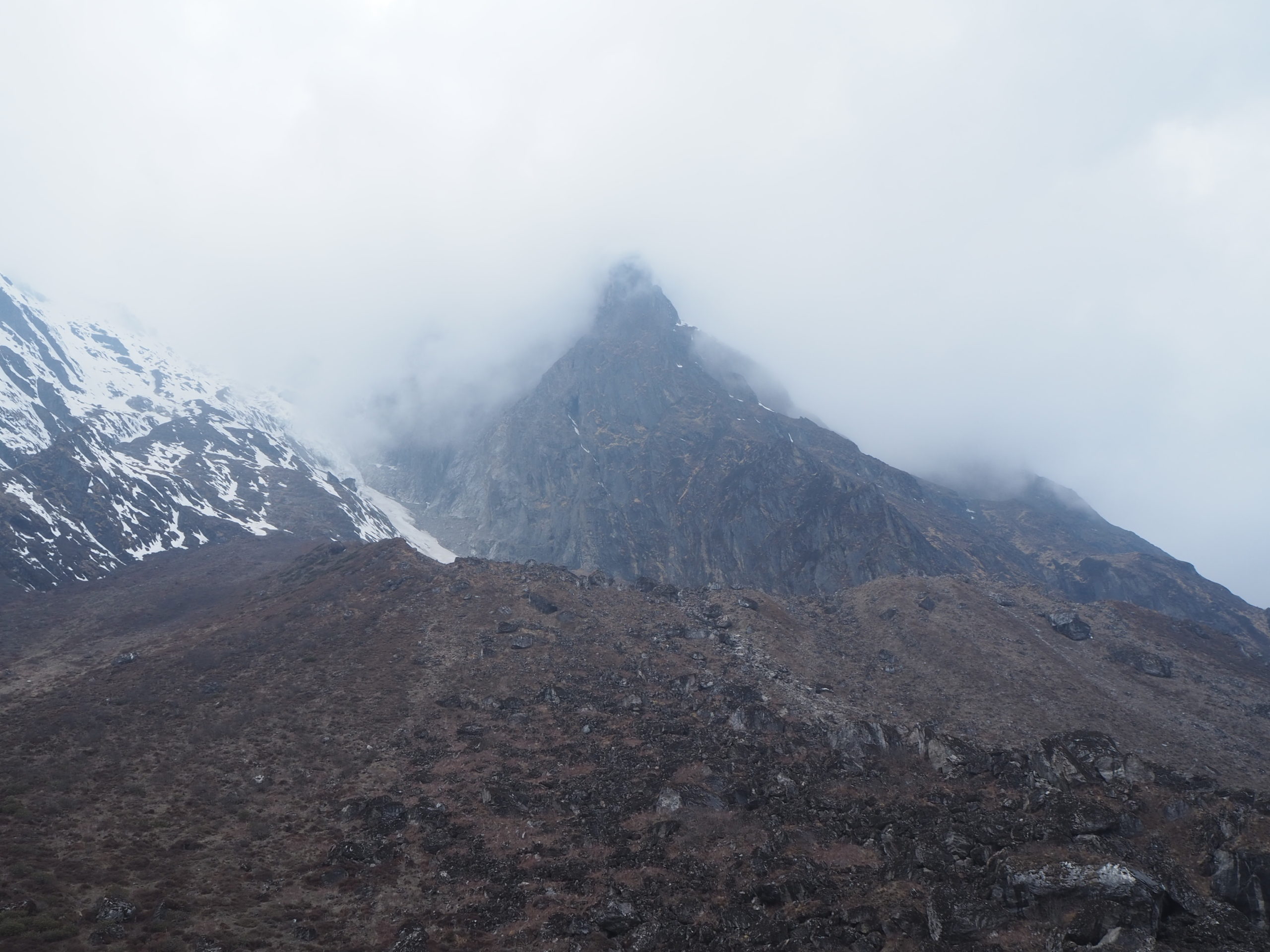
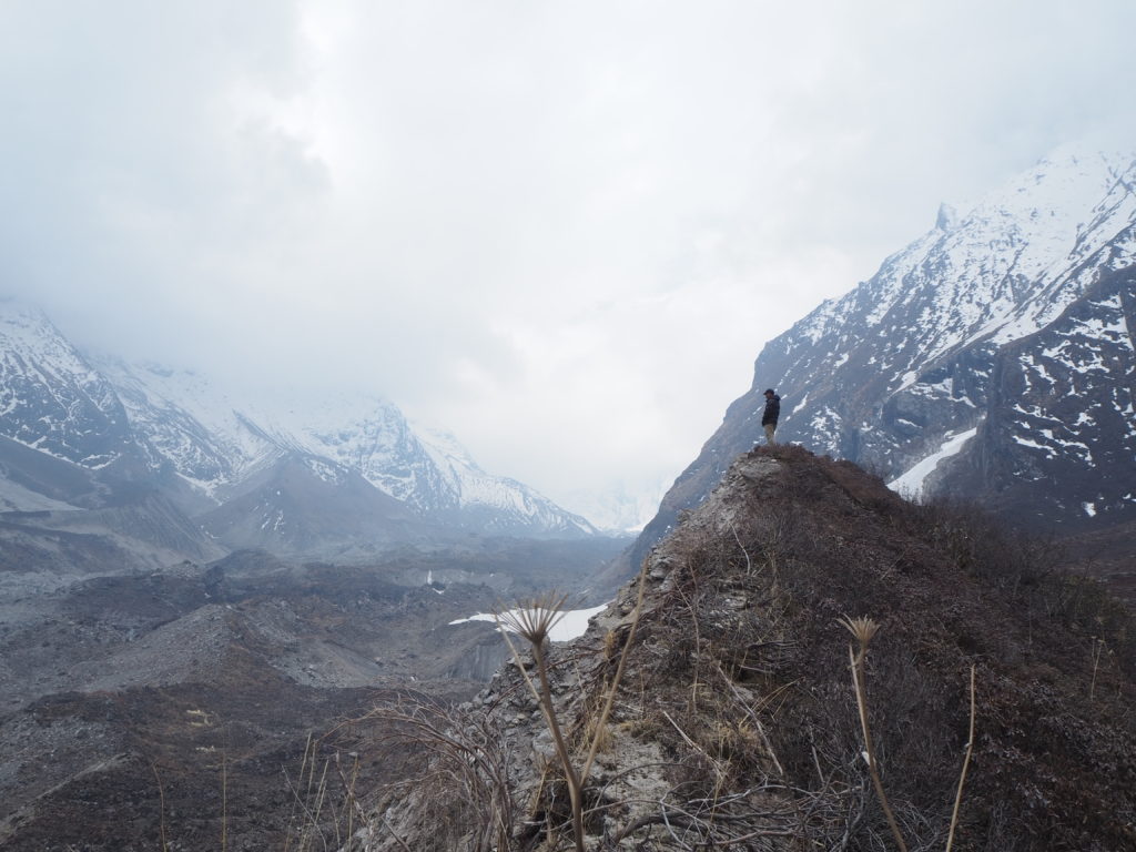
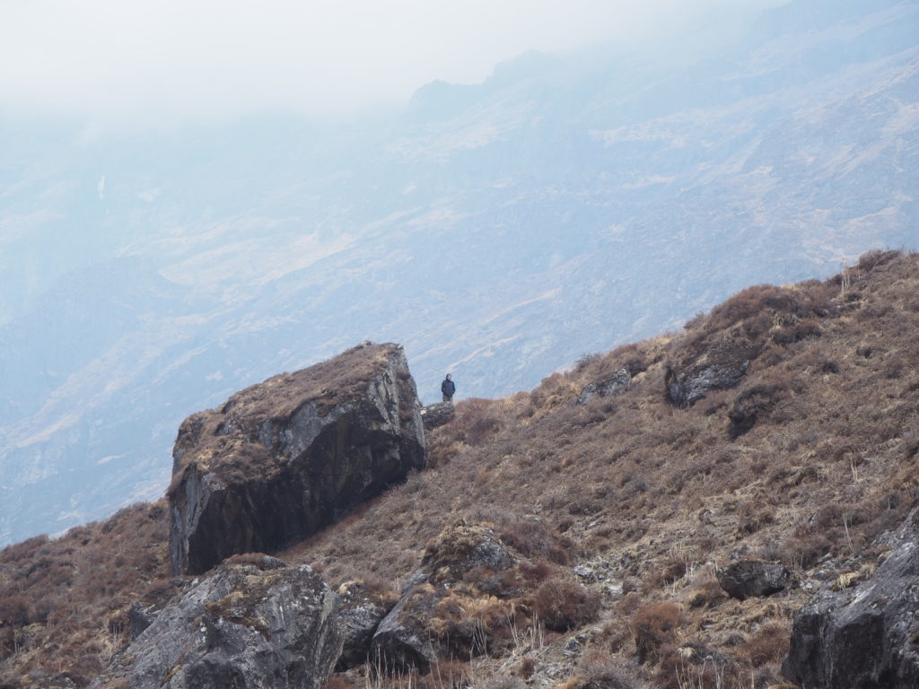
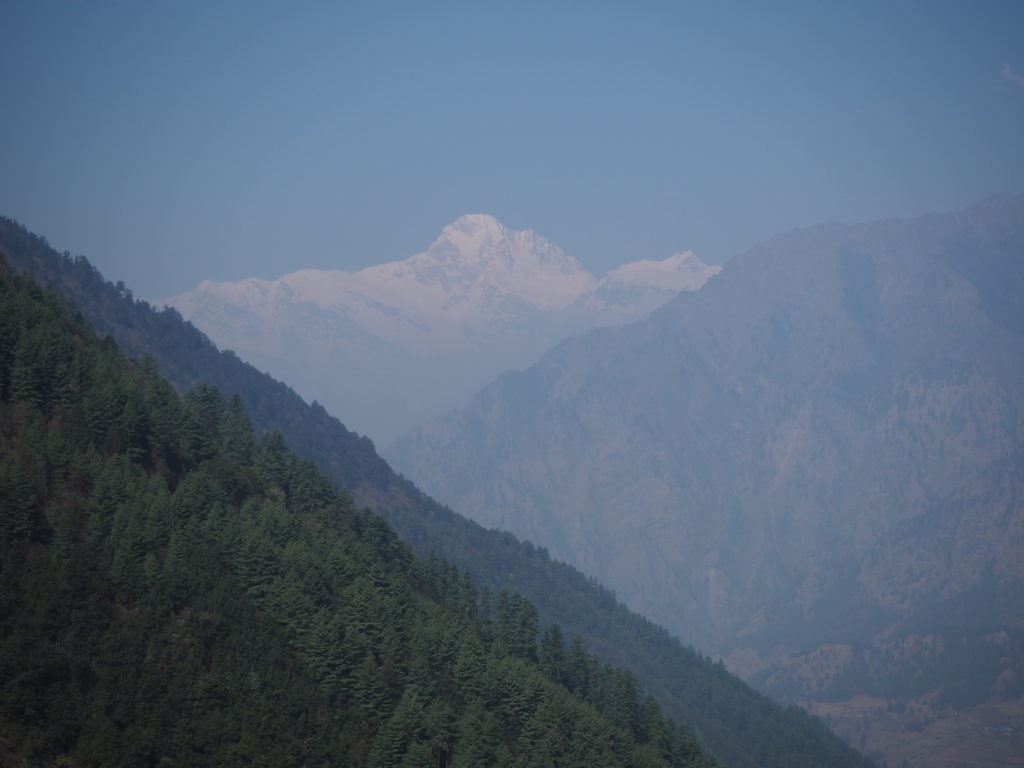
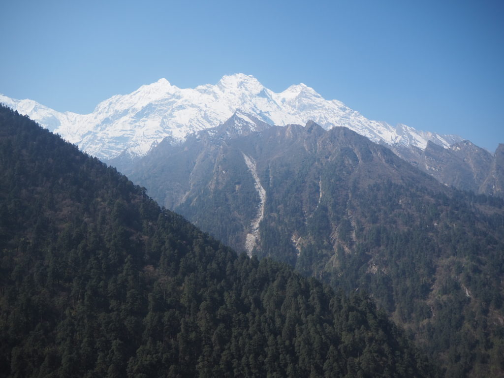
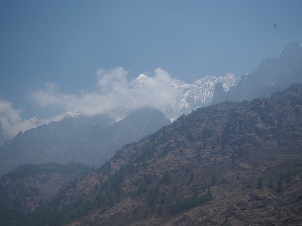
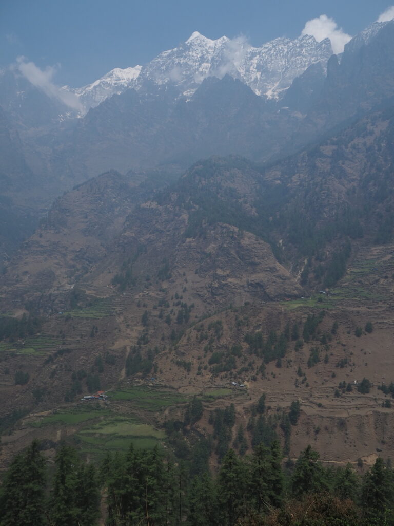
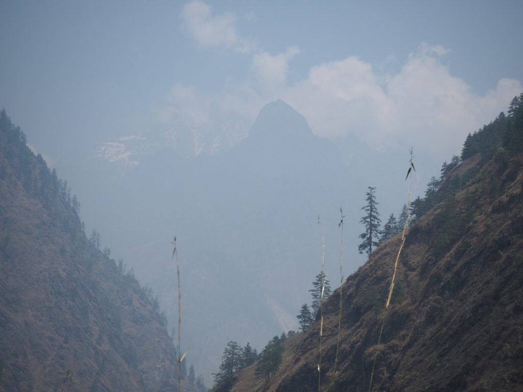
The mountain views walking up were phenomenal. We were entering the Ganesh Himal valley, and that entire family of mountains began to engulf us. With barely a cloud in the sky, we could see all of the peaks in their full glory. Some were jagged and shear. Some looked a little more structured. But they were all fantastic to see. We could also see the Chuli Himal (I think) range in the far disntance, where the entrance to the Manaslu valley lies.
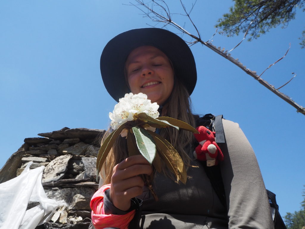
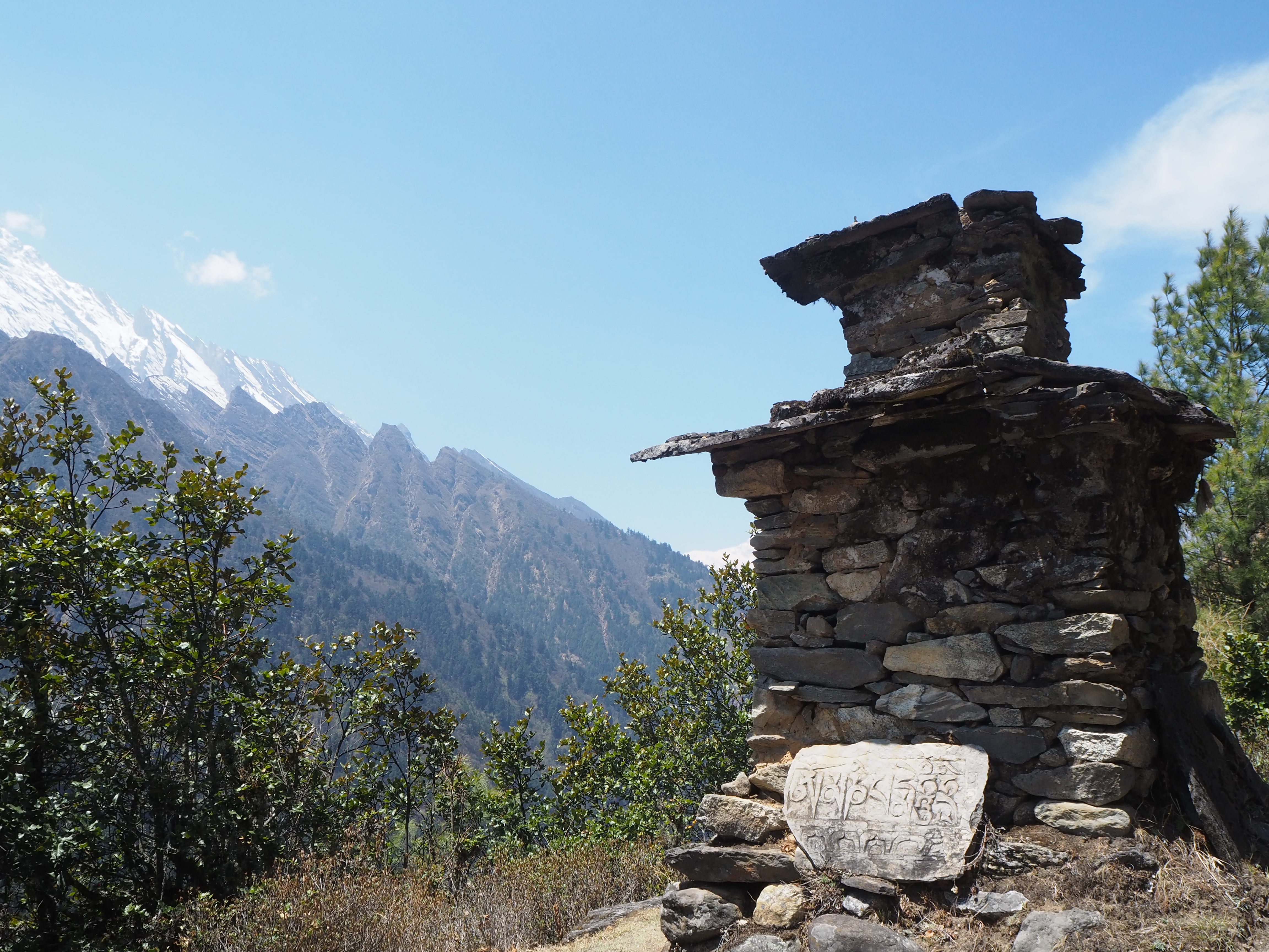
Nearer our destination, the mystery of the cows was solved. We were having a little break at some mani stones, and Shubus went to pick some white rhododendrons for his girlfriend. We had some pocket candies, and were generally enjoying the views. A stressed out man somewhere in his 40s comes near running down the path, carrying nothing (which is really odd for the area) except a small machete. He and Hari had a quick conversation and then he was on his way. Hari then explained it was his cows that escaped! The cows must have had a 45 minute head start to freedom on the man. I’ve never met someone on what was clearly one of the most stressful days of their lives, but here he was.
To make matters worse for the poor lad, his clearly old shepherd dog was lagging a couple minutes behind. It got distracted by us, and did not follow the man now barelling down the mountain. When we continued hiking again, we discovered two straggler cows that the dog was taking care of. I have no idea how one man with only a machete is going to find and wrangle up their 15ish lost cows and bring them home, without their shepherd dog. But best of luck. We never learned of a follow up to this tale.
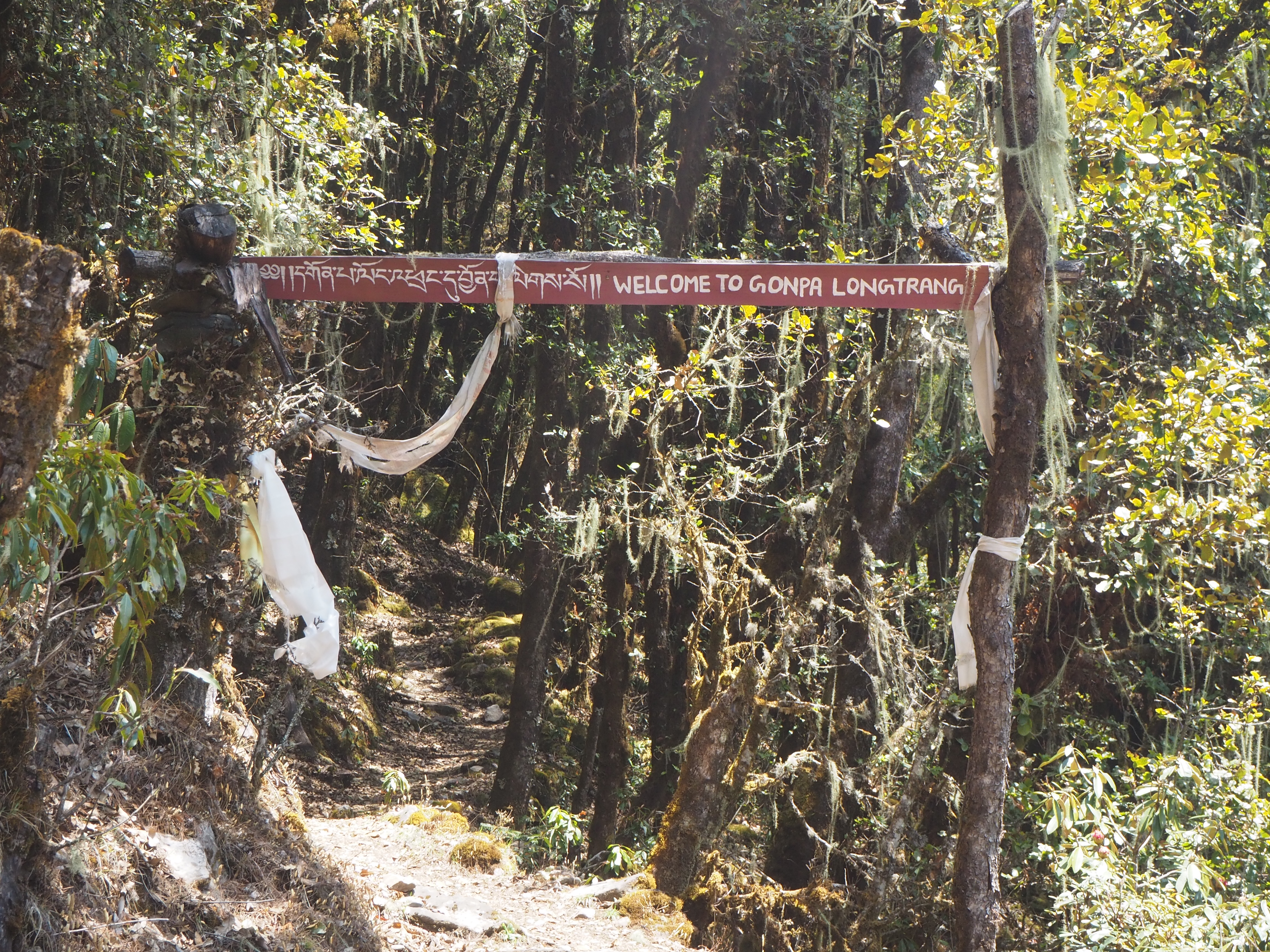
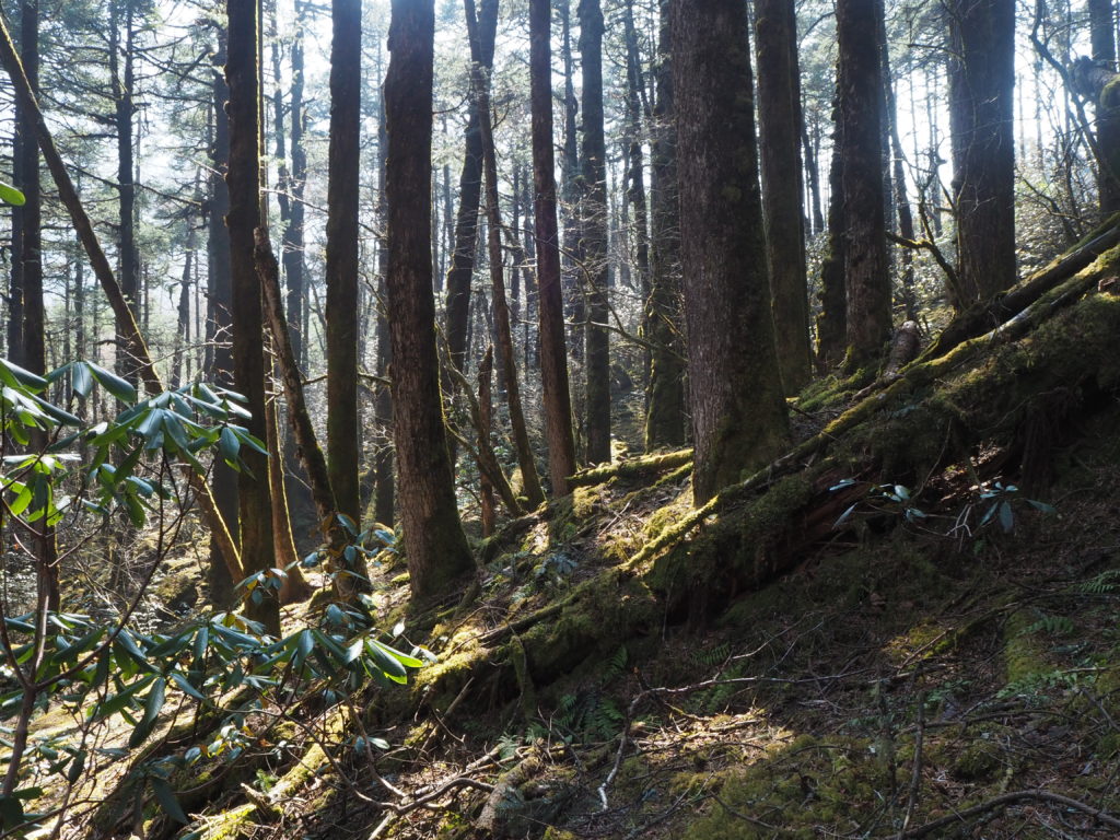
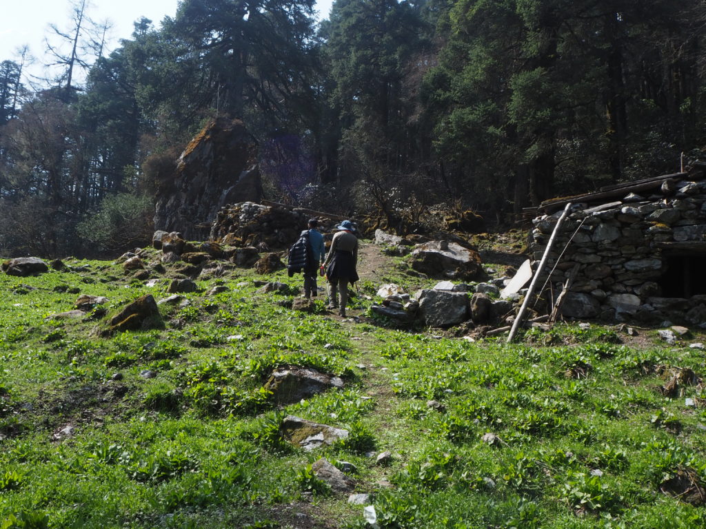
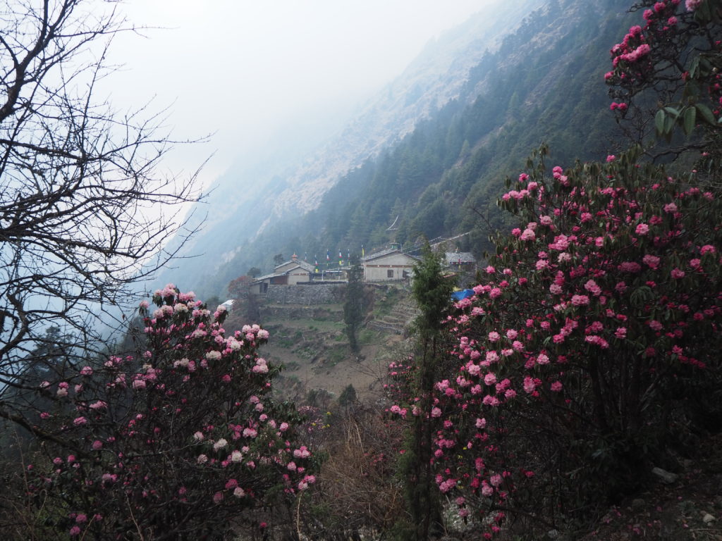
Shortly after we arrive to the entrance of Gumba Lumdeng. It was a nice little gate in the forest. The foliage in the higher elevations was different. There was lots of lichen and fungi growing from the trees. Old branches hanging down, and young trees growing at odd angles, giving their best effort to gain more light. The whole area had more of a magical feel.
It certainly was still a walk from the entrance gate to the actual nunnery, another half hour or so through the natural enchanted forest.
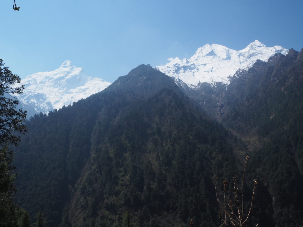
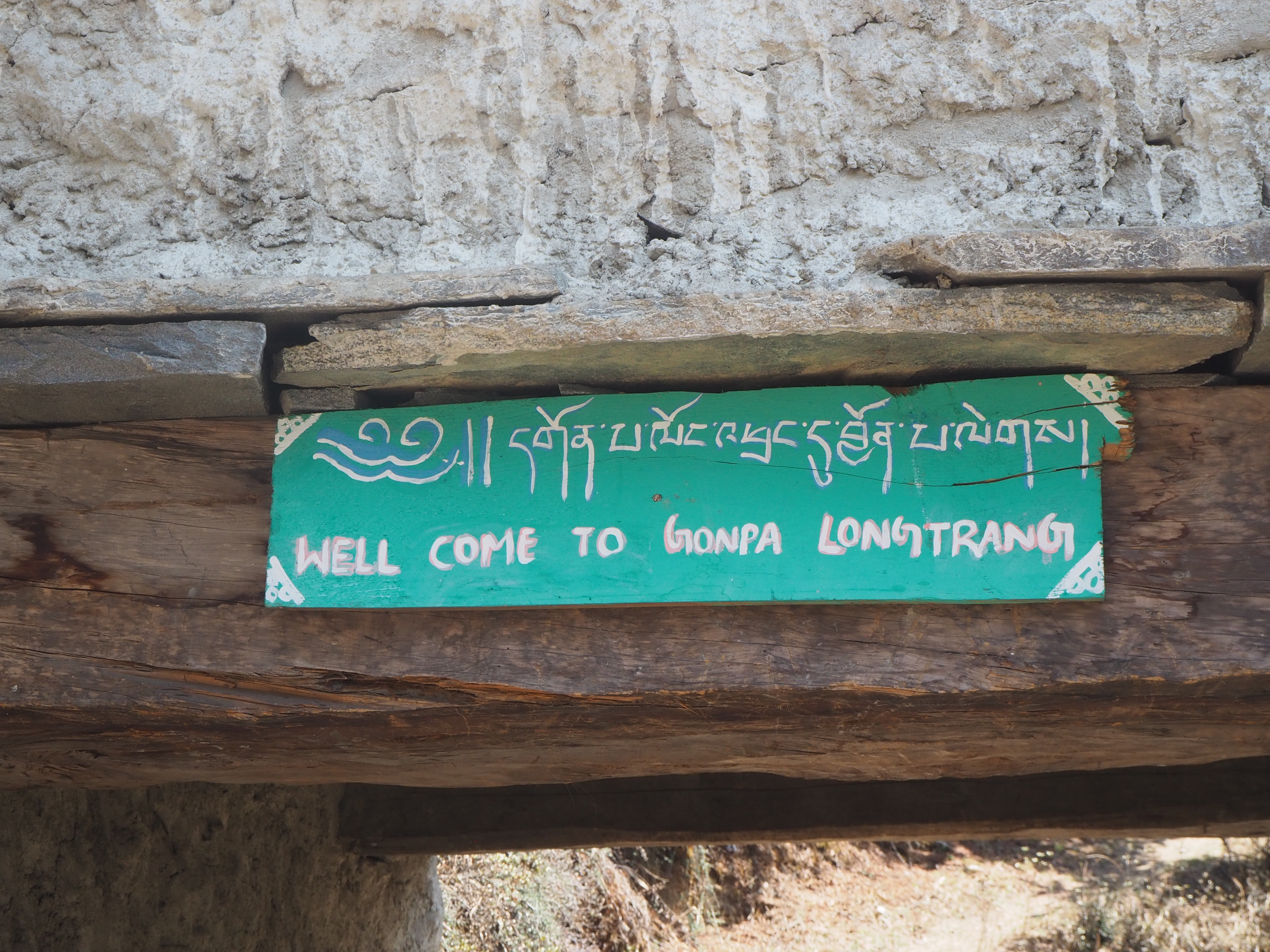
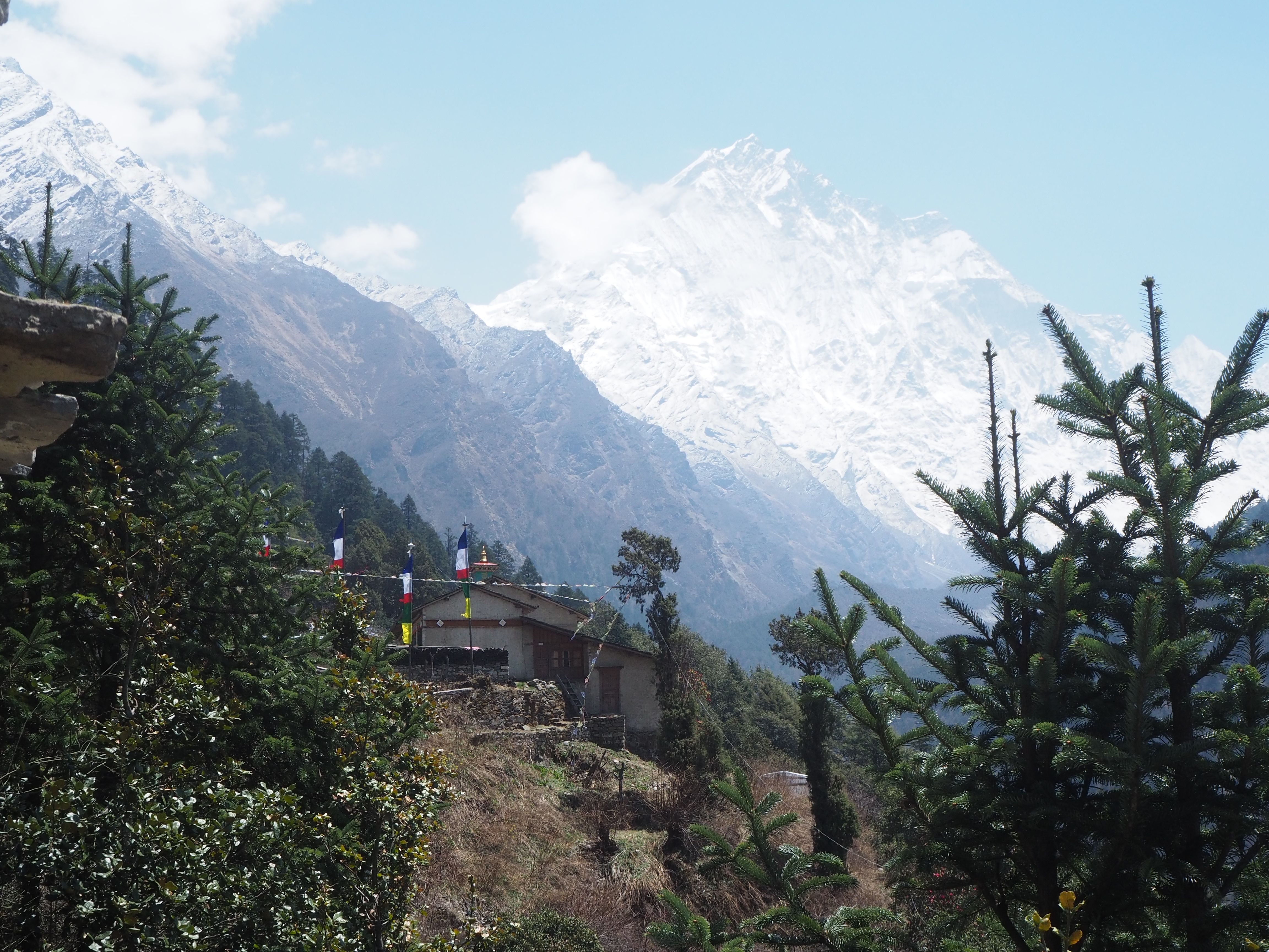
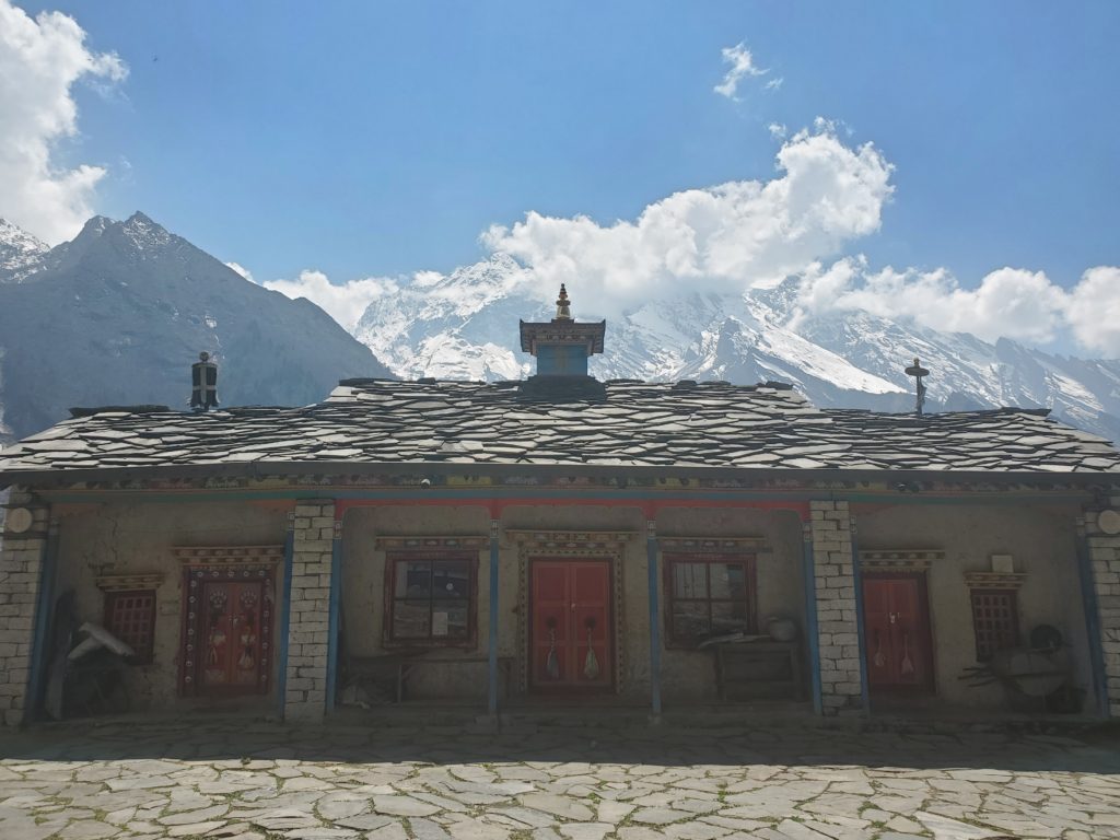
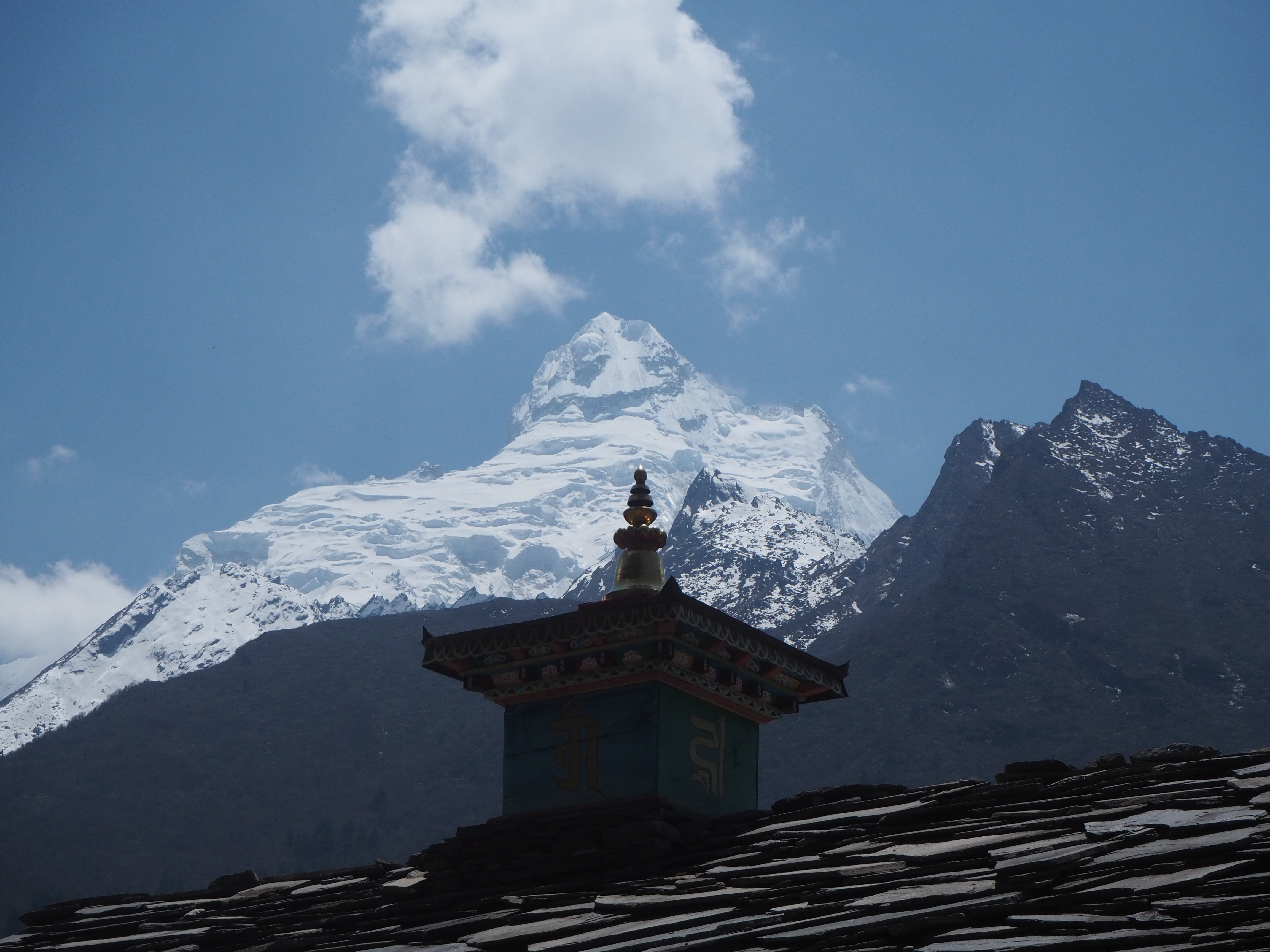
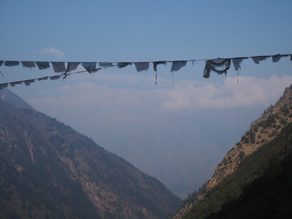
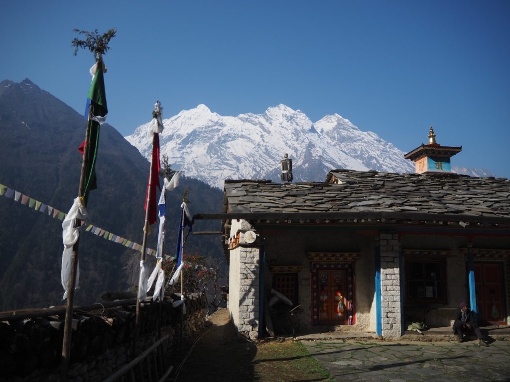
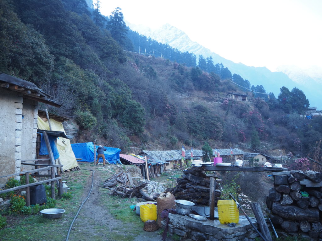
We arrived at Gumba Lumdeng near midday. It is one of the coolest places we’ve been. First of all, the views of all of the mountain peaks were simply stunning. The nunnery courtyard made quite the lookout spot for Ganesh 1, Ganesh 2, and the rest of the numbered mountains. Between arrival and lunch, we sat on the temple steps and took in every detail the Himal had to offer, and watched the clouds slowly encompass the peaks to mystery. It really was a special landscape to witness.
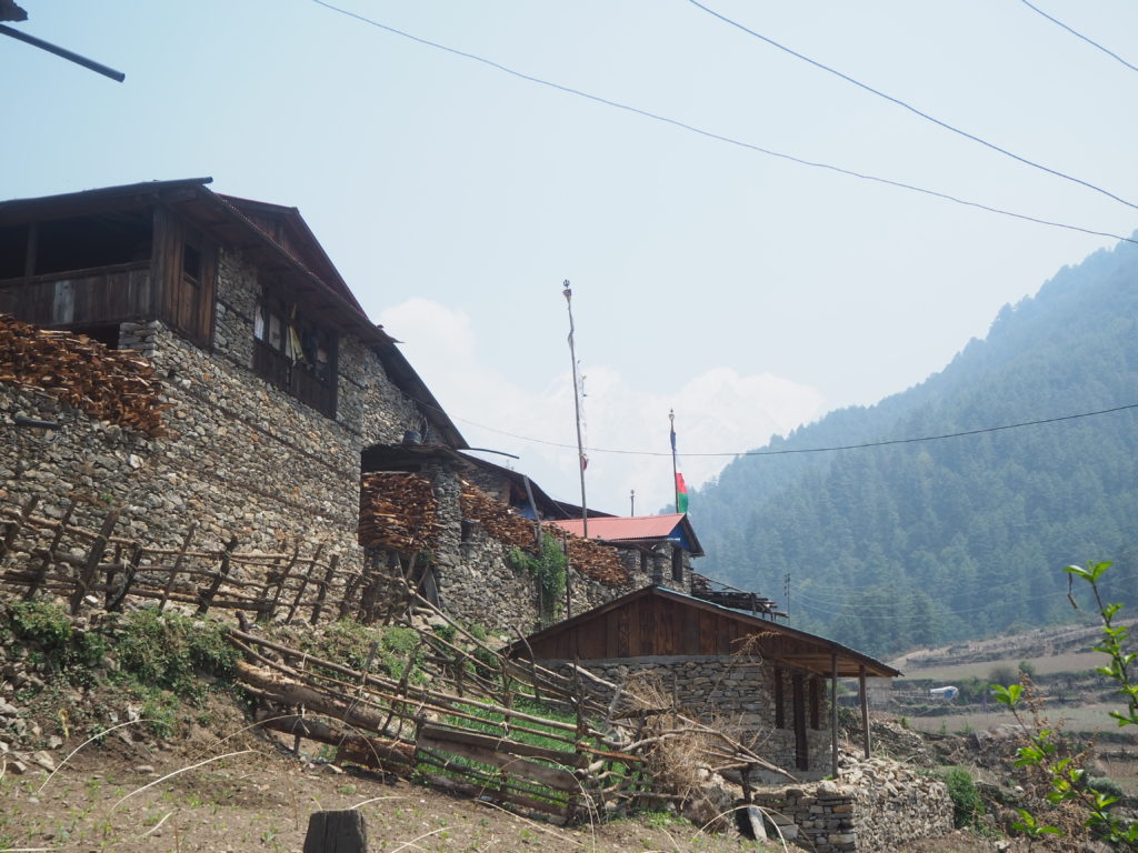
Only one woman lived in Gumba Lumdeng, and she takes care of all the few visitors that make their way up. She was 65, and had been living here at Lumdeng for 50 years. We were the only party for the day. She makes dal bat for lunch and dinner, and only tests to guests in between her prayers and chores and generally expects everyone to keep their room tidy. There is only electricity in the kitchen and dining room, where cooking is done over a wood stove. It is a simple life up here for her, but she does look tired. I cannot fathom being here for 50 years. The nearest village is a two hour walk down, three up. The nearest road is two long days, thee normal ones. But all of her supplies come in via donkey, and it takes care of her simple needs. There were more nuns before, but they passed a few years ago in their 80s. Some nuns will stay on an extended visit to keep her company.
This is a fantastic place to visit, and we are happy that we have made it. But it is a massive day tomorrow to Ganesh Himel base camp, for hopefully more stunning mountain views.
Day 9: Day Trip to Ganesh Himal Base Camp
Length: 16.57km
Elevation: 1180m
We woke up and there was nary a cloud in the sky. That lasted for 20 minutes before fog consumed the peaks and valleys. After our breakfast of Tibetan bread, we headed into the forest to find the now abandoned base camp. It is against the law and religion to climb the peaks of the Ganesh Himal range.
Hari had never been up this way before, so it was a new adventure for all of us. We decided that we would go to a good turnaround point, following the directions of a French couple who had gone up the day before. The trails on our online map were too straight to be useful.
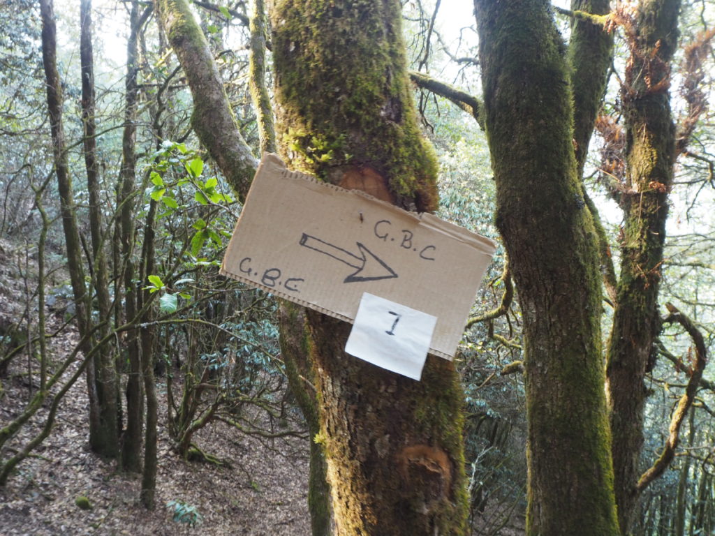
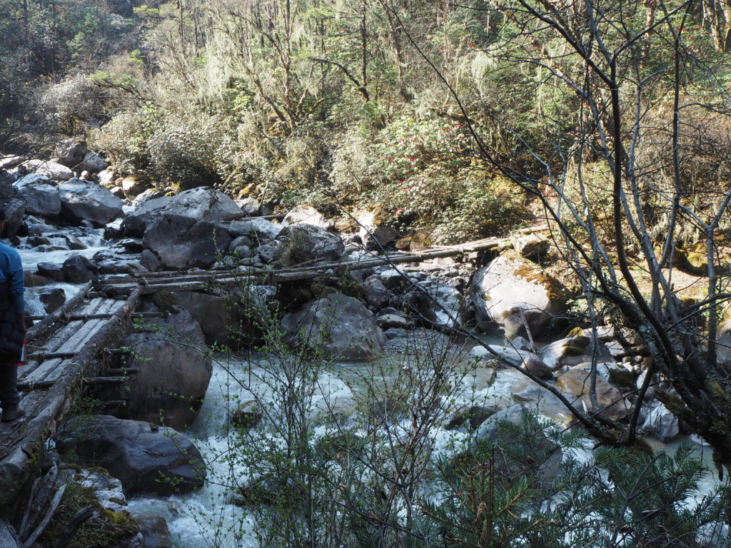
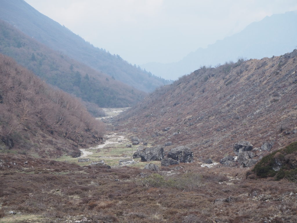
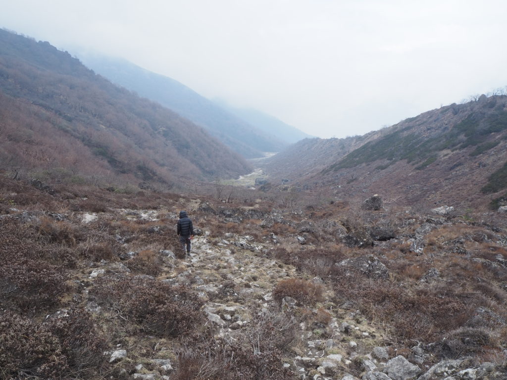
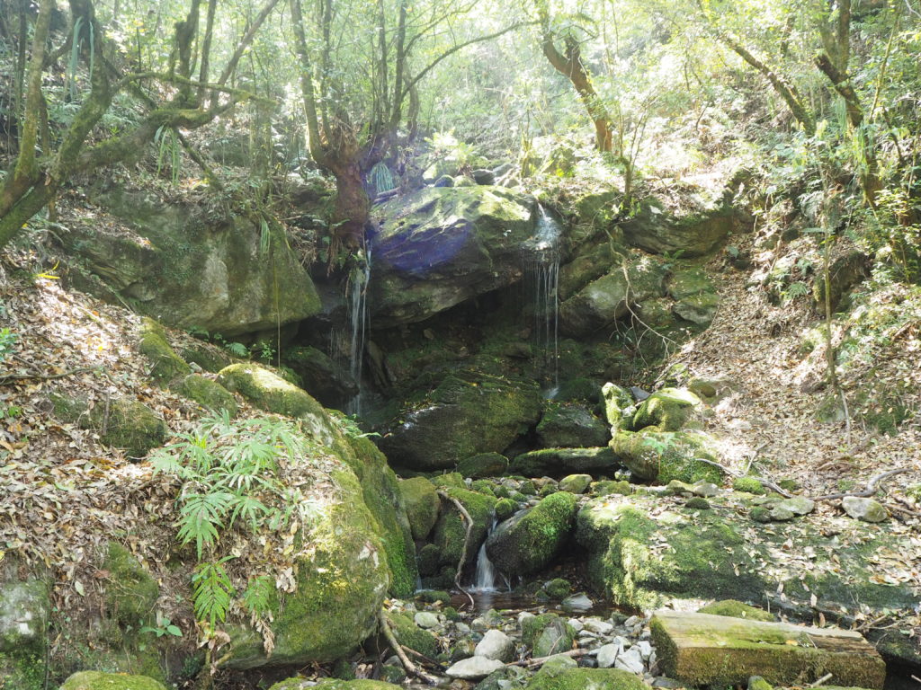
So we went into the woods. Someone had signposted part of the trail with cardboard posted to trees fairly recently. That only lasted for three posts through. Or we went a completely different direction. Either way we had found a trail, and it was fun. It started with a fairly steep descent through the enchanted forest to the river. Gumba Lumdeng is on a hillside, and we had some streams to cross.
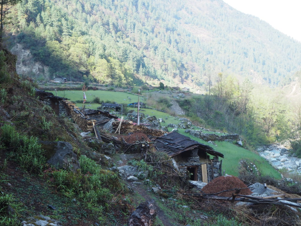
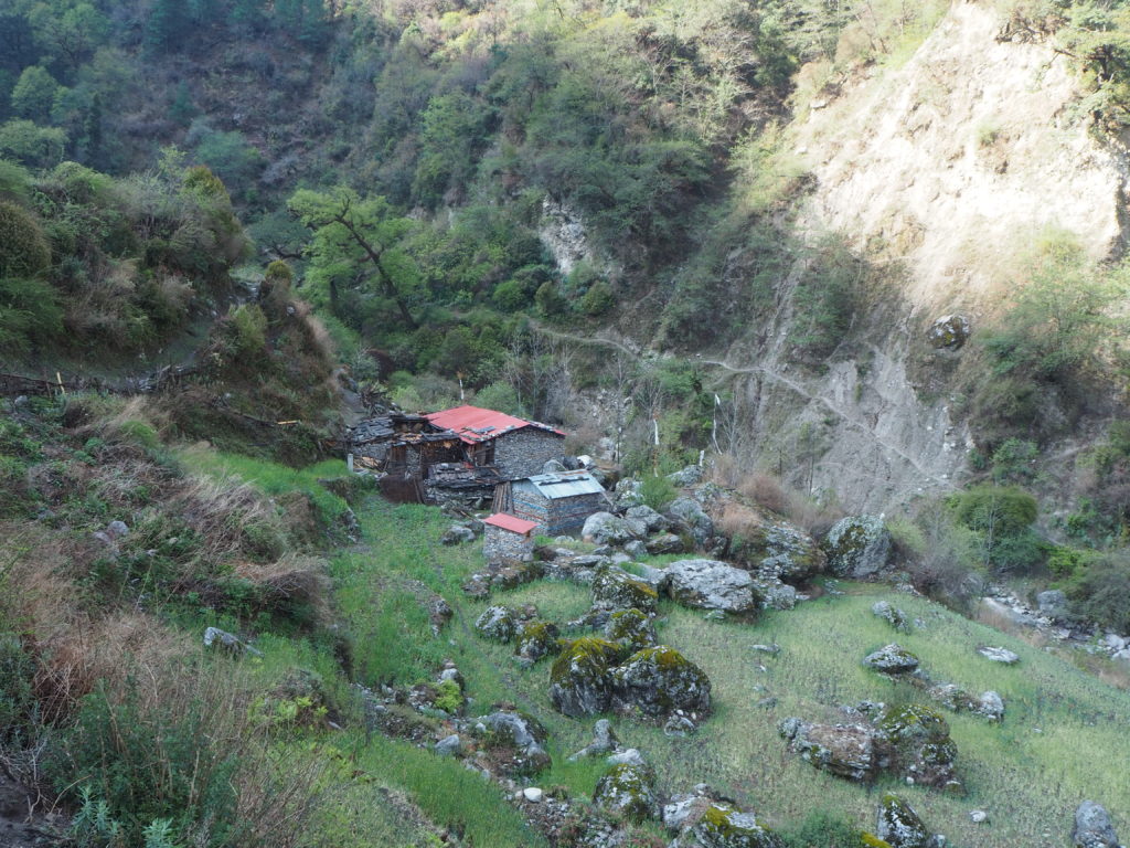
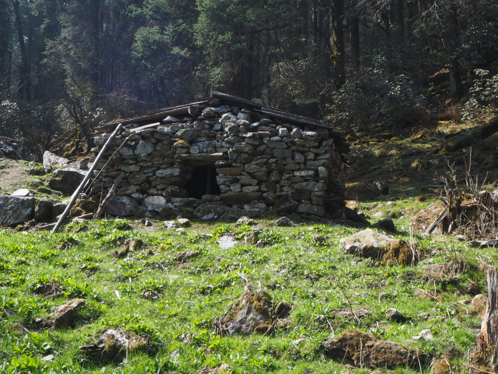
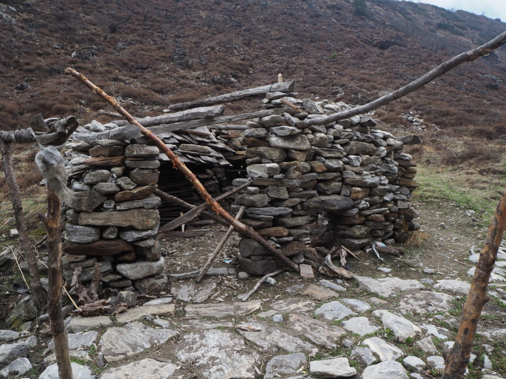
Two river crossings later we were well off of any path on any map we had. But we were certainly on a path. Turns out, it gets used a few times a year by cow ranchers, who bring their cows this way to graze. Maybe that’s where the loose bovine made their dash from. The trail went uphill now, still in the old enchanted forest. There was a clearing with little meadow, where some small stone and wood huts sat. These are where the ranchers sleep while the cows graze.
As the elevation increased, we started following a dry creekbed. A lot wildflowers were starting to bloom. We got higher, and the trees parted for the shrubs. This was our second foray into the alpine biome, after Mu Gumba days prior. We didn’t quite know what we were looking for, but we felt like it was something cool. The French couple had declared it so.
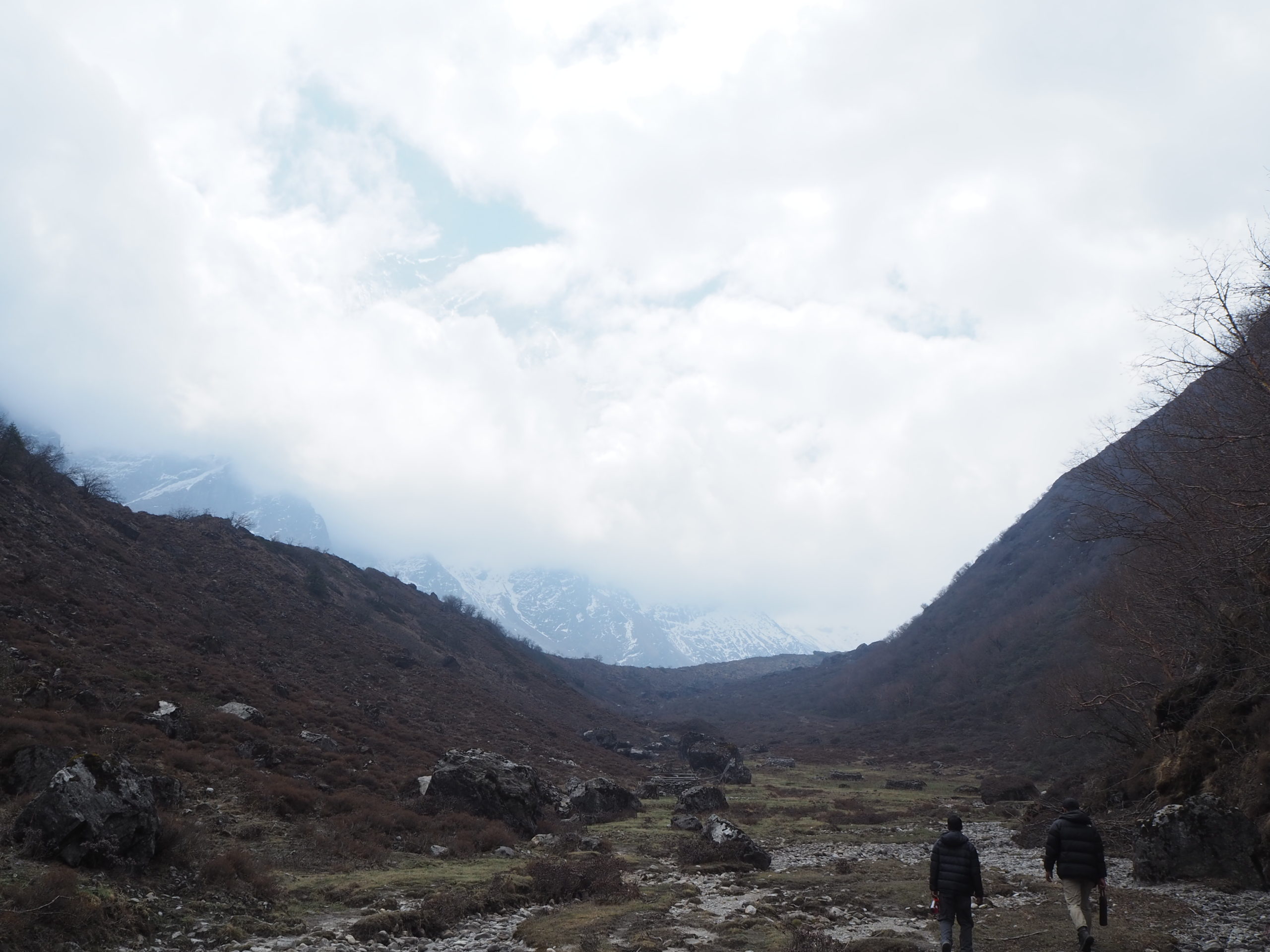
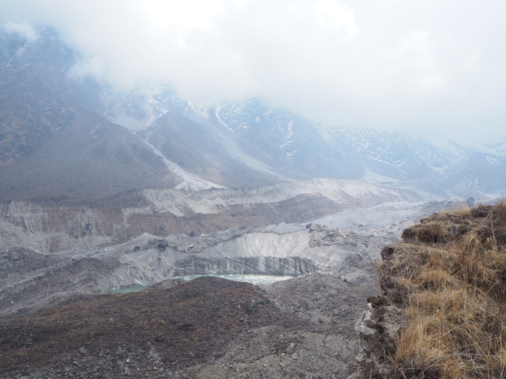
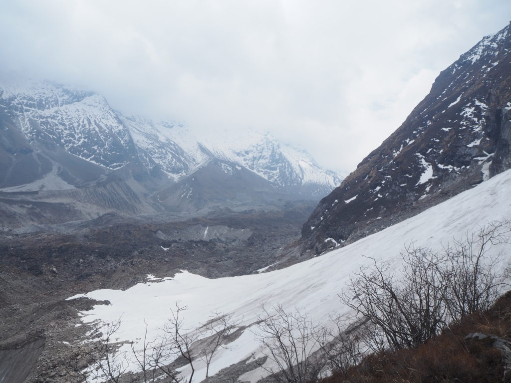
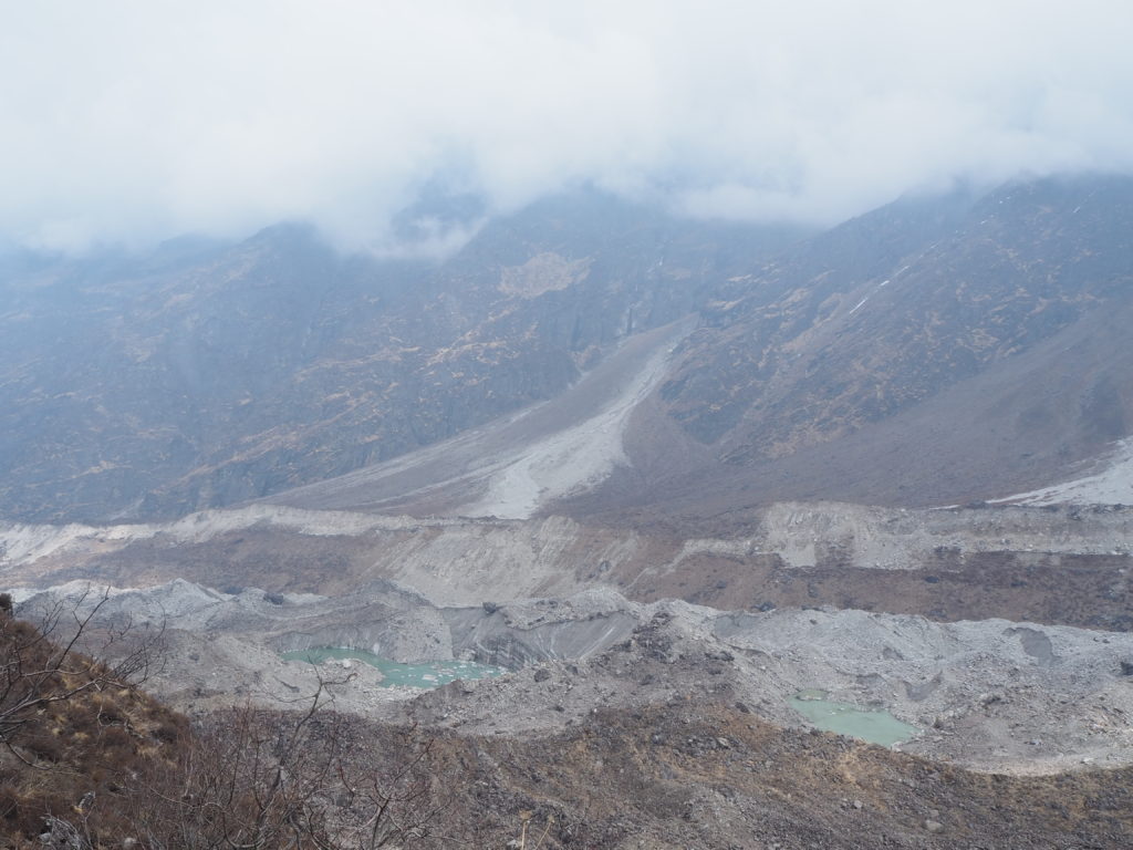
Something cool came quick. We found the source of the dry creekbed, which was a dry pondbed. A large flat meadow lay before us. Dotting it was large boulders left by previous glacier cover, and more stone huts for the ranchers to stay. To our right was rocky slopes that disappeared uphill to the clouds. To our left was a small dry grassy shrubby hill. And in front of us was a sky full of clouds, with mountain peaks poking through much higher than they should have been.
We continued beyond the pond and up the shrubby valley. The hill to our left continued with us, and we realized that there was probably a glacier on the other side. When a glacier flows, it displaces a lot of material, and that is what the hill likely was.
We had lunch at a rock near the top of the hill, and confirmed the glaciers existence. A dirty and rocky lounge was snaking down, carving its own valley in the landscape. We could not see much ice, only as the walls of pools that have accumulated on top. The rest of the cover was all mountain debris. We also could not see source of the glacier, as that stretched deeper into the valley and into the clouds.
Lunch was decent. More Tibeten bread and boiled eggs. We brought a chocolate bar for a treat too.
After lunch, Shubus and I went exploring deeper into the valley. We wanted to go to the end of the grassy section that we were on. It wasn’t that far, and at the end the view wasn’t that much different. Just more ice, rock and clouds, with no dirt hill in the way. Cam stayed back at the lunch spot and watched ice and rocks collapse. It certainly was an active geological area.
Going back down was tiring. It was a lot of up, and what follows that is a lot of down. Cam got quite tired. She hasn’t been eating much lately. Its only dal bat on the menu’s and the lentil rice combo still makes her stomach queasy (due to the Ecuador homestay nonsense). But we made it down in one piece, quicker than we would have thought.
We had some great guests for dinner. We met Steve, a recently retired Calgarian who was filming his own documentary on the Tsum valley. This was his third time in the region, and he was getting his final shots and interviews before piecing the whole thing together. We had nice conversations into the evening, sharing stories about home, travel and the work-life balance.
We went to sleep knowing that this would likely be the last tie we ever set foot at Gumba Lumdeng. Few ever come up this far. Only the ranchers, visiting nuns, the odd travel groups, and fanatics like Steve. What an honour it was to be here.
Day 10: Gumba Lumdeng to Lokpha
Length: 19.01km
Elevation: 900m
Today was all about miles. We said goodbye to the nun who had hosted us for the last two nights, and set our way back to the starting Tsum Valley village. We had noodle soup for breakfast. Hari wasn’t a fan of the Tibetan bread at the nunnery. Not sure why. He can be quite the food critic sometimes.
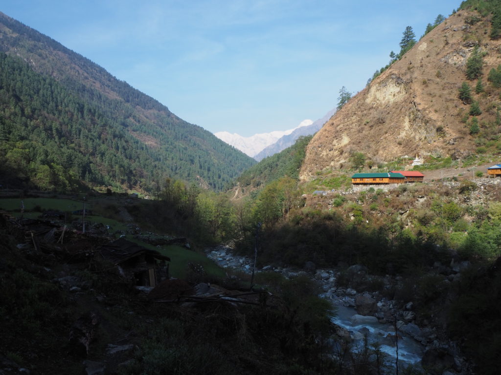
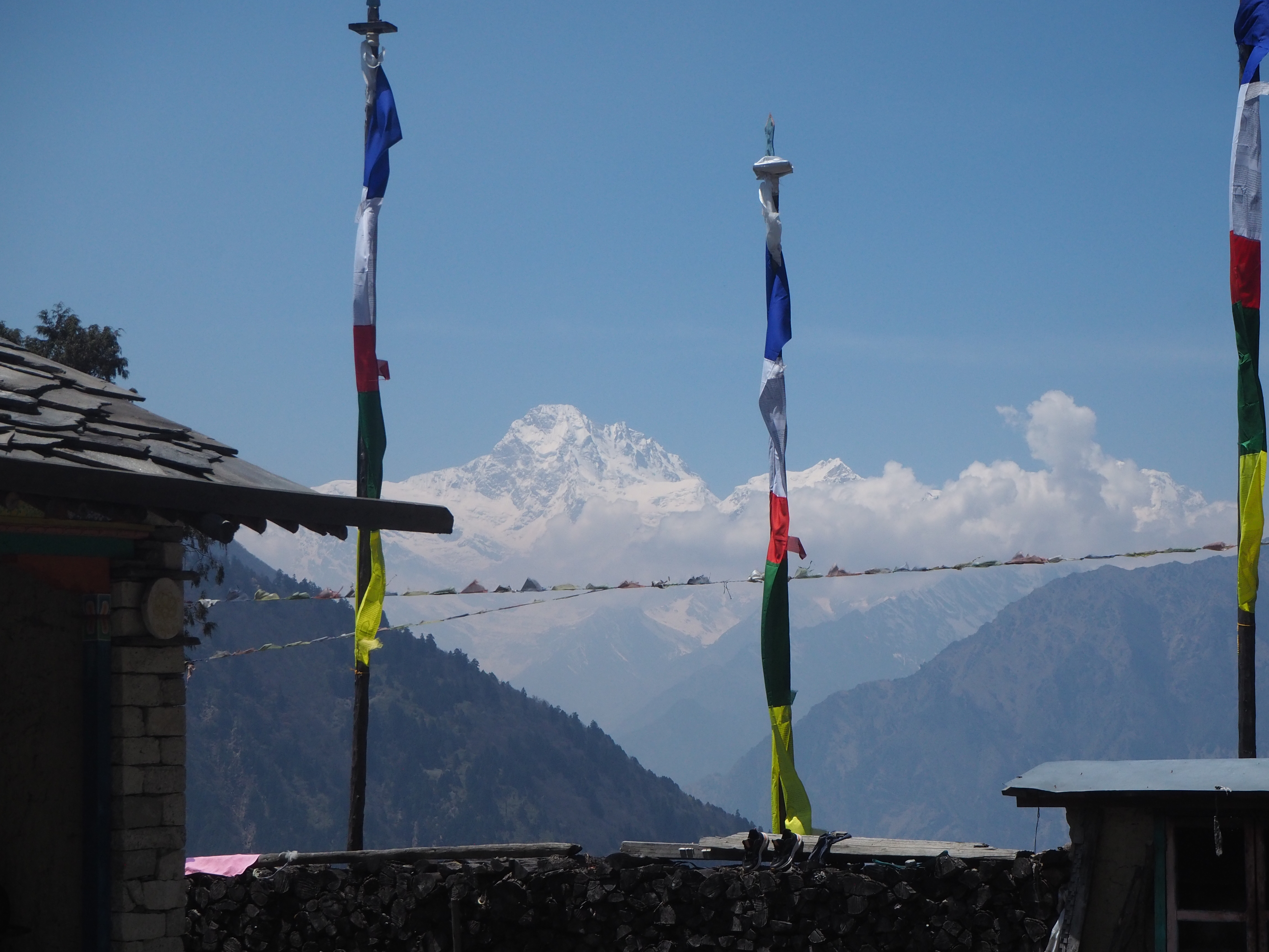
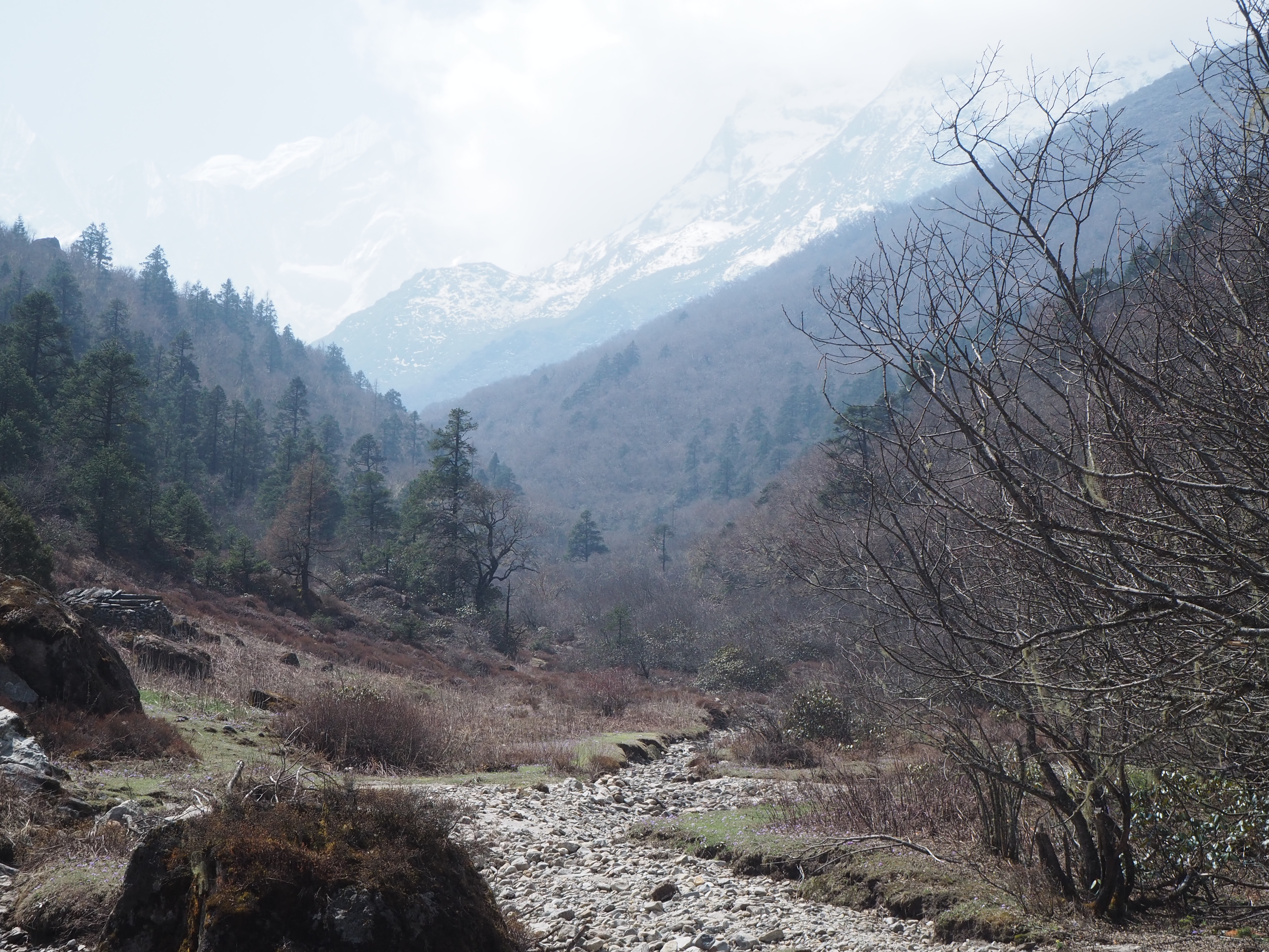
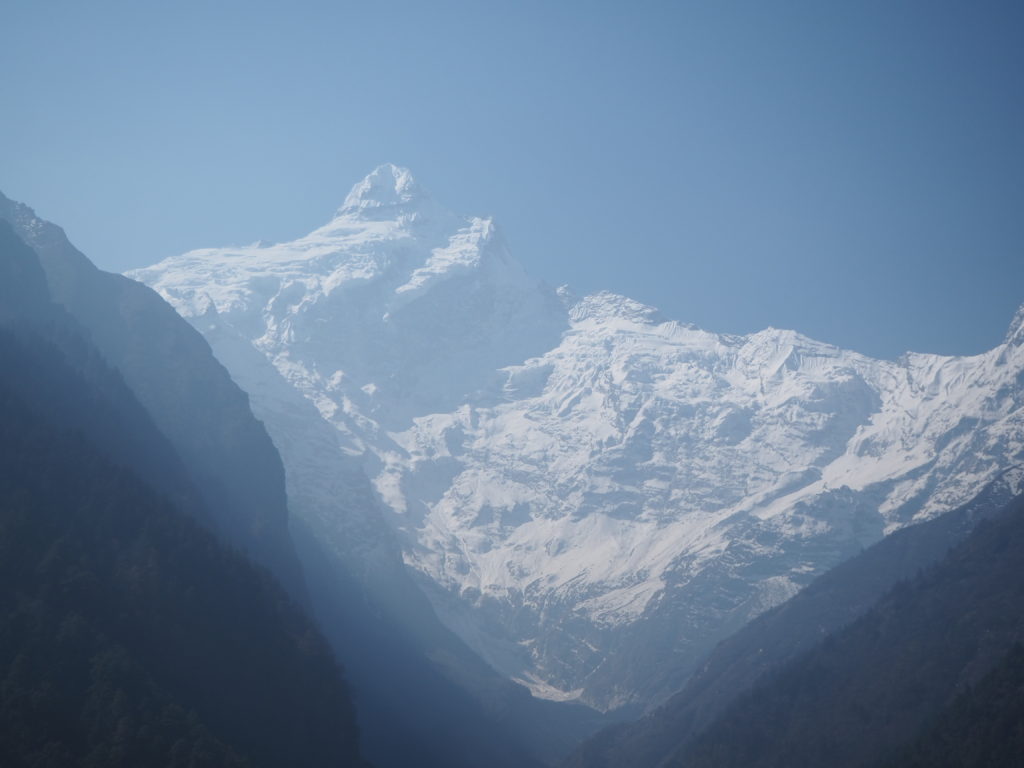
The path was all mostly trails we had done before, so we didn’t pay too much attention to the scenery. The morning was quite nice with our final looks at Ganesh Himal, so we stopped a few times to look, but once we hit the Shyar Khola river again, fog had set in, so it was straight to business.
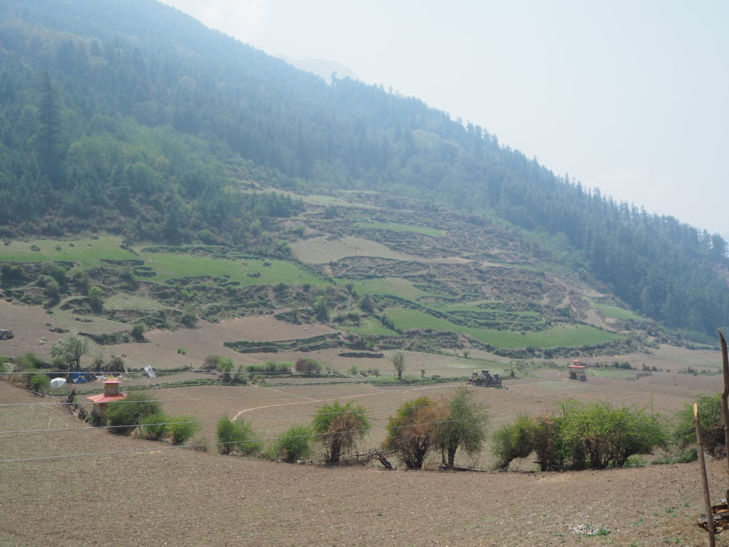
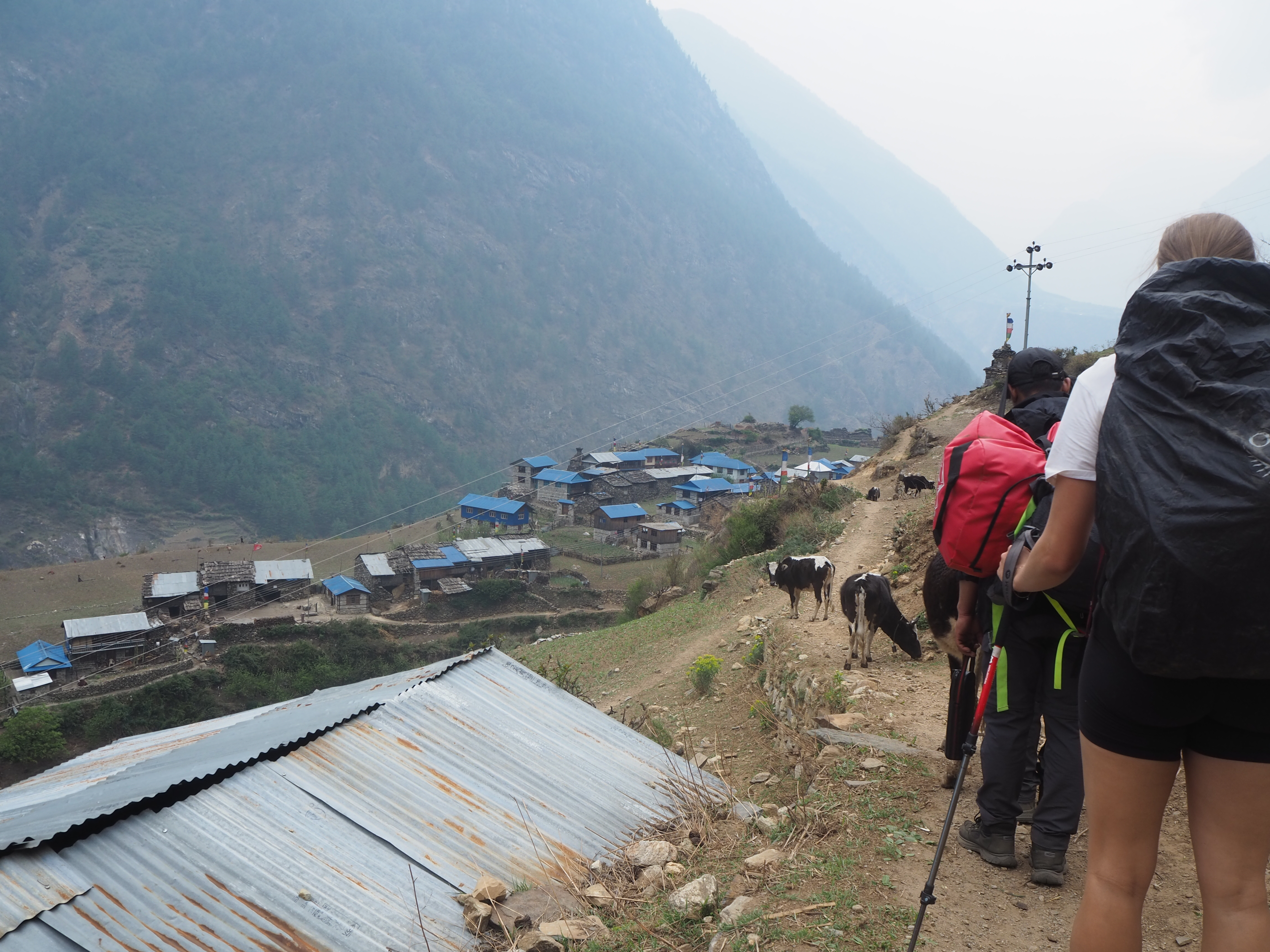
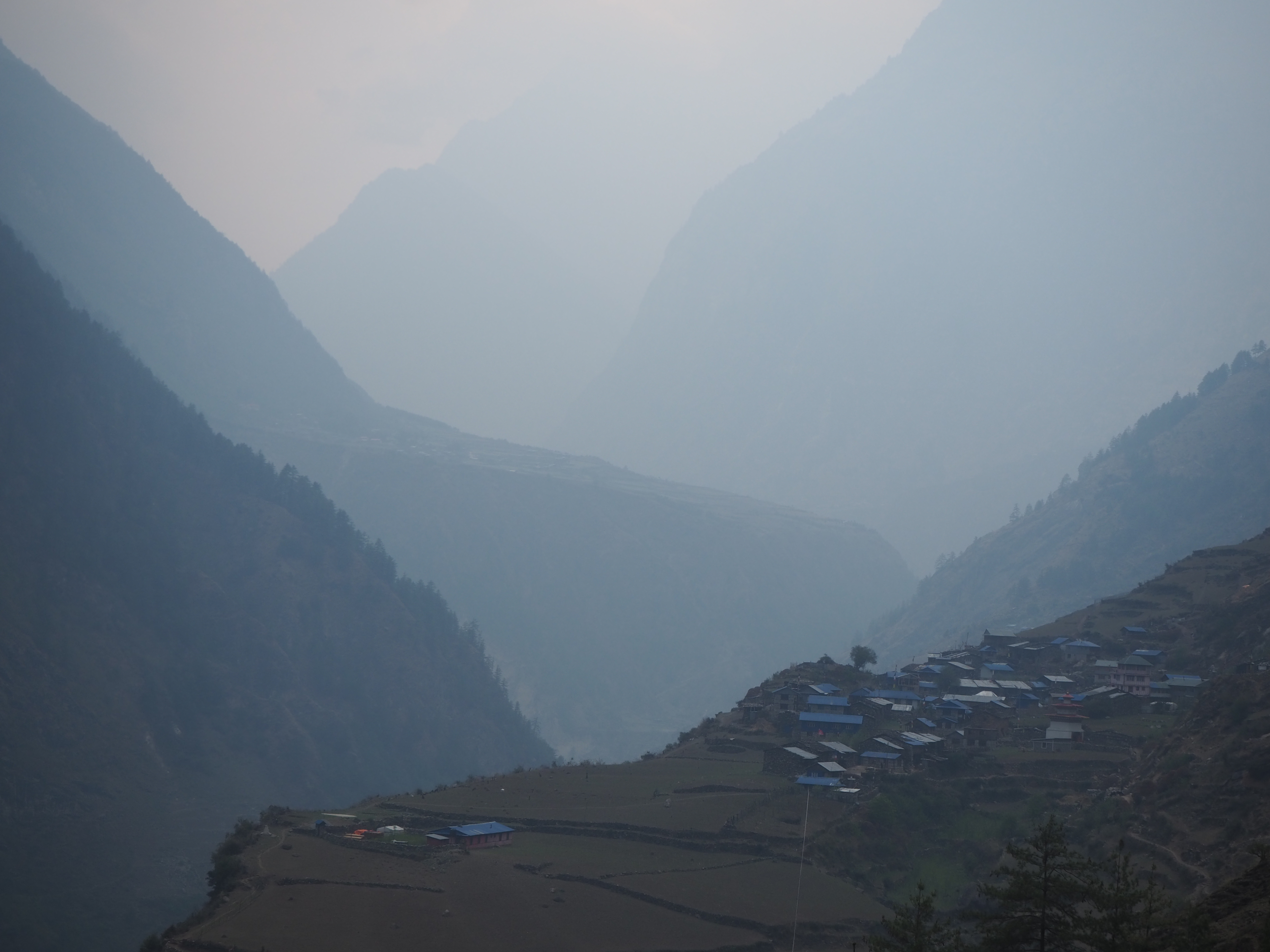
We were on the opposite side of the river from where we once were though. When there was a break in the trees, we could see Chumling and the nearby farmland in the distance on the hillside across the valley. But it was a mostly forested path that cut through the side of the mountain. Our first destination was Ripchet, a small village where we would find lunch. But sometimes its not so easy.
Ripchet has two hotels, and for whatever reason (We would later learn that there was a Buddhist retreat in the Manaslu Valley at Sherang Gumba, somewhere we would soon make it to, that the hotel owners were at), they were both closed and the owners out of town. We had been hiking for 4 hours at this point, and were in need of a good dal bat for fuel. In Ripchet is a monastery, so Hari went to go ask them what was up.
The monastery was very gracious, and understanding that there wasn’t anywhere else in town for us to eat (or anywhere else within an hour walk). They offered to feed us, free of charge. We were ushered in and came across quite the chaotic scene.
First, there were a couple of young kids with too much energy enamored with Cam. I don’t think they have ever seen a white woman before. Ripchet isn’t exactly on every Tsum Valley itinerary. The Tsum Valley isn’t on every Manaslu itinerary. And Manaslu is rarely on a Nepal itinerary. They had to be scolded by an adult to leave her alone. They ended up just jumping off of things the rest of the time.
Next, there was a good collection of very drunk older men. One was passed out on the monastery steps. They all seemed to want to make jokes to me, and I tried my best to get what they were saying. But they were slurring their Nepali so bad even Hari and Shubus had troubles interpreting. I think it was a joke about becoming a monk and asking for alms to get lunch. I had about 20 tries to figure it out, but never could get there.
Finally the monastery was being used as a supply depot, so all of the couriers with their baskets were dropping off and loading up on supplies to take to everywhere else. Some were halfway through their own lunch. Some were on break. And a few were furiously trying to figure out whos stuff what whos, and what’s going where. The culmination of all this activity made the small courtyard much bigger in busyness.
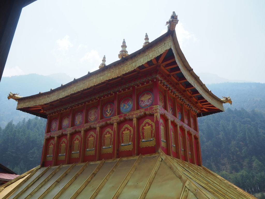
Our host at the monastery was a well dressed young man who seemed somewhat embarrassed guests were seeing his place as it was at the moment. But he fed us some very spicy dal bat, and it was much needed on our hungry stomachs. After lunch, I was invited to check out the inside of the monastery, which doesn’t look like it gets much use for prayer, storage instead, and took some photos of locals, who were all enamored with my camera. They get really happy when they see their faces on the screen.
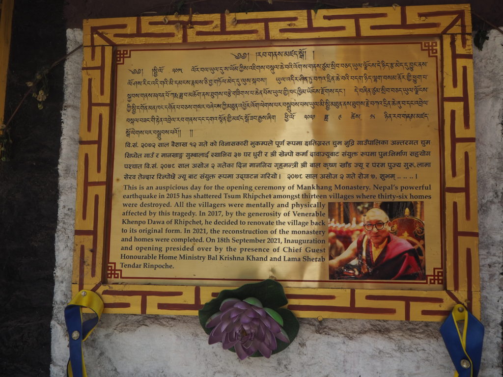
Ripchet as it turns out was completely destroyed by the 2015 Nepal earthquake, an event that completely devastated the country. The monastery was one of the first buildings to be rebuilt, and the rest of the village only came back in 2021, six years later. Its clear that this village suffered much over the last near 10 years, and they are just returning to what they once were.
The walk from Ripchet to Lokpha was a long and tedious one. It started with a sharp stair descent 250m to a previously visited tea stop. This is where we would meet with our previous trail. From there is was another 3 hours of slow up and down through a bamboo and fern forest. Neither Cam and I wanted the old French couple to be faster than us, but we both wanted a break. Our competitiveness won out, and we ended up exhausted at the end. But we beat the old couple, who have slow and steady completely figured out. They had a much nicer evening than us, with the extra energy they had.
There were no nice views in Lokpha like the last time we were here. The fog has set in too much. This will be our last night in the Tsum valley as well. Tomorrow, we will head to the Manaslu valley, and explore there.
Hari had an interesting quote about the difference between the two valleys. “In Manaslu, there’s everything. You can get whatever you want. In Tsum, its all about survival.” He’s correct about the Tsum Valley in that regard. With the advent of education, almost all young people that were born in the Tsum Valley are leaving it, in search of an easier life. And the parents are thankful for that. They can live somewhere with hot showers, more than 3 meal choices, nights above 0C indoors, and most other modern amenities. But when they go, there is no one to take their parents place, and to keep the valley alive. It is slowly dying. Steve, who we met the day before, is documenting all of it before it geos away.
The Tsum valley is also a bizarre collision of the basic and modern world. In these stone huts, inhabitants will be watching the latest YouTube videos on their smartphones. Inhabitants are either speak Tibetan, or a trilingual with Nepali and English as well. Everything is transported on human or donkey back, but families will facetime their kids in Kathmandu. Its like this valley has skipped the steam engine, a proper electric grid, and any sort of modern machinery and jumped straight to the information age.
Day 11: Lokpha to Bihi
LEngth: 13.2km
Elevation: 1000m? (The GPS went haywire)
Well, we’re leaving the Tsum valley today. For one week we explored this remote region of Nepal, meeting people, sightseeing mountains, and having a most wonderful time in between. But now we take on the Manaslu valley proper, a longer, higher challenge.
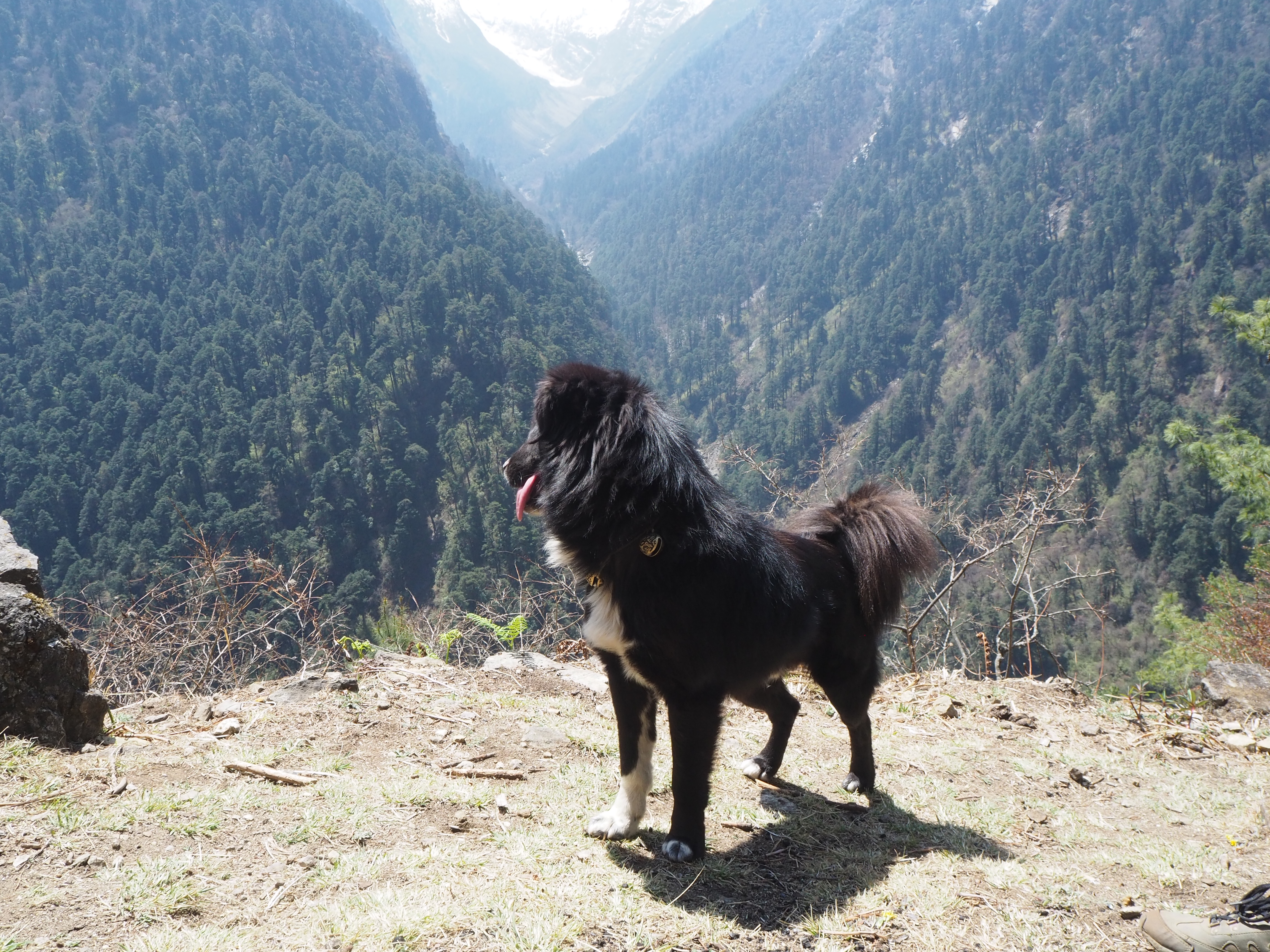
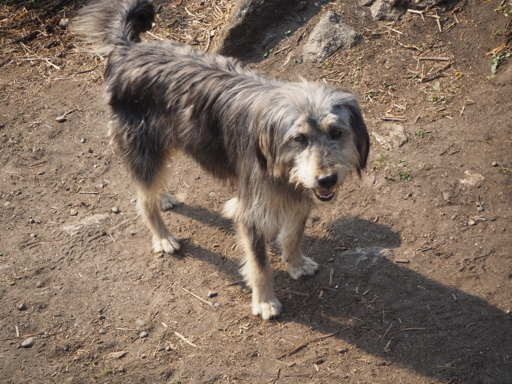
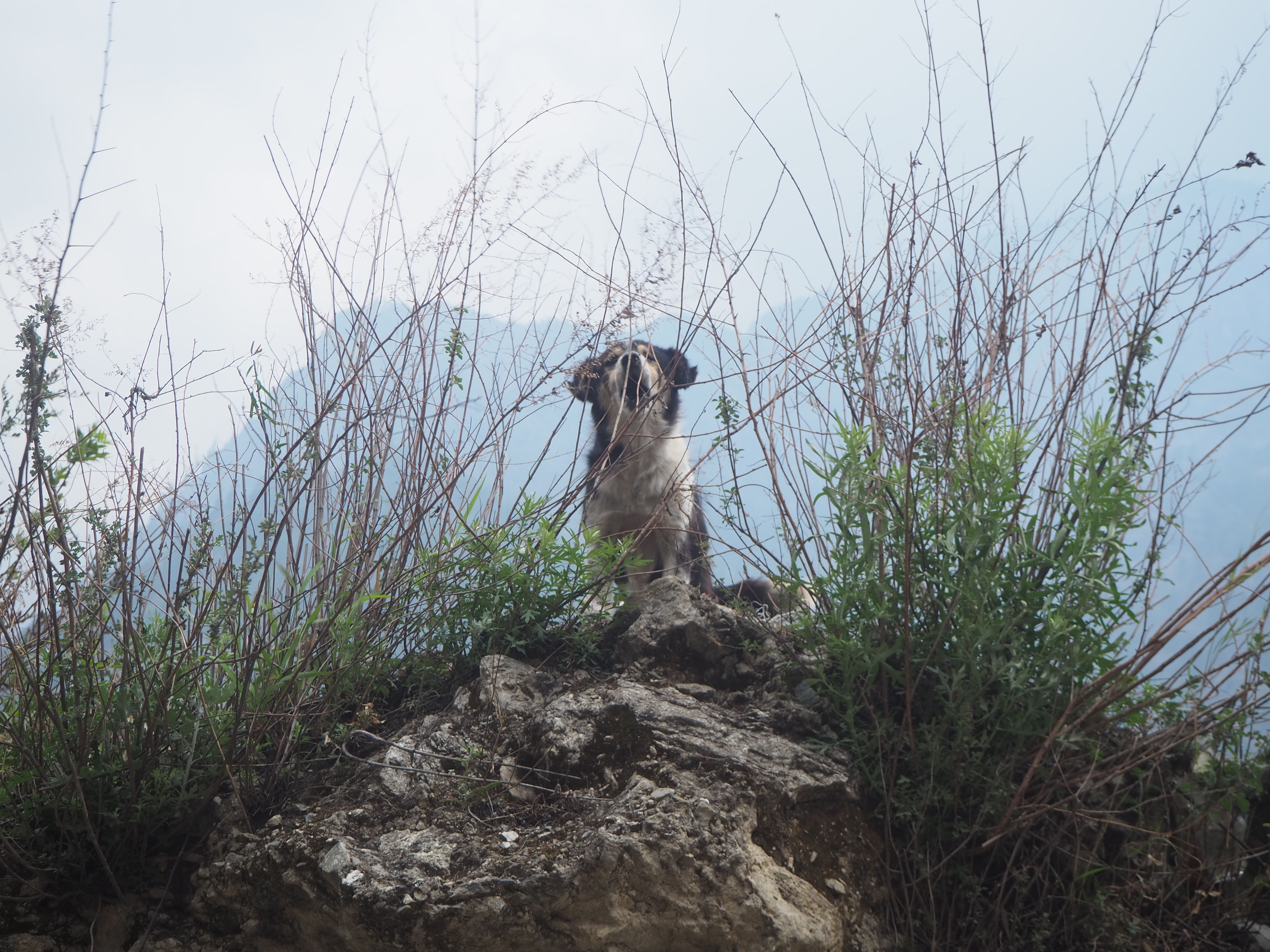
We left Lokpha gaining a fifth member to the group. An old pupito was hanging out with us for the first bit, walking along. As much as we like canine company, its generally frowned upon to let dogs follow hikers. The dogs generally belong to a family and have a home in their village. When they follow hikers, they end up in new unfamiliar territory and can get lost, confused, then eventually feral. This normally happens after a few days of hiking, but no one likes to take these risks.
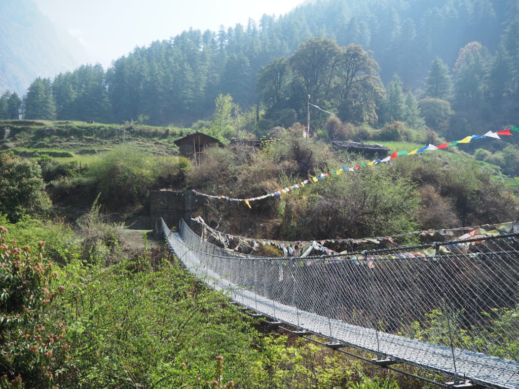
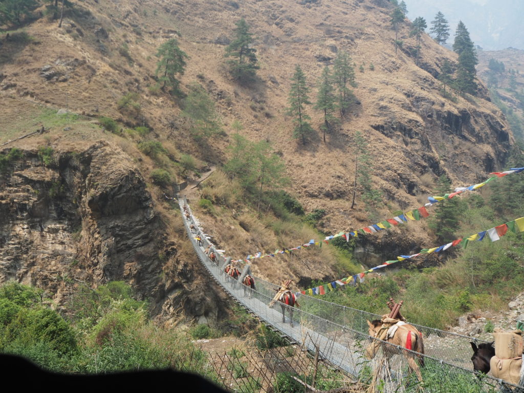
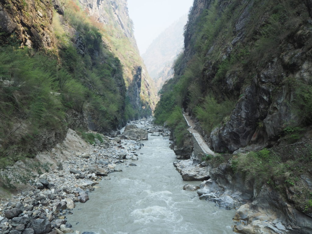
The dog eventually disappeared after an hour or so, so it must have got bored from our inattention and turned home. We left the Tsum valley, out from the arch, crossed the Buri Gandaki river, and followed it up past the confluence onto new terrain.
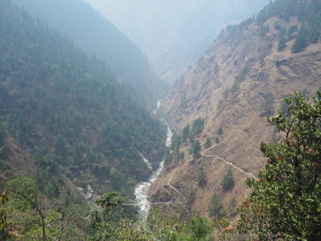
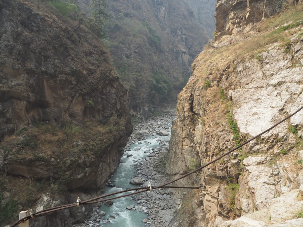
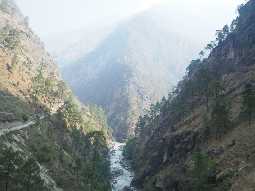
The Nepali theme of steep canyon-like trekking with a raging river was mostly the same on this side. There was not much room for vegetation, and when there was, small ferns and bamboo generally took hold. The river here was visibly much murkier than the Shyar Khola from Tsum. We bobbed up and down following the path, still sore from the day before. Shubus especially was tired.
With a bit of fog in the upper air, we could only see the outlines of mountains. We know from our maps and experience that these first views are shorter, 6000m peaks (well, short for the Himalaya’s) that introduce you to the landscape. In all honestly, this may have been the most unremarkable day for terrain, which just shows how blessed we are on this hike for views.
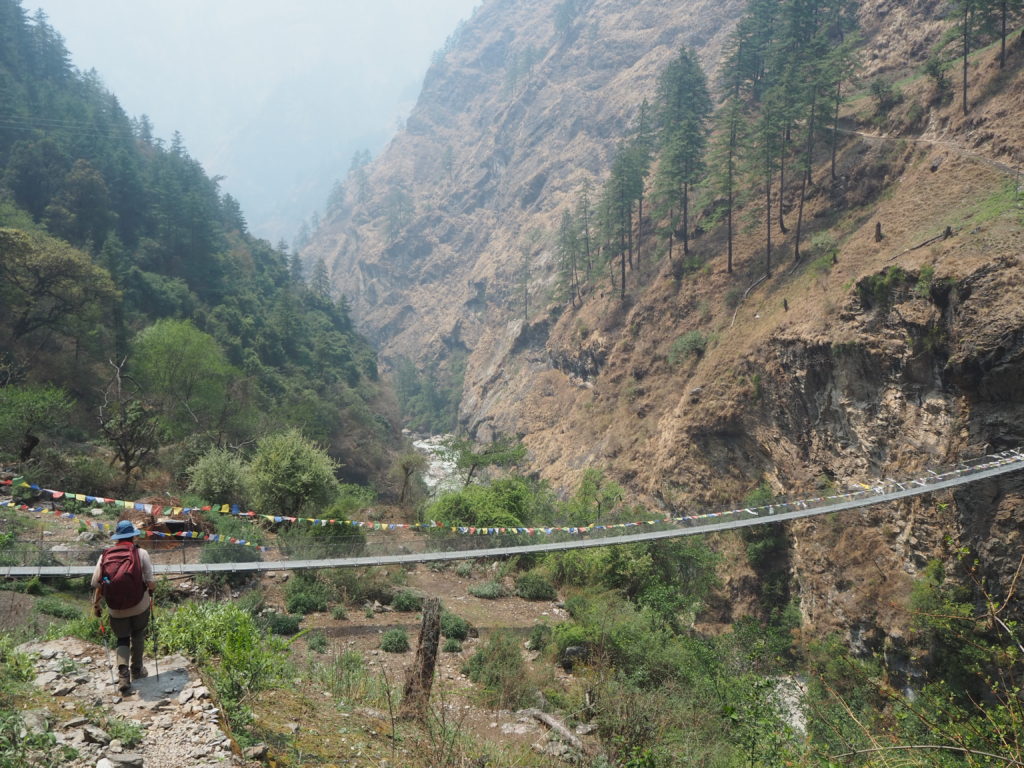
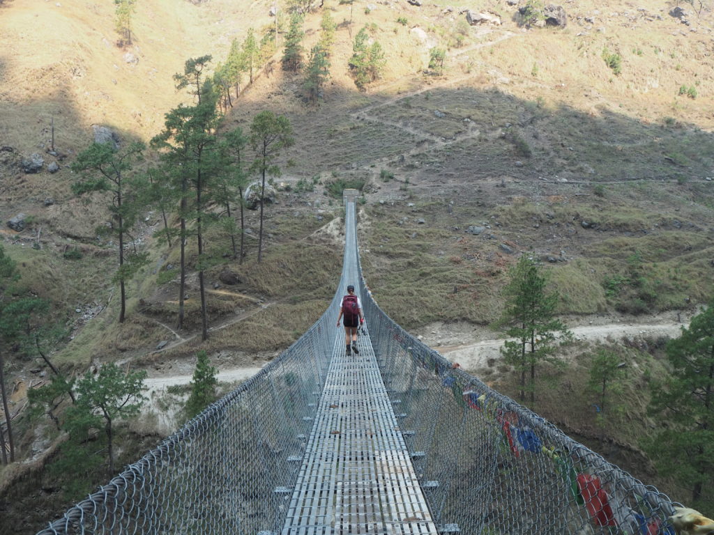
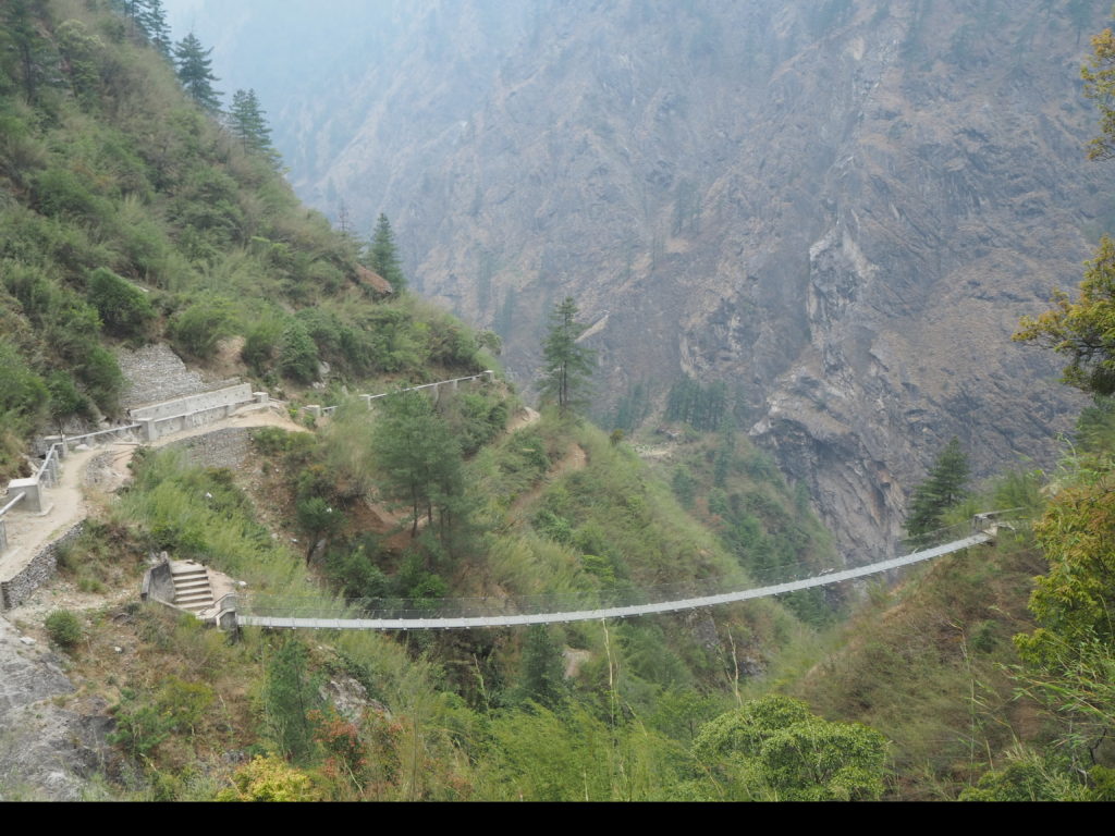
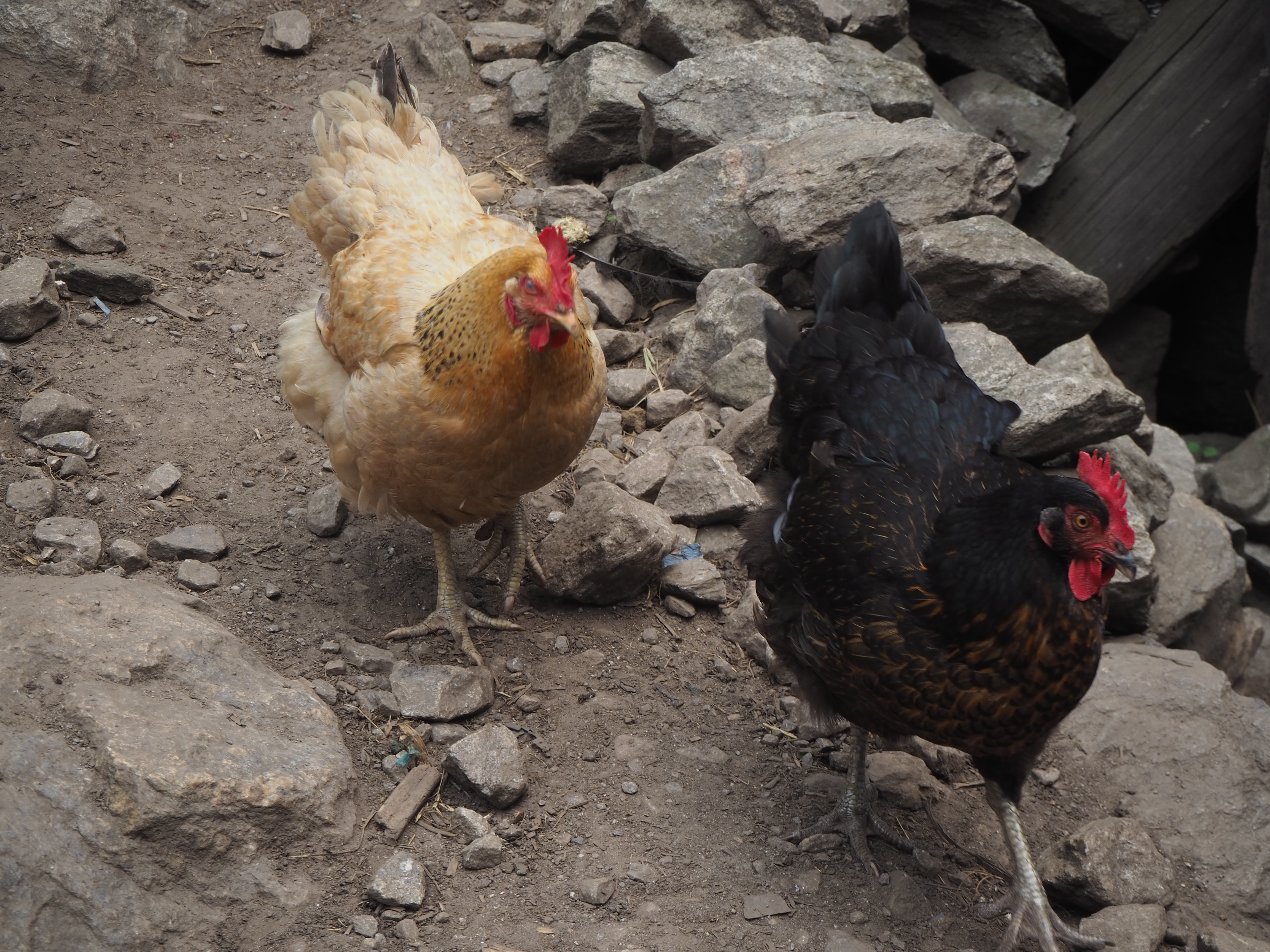
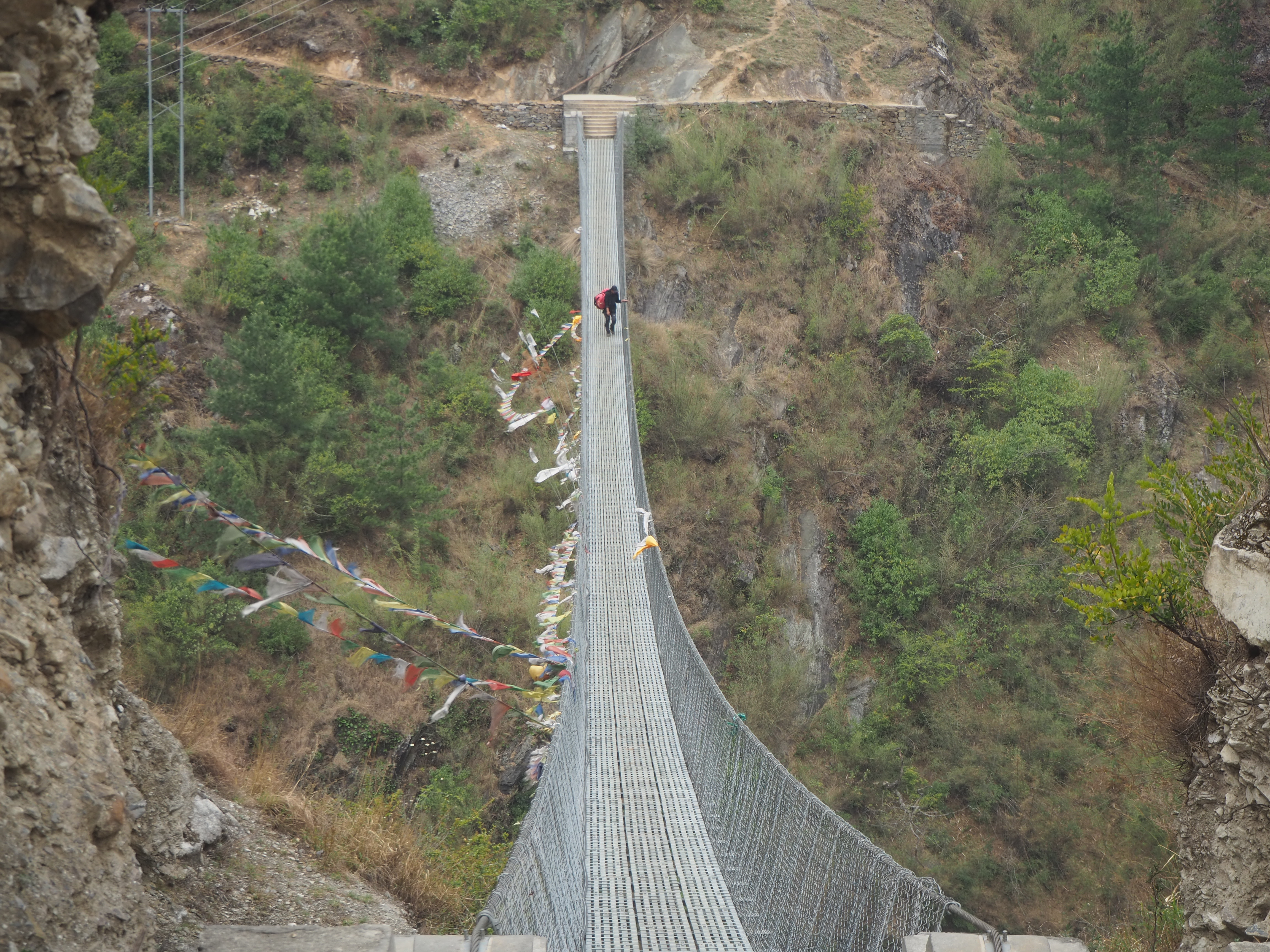
As we neared Bihi, we ascended sharply up the cliffs, and the winds picked up. There was one particularly dodgy feeling bridge, with the sharp winds going over a deep canyon, and some extra elasticity in the steel cables. Prayer flags were near horizontal. We were greeted at the end by the oddest sounding dog, who was barking to let us know he was present and territorial, but the body language had a much friendlier story. It sounded like a chicken. The property had lots of chickens, so that makes sense I guess.
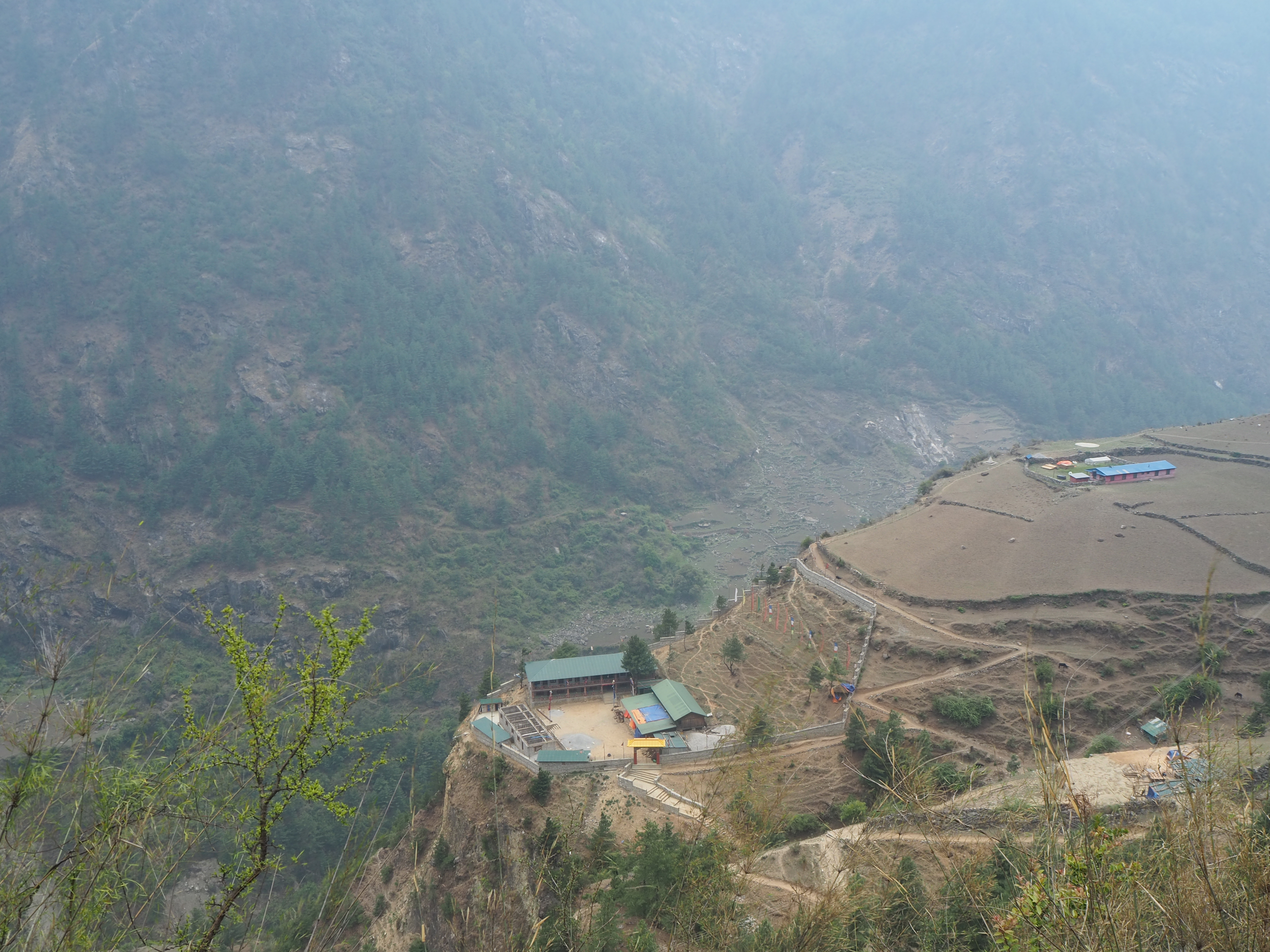
Bihi (pronounced bee-ee) was quite the metropolis. It had a school, the first that we have knowingly seen. It had many stone houses in two major sections. Most hikes skip Bihi, staying in Deng before (where we had lunch), and then Lhi after. There is a lower path shortcut that these itineraries take that skip the town entirely.
But being in Bihi we can see that it is a major hub for the local Manaslu population. Up the valley from it is the surprisingly thriving Serang Gumba, our destination for tomorrow. This monastery is missed by almost all tourists, but appears to be quite a hub as well. We know it has a boarding school for local children. We also learned that it just hosted a 3 day prayer festival, one of the most important in the Manaslu calendar. One of our hosts just came back from it today, after a 4 hour walk and started cooking for everyone.
From that course, many local people are staying the night at the hotel as well. We are the only non-Nepali people here, which was to be expected. We will catch up with the regular Manaslu trekkers in Ghap or Lho (different than Lhi) later.
It was in Bihi we did our first proper wash by hand laundry attempt. We gave it a confused shot in Nile. But now with more observing of the techniques over the past week, we gave it a go. Long story short, we are blessed for washing machines. Hand washing, you soak your clothes, you scrub your clothes, scrape soap against the fabric again and again, and more and more dirt will keep coming out. It took us an hour of good labour to get it to ‘good enough’ which is more than fine for hiking. We will never complain about paying for laundry again.
This is pretty much the halfway mark of our Manaslu trek. We’ve gotten to know Shubus and Hari pretty well over our time so far. We were very lucky to have gotten them specifically. We have a lot more kilometers in front of us though. We will see you there!
Your story is wonderful to follow. Thank you for sharing it. What an amazing experience to see how people live so differently. You have so many references from which to continue to grow into your precious lives. After we came back from Myanmar, I was (and still am) so grateful for running water and washing machines. …and then we had our Calgary water crisis which reinforced my gratitude. Looking forward to reading more of your adventure.