
This is a continuation of our 21 day trekking adventure around the Manaslu massif in the Nepali Himalayas. For other entries in this series, please check out the home blog page.
Day 1: Macchakhola to Jagat
Distance: 17.89km
Elevation: 1430m
We got up bright and early, and then a few more times after that. The morning in Macchakhola was busy and noisy. Dogs got into some yappy fights. Vendors got their shops ready early for every trekker about to start their journey, who were all set to leave between 7 and 8. We were no different.
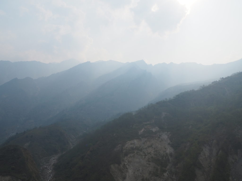
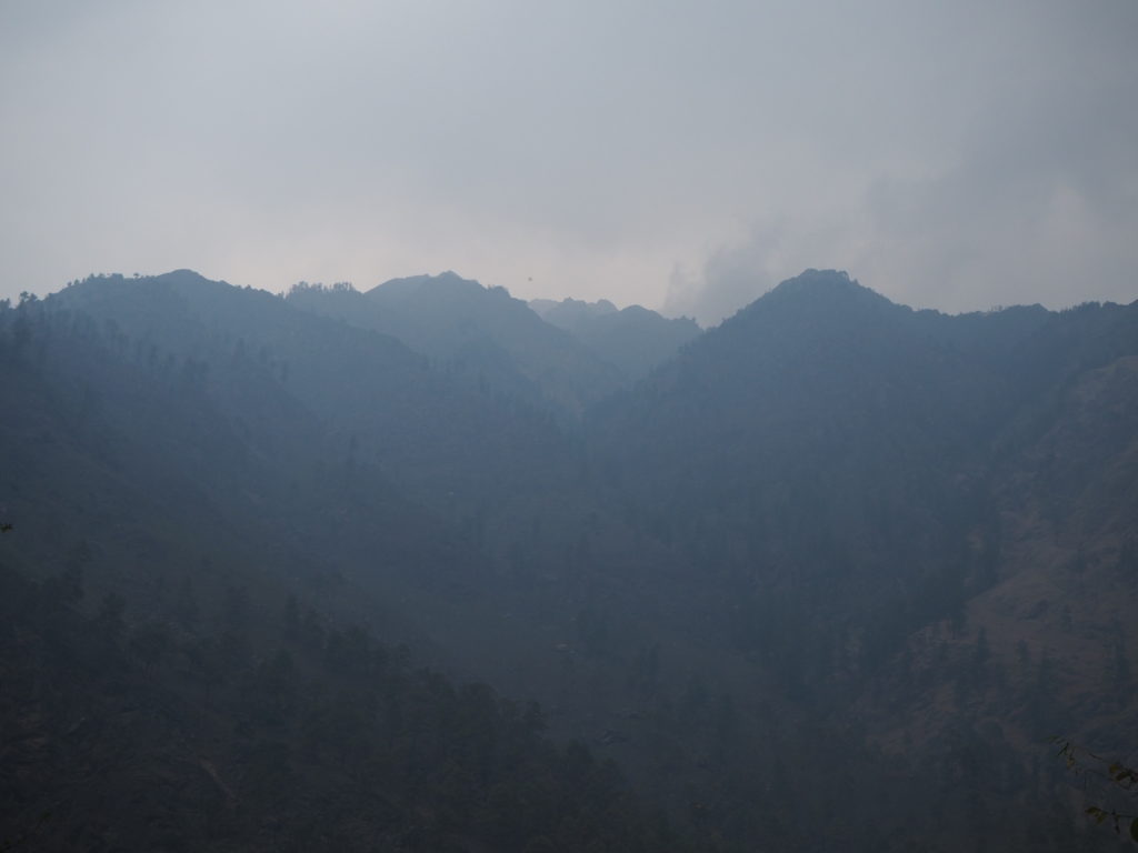
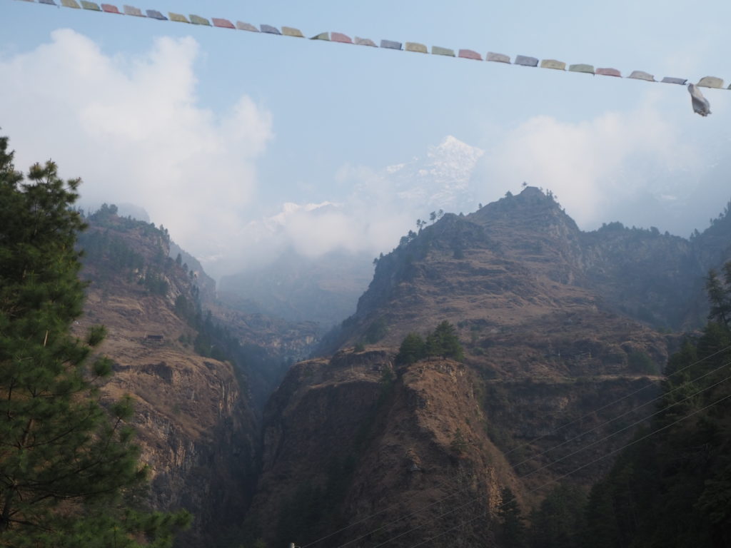
The air was decently smoky from the annual burning around Nepal. Old crops are burned for soil nutrients, and forests are burned for more arable land. It wasn’t choking level, but it wasn’t the most pleasant. The views were dimmed throughout the day.
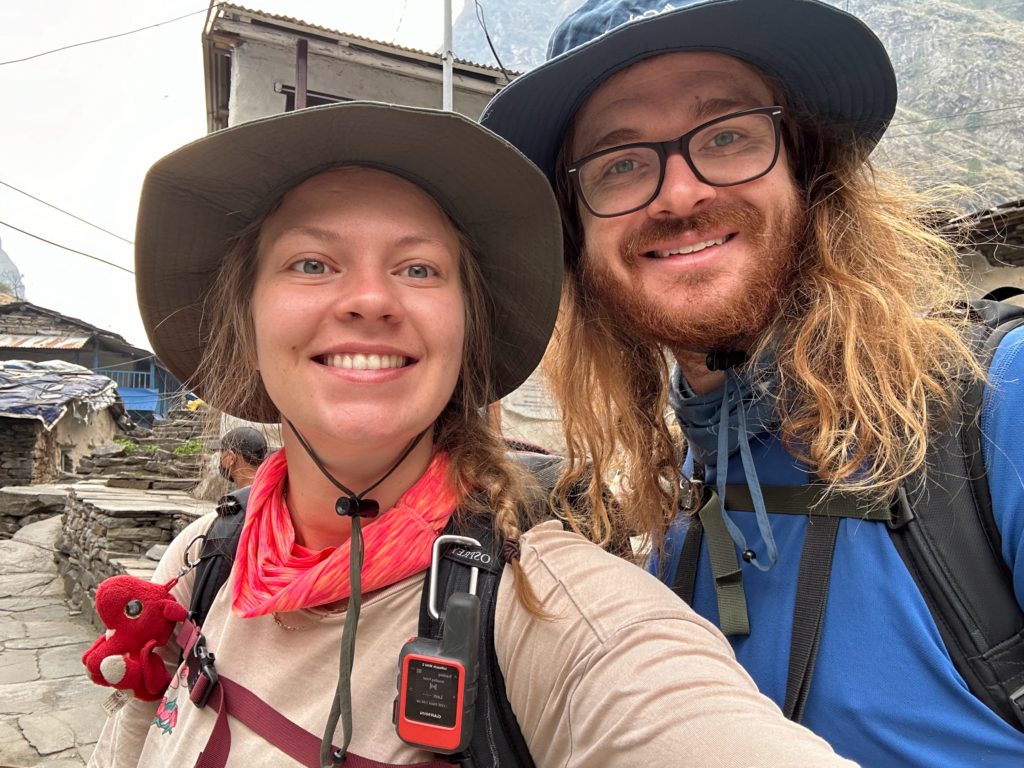
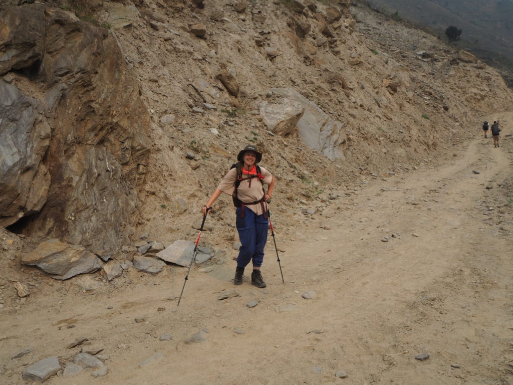
Breakfast was fairly simple, and then the four of us departed. There was us two, our guide Hari, and our porter Shubus. The porters are intense. They all strap the duffle bags of tourist luxuries together with rope, and then rest their little personal bag on top. The entire bundle is attached to them by their forehead with a strap. No back support, no hips support. All through the neck. They walk somewhat hunched over, so the weight lays on their back. Overall it must weigh a lot. I’m sure we will try it sometime this hike (we never did. Shubus, with less stuff to carry, gave up on this practice fairly early).
The hike takes us from village to village, half through a recently made hillside road, and half on a footpath across the valley. We follow the Buri Gandaki river upstream, hiking near the base of the very steep valley. There are groupings of dwellings every couple of kilometers or so. The locals were quite lovely. Some carrying supplies in a basket in a similar way to the porters, a strap on the forehead. And many cute kids. Some very happy to see us, shouting “Namaste!” when we pass. Others cut to the chase with “Namaste, chocolate?” hoping for a quick stash.
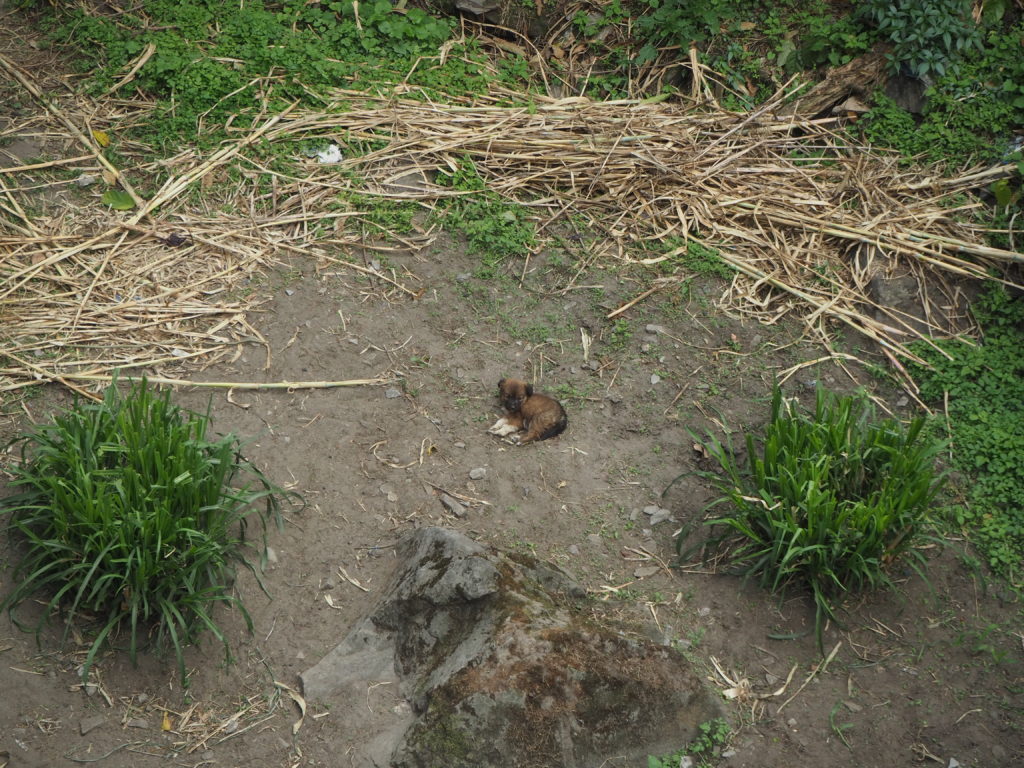
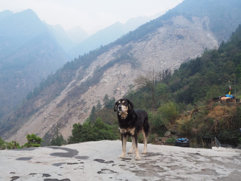
And so the hike started for us around 7:45. Shubus was all strapped up (we only had 1 duffle of luxuries) and we set off. We didn’t get far though, before Hari had to stop at the permit office for permission for the hike. While we waited for him to sort it out, I made friends with two dogs. The strays in Nepal are not aggressive at all, and very friendly. So much so that Hari gave us a warning. If we get too friendly with the dogs, they will follow us all the way to Dharapani for our whole trek. Then they can’t find their way home, and go feral. So we said goodbye and continued on our way.
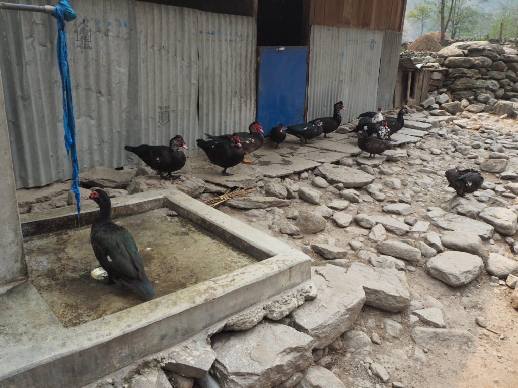
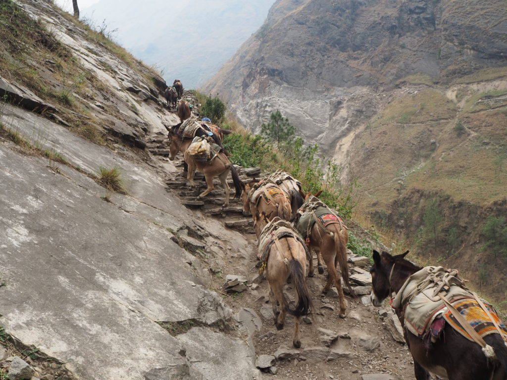
There are lots of domesticated animals that live around here. Our next run in was with some pack mules. A herder had them going down the road to some destination. I guess the donkeys were quite slow, because he was throwing rocks at them to try and make them go faster. Even we were keeping up with them.
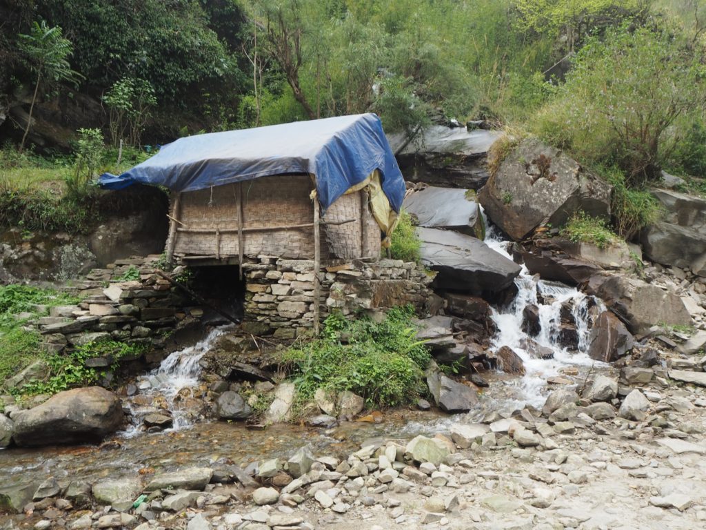
We stopped every second village or so for a rest. Each one has a small hotel that people could stay at, or fill up their water bottle. The tap water up here isn’t potable, so we are using chlorine tablets to kill the bacteria. Other groups have filters. The first rest stop had a hot springs though! They have made a little bathhouse out of it. We didn’t take a dip, but we did wash our faces in the water. It was very nice.
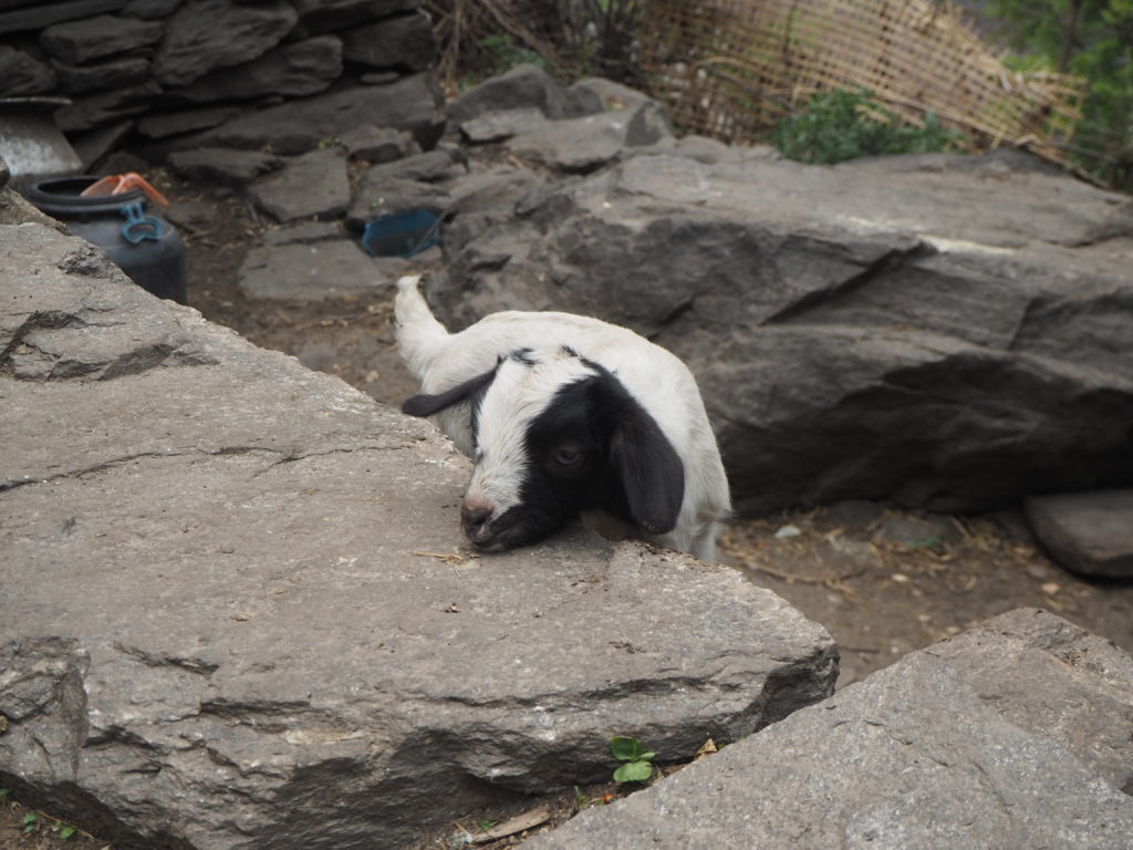
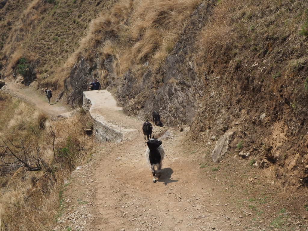
Goats are the final main domesticated animal that we saw. Every village seems to have a pack around that are used for meat or dairy. There are a lot of cute little babies running around too! They seem very accustomed to humans, and paid us no bother when we walked by.
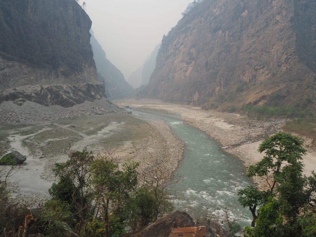
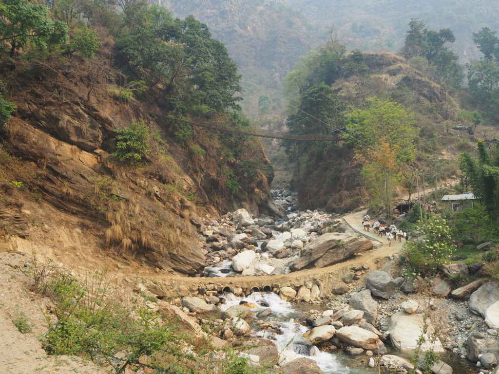
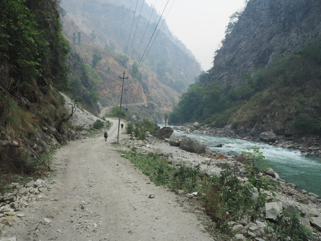
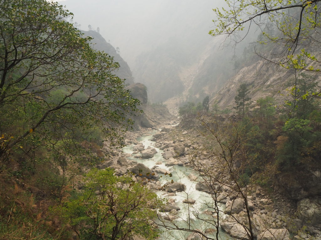
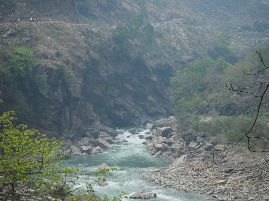
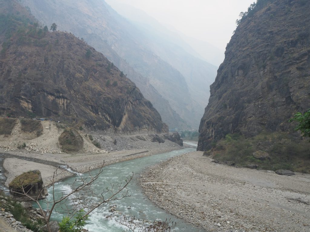
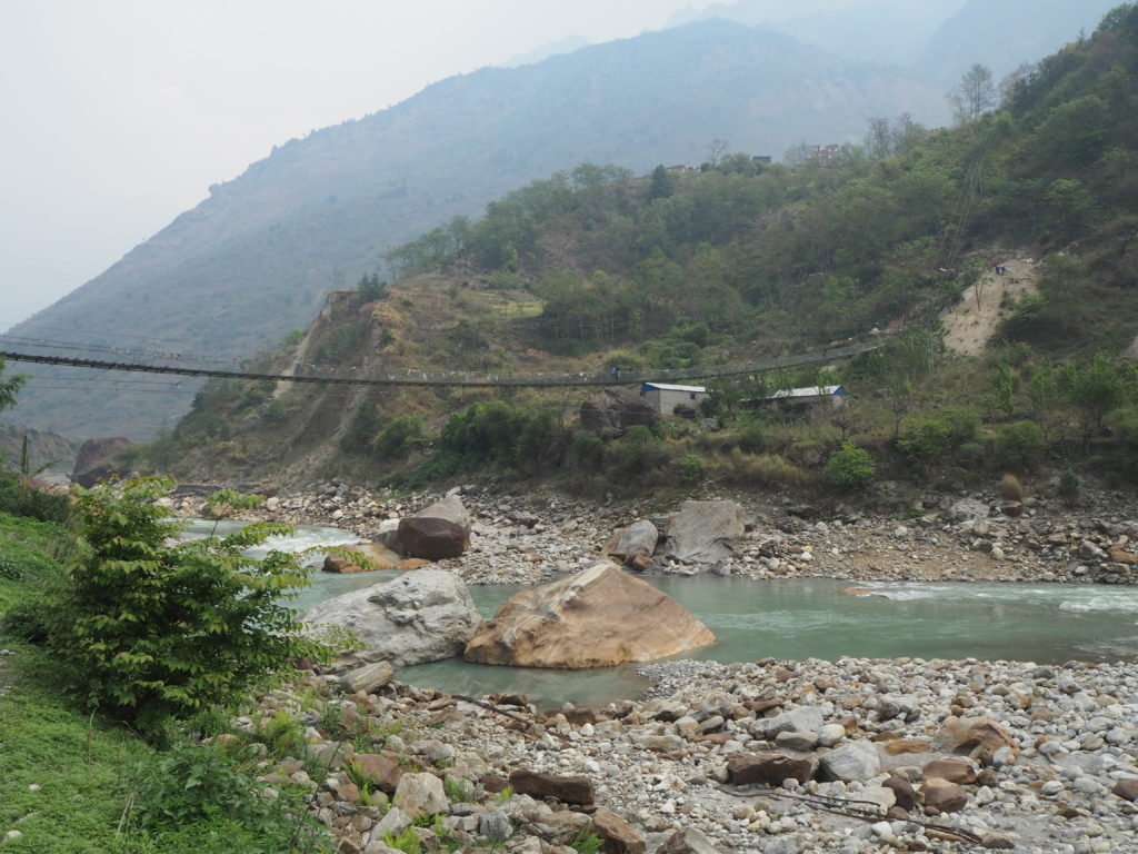
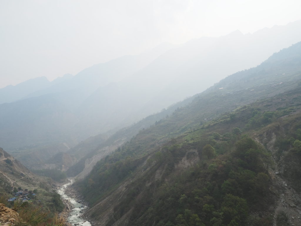
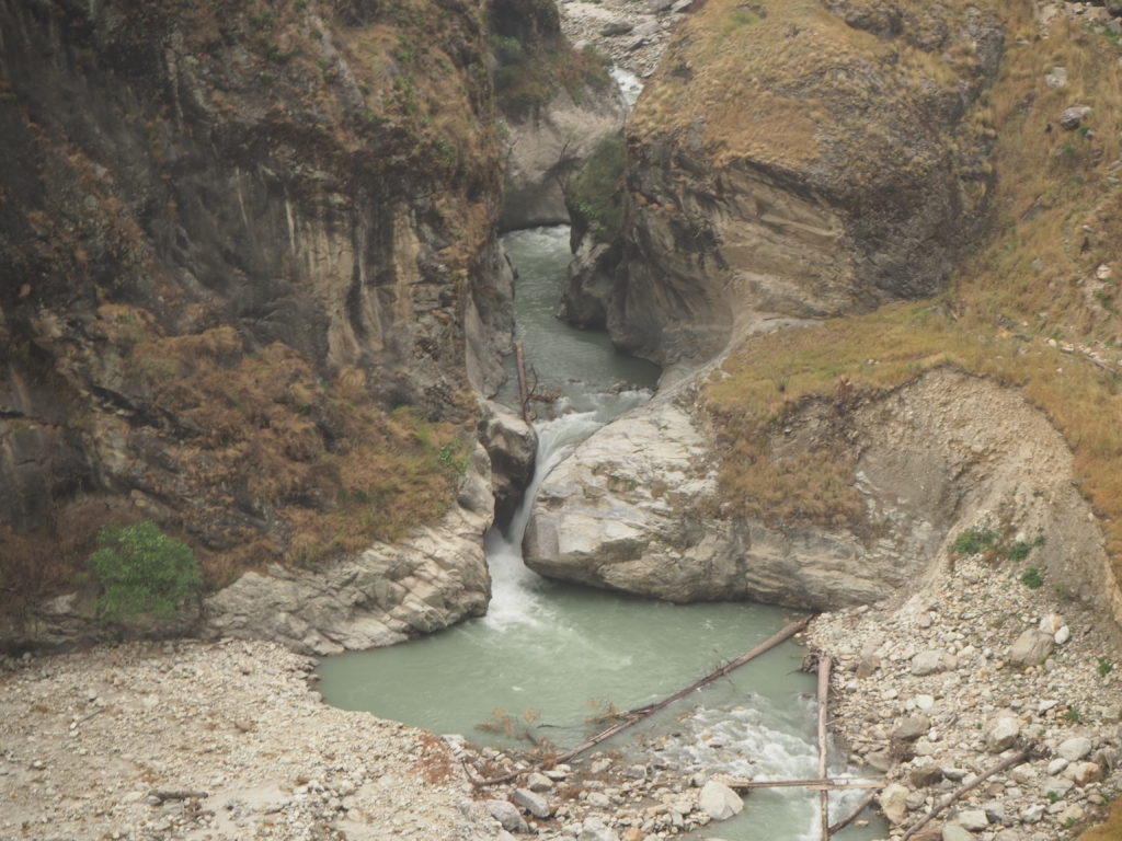
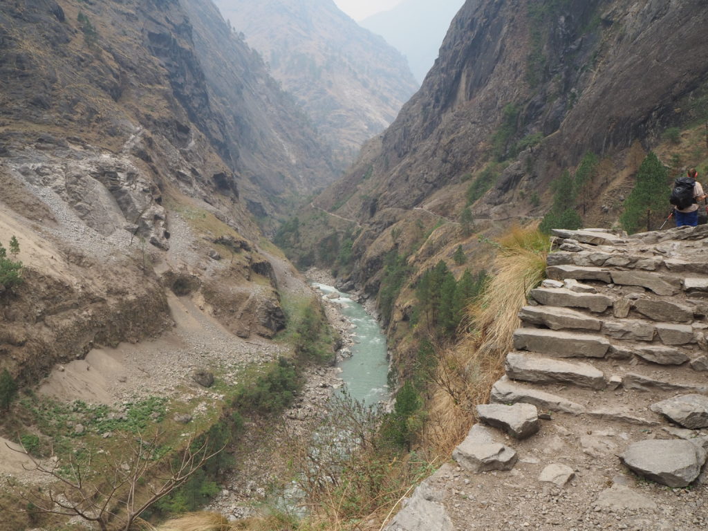
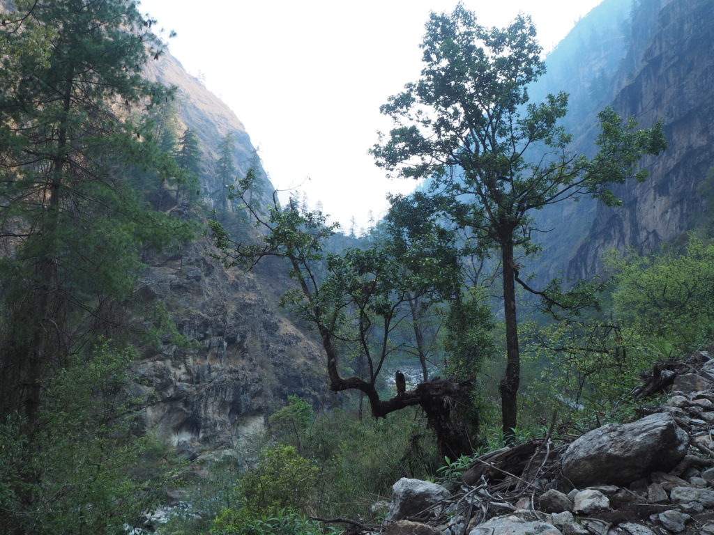
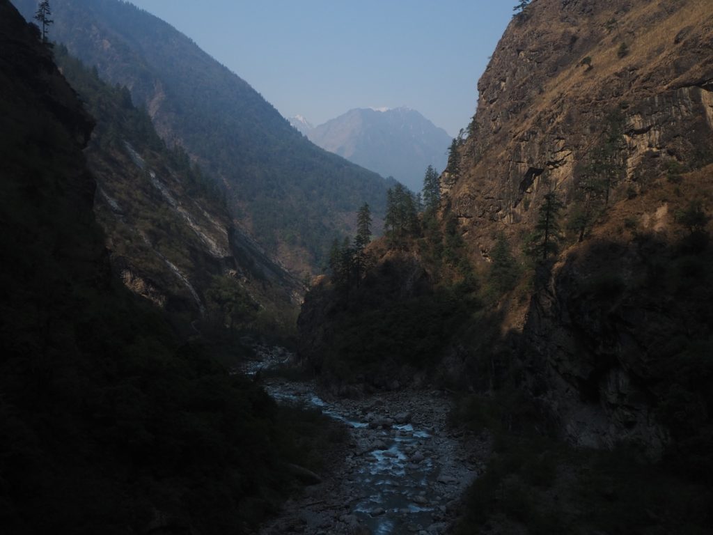
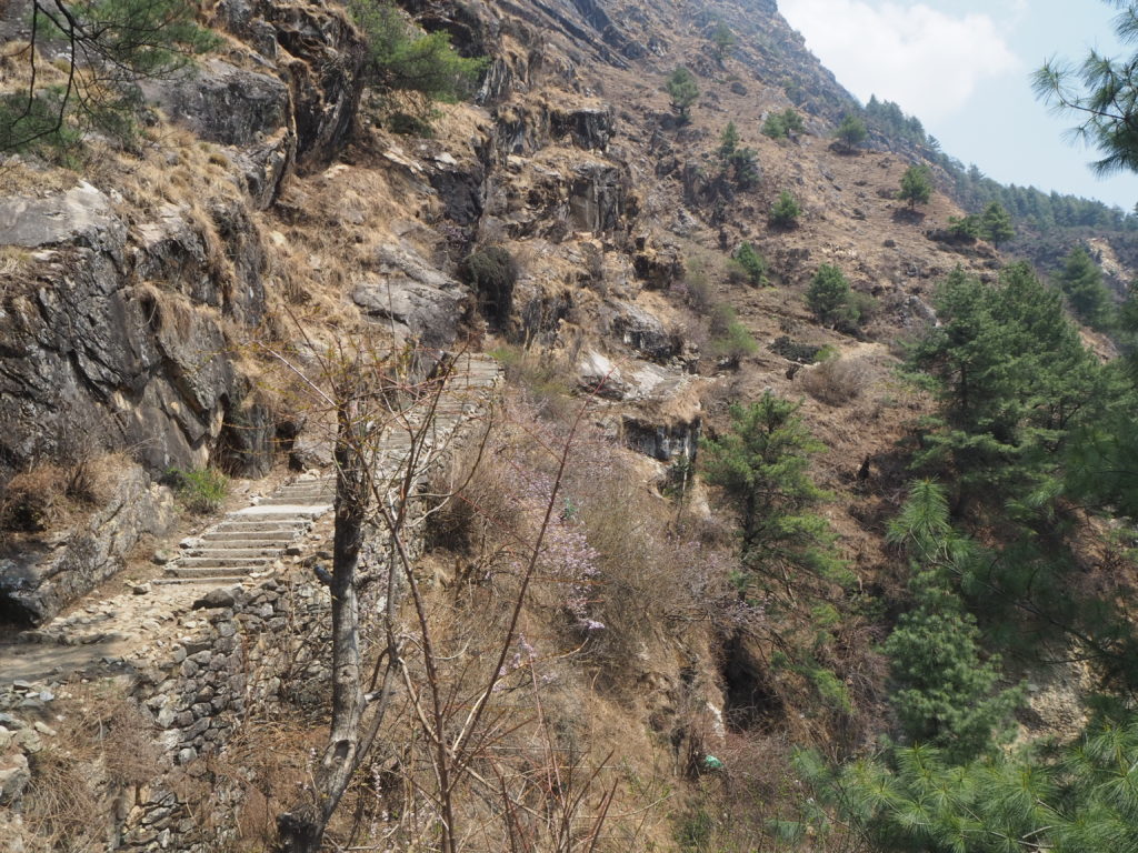
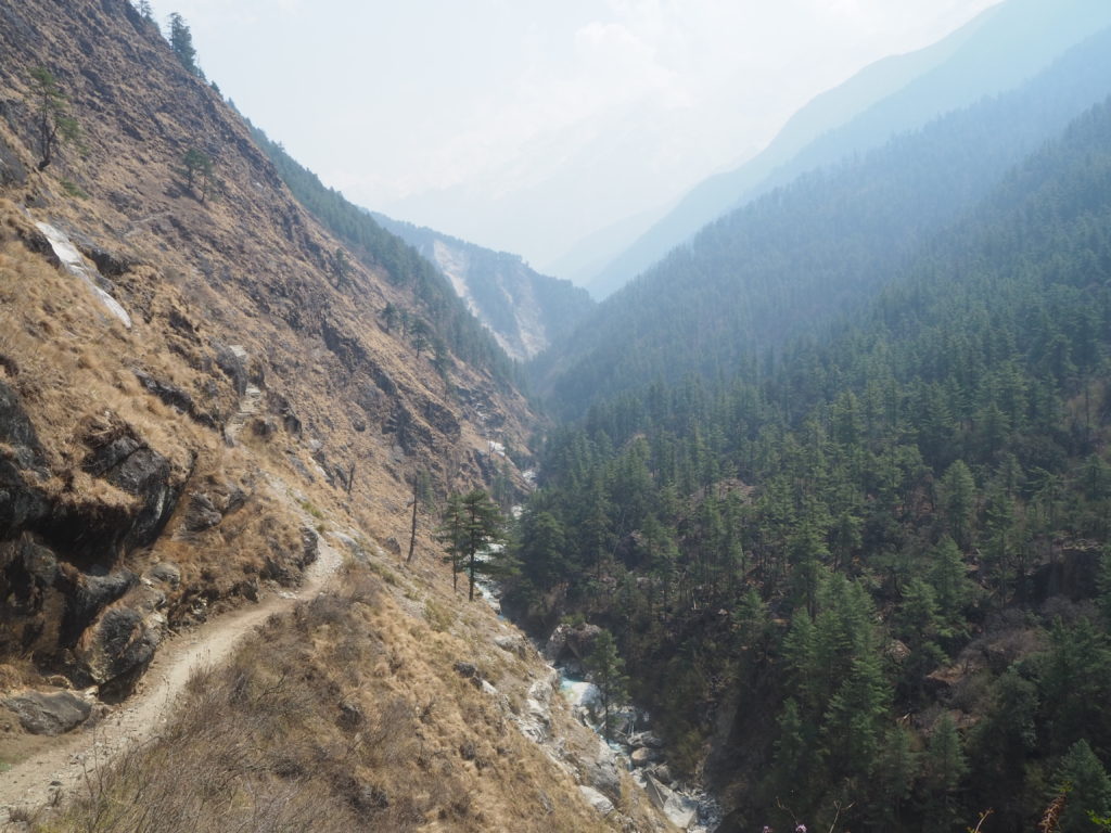
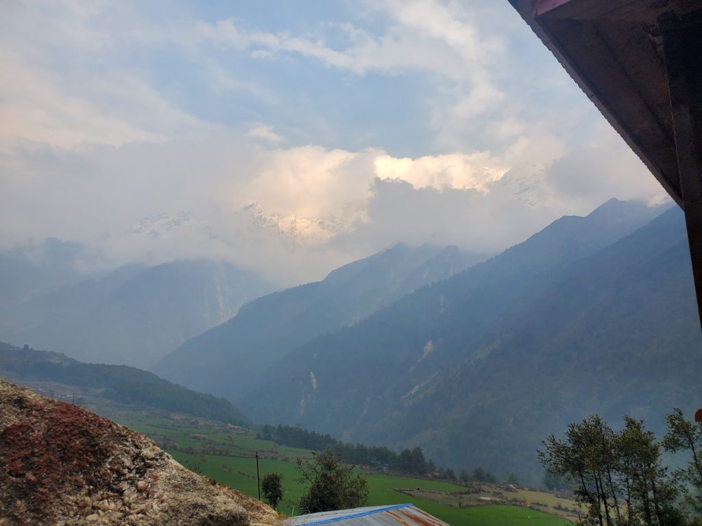
The first half of the day had very similar, but beautiful terrain. It was a sharp river valley. Light blue water was flowing below us, with very frequent rapids. Above us was only cliff. We were walking on a rocky dirt road for vehicles here, and it was cut well into the side of the mountain. We only got passed by 10 or so vehicles the whole day, most carrying goods.
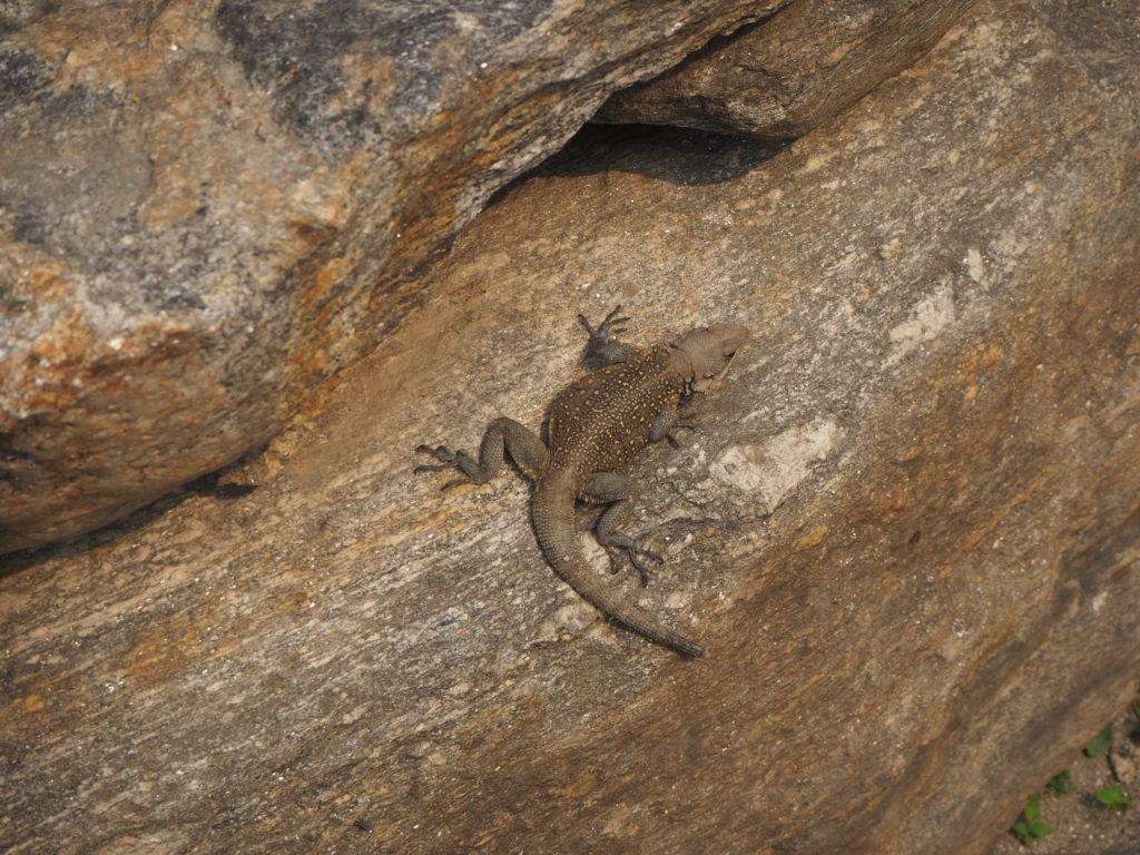
But this valley was wonderful. The rush of the water made such a pleasant sound to listen to. The mountains were high enough to keep us shaded for most of the day. We are not in super Himalaya territory yet, that will be in a couple of days. These peaks reach probably 1500m or so above sea level, 3-400m above where we were walking. Lizards really like the road to bask as well. We saw plenty of them.
Lunch was nice, we had what was probably our final non dal bat meal. Dal bat is a common Nepali meal, used for pretty much everything. Its rice with dal, and a few other sides, all served in a platter form. We had veg fried noodles instead.
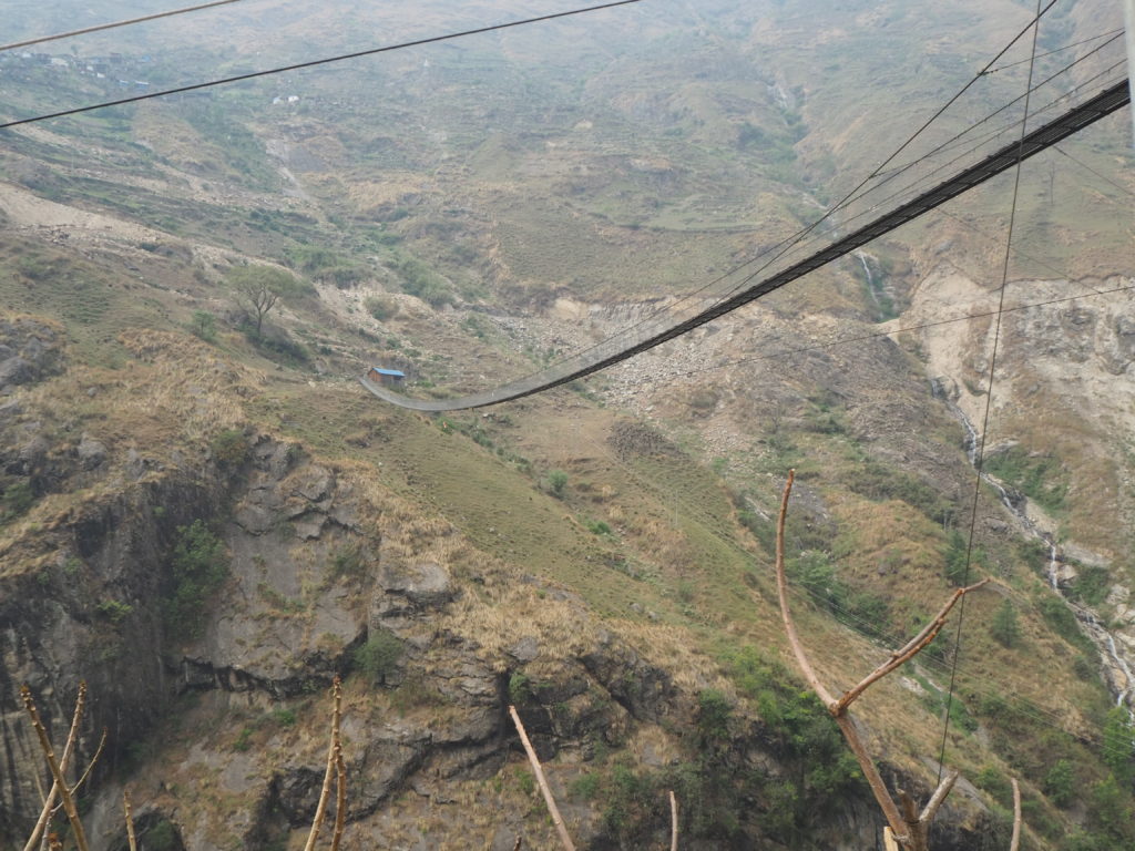
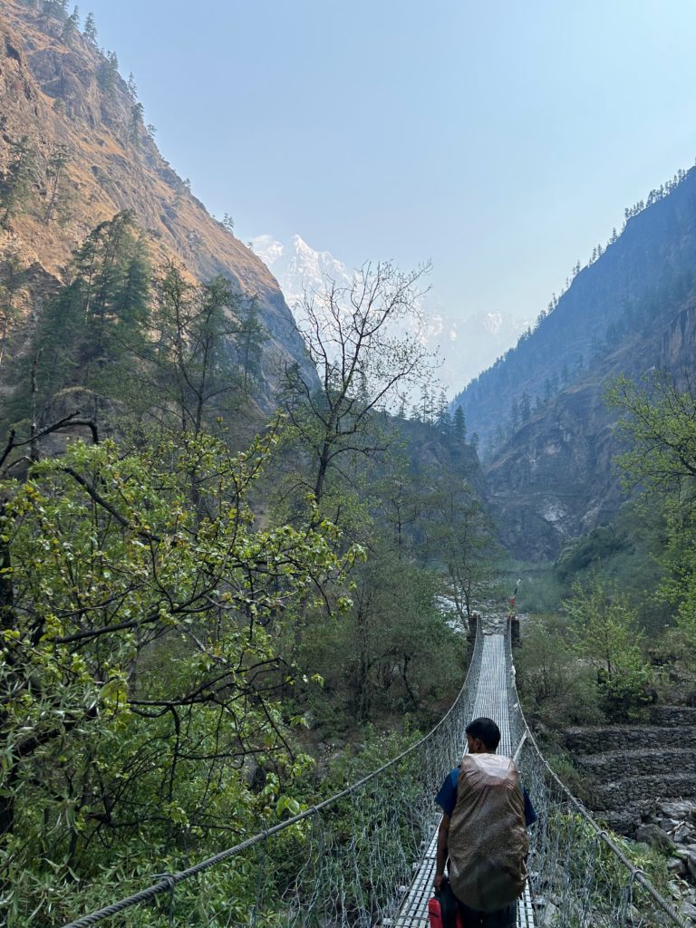
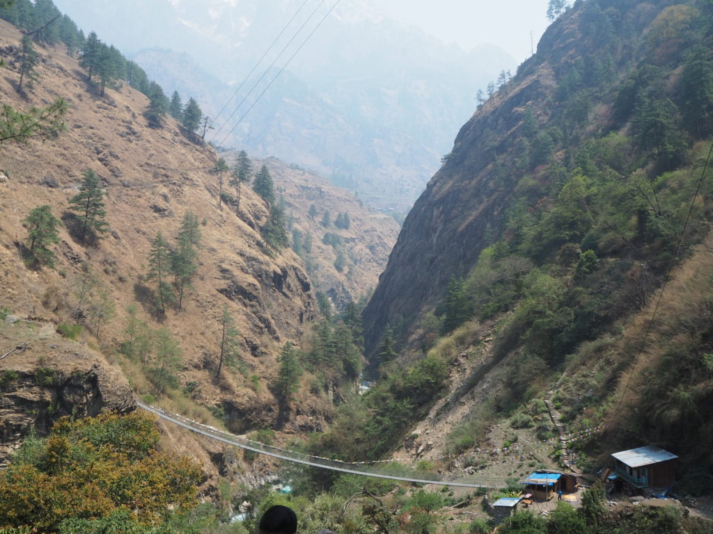
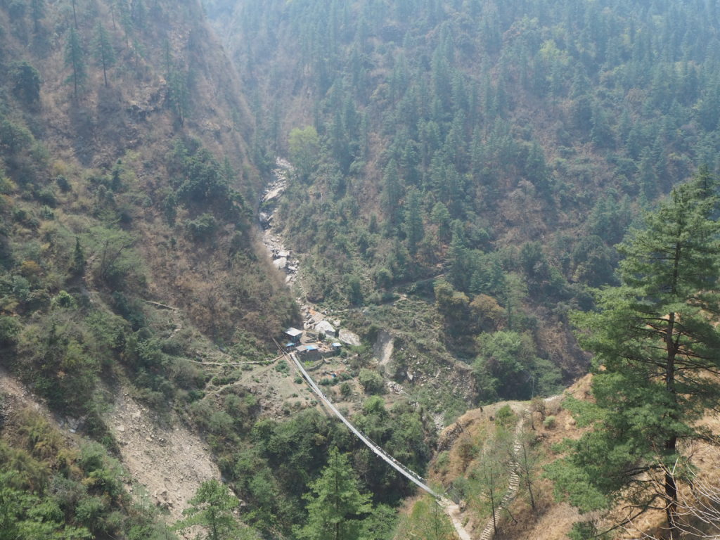
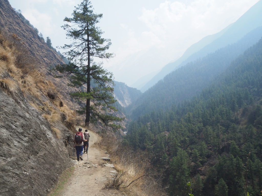
The second half of the day was on the opposite side of the river, where the old footpath used to be. We crossed a couple metal suspension bridges, which were very bouncy, but felt very secure. The path navigated up and down the hillsides a bit, before hitting an exposed slope and elevating quickly. Finally we were mountain trekking again.
Physically, we felt very good on this first major uphill. Shubus looked like he was struggling a bit though. We’re going to take more weight into our packs tomorrow. He is also carrying twice the weight we are, so it makes sense.
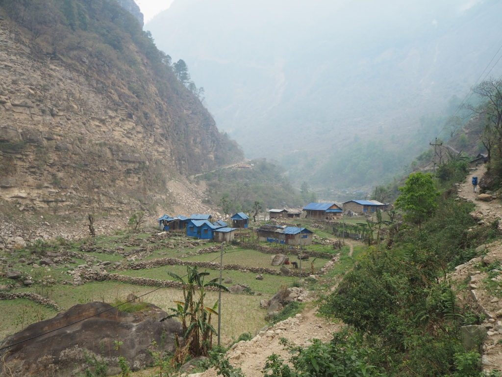
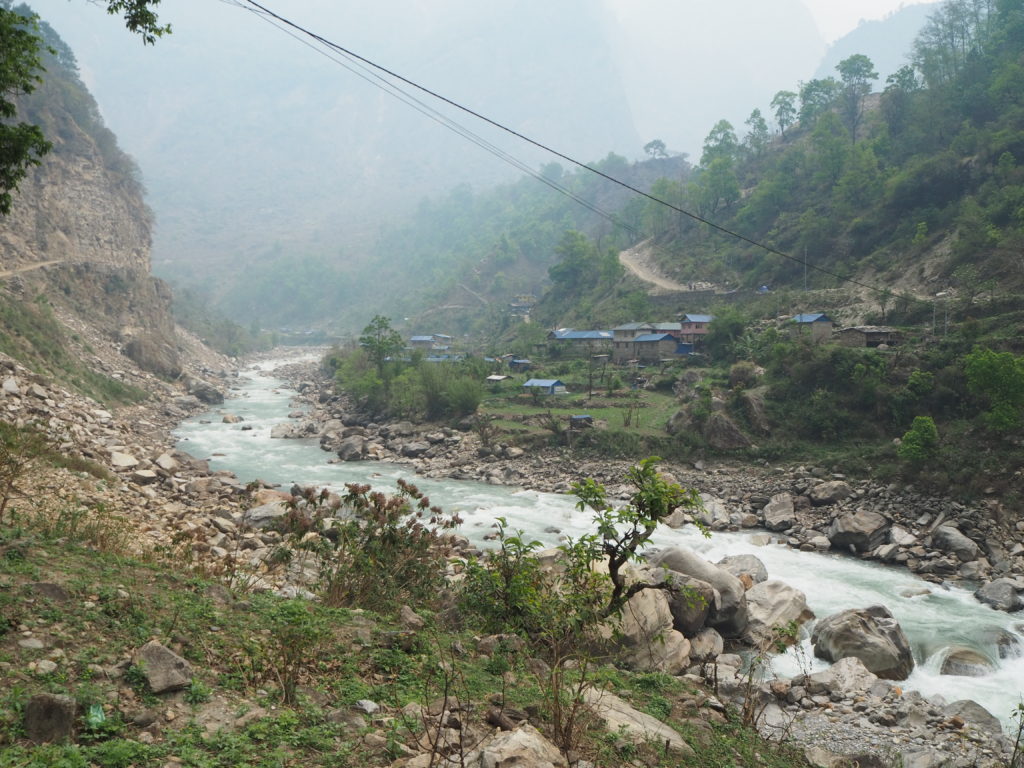
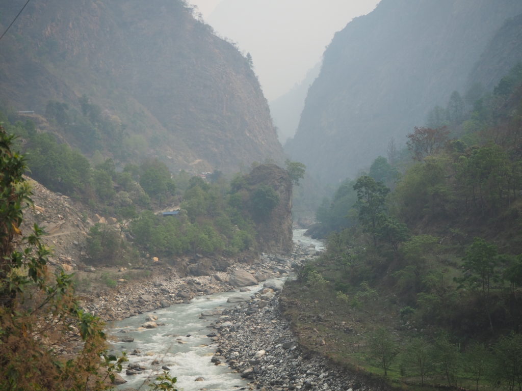
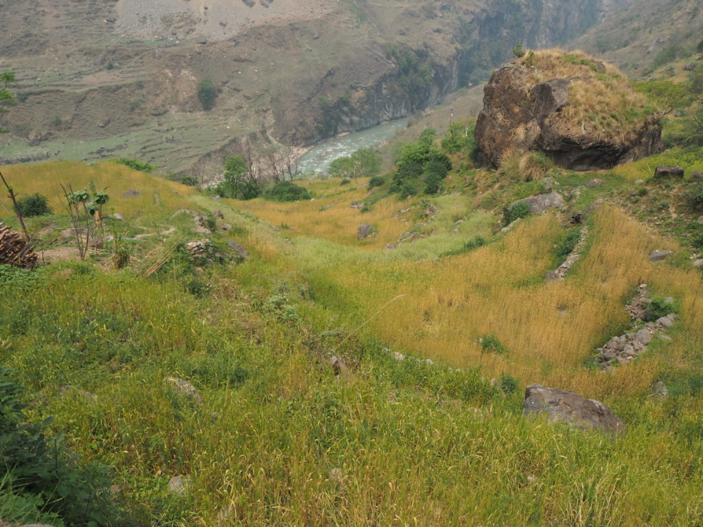
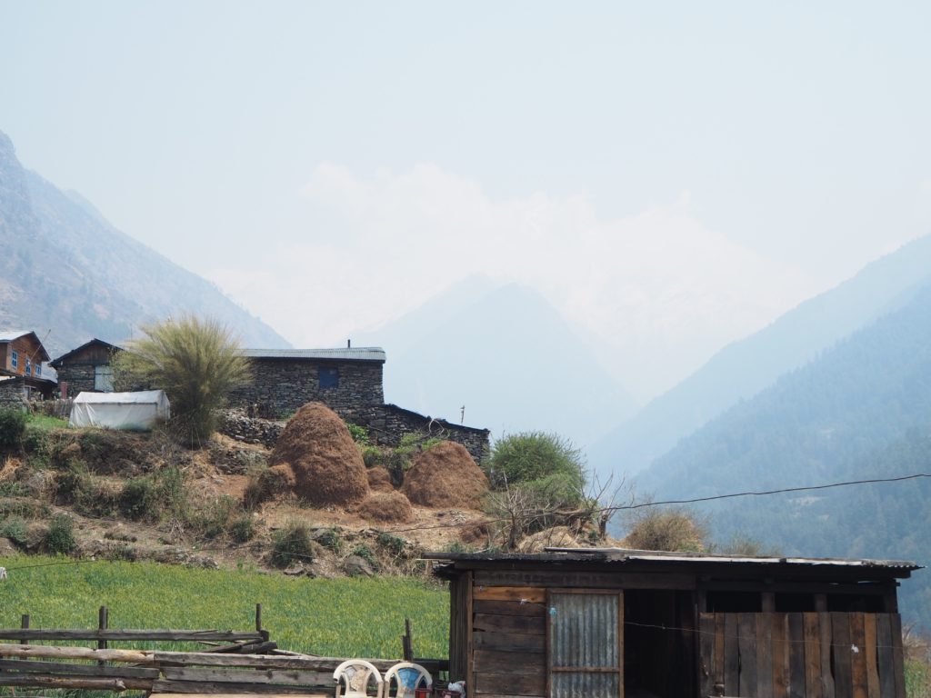
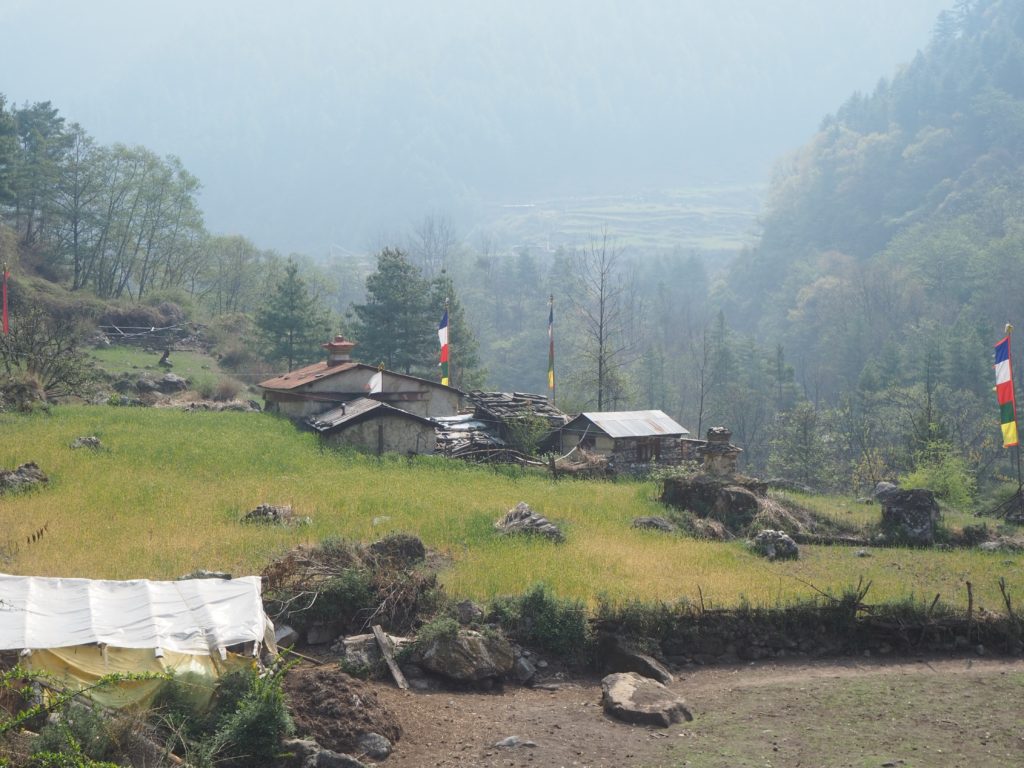
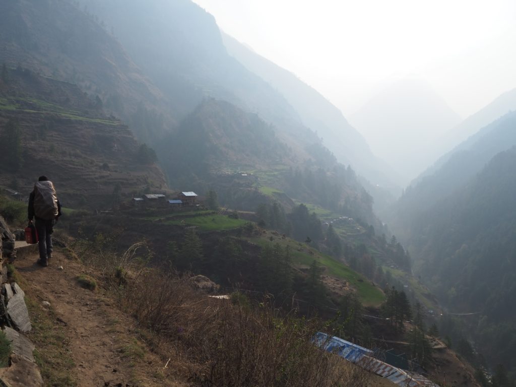
After the uphill, we ended up in this community with houses on the tops of large boulders. Not sure the reason, maybe a view. The valley then widened a bit. There were still sharp sides to the valley, but now a larger floodplain to walk upon. We were beside the river for a bit. This is only possible during the dry season. When it monsoons, the path used instead is the one bolted to the side of the mountain.

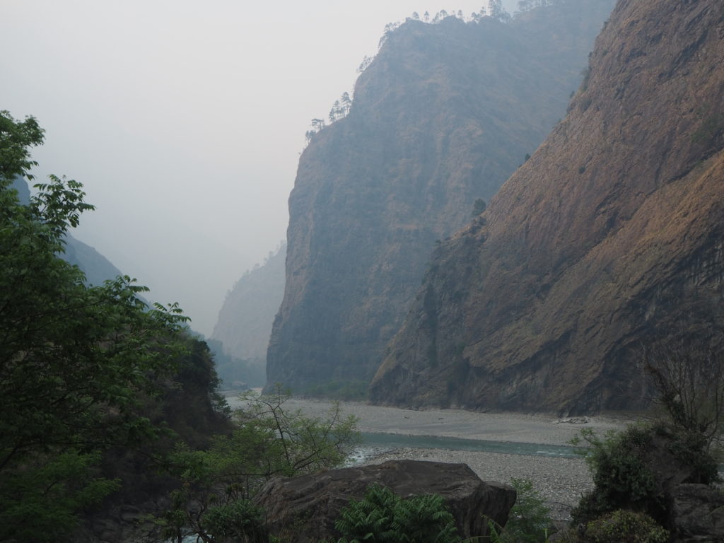
As it got later in the afternoon, the sun sat beautifully on the mountain faces opposite us. The smoky air gave a nice yellow filter to the already yellow-brown cliffside rocks. The entire world had gone to a sienna tone for a bit.
Finally we arrived in Jagat, in good spirits. We were tired sure, but we felt good after the first day. No real sore muscles, no cardio issues. Joints are fine. Hopefully that keeps up.
Day 2: Jagat to Lokpha
Length: 15.0km
Elevation: 1210m
The day started on a good note. Our curry chapatti for breakfast was very nice. On a better note, the skies were not smoky anymore, just humid. We could see better, and smell better too.
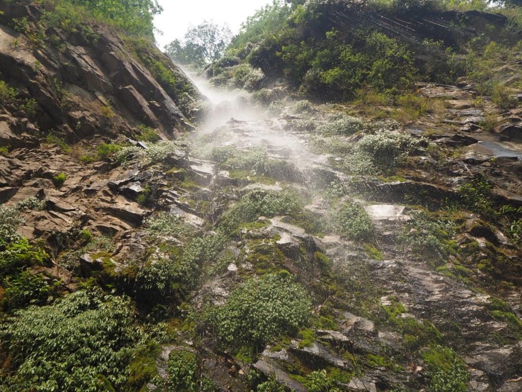
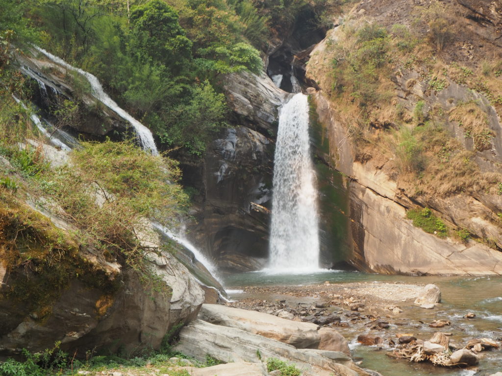
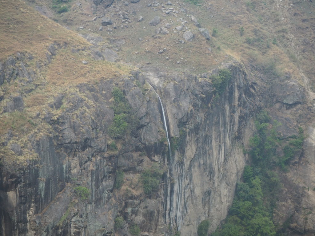
The trail today picked up where it left off the day before. We walked along the road west of the Buri Gandaki, headed north, and kept up a fairly good pace for the first two hours. The scenery was much the same as day 1, an absolutely stunning steep valley that cascaded into the raging light blue river below. The start of our hike today had a lot more waterfalls though, so that was a nice surprise.
By this point we had gotten to know a few of the others attempting the Manaslu circuit with us. Most will be in the area for 10-13 days, just doing a strait point to point from our river valley, over the Larkye pass, and exiting out the Marsyangdi river valley somewhere near Dharapani. This is part of the more famous Annapurna circuit. We were exiting there too, but with many in and out extensions.
Some notable characters include an old German couple who were moving slow, but never stopping. They had their pace figured out really well. There was also the British lad who had lust completed a 12 day Buddhist retreat, and left for this hike on a whim the next day. He was struggling, mostly because he couldn’t keep any food down. At any point when we asked, his mood was bad to “it is what it is.”
As we were in our own foursome with Hari and Shubus, we would leapfrog with all of these different groups with their different itineraries for rests.
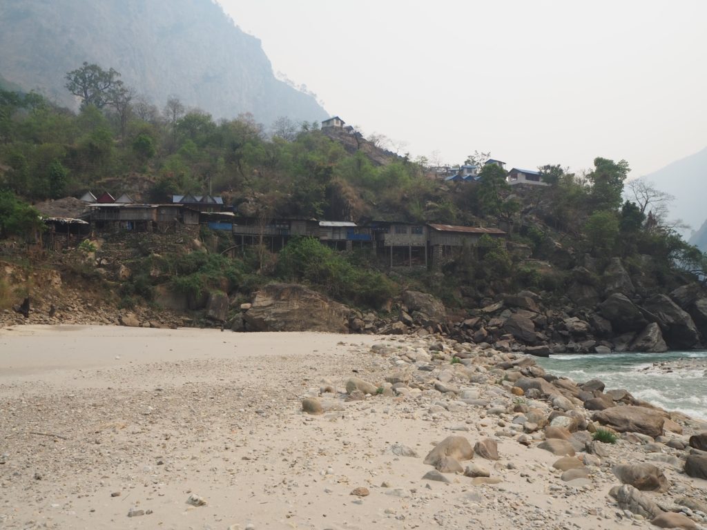
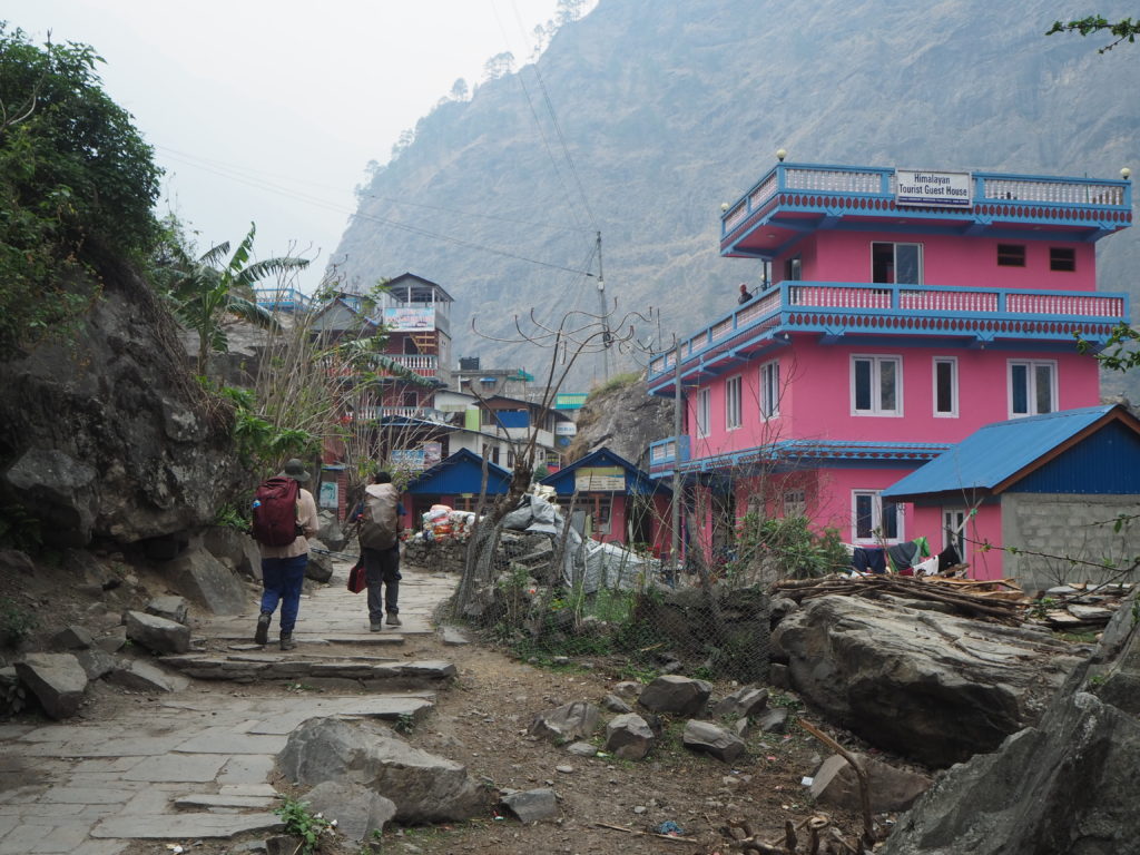
Two hours in, we crossed over the river on a somewhat dodgy left leaning suspension bridge to Philim, where we stopped. This town is the main municipality in the entire Manaslu region, and features such luxuries as a clothing store, electronics store, and a volleyball court. It isn’t connected by road though, that’s a 10 minute walk away over the bridge and river.
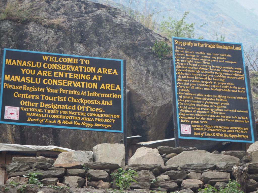
We were here on business. This town is one of a few checkpoints on the Manaslu circuit route. As we had arrived a little late (we started a little late) Hari was in line for nearly an hour waiting for them to get our information in. He was very kind about his displeasure of the permit recording system and how slow it was.
We spent this time hanging with ourselves and other groups. Everyone was just waiting to get on with their journey. We passed the silent times by watching the local kids run around. One in a little blue boxer had always seemed to be coming by piggybacked on someone else. But after some time, Hari got our information into the little book and we could continue on our way.
We didn’t get too far before we stopped for lunch in Eklebhatti. I have already converted to the local Dal Bat diet, and had a lovely meal of rice, curry and dal. Cam is still an afternoon hold out at this point sticking with her veg fried noodle lunches, in an effort to not get sick of rice and lentils again.
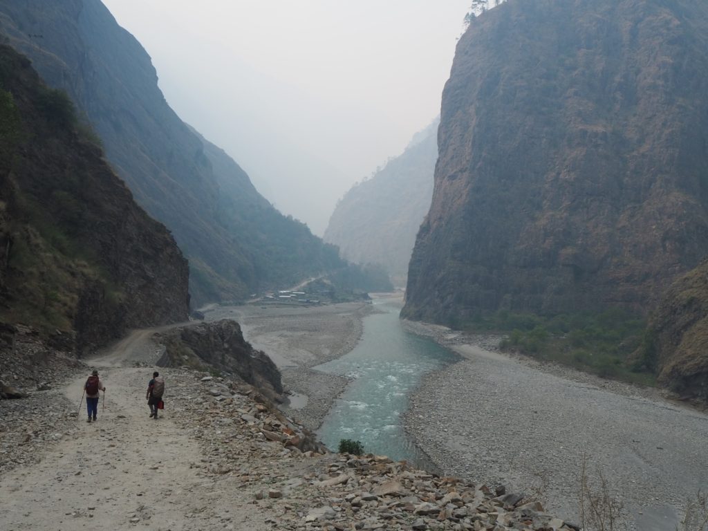
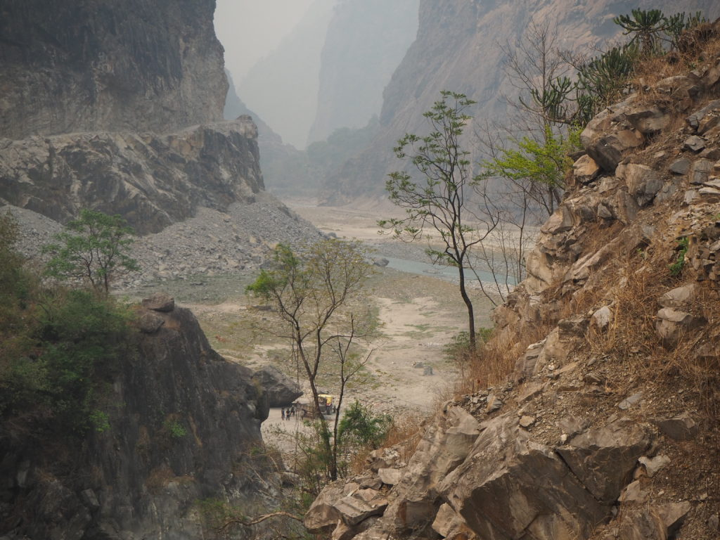
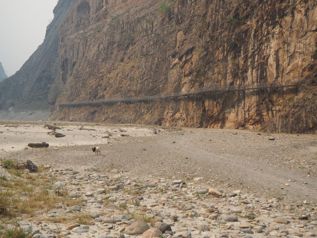
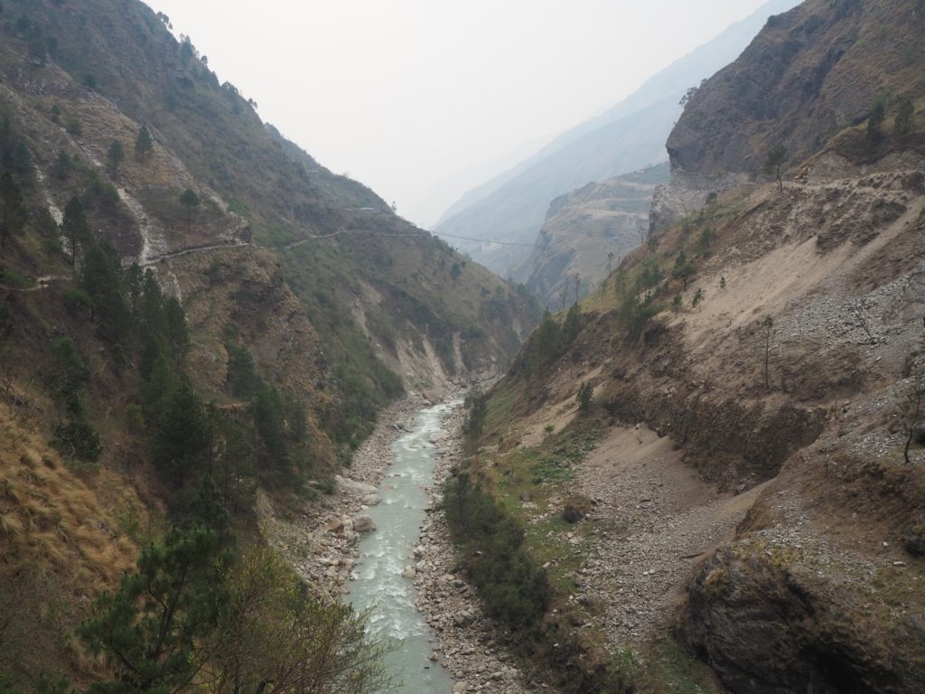
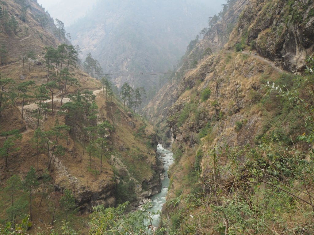
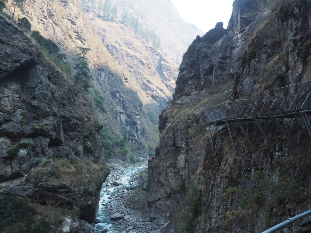
Finally onto the second half of the day’s trek, and things really started happening. The valley got steeper, and turned into a canyon. We were walking on the east side of the river on a footpath, and it was quite busy. Many mule caravans were coming by the other way with their backs empty. I guess a lot of dry concrete gets hauled up for houses and other long term construction.
They had to use the footpath though, because the road on the other side of the river just ended! It turns out, the end of the road is 8 dudes with jackhammers and an excavator on the side of a cliff. They were making very slow progress. The road to Jagat has been around for 8 years or so, Hari estimates. They’ve made it about 8km past Jagat into the valley since then. The plan for the road is for it to go to Tibet, which is at least another week away from here at walking pace. So that is a long way away. They’re also jackhammering into what appears to be a vertical cliff at the moment, so I have no idea what the plan is.
A flat road picks back up again after a kilometer or so of cliff. There’s no vehicles over here though. I think this is in anticipation of that cliff section getting sorted out. The road more upstream just functions as a much nicer footpath for now.
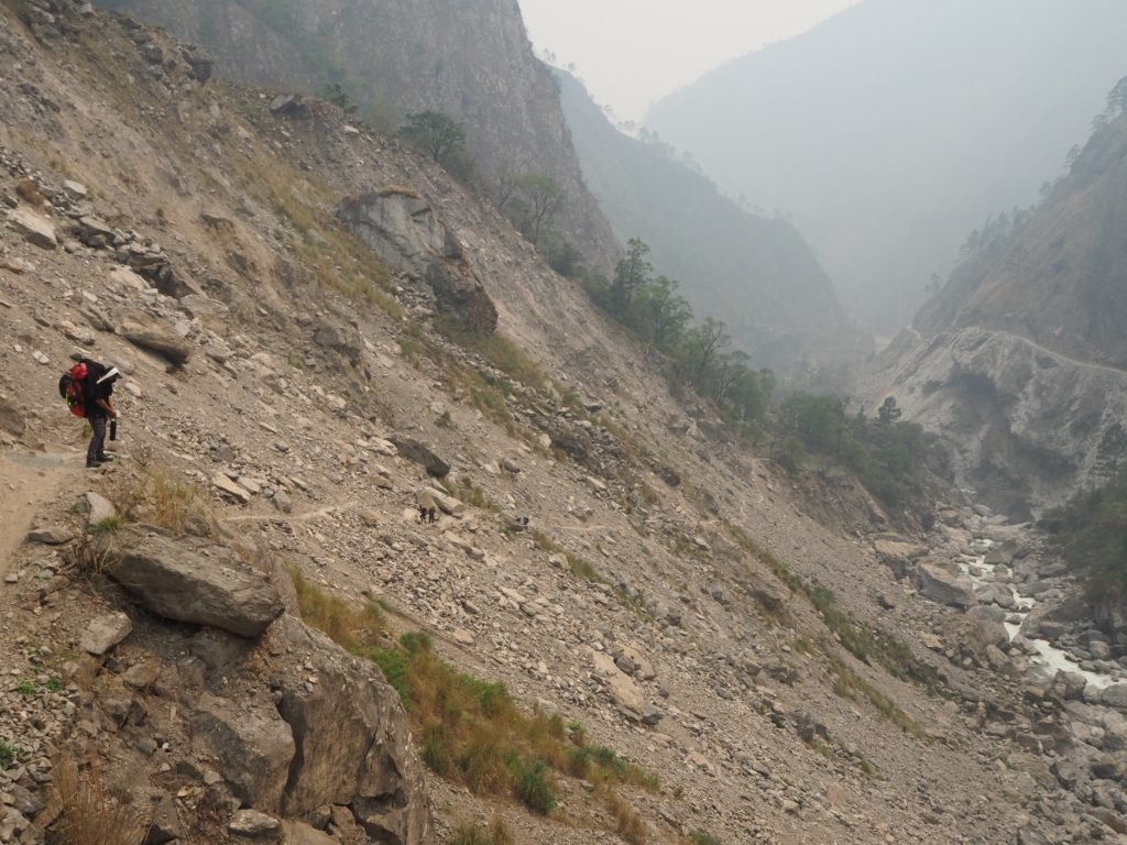
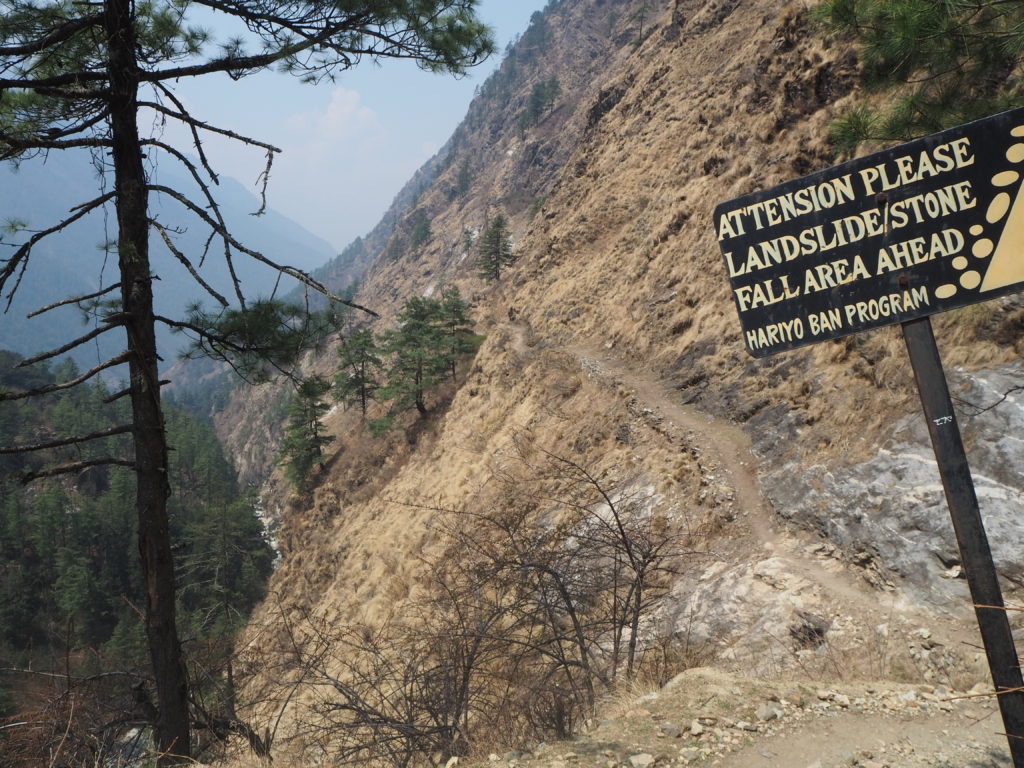
At this point, the wind started to pick up. We were nearing a river convergence, where the Tsum Valley and Manaslu Valley’s meet. Maybe that had something to do with the wind. We were in a bad place for it, walking over a landslide. Without vegetation, the dirt kicked up all over the place. Small rocks left a good impact on our exposed skin. The wind died down as soon as we entered a forest biome.
At the convergence, the paths split. All those with a shorter itinerary cross back to the west and head up the Manaslu valley. We went east, and into the Tsum valley. We said goodbye to some friends we had been hiking with, and departed alone into the forests of the Tsum.
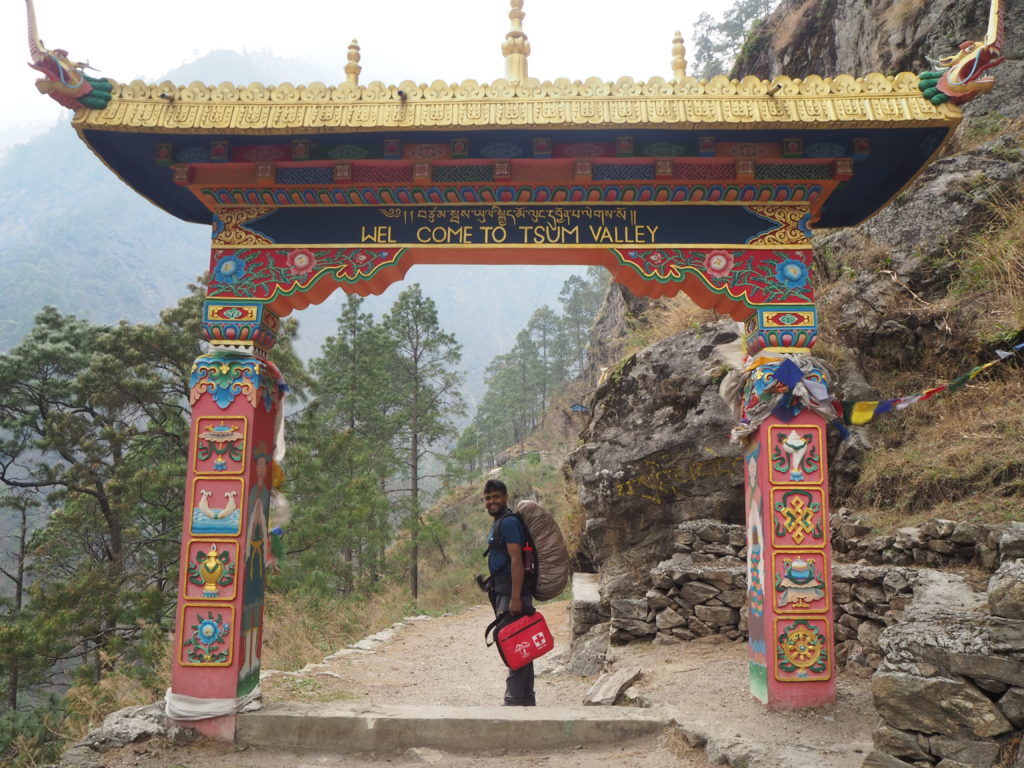
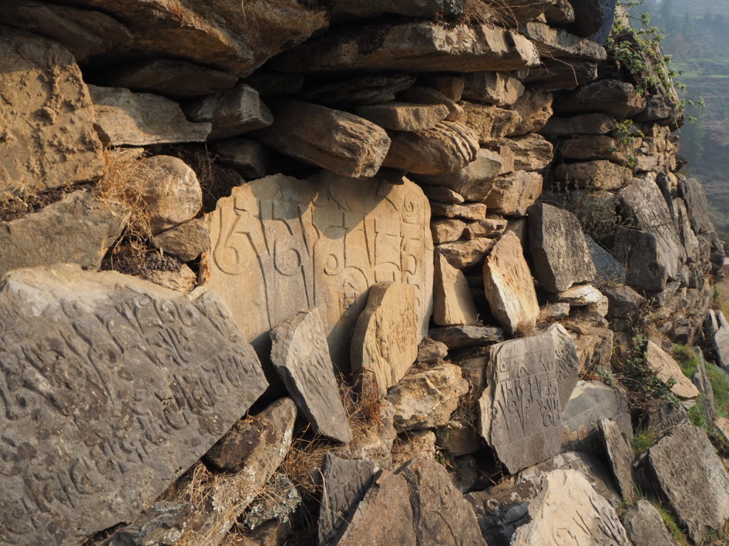
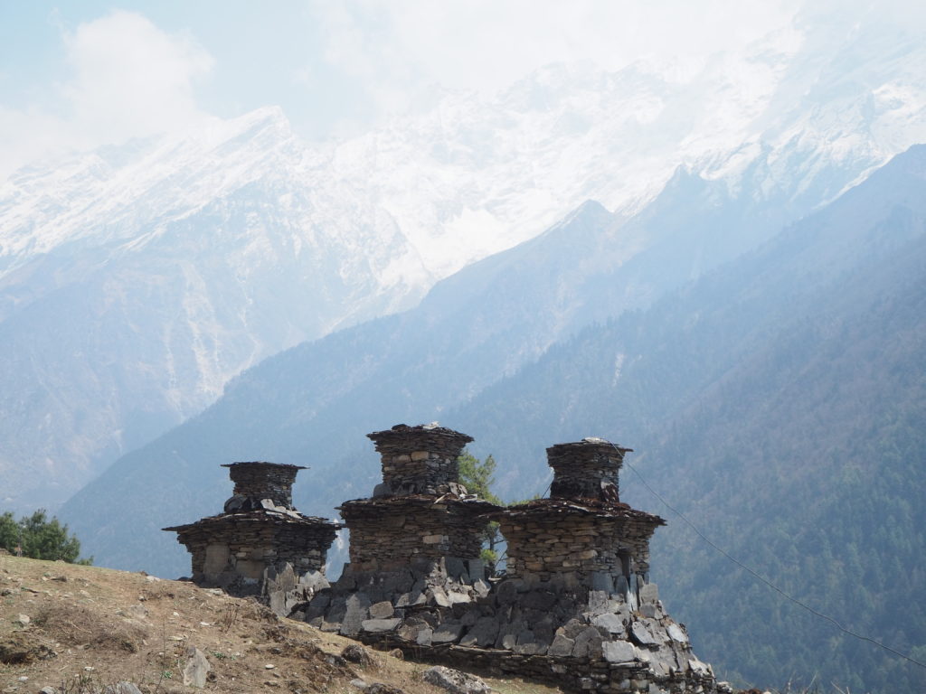
After a couple switchbacks, we were welcomed into the Tsum Valley with a nice arch and a sign outlining all of the rules of the valley. It is a ‘No Violence’ zone, which means no harming of animals. There is no slaughter, and there is no movement or sale of animals for slaughter. People in the region only eat meat after the animal has died of natural causes. Of course there still is a lot of husbandry in the region for dairy, eggs and transport.
The forest was a nice change to the sharp shrubby exposed cliffs of before. We were now at an elevation where bamboo could grow, around 1500m or so. That and ferns took up the forest floor vegetation. Apparently Red Pandas are native to the valley, but they are very shy and rare. Hari has only ever seen one after someone caught one brought it back to their village to show off, only to release it later. Our future homestay host had never seen one.
The purpose of the previous wind was finally revealed to us, and for the last 20 minutes or so, we walked in rain to the town. The rain was a nice change, as it meant the humidity would disappear from the sky, and our sightlines would be greatly improved. It was also somewhat warm for rain at this elevation.
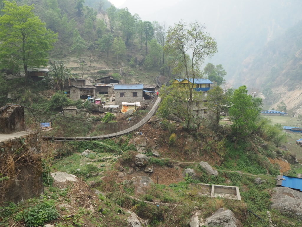
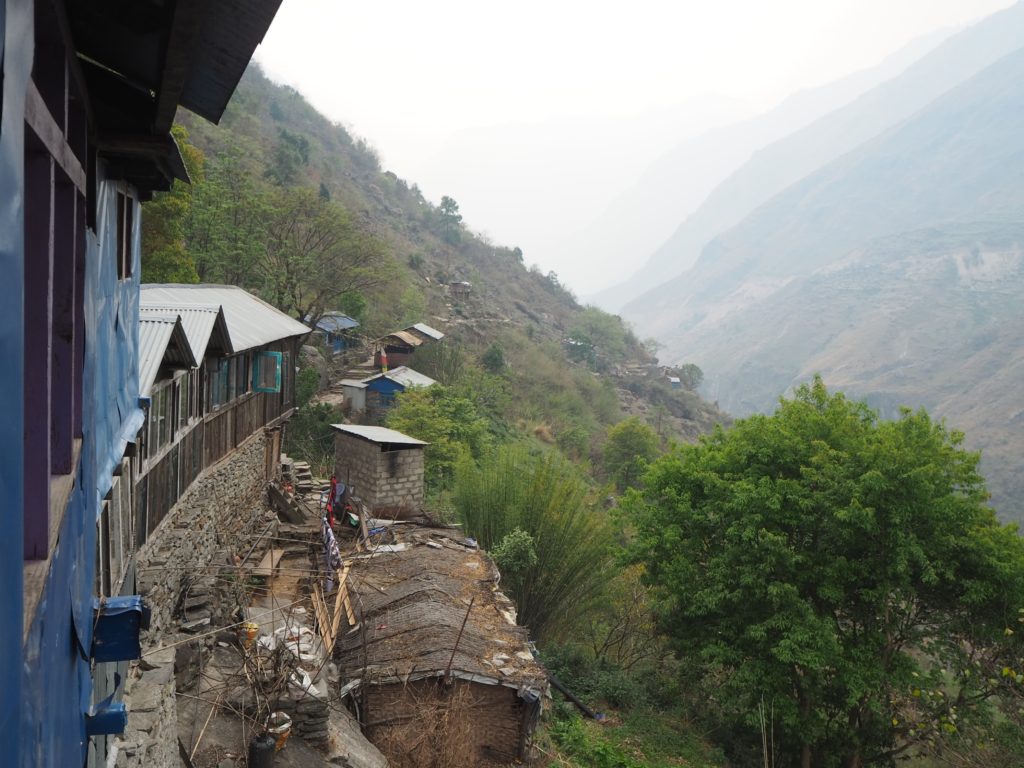
We made it to Lokpha, and quickly got to shelter in the homestay. We properly met Val and Ilona, a French couple on their own 20 day adventure, though they planned to tackle parts of Annapurna as well. We watched the rain together, and as the sky cleared we went out to see the mountains.
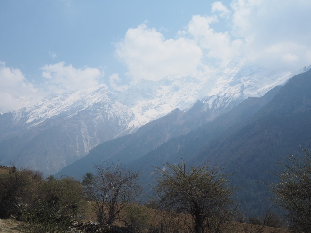
Slowly (ever slowly) more and more mountains came into view. With the humidity and clouds receding, we could see details on the peaks. Snow on some of them! We were excited and satisfied, but they just kept coming. We believe that the most distant visible peak was Langju Himal, a mountain that stands 6426m tall, around 4000m above our vantage point.
While waiting for dinner, we met a more elderly New Zealander, who was homesick, Julian. He was on a solo trip to Nepal (the last one, he promised his wife), and was missing his sons move in to a new home. With grandkids and everything else, he just wanted to be back with them. He then rattled on about a bunch more excuses as to why he couldn’t complete his own journey through the mountains. I think he was just nervous. Elevation was something he had not had much experience with.
We had dal bat for dinner again, and it was wonderful as always. Off to an early bedtime as well. Hiking is an early to bed early to rise kind of activity.
Day 3: Lokpha to Chumling
Distance: 8.14km
Length: 890m
It was a slow morning. I had my chapatti curry, and Cam tried the Tibetan bread. It’s a fried dough, and tastes like a really big and plain beavertail. Just plain fried bread. Hari gave us a warning for the day, that there would be no lunch until Chumling. Luckily it was a shorter day in terms of distance, but not in elevation.
We headed out around 8:00, to a beautiful sun and mildly warm weather. It really was a perfect hiking ambiance. The trail started through a slopey bamboo forest, but that quickly gave way to the sharp cliffs of the Tsum Valley. So sharp, that parts of the trail were steel sections bolted onto the rock.
The trail today was not for someone with a phobia of heights. At various points, the trail was carved into the rock, and on the edge was an un-railed vertical drop of way to many meters. We could not see the river at the bottom of the valley for most of the day.
Hari was telling us that this path had been carved out of the rock face almost entirely by hand. How long ago, I don’t know. The steeper sections have more recent concrete stairs on them to aid in travel. We talked with Hari about education. His son is excelling in his school and is looking to America for post-secondary education. He wanted our opinion on the country. He would rather his son go to Canada.
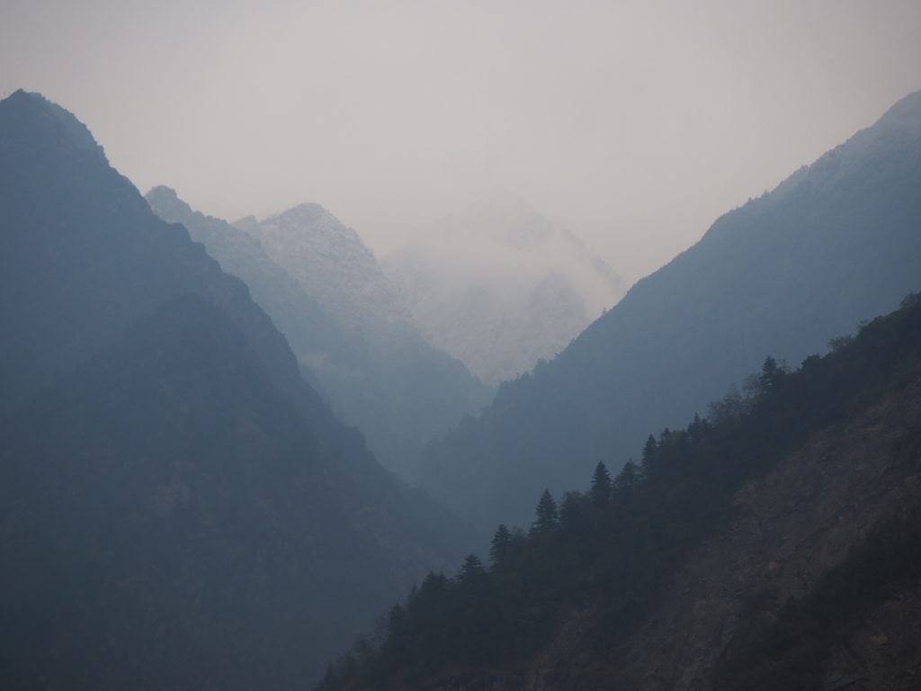
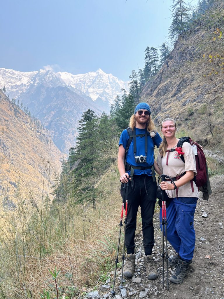
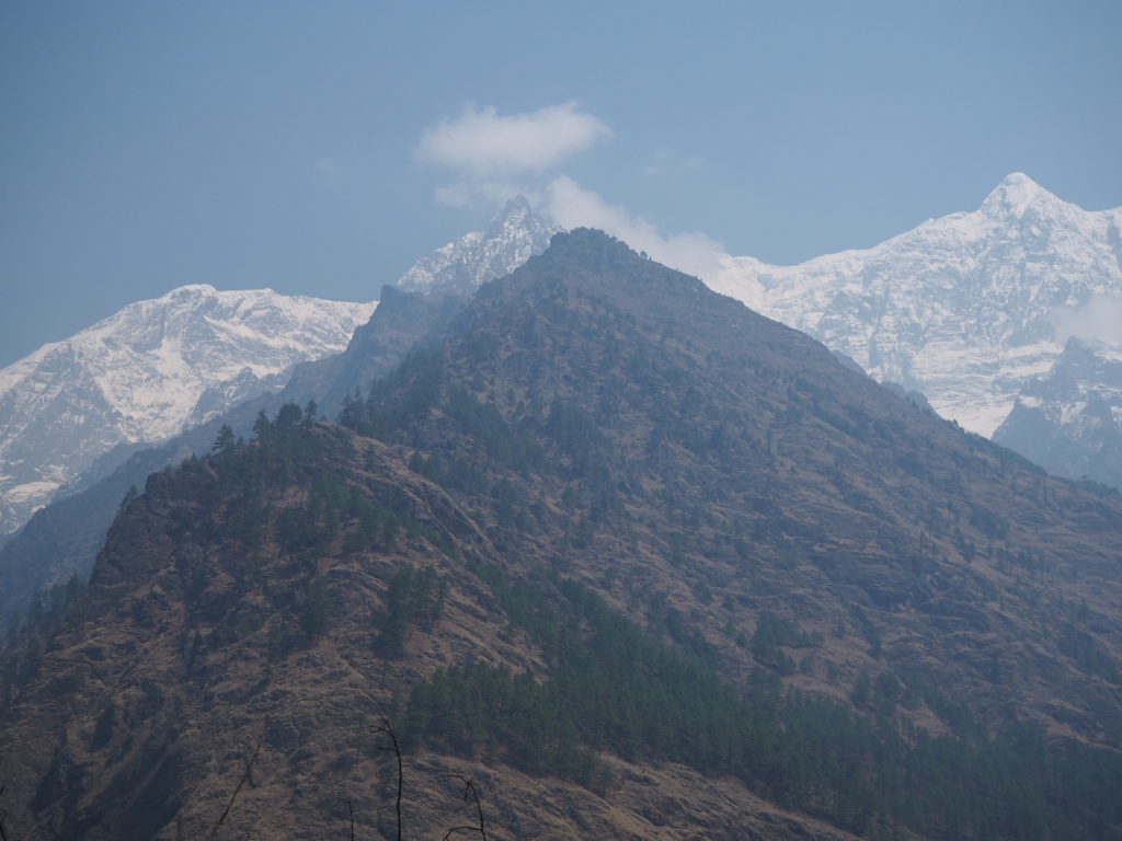
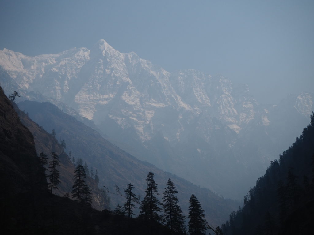
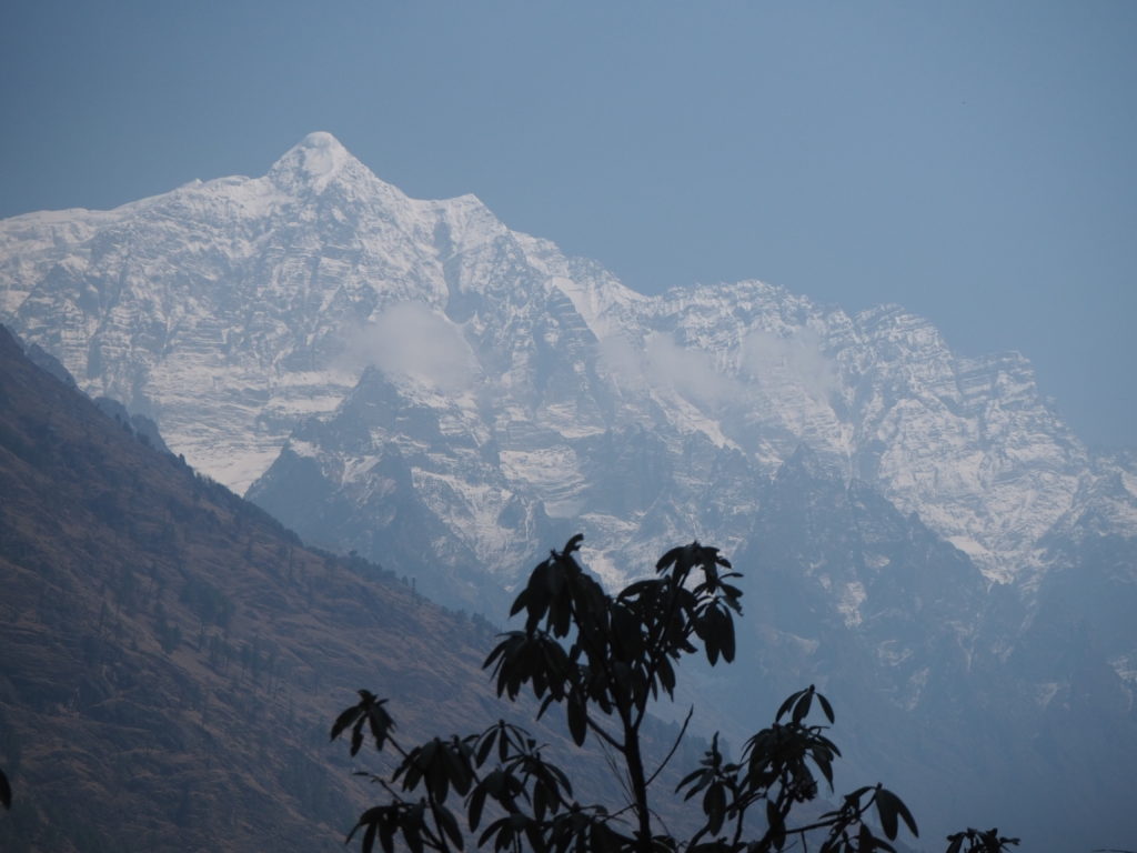
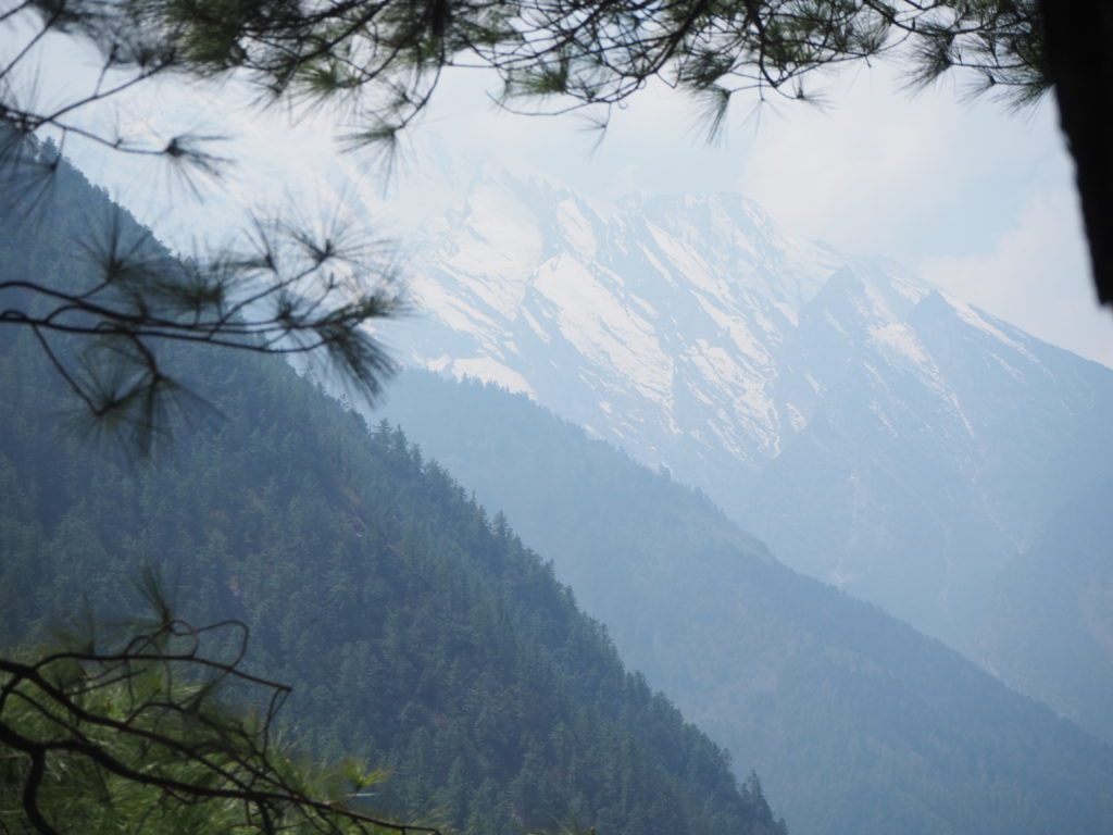
While hiking, the path moved steeply up and down. We were slow. The valley was a dogleg to the right, restricting our views up the valley. And as we approached a low point and a small turn, we could see in full view our first Himalayan mountain face. Towering over 4000m above us, it was a complexion of blank and white. Sharp spires protruded from the glacier to for various spikes. As it got higher, there was more snow, all culminating in a pointy peak. To our astonishment, when we pulled out the map to determine what mountain was in front of us, we found the peak 6300m tall unnamed. How much greater could the other mountains be if this one was merely a footnote?
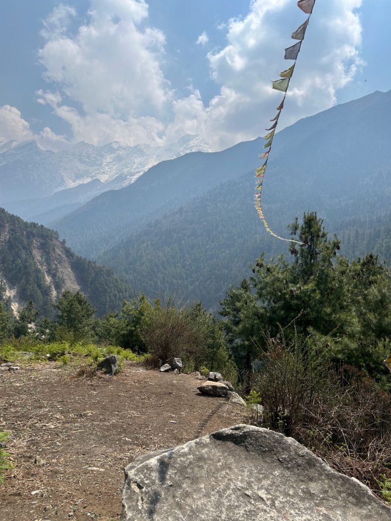
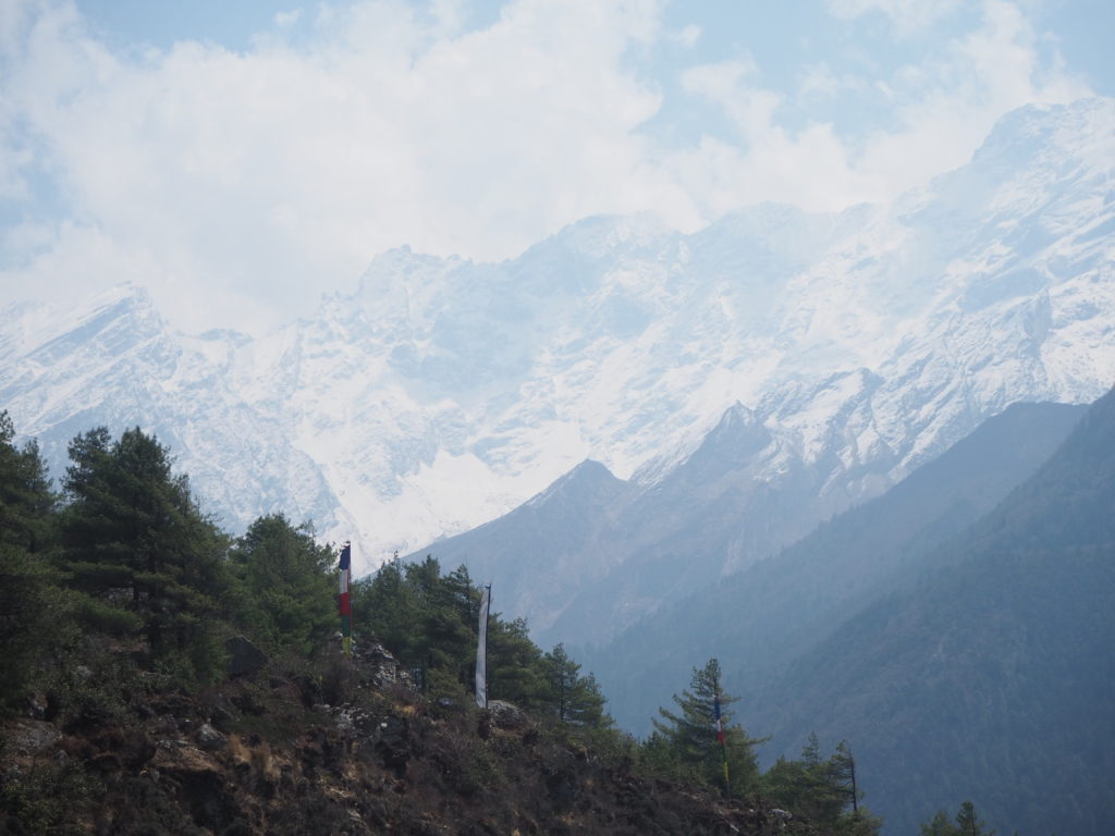
The further we walked, the more the mountain face came into view. These mountains form the border with Tibet, an international watershed boundary. Tibetan influence is very strong in the Tsum Valley. There are prayer flags on every bridge, and every structure, inhabited or not. Most people that live here are of Tibetan descent.
Eventually we arrived to a tea station beside a bridge, half an hour before the finish line. We stopped for a nice tea, and spent our time trying to place the geographical features in front of us on a map. We had some side valley excursions coming up in the next week, and were trying to predict which valleys we would be ascending. With such steep walls to the current near canyon we were in, it was near impossible to tell.
We crossed the bridge after tea, finally seeing the river for the first time in the day. It was still rushing, rocky and blue. We noticed some bags full of clay at the base though. The sediment from the river is used to make clay bricks for houses. We’ve seen that in action a couple of times moving up the valley. How they get down to the streambed is beyond us. The slopes are over 70 degrees everywhere around here.
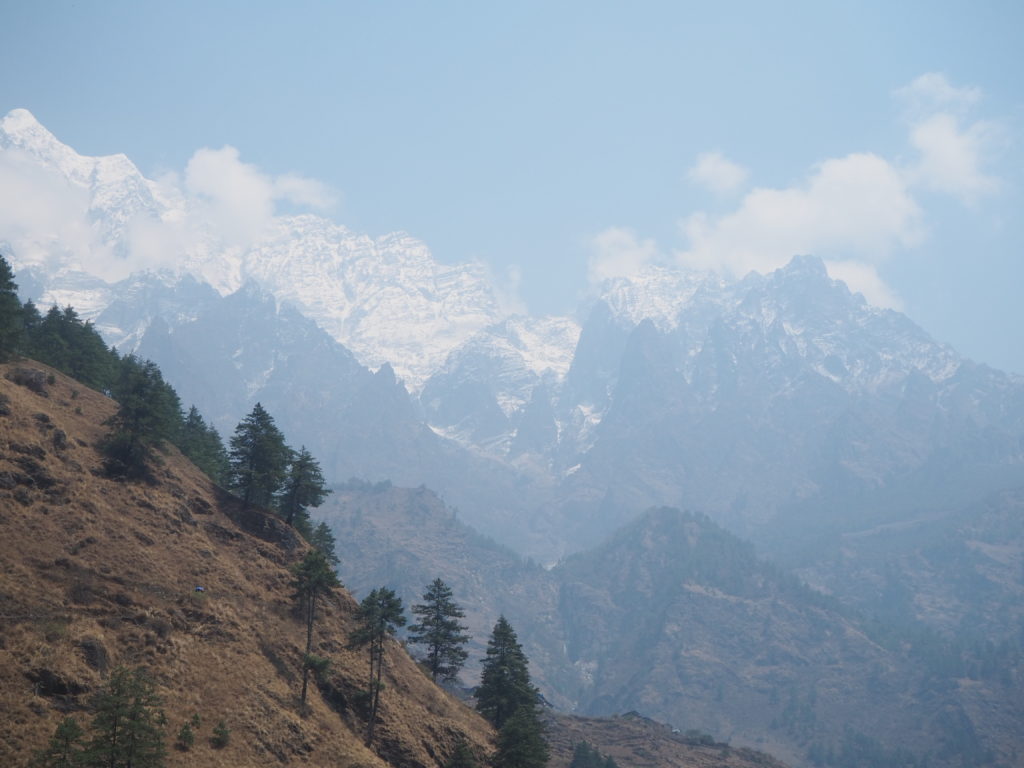
It was one final ascent after the bridge to Chumling. Now across the river, we had a different set of mountain views, and a new mountain face. Ganesh I. This beast stands over 7400m tall. And we now understood why the previous peaks had no name. Ganesh is a fearsome mountain. Viewing it for the first time was literally awesome. The peak was over 5km above us, and it looked like it. We could make out larger features, like glacial falls and rocks. But it was so far away that we couldn’t get much past the shape. We will be headed to the base camp soon for a better view.
Chumling was very nice. Our stay had a little yard, inhabited by a very inquisitive one year old. He and I would talk to each other, neither understanding what the other was saying. We had our lunch of fried noodles and dal bat for lunch, with the sheer power of Ganesh I overlooking us. Slowly, the clouds rolled in from behind the mountain, obscuring the view, as if Ganesh himself was telling us to be patient. The god of wisdom works in holy places such as this.
With the view of the mountain gone, we laid down for a long nap. Dinner was dal bat again. Hari taught a Nepali card game called Dhumbel, which was easy to learn and good fun. Lots of luck and strategy involved.
Tomorrow will be a big day to Chhokang Paro. Lots of elevation.
Day 4: Chumling to Chekumpar
Length: 11.10km
Elevation: 1090m
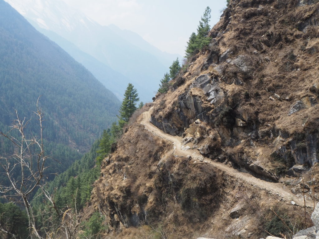
As we got higher into the Tsum valley, the scenery all started to become all too familiar. The river was hardly to be seen, but could always be heard. The cliffsides were steep, and every flat-ish patch of land had some sort of village on it. The goal as far as we knew was Chhokang Paro, but no village of that name appeared on any map we had. We assumed we were headed to Chhokang.
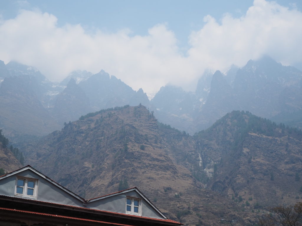
The start of Day 4 was much of the same. We walked through a nice flat patch, and slowly the intimidating face of Ganesh Himal I disappeared behind some closer mountains. In its replacement was the rest of the Ganesh Himal mountain range, and they did not disappoint when we could see them. We spent most of the first walk in the forest.
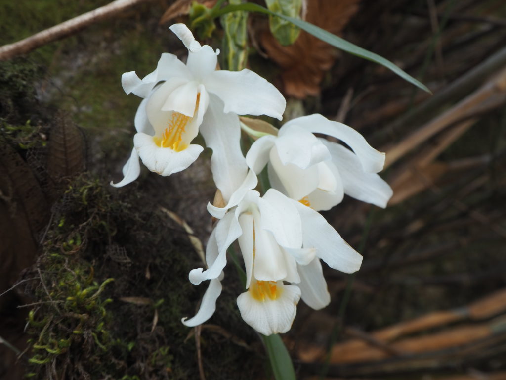
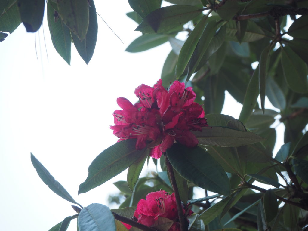
The forest here is very similar to back home. At this elevation (~2400m or so), the pine tree is the dominant tree. There are also rhododendrons, which have their red flowers in full bloom. Orchid flowers are also blooming at the moment, though they are more rare.
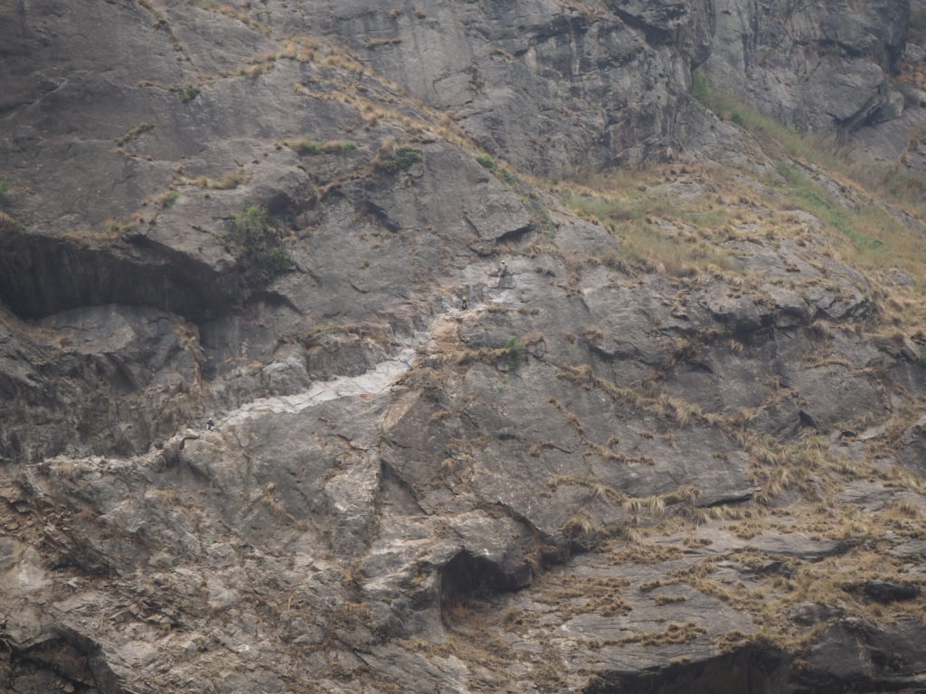
The forest was a good change of pace from the steep cliffsides, but that didn’t last long. We reached Dramba within an hour. This is a crossroads. From here you can head across the Shyar Khola river and up an Lumdeng river valley to Gumba Lumdeng, a nunnery, and further along to the Ganesh Himal I base camp. We will do those excursions on our return done the valley. Instead, we approach the most dangerous section of the whole circuit. Two hours walking cliffside, with a fall and your dead drop to our right. Animals can kick rocks down the hill from above to hit you in the head. Due to the narrowness of the canyon at this point, there isn’t really a good alternative to get into the upper regions of the Tsum valley.
We decided to forgo an early lunch in Dramba and powered slowly up a 6km, 800m elevation section. There’s not much to say about the scenery here, because nobody from the party had the heart to look up and recognize our location. Any stumble in our feet would mean at minimum, a massive scare. So our focus was entirely dedicated to the careful placement of our feet on the well used path.
About halfway through the cliff section, I had a good sense of regret of not getting lunch. The combination of a hungry stomach, the starting effects of altitude, and the constant awareness of surroundings were having an effect, and we were moving quite slow. It didn’t help that we thought the final destination was another 4km past this steep section, so there were many kilometers to go. Our only sustenance was that of some hard candies that we had bought in Kathmandu.
Eventually we made it to a flatter section, and in the near distance was the village of Chekumpar. Maybe here we could get some lunch. Imagine our surprise when Hari announced that it was our final destination! The rest was good for my bones.
So confusion of final destination lied in the translation of names from the local Tibetan language to that of English. Phonetic translations to English are not an easy thing, as English likes to laugh in the face of easy readability. We thought we were headed to the village of Chhokang, when Chekumpar was the final destination. Different maps have different English translations of each village. In fact, sometimes the Tsum valley is labelled as the Chum Valley on signs.
We had a very lovely evening in Chekumpar. We played a lot of Dhumbel with the guides, and even taught Hari spit! He got overwhelmed very easily at the rapid card placement needed for the game. Cam went easy on him. Cam got some ting mo-mos for dinner with a bowl of curry. Ting mo-mos are steamed bread, and they go well with the curry. We are enjoying trying lots of different Himalayan meals. There is more variety in the menu’s than anticipated.
The introduction trek to the Tsum Valley, and the greater Manaslu region was quite exciting. At this point we felt healthy and strong. There was not much for exhaustion. The ramshackle tea houses didn’t take much time to get used to. It was quite the change to be without any sort of modern technology. Just well designed clothes. But it was nice to separate from the world.
The next section of the hike was quite beautiful, hard, and simple. We visited monasteries, and saw the most remote region of the Manaslu valley. The way of life is quite different. We will see you there!
Great summary, enjoy vicarious trekking thru your eyes and words. Your great pics do justice to the stunning landscapes, skyscapes. Enjoy the Tibetan vibe, making do w very little, a lesson for all. Trek on.
Gulp! No kidding about not having any fear of heights. Those are ‘pay attention!!’ pathways. How wonderful that you will have these memories with you forever. What an incredible experience. You describe it so well in your writing!