
Day 12: Bihi to Sherang Gumba
Elevation: 9.55km
Elevation: 1990m
We did not know what to expect from today. Our guide and porter have never been to Sherang Gumba (Shubus has never been to Manaslu even!), and didn’t quite know what to tell us to prepare for the day. We learned from our hotel that it was going to be a 5-6h walk up, and maybe 4 down. Sherang Gumba had just hosted a Buddhist prayer festival for the last three days. We never quite figured out what the festival was called, or what it celebrated. But it is the major event on the local Manaslu calendar for the year. It certainly is a hub locally, but only locally.
According to every map that we have seen, Sherang Gumba is this out of the way monastery that is mostly ignored by the community outside Manaslu. There are no paths on the map to it! We knew what path to head out on, we know it would take about 5 hours, and we knew it would be mostly uphill. The rest was for us to figure out.
Breakfast was nice. Cam got cornbread, which really is just a dense pancake. While leaving, our host was enamored with my camera, and I got a nice picture of him with his hotel. He also joined us for our now routine start of the hike selfie.

The uphill started instantly. We scrambled up a hill, through terraced farmland, to make it to the highway to Sherang Gumba. Hari was constantly asking whoever we crossed if our path was correct. He was really excited to see this place, must have heard good things from his friends. From there, it was a mostly rolling up and down through farmlands for an hour or so, until we got to our last town before the monastery. We were feeling decent, so we powered on through.
It should be said that at this point in the trek, our bodies are generally tired. Our legs wake up sore, and the vegetarian diet that we have been on has not provided enough protein. That’s not going to change anytime soon. The night before was not the best rest, as there was chatting and celebration after the festival. None of the walls at these hotels have insulation. We are at the mercy of the surroundings around us.
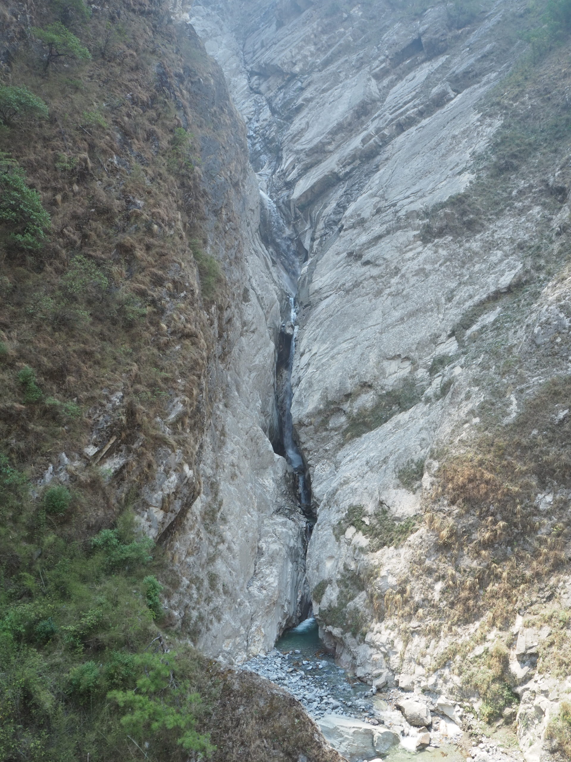
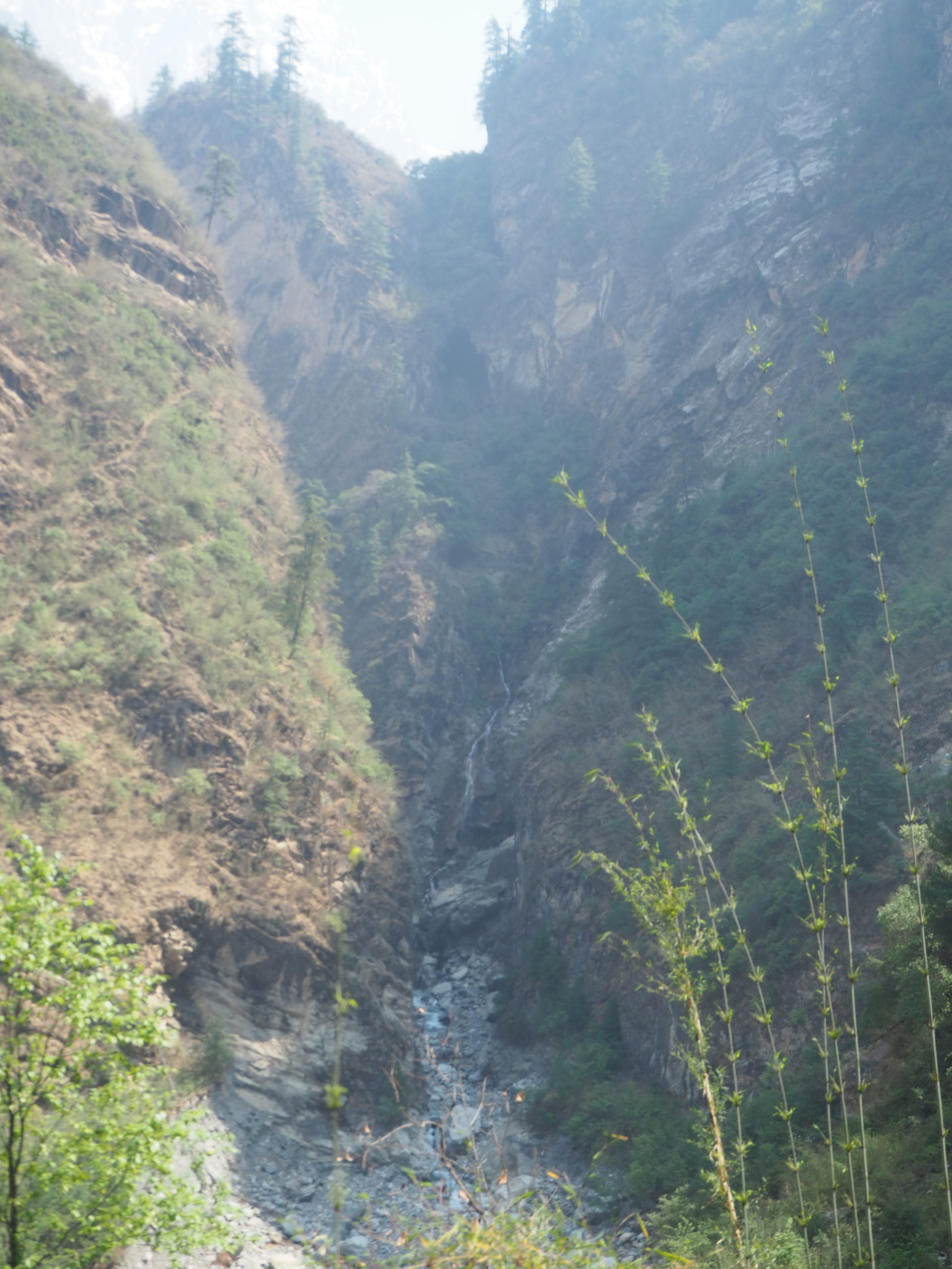
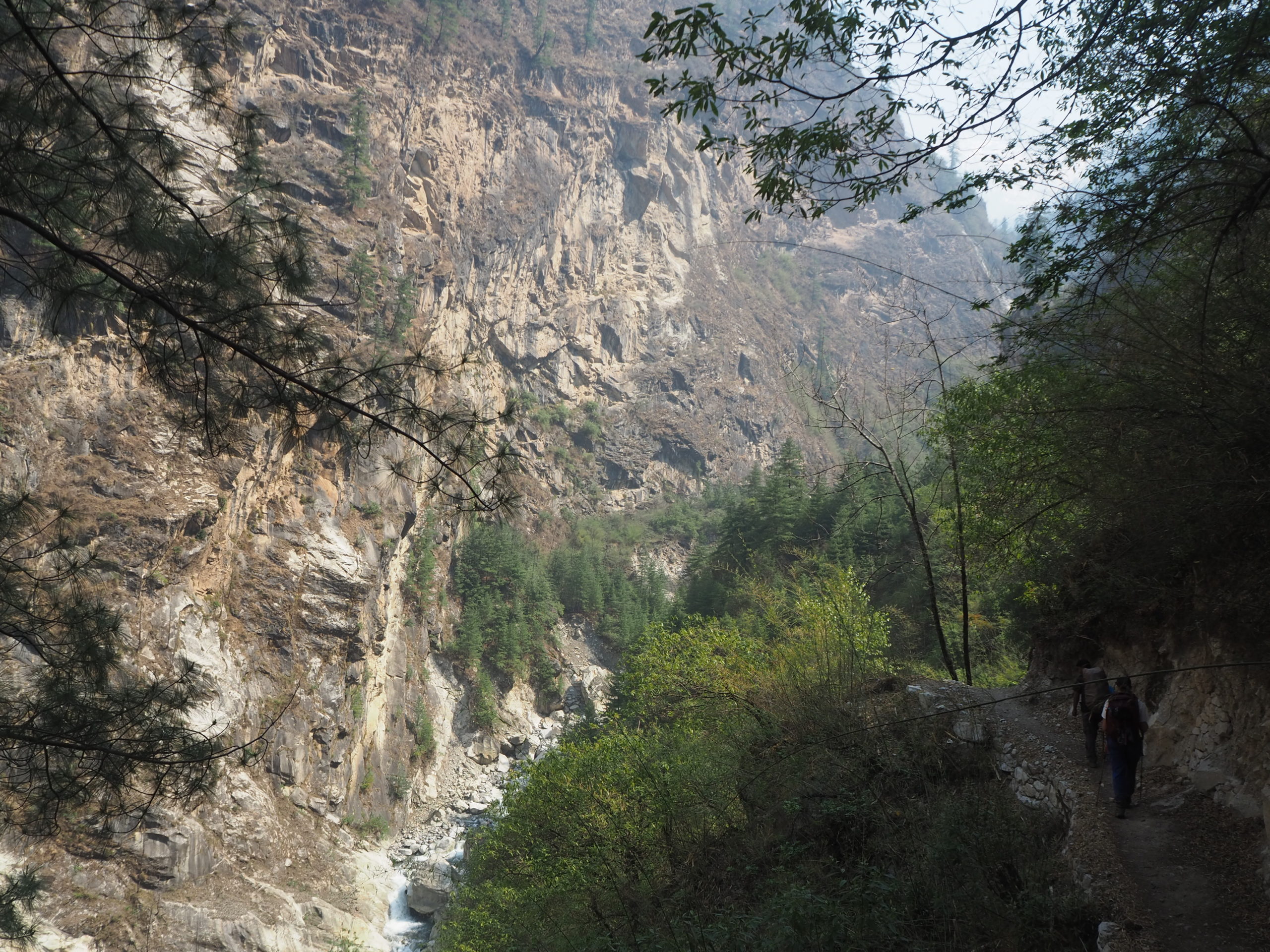
Past Gyoyang, the river valley we were following narrowed significantly, and we followed the river closely. We passed babies being carried in baskets by their mother twice. Vertical cliffsides started to form on either side of the river. Small waterfalls would crash over these cliffs and into the river below. We arrived at one particularly tall and nice waterfall, and there was a suspension bridge to cross. The gorge below was a fair bit deeper than expected.
Across the suspension bridge was quite cool. The path seemingly disappeared into the brush. The slopes of the valley sides rose steeply from the floor, to the tune of 300-400m until they levelled out. Each waterfall branch had its own deep canyon. It created a weird elevated island island sort of effect, unlike any other canyon I have ever seen. But we crossed the bridge, and discovered, much to our disdain where the path went.

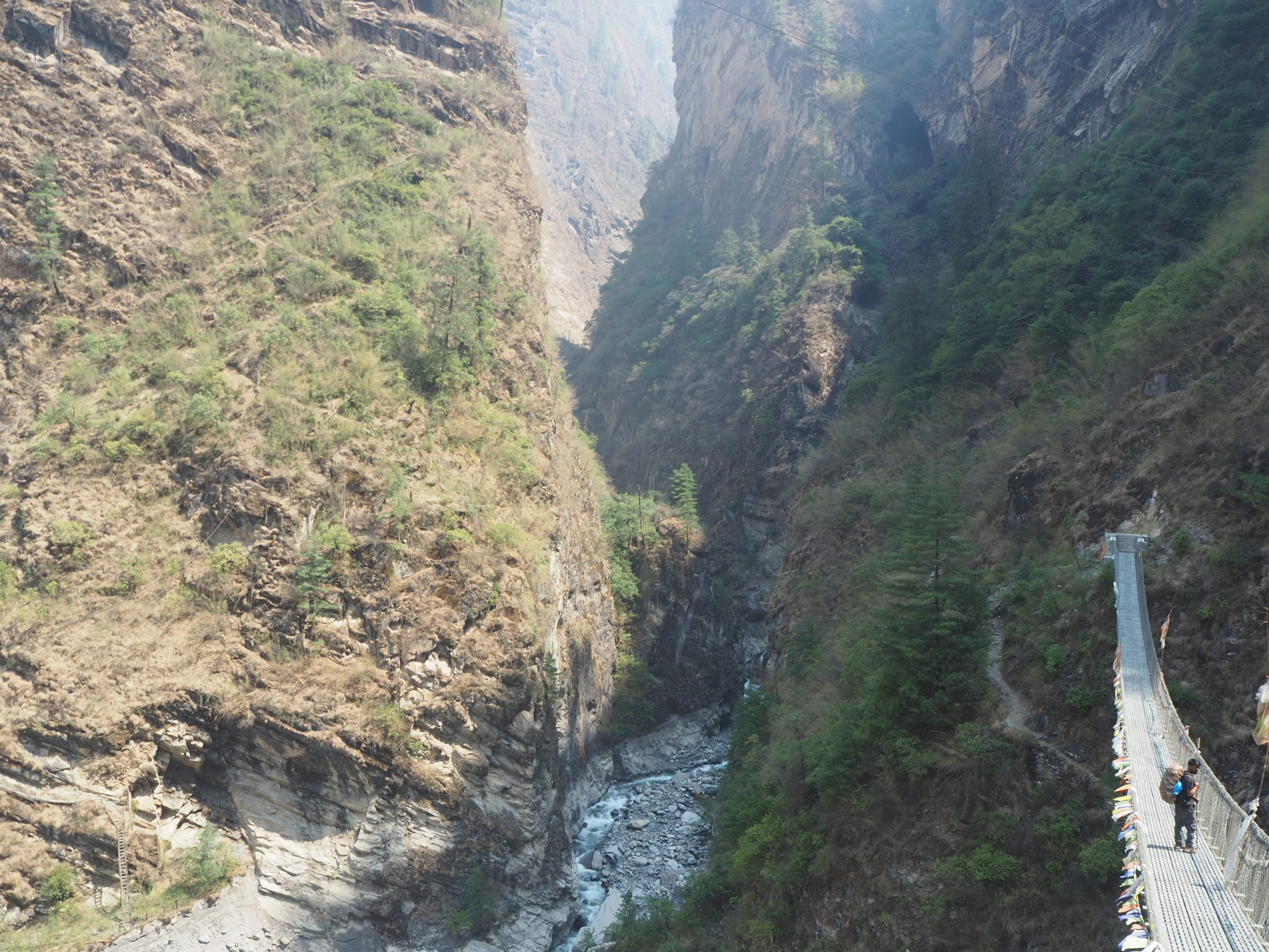
Directly up. The path went directly up. We walked up 250m worth of concrete stairs, to end up nearly on top of the bridge. If you’re a math guy, you would estimate the amount of stairs in this singular outdoor staircase. I’m a math guy, so I did. Average 15cm step height (a guess), 250m of elevation, puts the staircase at 1,667 stairs. Plus or minus a few hundred. At that point is doesn’t matter. It was a lot.
This path to Sherang Gumba, with 250m of steps, is the easy path. It opened in 2019. Previously, it was apparently a 10 hour walk from Ghap, where we will go tomorrow. From the top of the stairs, we had a great vantage of the maze of deep gorges and island like tops that make up the valley. Small creeks that have carved their way hundreds of metres down, but only 10s of metres wide, led a maze of canyons that we were now on top of.
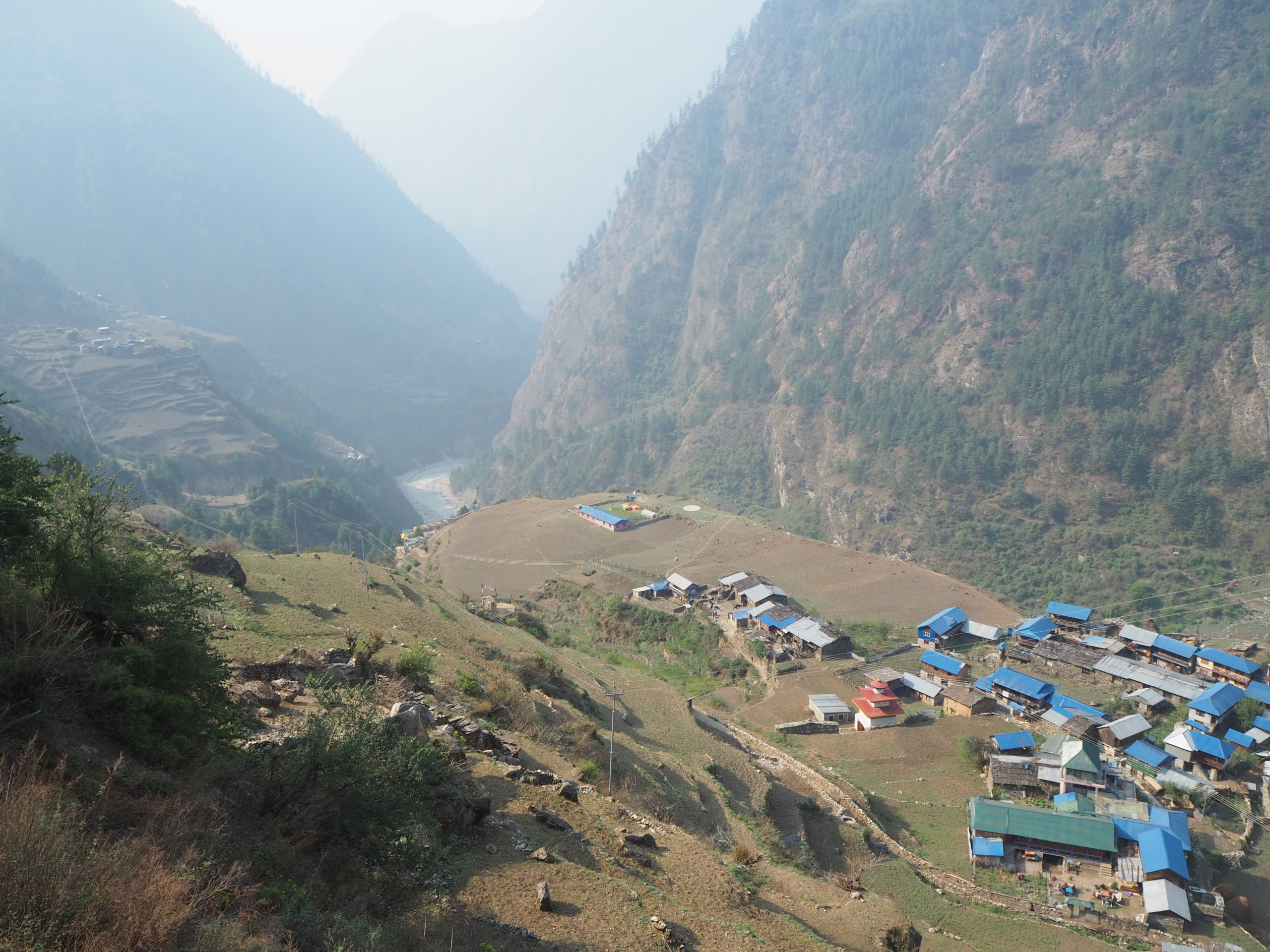
It didn’t take much more walking until we made it to the nicest lunch spot of the trek so far. On top of one of these islands, a small hotel and restaurant has been set up. It appears to be a basic rest stop for everyone. There were horses and mules grazing in the fields. A bunch of women were sorting out the goods they were carrying. And the views.
So with every vantage point in a valley, you can look back out and see where you came from. At the end of this valley was the massive slate of snow and rock that made up the beginnings of the Manaslu Himal range. It gently rolled over the horizon. Below that, narrow valleys cut through the land, creating a unique vertical terrace sort of look. Looking up the valley, we were able to see the Shringhi mountains for the first time. These are towering, spiked peaks that have glaciers completely falling off of them. They imposed their will on the world below in a gentle way, but one that commands respect. We spent at least an hour sitting on a shale pile enjoying the views and lunch.


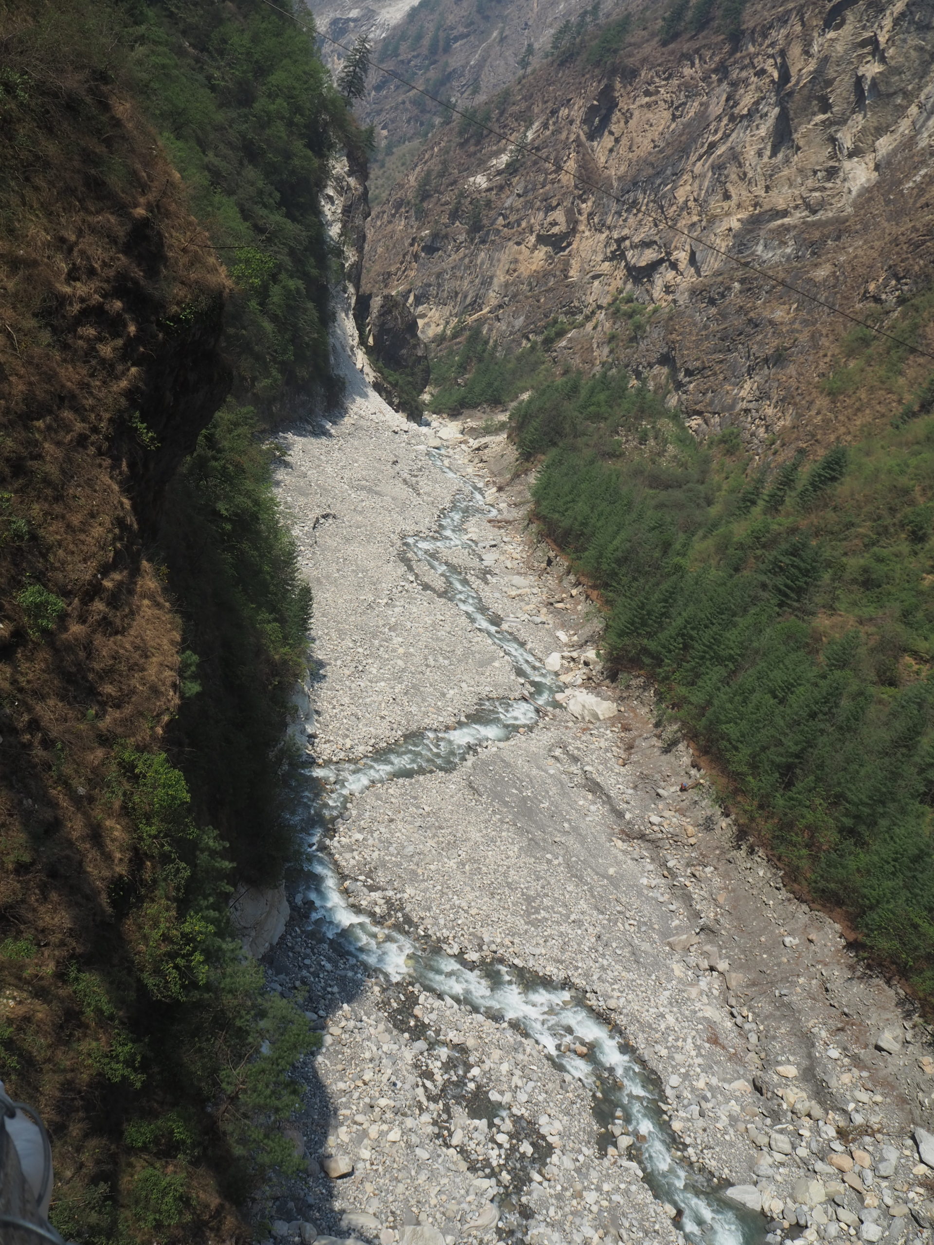
We had to depart our wonderful island top. As we moved deeper into the valley, the streams all separated, the gorges got thinner, but they remained impossibly deep. Suspension bridges connect all of these islands. They sway in the wind and bounce as is, but now had a sliver crack through the rock 100m below them that would show up as a surprise every time we made it to a new island.
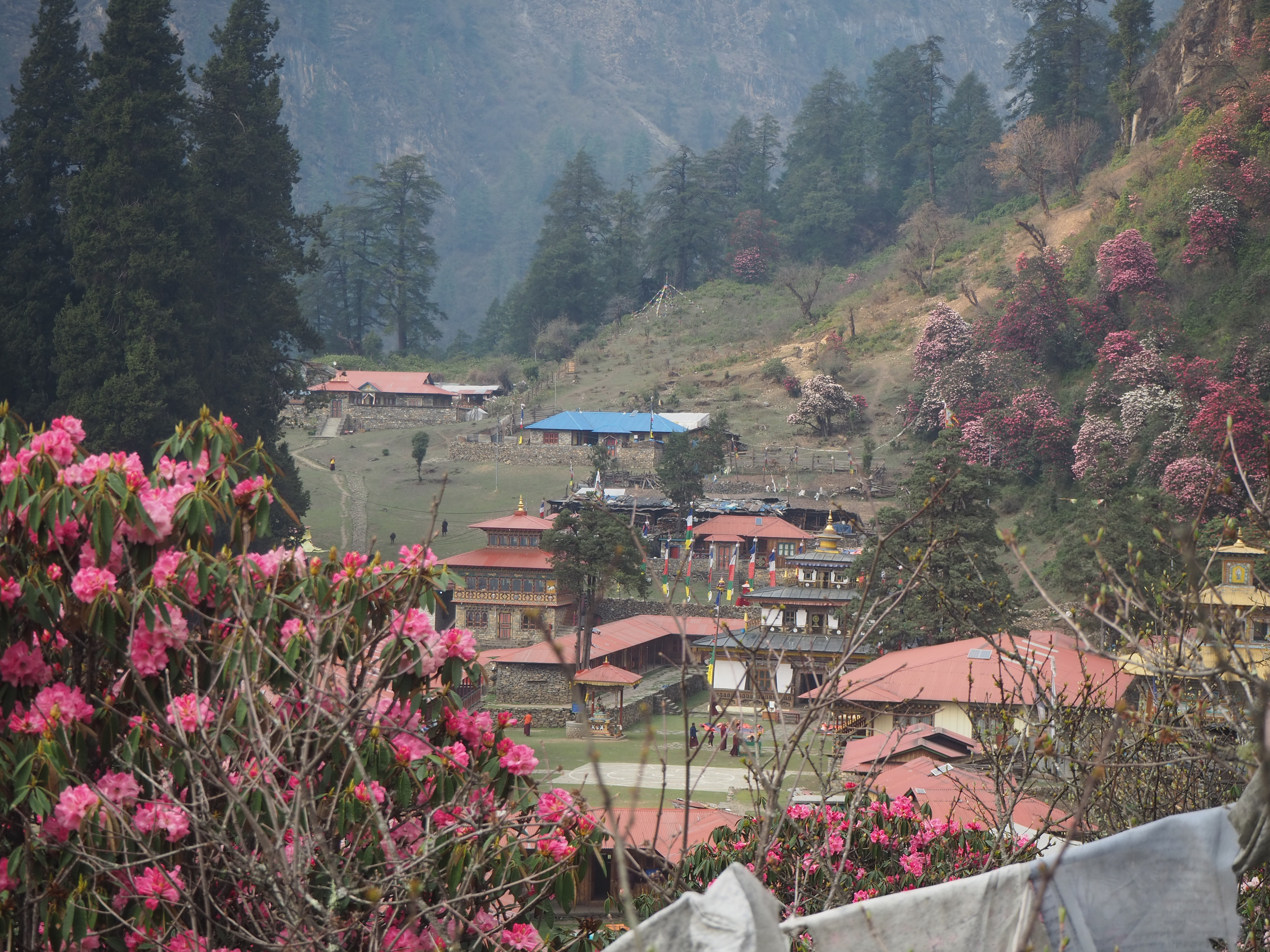
We still had more uphill to go, and we enjoyed wide open views of the Shringhi range for the majority of it. In the distance, nicely framing a plateau, were the reds and pinks that resembled rhododendron trees. We theorized that this was Sherang Gumba. This would turn out to be correct. We were moving slow at this point, but the combination of the mountains, deep canyons, and a pop of colour made the slow wonderful. The weather was really nice for the afternoon as well.
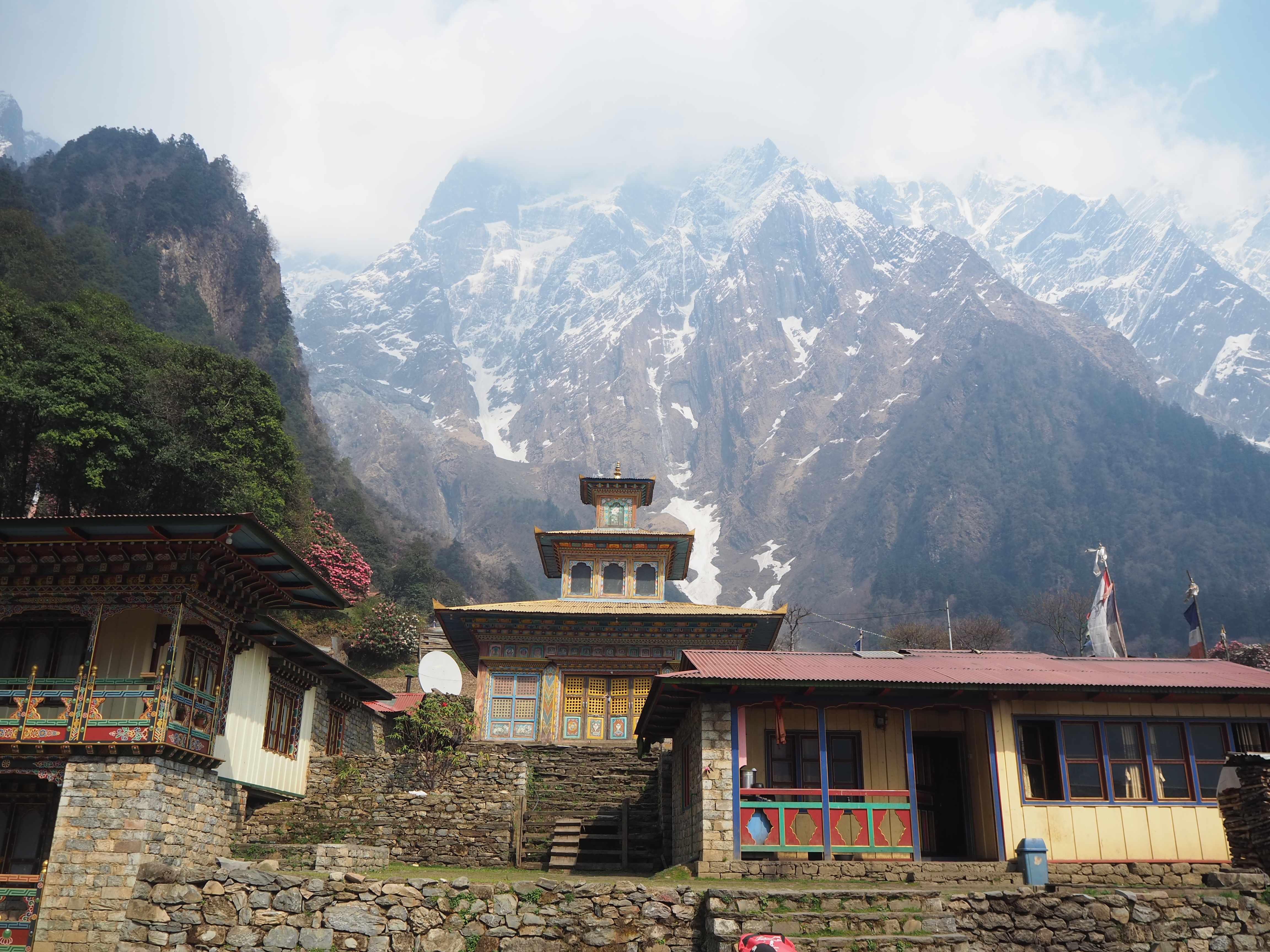
The final ascent to Sherang Gumba was magical. The pathway was nicely lined with rhododendrons of red, pink, white, and every shade in between. We turned one final switchback to feast our eyes on the school. Kids from roughly 4-14 were running around, hanging out, and generally being kids. We were not staying at the school, but at the courtyard a little further up the hill.


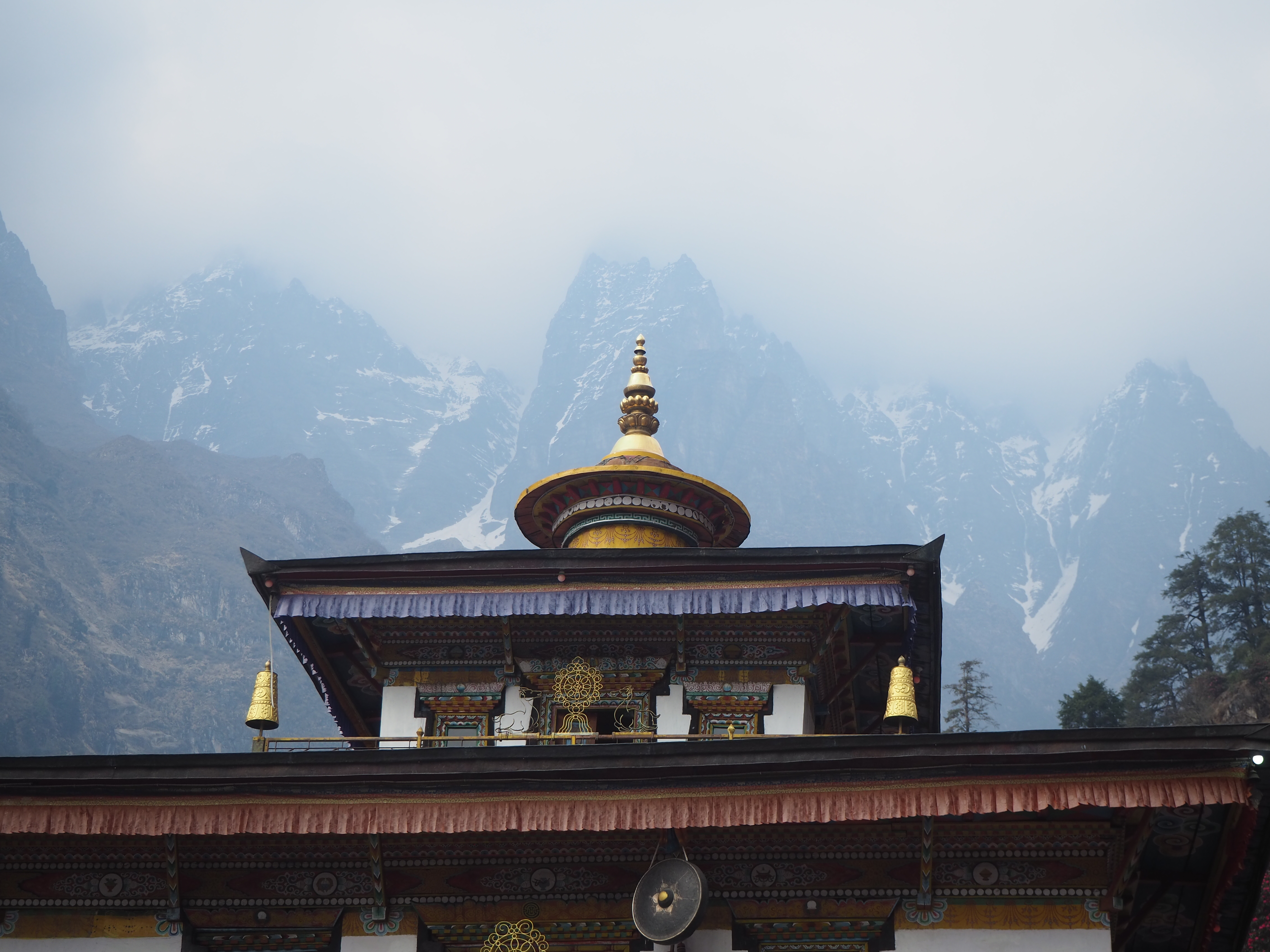
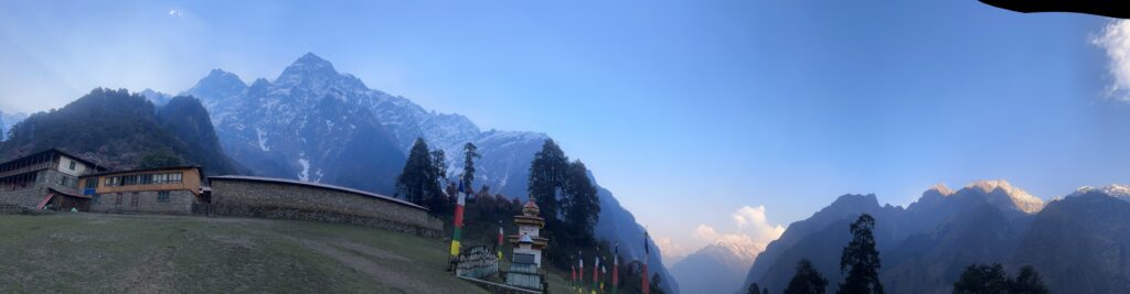
It’s hard to put into words the magical nature that Sherang Gumba provides. It is placed on a cliffside terrace, only accessible from a complex up and down network of pseudo-islands, like Pandora from Avatar. It is immediately surrounded by full in bloom rhododendron trees, providing a beautiful colour that pairs with the red and orange themes of the monastery. And in the skyline, everywhere you look, there is a beautiful, massive mountain sheltering the location. It is truly a unique, special place in the world.
The whole squad, Cam, Hari, Shubus and I, took a walk around the facility. We saw the workshop, where people were making furniture. We saw the monastery, and the big prayer wheel. The stables for the mules, including a mule that looked like a kid had taken some scissors to the mane. But mostly we saw the landscape. We saw glaciers run down from Shringhi to the point where the canyon floor drops 100m. We saw rhododendron trees sway in the wind. We saw the glint of golden hour sunshine provide a special lighting to it all.
Shubus enjoys taking artsy photos, so he had us all posing in various places for an impromptu photoshoot. Had we known, we would have cleaned our nice clothes for the occasion.
We spent the evening playing he card game Zap with Hari and Shubus. They enjoyed it a lot, so I think it will become an evening staple for the next week.
We only have one night here in this magical kingdom. We head down through the valley tomorrow, back the way we came.


Day 13: Sherang Gumba to Ghap
Length: 15.59km
Elevation: 1490m
The morning was ever magical. The air was still, the world was silent. We took a walk before breakfast and packing to see the sunshine on the faraway mountains down the canyons. We could even see a new distant mountain, Laringi (we think), which we have seen before from the Tsum Valley.
The children slowly woke up, and everyone started getting along with their day. To our untrained eyes, that consisted of a couple of fires, one likely ceremonial and others for trash removal, a cacophony of music from the monastery, and kids just having a good time. Hacky-sack seems to be a popular game here.
I should mention the VIP bathroom in Sherang Gumba as well. It came with a western style seated toilet, a sink with soap, toilet paper, a bidet, and a wonderful view. All standards at any hotel in the city, but to have all of those things in one place again was really nice.
We said goodbye to the mountains and monastery, and were presented with ceremonial white scarves before we left by the lead monk/ headmaster. These are a ceremonial gift that, symbolize peace and good fortune. A lovely souvenir to keep.


We headed down around 8AM. The walk down was much easier than the walk up. We reached the lunch spot in a little over an hour. Gone was the exhaustion from the day before. Before we really knew it, we were crossing over the dodgy suspension bridges again. They were much more pleasant without the wind. Then came the stairs.
We had the foresight to count the stairs this time. These include both ascending and descending stairs. The numbers are as follows, from Gyogang to the lunch spot, as if you were ascending. (I took an average of what Cam and I separately counted):
- Before the bridge, separate sections of 8, 10, 13, 34, 45, 57, 114, and 300 steps
- 176 right before the bridge
- 1130 for the big 250m section, from bridge to rest stop
- 198 after the rest stop
For a total of 2085 steps over a 3km stretch. Most (approx. 1800 or so) ascend towards Sherang Gumba.
We were going down, so it was the easier route for sure today. It was nice walking back along the path, as the mountains now in front of us were in full sunlight, for a fantastic view.
We had lunch at our hotel in Bihi. The host was excited to see us, and kept asking if we enjoyed Sherang Gumba. We certainly did. It was a very long lunch today, as we met Bridget and Darren, a couple that also sold their stuff and are long term travelling. They were 6 months in, and were planning a South America journey, so we spent a lot of time giving recommendations and planning advice for their journey. It was a nice, free flowing conversation, and good to meet some people in the same place in life as us. We should see them down the path.
The second half of our day was an afternoon walk to Ghap. As always in the afternoon, it gets windy, and clouds start coming in. So we buckled down and just powered through. We were following the Budhi Gandaki river again. Its raging current always provides a good sound to walk to. The canyons in this valley were large and steep. Small villages, and sometimes lone farmsteads, are all perched above the cliffs on a flatter (but still sloped) piece of land, one of few suitable for suitable for agriculture. Getting between these villages takes a lot of time, especially if they are across the river. There is quite the community on the other side called Prok, but it takes 2 hours to walk, as you have to decend the canyon on to cross a small bridge, and climb up the other side. A new, higher bridge is getting but in, and we could see the early construction afoot.
Were staying about 5 minutes upstream from Ghap in another teahouse. This one has cottages and a nice vegetable garden. We had our first (and likely only) hot shower of the hike, as a celebration for making it halfway through. It’s a long day tomorrow to Lho. We had some lovely dal bats for dinner, but we were tired, so we went to bed early, only to be invited to a birthday party that night.
One 5 year old’s birthday party later, we actualy made it to bed. The celebration was so sweet. Our host walked 7 hours to and from Namrung, where there are a couple bakeries, to get a birthday cake for her daughter. The family then brought out the cake, as well as free beer, coca cola and mountain dew. These things run a fair bit on their own (200 NPR, or $2 CAD), so it was an expensive celebration. Still, the family invited all of the guests to the party as well. It was lovely, even if we just sat there while everyone chatted in Nepali.


