
Day 14: Ghap to Lho
Length: 17.37
Elevation: 1530m
Another big day. Everyday at this point feels like a big one. It doesn’t help if you have 3 cups of coca cola before bed, like Cam did, and don’t sleep till 2AM. She will be the first to tell you that this was her roughest day so far. It’s been three bad sleeps in a row for her, and its taken its toll. She will also tell you that she’s having some digestion issues. It “all digests at once,” apparently.
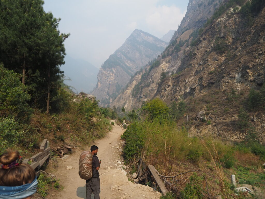
Anyway, it was a nice sunny morning to kick us off. We followed the river near at level for a while, which is unusual. The terrain around us was mostly a rocky forest, which gave some cool Indiana Jones vibes.
The valley around here is a lot more populated than everywhere else we have been. Namrung, our lunch destination, was an original hub of the Manaslu Valley. Its also a lot flatter around the river here, which is better for agriculture. We could not go half an hour without walking by a village, or at least a lone hotel. The villages don’t really take away from the natural appearance of the valley. Being made mostly out of stone, they add a nice aesthetic.
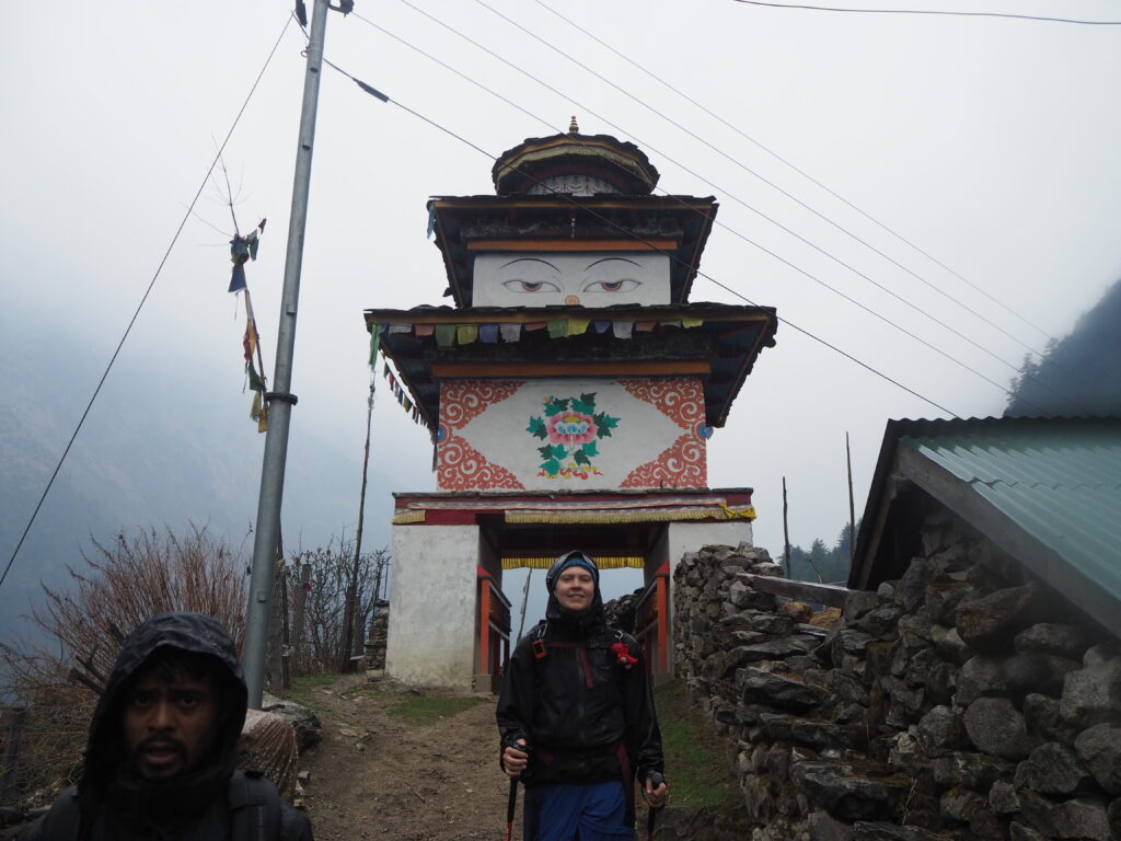
We ran into Julian again, for better or worse on our way to Namrung. He was our friend from earlier in the Tsum Valley, who was having issues with altitude. It was nice to see him again, but he was going the wrong way. The altitude was too much, so he wasn’t sleeping at all. Unfortunately for his adventure, and fortunately for his health, he made the call to head back out the way he came. His new itinerary will have him stop at Sherang Gumba though, so that will be a nice parting treat for him. He left a Neil Gaiman book for us in Namrung as well, completing a book trade we had initiated a week before. That was really sweet of him.
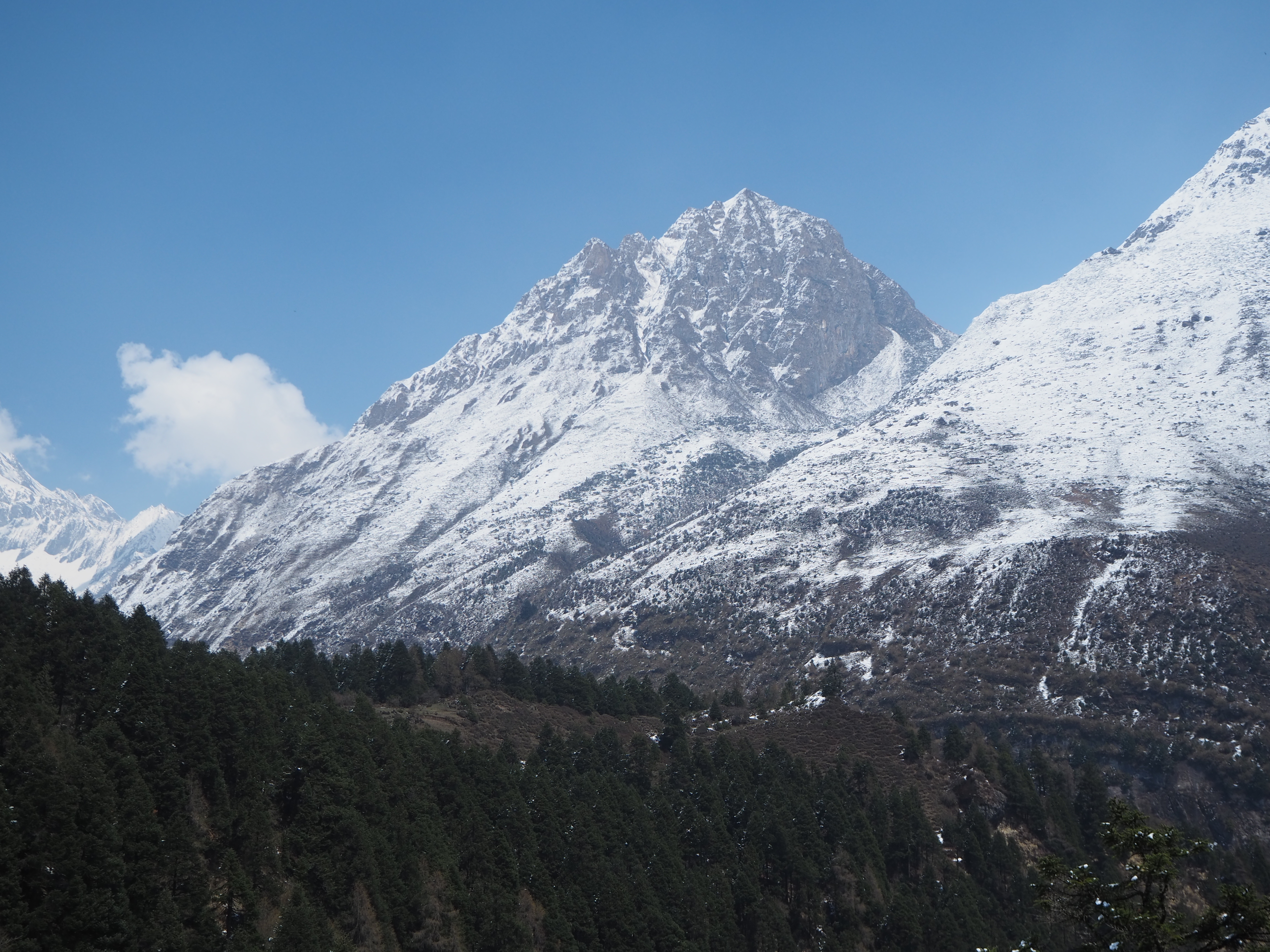
So we said goodbye one final time to Julian, and lumbered on through the jungle, counting down our time to Namrung. Cam was in a bad way, and needed to get there so she could nap and get some food down. For the healthy rest of us, the afternoon walk from Namrung to Lho would have wonderful views of the Manaslu peak, the 8th tallest mountain in the world. One of the main reasons were here.


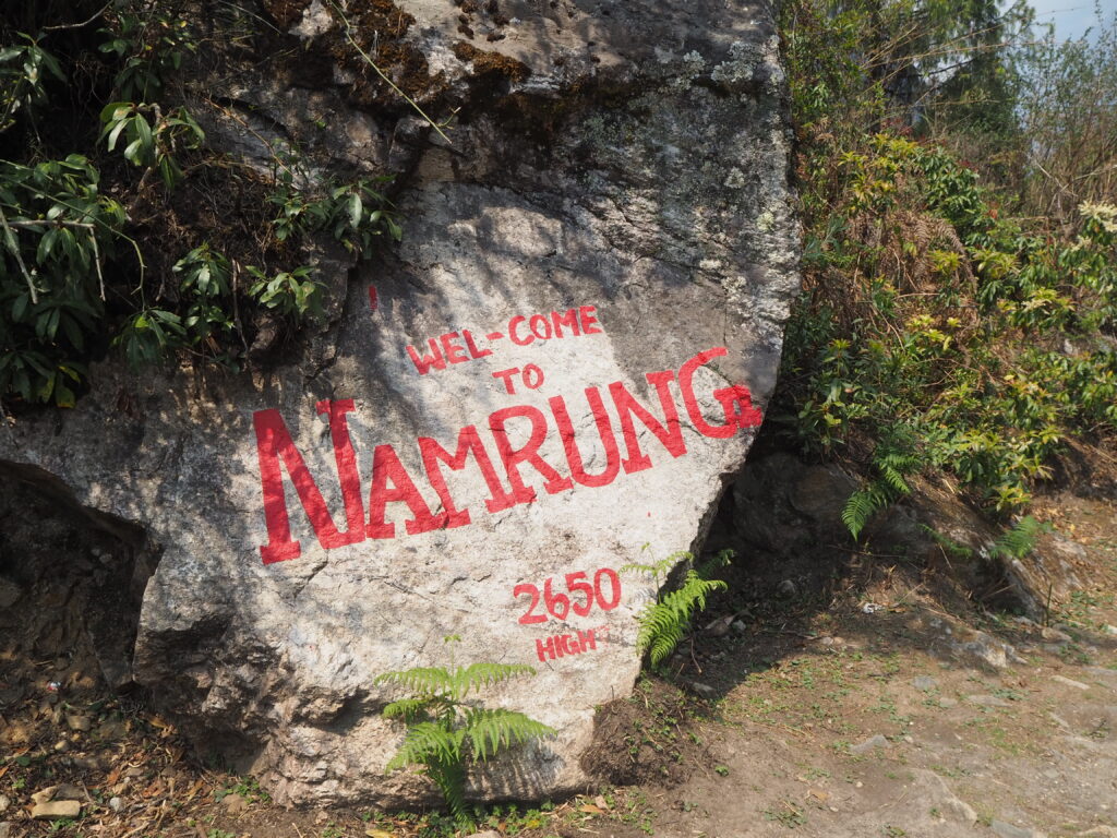

Luch was good. Cam had a rest, not a nap, a noodle soup, and a little carrot cake from a nearby café. That is apparently a potent combination to get a ton of energy back, cause for the afternoon she was fine. Namrung was quite a fancy vibe. There were flat stone paths, carefully levelled. New looking posters on the hotels. A German bakery with saran wrapped pastries to greet you. It looked like the entire entrance to the town had been recently renovated. So it was a step up from the Nile’s and Bihi’s that we have spent previous nights in. And with it being a tourist hub, and main stop on the Manaslu circuit, it had a little more food variety.
The clouds started to come in at lunch, so there were no views of Manaslu. Instead, it rained. Hard. We’ve experienced light Himalayan drizzles before, so we assumed this was the same, and didn’t put our rain pants on (which we had bought specifically for this occasion). It wasn’t. For the next 3.5 hours, we trudged through the rain to Lho. All of the promised views were for naught.
Morale was somewhat low. The temperature plummeted with the rain, and we all arrived cold and soaked. No rain jacked survived the almost four hours of continuous torrent. But we all made it in one piece, changed into dry clothes, and had some hot drinks to warm us up. I had a hot chocolate. It was a blessed cup.
Lho is quite the large city as well. Some down valley clouds cleared, and we could see some of the mountains that we had missed. Not Manaslu, but beautiful still. We spent most of our evening under the blankets trying to get warm. But we hoped, tentatively, that our experience of a rainy evening making a clear morning continues, and Manaslu reveals itself for the first time tomorrow.


Day 15: Lho to Samagaun
Length: 7.91km
Elevation: 620m
Sometimes, when nature calls at 5:30am, it’s a good thing. This was one of those mornings. A clear pre-sunrise sky lay across Lho. Some freshly fallen snow lay as well. There was one spot with sun on it, far in the distance. The twin peaks of Manaslu, the 8th tallest mountain in the world, at 8163m above sea level.

Cam wasn’t feeling good this morning at all. Her stomach felt like a “bubbling witches cauldron.” Hari had some drugs for her that for the most part sorted her out. She didn’t have much for energy for the day.
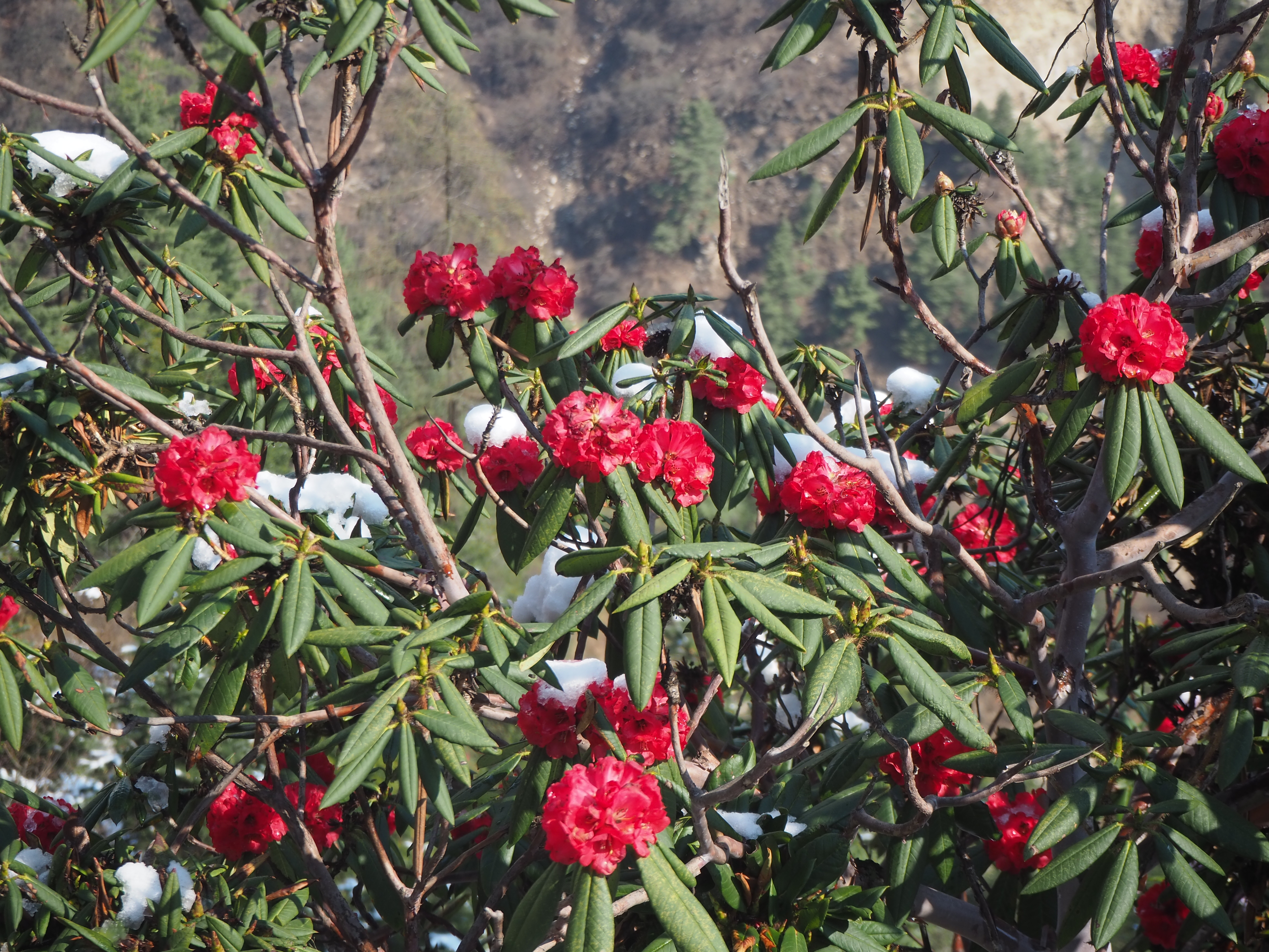
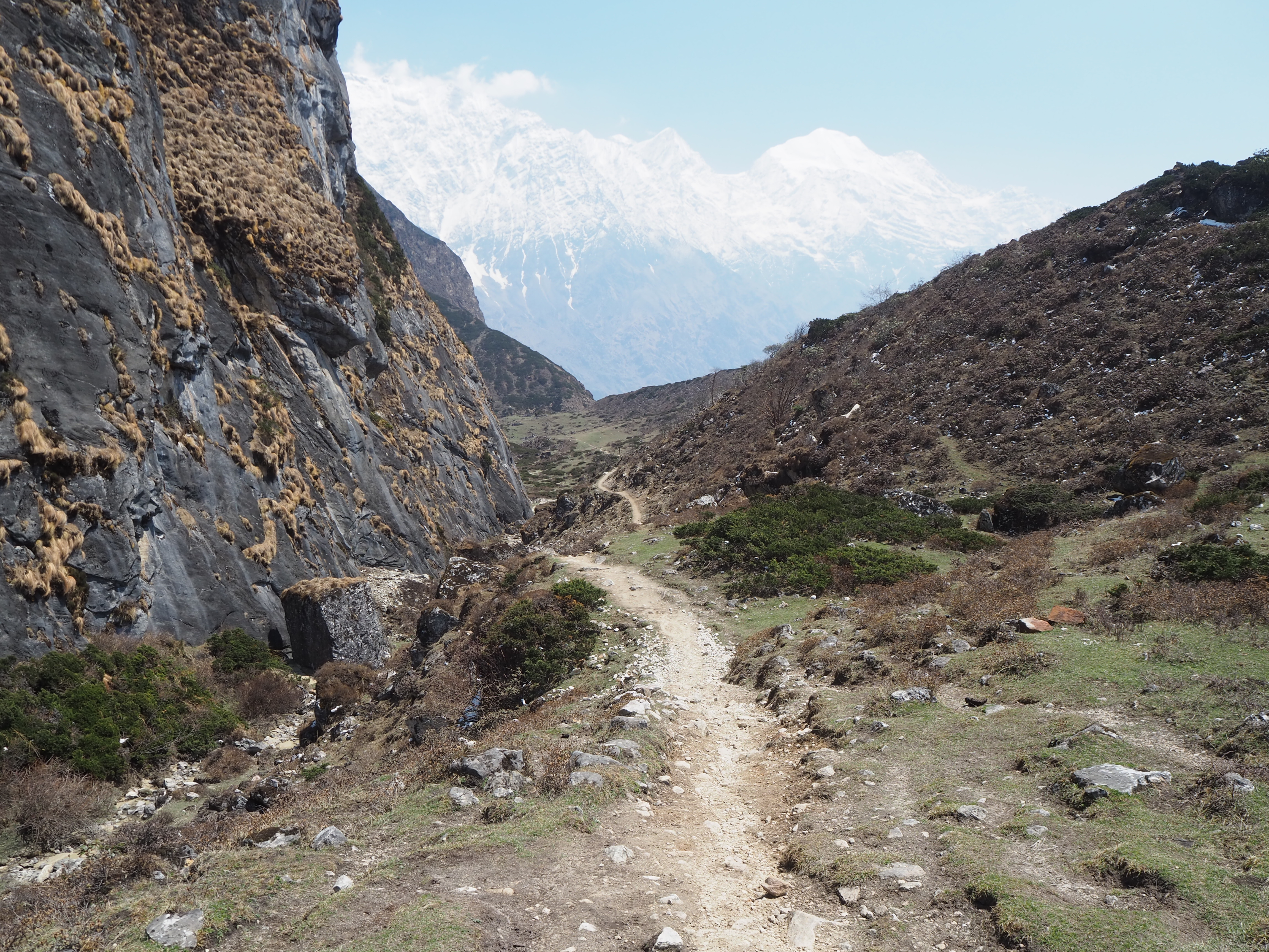
We departed with the sun up, and the entire valley starting to melt. High on the now visible mountains that flank Lho we could see a fresh sheet of snow, curtesy of the storm that we walked through the day before. It was quite serene, and it was clear to us now that we were in the Upper Manaslu Valley, colder, snowier, and much, much more mountainous.


We barely made it 10 minutes down the trail before we heard a dog whine. The source was found quick. A small black dog with steaks of tan stretching from her snout to her paws was above the path on a patch of dirt. She seemed to be in complete distress, whining, and begging for our attention. We initially thought she was hurt. After some initial sniffing and trust exercises, she decided she liked us, came down onto the path, and began to follow.
We didn’t make it far before we came across a standard cable suspension bridge. Scoots, as we would eventually call this dog, did not want to cross. Hari picked her up and carried her over. None of the dogs like the see through, bouncy and windy nature of the bridges. On the other side she immediately looked more comfortable, and bolted down the pack, turning around to make sure we were following.
We then theorized that she was stranded from home. Somewhere along the way, Scoots had made it across the bridge or over the stream, and couldn’t get back. She had a white scarf on, so she clearly wasn’t a stray. But she stayed with us, eventually becoming a short term loyal hiking dog, who would walk beside me step by step.
The scenery the now five of us were journeying on in forested terrain and weather that resembled early Canadian spring. Freshly fallen snow was melting off of pine and spruce trees. Moss covered some rocks and logs on the forest floor. We were following a crystal clear mountain stream, which would have small cascades every hundred metres or so. It was a beautiful scene to walk through.
We learned that Scoots doesn’t like mules. When they come by to pass us on the trail, we step aside, and Scoots would step to the outside of us. There were a lot of mules coming by the other way on the trail, which just gave us more time to hang out with Scoots.
We bumped into the back of a yak herd as well. The yaks were slow, stubborn and naughty creatures. Twice we watched the yaks cross the creek for some grazing, sending their human herders into a frenzy to get back on track. We stayed behind the yaks for most of the walk. Scoots didn’t seem to mind them.
Shyala was the halfway point of the hike today, and Scoots felt very comfortable here. This was as far a Julian made it, as he told us yesterday. Two days of not sleeping was enough for him. There was a steep ascent out of the forest up to a clearing to get to the town. Scoots didn’t mind the ascent, but the yaks sure did. Those rambunctious animals would have rather been doing anything else than climbing up to town, and they often did. But they never bothered us, and we all made it to Shyala in good enough condition.


We deduced this was probably Scoot’s home. She seemed very comfortable here. We said goodbye, and she wandered around town, stopping back to say hi a couple of times while we were taking our break. Scoots was a good dog. A friendly, loyal hiking companion. She must bring the residents of Shyala much joy with her presence, and any other hikers who are lucky enough to have her along as well.


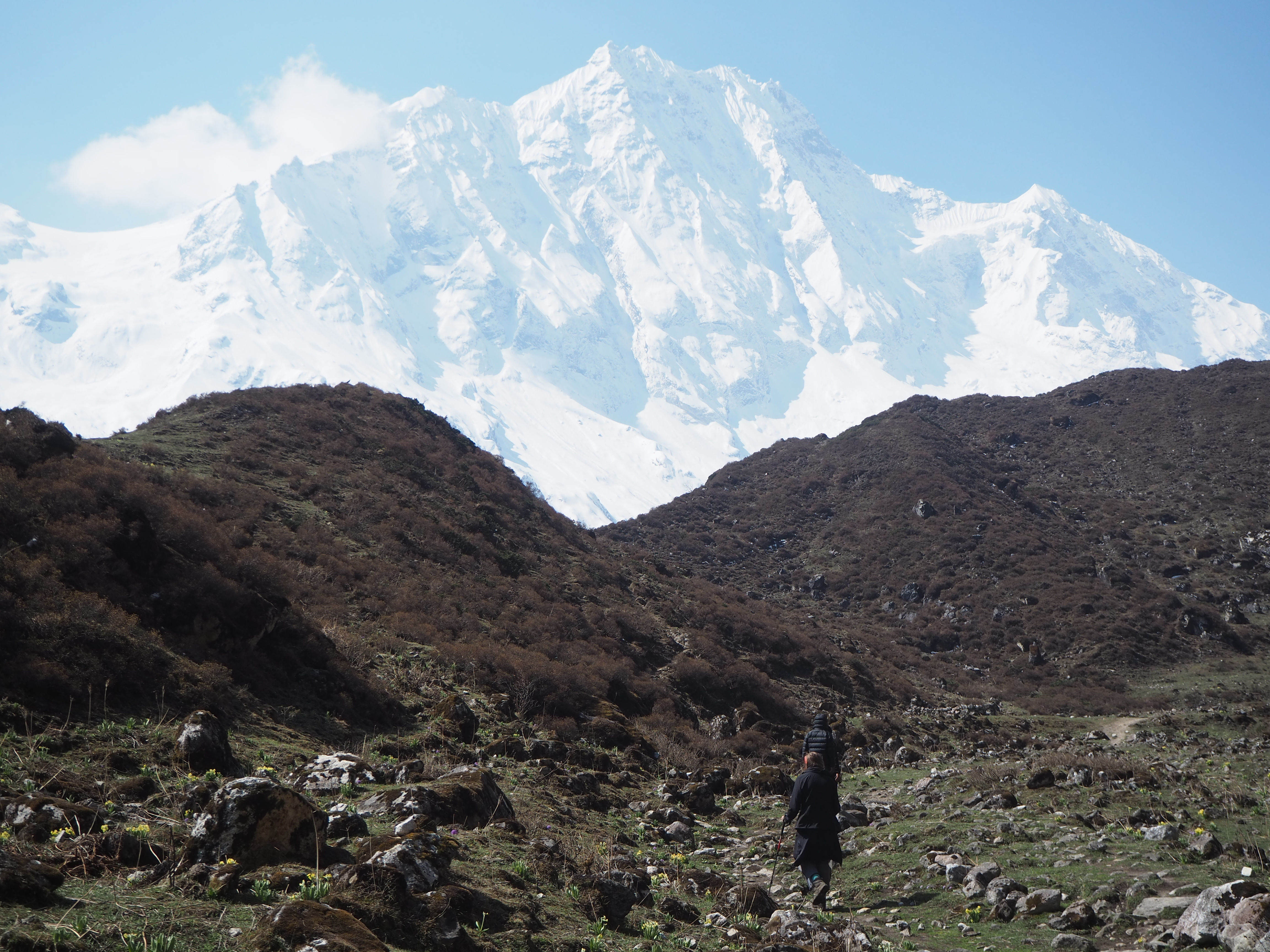
Shyala as a town was gorgeous though. We could see a near 360 degree view of all sorts of mountains. Manaslu’s peak was starting to get covered in clouds, but the rest were free. Nike, Manaslu North, and a whole host of other peaks were all in our viewpoint. And the visibility was crystal clear today, as all the moisture was on the ground in a fresh blanket of snow.


We were in much better spirits today than yesterday’s downpour. Cam’s stomach had settled to a degree. I showed Hari and Shubus how to smack a tree to make it snow on your friends. Shubus got some snow down his back, and Hari retaliated on me for him. Good fun all around. The views along this road to Samagaun cannot be understated. The Himalayas around here were simply sublime. Only photo’s do it justice, and even that is a stretch.
Samagaun lies at the base of a large grassy valley. We walked down from the hills, over the valley to the town. Here horses had jockeys, and were going at full speed. Kids were playing soccer outside of their school. It was a serene wide open and active valley to walk through.
Samagaun itself is quite large. It is the helicopter fly in/ fly out for Manaslu peak mountaineers (none here now, the season is in September – November). They also get supplies flown in, so there is more variety in hotels and restaurants. All the same, we had T momo’s and veg spring rolls for lunch. Cam went down pretty quickly after lunch for a nap.


Dinner was a small struggle for Cam as well. The sight of dal bat was enough to stall her appetite, and her plate of fries and ketchup went unfinished. Thankfully, she slept through the night. The next few days would be shorter, as we climbed higher into the Himalayas. We at least had the foresight to have acclimatization hikes and rest scheduled in.
Day 16: Day trip to an unnamed viewpoint from Samagaun
Length: 10.78km
Elevation: 700m
Hari had explained to us, for today’s day trip, if there is good weather we go to Pungen Gumba (better mountain views). If it was bad weather, we go to Manaslu base camp (nice lake). The weather was surprisingly brilliant, so to Pungen Gumba it is.
Cam could take down her whole peanut butter pancake for breakfast as well, so she felt good enough to come. This was a question mark at the start of the day as well. It was just as feasible she could use the day to rest. But she didn’t get to enjoy the views the day before (too tired), so today was the day to see the sights of the valley.
The trail went down the valley for the first half hour or so, before abruptly turning uphill towards the monastery. In the morning, the baby yaks were out (or nyaks, if they are female) and they were adorable. We watched them switch between grazing and goofing off with high frequency.


Going uphill was still a struggle. We are well into the high 3000m elevation at this point. It was a day hike, so we didn’t bring backpacks or anything. That didn’t stop the ascension from being difficult on our exhausted bodies. The uphill was parallel to a glacier stream. You can tell which streams are from a large glacier tongue, as they have a massive streambed, and are very dirty.
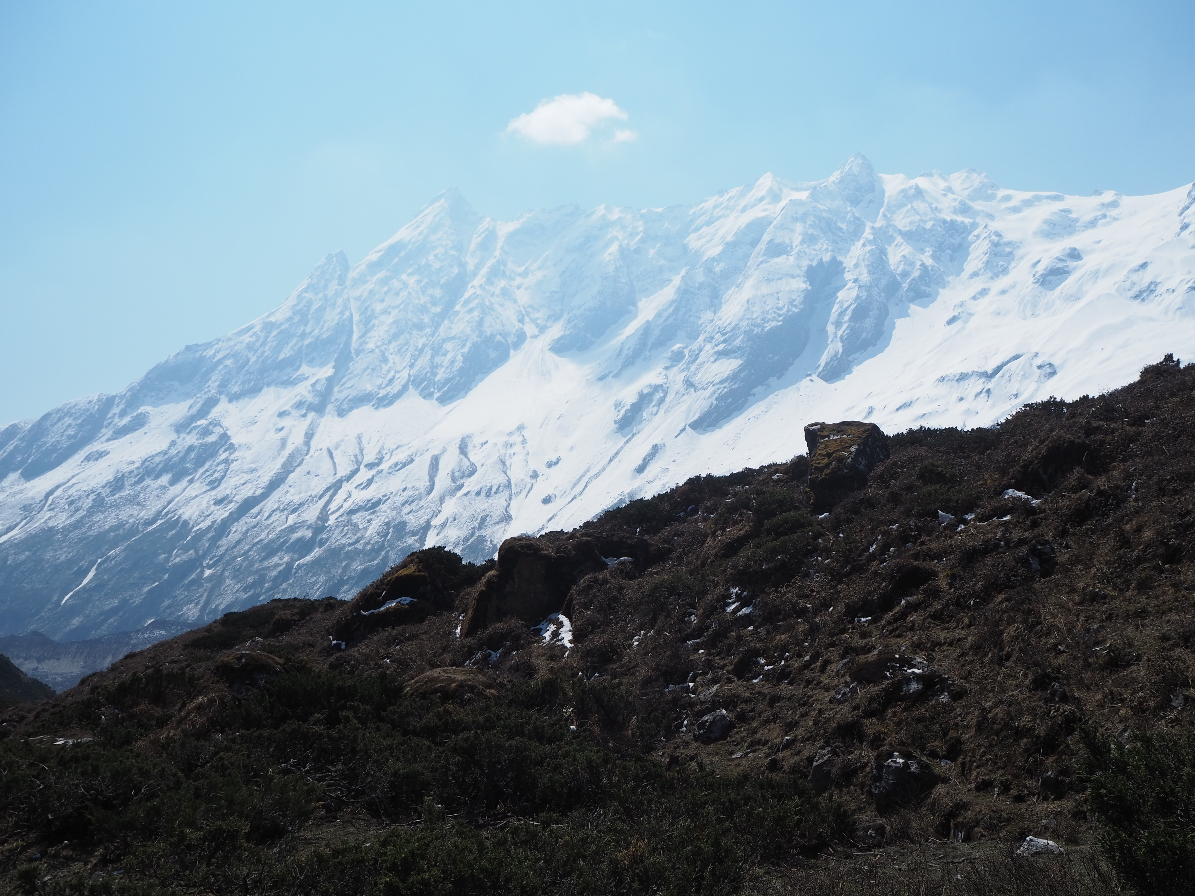
As we got higher, more mountains came into view. The glacial stream disappeared into a glacier. Manaslu and its two peaks dominated the frontier. To our right were some sharp cliffs above us, and to our left was a glacial coulee hill, backed by a full range of mountains. The path came into a grassy valley, with grazing yaks and juniper bushes dominating the ground. Very similar to the Ganesh Himal valley we had explored over a week prior. Shubus and I quickly bolted to the top of the small hill, only to discover there was another glacial hill beyond. Then the glacier.
We walked along the top of the ridge, taking in the mountains and the glacier all at once. Cam and Hari followed the main path towards the monastery.
Hari then veered off the path, to meet up with Shubus and I. He stopped at a fairly open patch of grass with incredible views of every possible mountain around, and declared this our turn around point. We hung out for half an hour or so, taking in the near cloudless behemoths around us. Manaslu and its twin peaks towering over us.
Manaslu mountain as recently as 2022, had confusion to which of its two peaks was the tallest, and the true summit of the mountain. People before then had been inadvertently summiting at the slightly lower peak, which was easier to get to. To our eyes on the ground it seemed obvious which of the two was taller, and a drone shot confirmed the trickier peak as actually taller. Now, mountaineers have to get to the small peak, then traverse the ridge to truly ‘summit’ Manaslu.
There was a promise of poor afternoon weather (that never came), so we headed back down to Samagaun, having never actually seen the Pungen Gumba. Not that we needed to. If we enjoyed our day, it’s a day well spent. And we had enjoyed our morning hike.
We came back to town around 12:30 or so, and a stream of other trekkers from Shyala, Lho and beyond were streaming in. This was the first time we could see how busy the Manaslu circuit actually was. For the last two weeks we have been on our special itinerary, staying in the smaller towns that were other’s lunch spots, a half day separated from the rest. But now we were fully on the standard trail, and would be until the end of the trek.
The afternoon was spent reading. Cam tackled more of the Dalai Lama’s book The Art of Happiness in the Troubled World, while I crushed JP Delaney’s The Perfect Wife, which was a surprisingly good psychological thriller. We played cards, before retiring for the evening. We are still very exhausted.


Another easy day tomorrow to Samdo, our second last stop before the pass, and the end of Manaslu valley.