
Simultaneously the best and worst thing we have ever done. The highest high’s and the lowest lows on our trip were mere hours apart.
Huyana Potosi is the 5th tallest mountain in Bolivia, rising an impressive 6,088m above sea level, and 2500m above the city of La Paz. In the mountaineering world, it is regarded as one of the easier 6000m summits in the world. It advertises itself as the easiest, but Chachani in Arequipa is consensus easier according to internet people and locals who have done both. With that said, Huyana Potosi is not easy.
The first recorded Huyana Potosi summit attempt was in 1877 by six German climbers. All lost their lives. The first recorded summit was in 1919 by Germans Dienst and Lhose (first names have been lost to time), who pioneered the route that we took to the top. I wasn’t able to find any news on any more deaths or the safety of the mountain apart form those first six, but it wouldn’t surprise me if there were more before, especially before the tourism infrastructure was put in place.
The standard itinerary for a non-mountaineering tourist to accomplish the mountain is a 3 day, 2 night adventure. As non-mountaineering tourists (Mountaineering and trekking, like we did for Huayhuash and Salkantay, are not the same. Mountaineering strictly deals with maneuvering over ice and glaciers, trekking does not. There is special equipment, risks, and safety precaution’s for mountaineering) we decided to go with the 3 day, 2 night adventure. We went with the same tour company that we did Pico Austria with, as they seemed fine.
The adventure started before we got to the mountain. We arrived at the tour office at 8:30, and were escorted to a neighboring agency. This is nothing new, at low tourist seasons like this, tour agencies amalgamate their sales to a group together. We got set up with our equipment (really warm clothing, crampons, ice axe, etc.), and met our guide, Santos. We then took a walk to the car, and at some point, Santos disappeared.
We never got an explanation as to where Santos went for the 20 minutes he was gone. But he arrived to our car like nothing was wrong, and our driver started the 2 hour car ride to the base camp of Huayna Potosi.
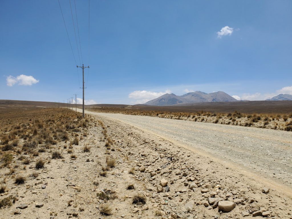
About an hour into the drive, we turned off onto a gravel road. Our driver was hauling it down the road (I guess we were running late due to Santos), and ended up getting a flat tire on the way. Easy fix for him, he’s done this before. After the short delay, we made our way to the base camp without further interruption.
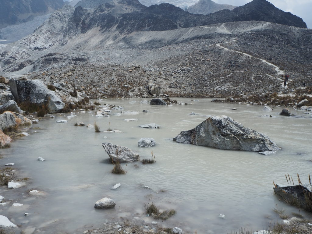
The valley towards the base camp was very clearly full of mining. Large orange-reddish lakes sprawled across the landscapes. Many industrial buildings were in the area. Bolivia has a lot of minerals within its mountains, especially lithium. Lithium is one of the main ingredients in lithium-ion batteries, which is a key tool in fighting climate change. As a result, China has invested heavily in Bolivia minerals and mining for their electric car future. Bolivians as a populous seem very excited about the economic prospects that lithium mining will bring the country.
Huyana Potosi
8.9km
1300m elevation
6,088m summit
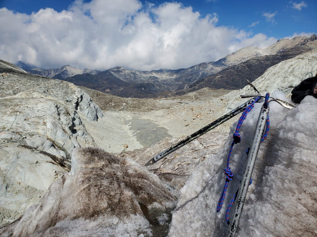
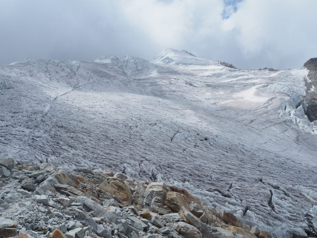
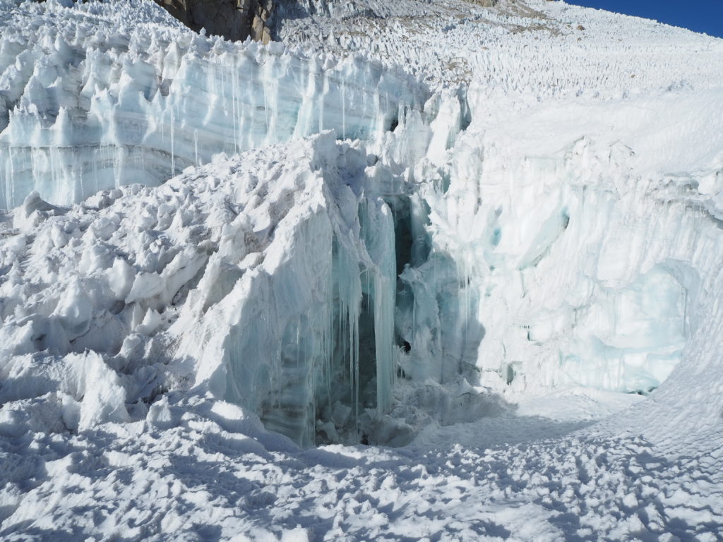
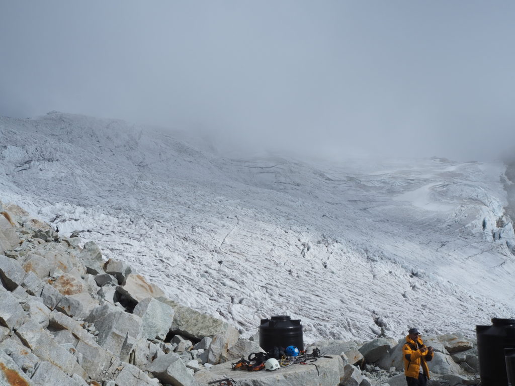
Base camp was pretty chill. We had an easy lunch, packed our day packs, and headed up the mountain for our Day 0 activity, mountaineering training. The first thing we noticed, other than the peak of Huyana Potosi (which turns out isn’t the peak), was the large elephant foot glacier much lower down. This would be our playground for training. It was melting really really quickly, and as a result, there was a dodgy water crossing via a small concrete barrier over a crashing waterfall.
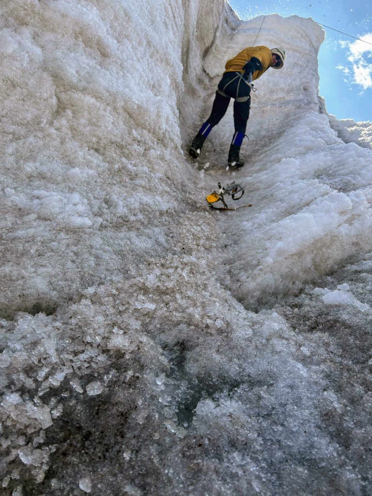
We worked with Santos up the glacier, practicing maneuvering on the ice. If the ice is mostly flat, walk how you want. If its somewhat steep, walk up pigeon toes. Steeper still, step over step sideways. And if its extra steep (45° or more), you smash your toes into the ice and use the little crampon prongs attached to you. Ice picks also become very handy when you smash them in the ice. The three of us are also tied together with rope, in case one of us falls, we don’t slide off the mountain or down a crevasse.
Our training ended with our first ever ice climbing experience. I scaled halfway up the wall, then I lost a crampon. That’s as far as I got. Cam made it all the way to the top, coming down exhausted. The idea of melting ice was questionable to us, and I don’t think we will ice climb for a good while again.
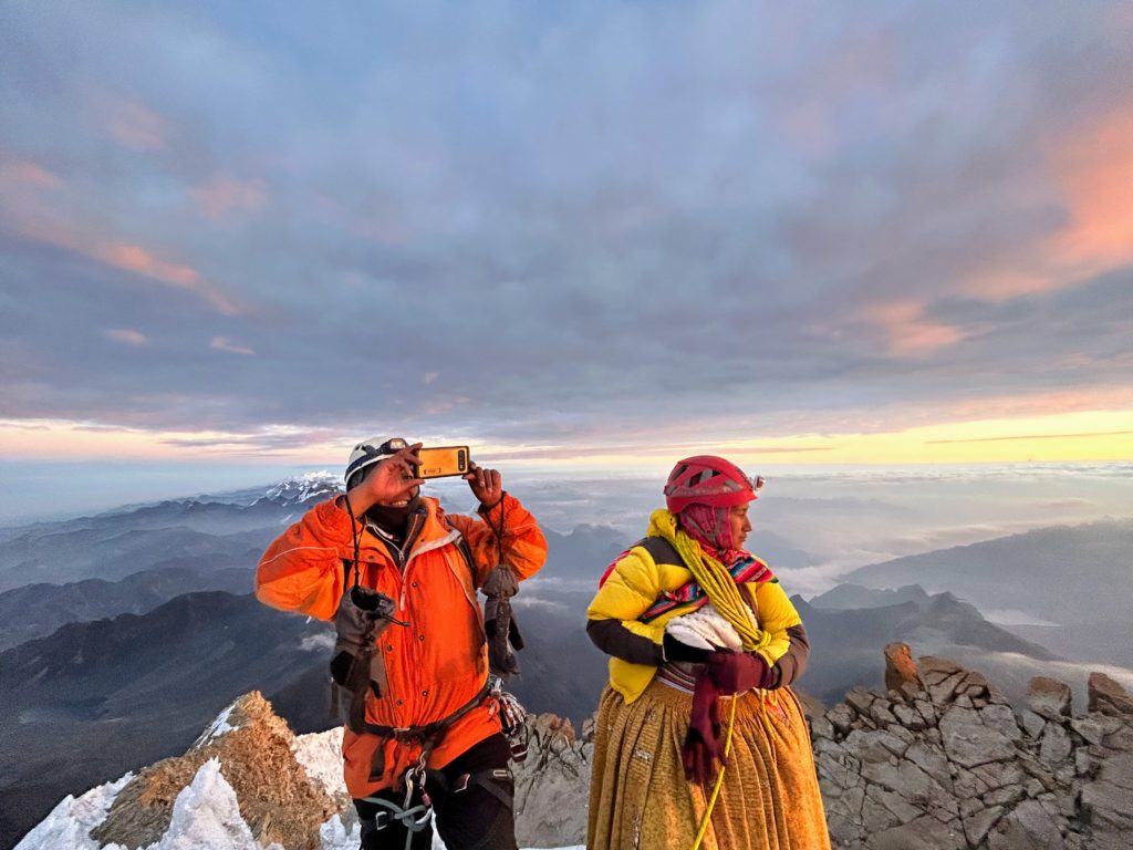
We met the other guides, one of which as named Yulia. She (yes she, only one we saw), was dressed in her full Cholita outfit, with crampons underneath. In fact, the entire climb, she would be in her big poofy dress, and brightly coloured tops. She also didn’t use a backpack, instead using the fabric sacks that they sew themselves, tied together around her collarbone. Yulia is a beast. She’s scaled Everest in this outfit, and she was off to Chile for a near 7000m ascent the next day.
We had dinner, and met the rest of our tour group. There were two Belgian friends, Matijas and Ian, and three solo climbers, Manon, Johannes and Scott from France, Denmark and Australia respectively. We chatted throughout the evening, before retiring to our respective mattresses on the floor in the loft for the night.
Day 1
2.76km
474m
1h, 28min
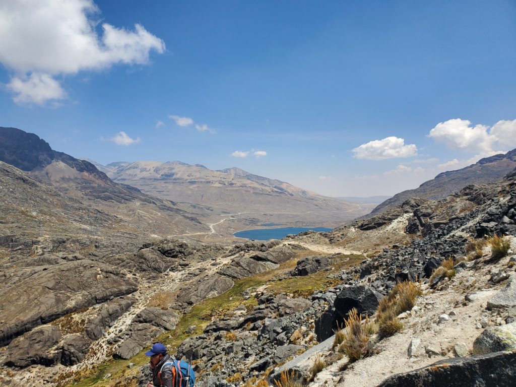
Day 1 (if you count training as Day 0), was a fairly easy hike to the high camp. The extra day for practice and mountaineering felt unnecessary in the moment, but is much needed acclimatization for the summit push. The raging stream from yesterday was a dribble now, making a much easier cross. What followed was a steep ascent to the camp at 5280m. Cam and I, alongside the Belgian dudes, seemed to have no problem with the hike. We were rather annoyed at how slow the group was going. But the other three were puffing heavy due to the altitude.
We encountered the Jabberwockies for the first time this day. The Jabberwockies (a name we gave them) were all of the climbers attempting the mountain that signed up with the Jawilki (Jakiwi, Jakiki? we don’t know) tour group. There were at least 25 of them on the same schedule as us, though they had their own lodging and system. They all had their same warm green clothing, and hiked fairly in unison. We were quite happy that we were essentially independent for this hike. That many people move very slowly.
We had our dinner, and tried to fall asleep as early as possible. We had a midnight wake up the next morning, to push for the summit.
Day 2
6.14km
827m elevation
6,088m summit
7h, 22min
Rise and shine. Or in Cam’s case, shine. She didn’t sleep. I got maybe an hour. We’ve developed a pattern of having painful stomachs when we have poor sleeps. So there was no appetite to eat anything in the middle of the night. We had some tea, got ourselves dressed, and began our journey to the top around 1:15am.
Santos led the charge, Cam in the middle, and I in the back. Nothing was visible except for the 30-50 feet in whatever direction you were looking from the headlamps. We were moving at a glacially slow pace for ourselves over the icy landscape. Every once in a while we would have to step over a small crevasse. Ice caves along ice walls were a common occurrence, but we didn’t have the energy or oxygen to care. Breaks were frequent, and steps were small. The only thing in our heads were the 1,2,3,4 counts of our steps.
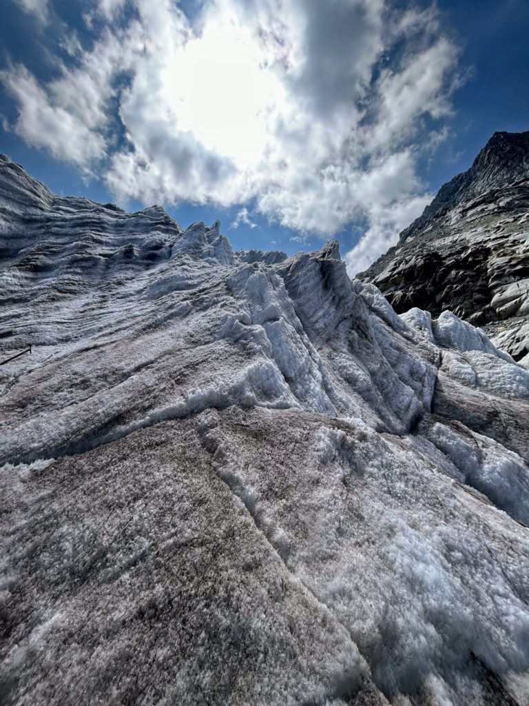
The path isn’t easy either. It was rarely flat, instead each step had to be carefully placed on the uneven landscape. The topography was as if the entire glacier were small foot-wide steep moguls sloping upwards. There were some flat sections in-between, but they were the exception rather than the rule. The path would sometimes narrow along a small ridge, with 3-4 foot drops on either side.
You climb at night for safety reasons. When the sun is out, the ice melts. This creates instability in the glacier, meaning crevasses can collapse, or avalanches become more frequent. The sun is also very harsh over 5000m. You burn easily, and the harsh rays sap your energy quickly. On our decent, the instability in the ice was noticeable, and it increased the difficulty significantly.
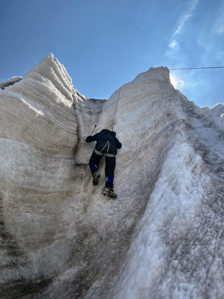
Our first sighting of Jabberwocky headlamps came around 3am. We had been hiking for a little under 2 hours, and the light seemed to ascend vertically above us. This section was why we brought the ice pick (also emergencies). It was a near 80° incline. A rope was dangling off the side of an intimidating face. Santos went up first, one hand on the rope, the other on his ice pick wedged in the ice. We smashed our toes in the ice as we ascended the 5-6m cliff. We then went horizontally (still a steep incline) across it, again with bolted rope assistance, until we ascended out of the steep into a flat reprieve.
The flat lasted for an hour or so. We were slowly gaining on the headlamps ahead of us. The stars started to appear as well, though with La Paz so close, we could not see the milky way. Our Belgian friends stopped by to say hi. It appeared they were handling the ascent better than us.
Throughout the whole ascent, we were short of breath. At no point did we feel anywhere close to 100%. Walking on ice at high altitudes is not only physically demanding, due to the lack of oxygen, but mentally as well, as any misplaced step could result in a fall and an injury, and its not exactly easy to rescue someone from up here. You move at a snails pace but your heart is beating at 200bpm and you can’t catch your breath. It is really scary and you stop often to try to slow your heart rate. But somewhere above us was a fantastic view, as promised by the successors from the day before. That promise is all you need to keep going.
It was at this flat section that we first saw some people turning around. Some of the Jabberwockies didn’t have what it took to make it to the top. Fair play. This is hard. We estimate from talking to various folks who also attempted Huyana Potosi that 60-65% of those who attempt this mountain actually make it to the top. The rest turn around for one reason or another during their summit attempt.
After the flat section, we had fully caught up the majority of the Jabberwockies. The faint glow of the peak was illuminated by the lights of La Paz and the start of the sunrise. By this time we had collectively failed to eat an apple twice. We needed some victories. And this was one of them. We were now at the promised awful last 200m, and we were going to make it.
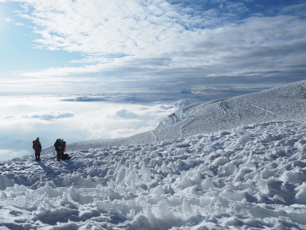
We passed many resting Jabberwockies in the first part of the final push. Some were being physically pulled up the mountain by their guides via their attached rope. In this short section, we must have passed 10 or so groups. We estimate there were 25-30 groups of 2+1 on the mountain trying to summit that evening. As we reached the end of the ice, there were maybe 6-7 groups ahead of us. The end of the ice is not the end of the climb. It’s time for the rocky scramble.
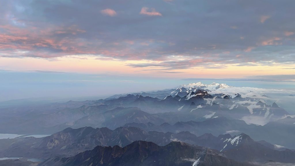
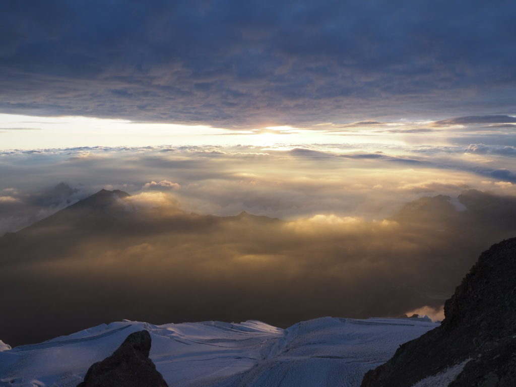
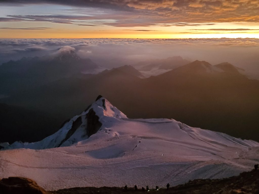
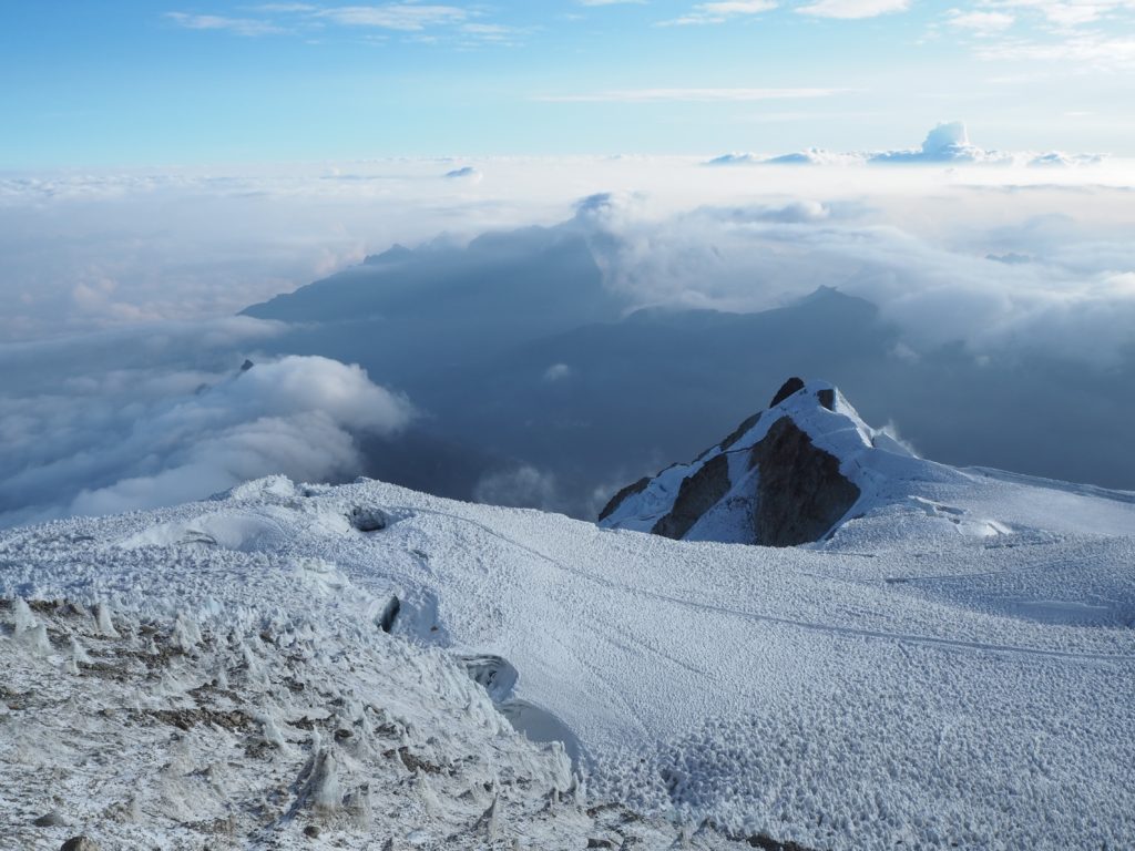
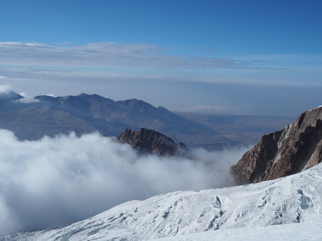
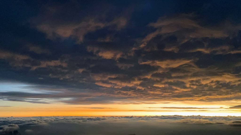
The sun started to rise from its slumber. Though el sol wasn’t visible yet, the landscape to our north was. A thick layer of clouds blanketed the shorter mountains. Some nearby peaks rose above to say high. The sky was a brilliant mix of greys and maroons. We took it all in as Santos took off our crampons, and we then began the rock section of the ascent.
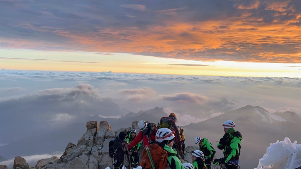
At home, we are rock climbers. The rock was so much more comfortable to us than the ice. It gave us much needed extra confidence to finish the climb. We could also see the first successors looking elated at the top. We moved quickly through the rocks. There was no obvious path, and steep drops below us. I became kind of manic moving over the rocks. I usually sprint to the top when I near a peak, but as I’m attached to people, all that energy went to my head.
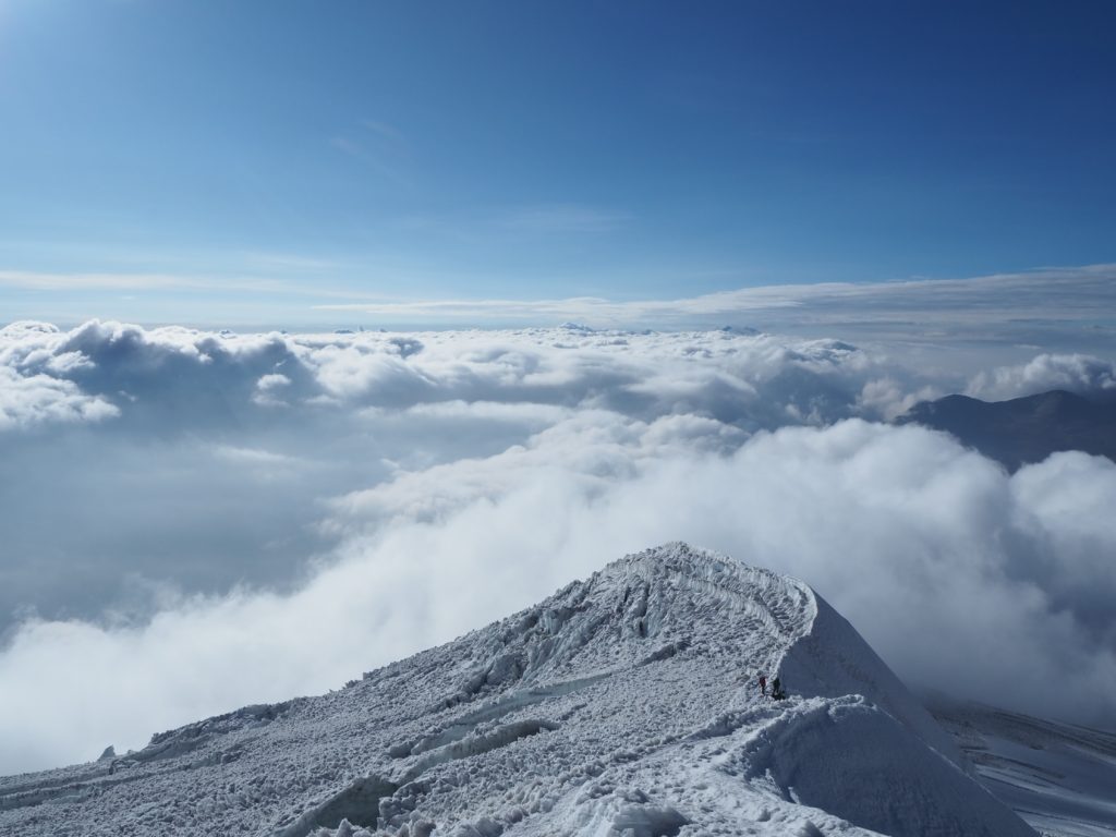
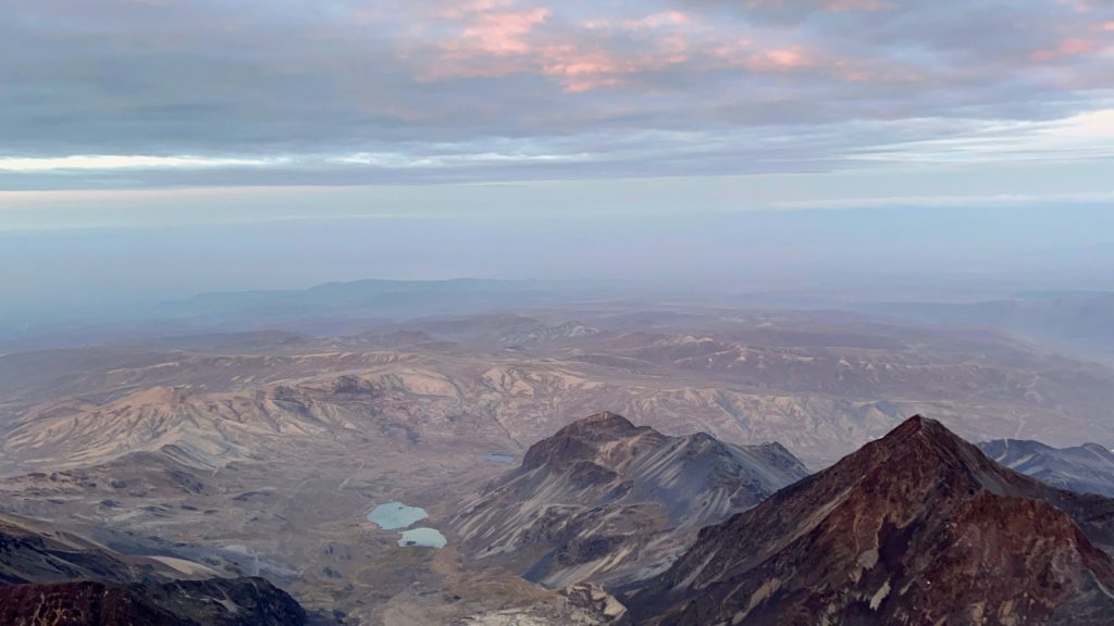
Our crampons went back on for the last 20m of elevation. It was a shallow path following beside an ice ridge. The view over the ridge was great. No clouds. A desolate rolling hill landscape, ending with the lights of La Paz. The sun had fully appeared a this point. The sky filled with yellows. And we made it to the top.
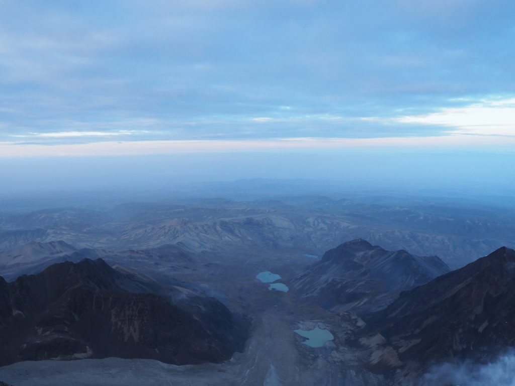
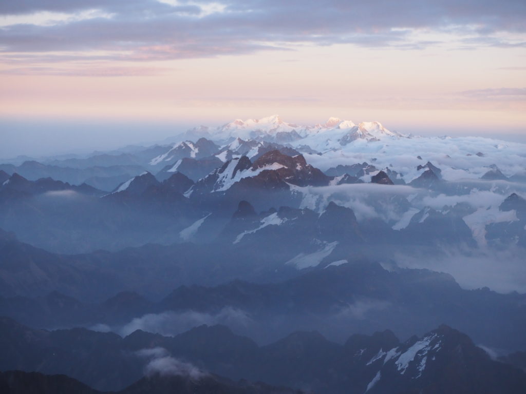
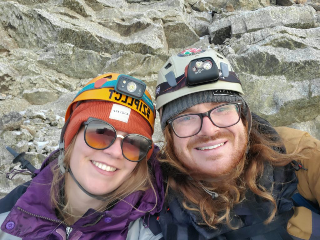
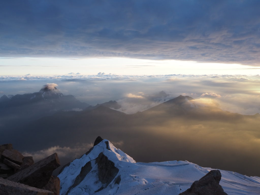
Both of us were emotional. We cried at the summit. Santos had fun with it. But this was an accomplishment for us. We weren’t supposed to be here, 6,088m above the world. Hiking is only a recent hobby for us. But here we are at the top of the world. Beautiful views for every direction around us. The glacier that we ascended. The next door mountain range. A field of clouds over the horizon. The faint industry of La Paz. We were here. We did it.
At no point in my life, and for Cam this is true as well, did I ever think I would do anything like this. Would I ever ascend 6000m on my own two feet. And sure, there was a guide. But it was our feet that got us there. We didn’t get pulled up the mountain. We passed everyone else. Not only did we do it, but we did it well. Really well.
After the joy of the top, reality sets in, and you realize you have to go back. A peak isn’t exactly a great place for a cup of tea and a nap. So after 15 minutes or so, we started our way back down. We ran into Manon and Johannes, who informed us that Scott had to turn back. I guess he’s afraid of heights, and the first crevasse had him on hands and knees uncontrollably shaking. We could also witness the struggles of other climbers. Most we passed still heading up were being pulled up by their guides. Many backpacks were abandoned on the glacier, as climbers opted to shed the weight.
We could also finally witness the absurdity of our path to the top. These crevasses were way bigger than we could see at night. These ice walls were way taller than we thought. The caves deeper. We could hear running water as well through parts of the descent. That was unnerving. We wanted off of the glacier, so as much as we could, we booked it.
For at least a straight hour, I led step by step down the mountain, passing even more groups. We were hellbent on getting back to rocks. Our brains were not working effectively, and had they been, the idea of pacing ourselves may have been considered. Proper exhaustion started to set in. Our feet began to knock into each other. Eventually, I gave up, and sat down for a break. The end wasn’t coming. We needed a new plan. We needed to get our breath.
One scary moment occurred on the decent. It’s easy to step up over a crevasse, but on the way down, you had to jump. I went for a jump, and got my feet tangled in the rope behind me. I fell on all fours safely on the other side of the crevasse, but this was a wake-up call. We couldn’t just mindlessly stumble down the mountain. Whatever brain power we had left, we needed to use to safely get down the mountain.
I frequently lost the path as well. It’s not exactly obvious, we were just following the crampon prints of the ascenders. Every minute or so, I would hear “left!” or “right!” from Santos, carefully watching so that I didn’t stumble into a hole. We had also descended into the clouds, so we couldn’t see very far. We didn’t know where the end was. We couldn’t see our hut.
The 20-30 minutes post stumble and pre finish were brutal. Our bodies had no energy. Our minds had no energy. The path was a complicated system of small ridges and valleys we had to carefully step down. It looked like there was no end in sight. We would frequently check the GPS, seeing that we had barely moved since the last time. But finally, breaking through the fog was the nicest hotel either of us had ever seen. Our tin shack, the high camp. There was the end of our journey. We got off the glacier, got our crampons off, and basically sprinted the 50m to the camp. We arrived to the front, and collapsed for near an hour.


The Belgians were only 15 minutes or so behind us. They were equally as exhausted as us. We watched as more climbers slowly descended off of the mountain. Scott explained his height phobia to us, and as we explained the climb to him, he looked equally relieved he didn’t do the climb, and terrified that we did.
We had soup for breakfast, and rested for another 20 minutes or so. We then packed, and our trio headed down the mountain again to the base camp. This took an hour and a bit, and by the end, there were no thoughts between either of us. We were as exhausted as we have ever been on the trip. We felt as weak as our sicknesses in Baños, Ecuador, but this time, we were carrying 20lb of equipment on our backs.
Once again, we collapsed outside of a camp. We saw the next set of Jabberwockies preparing for their ascent. We met a few other hikers who signed up with smaller tours and talked to them. They were already throwing up from altitude sickness. Bless their hearts. The Belgians came down, and eventually Johannes and Manon did as well. They made it back to high camp 9 hours after they departed, and looked like hell. We all chatted about the experience, and then our driver picked us up, and we went back to La Paz.
Conclusion
Mountaineering isn’t for us. Once is enough for that nonsense. The view at the top was incredible, but as I’m writing this three days later, I’m still not sure it was worth it. Our bodies are totally mangled now, were having troubles with the steps of La Paz. We’re completely exhausted, our appetites are strangely lacking, and our bowels are not our friend’s. Every moment on the glacier, apart from the very top, neither of us were happy to be there.
This is one of those things that feels like a fever dream. If I didn’t have the photographs, you could probably convince me I was never near that mountain. Its given us a lot of opinions on mountaineering now. The majority of people on Huyana Potosi with us that night should not have been on the mountain. We were the only one’s we met who did an acclimatization hike. We felt like we were just barely capable of safely being on that mountain, and we were both easily top-10 climbers that night.
It was absurd. It was insane. It was brilliant. It was terrible. It was Huyana Potosi. Please appreciate the photos below.


WOW!
I need a frame TV to have those pictures in the house as works of art!
Be proud of yourselves, a tremendous accomplishment. Many try, few succeed, a memory for a lifetime. Well done, great photos.
What a crazy adventure. Yulia is the real thing. So grateful you made it up and back down safely. Your photographs are wonderful. Hope your bellies settle down.
Unbelievable. Incredible documentation of your experience and photos are breathtaking.
xoxo
Mom
I got tears in my eyes for you! Hope you have no more treacherous climbs ahead of you, and I think not. How many actually made it to the top? Pray you get well rested up and eager to carry on. You still look good – mostly!
We estimate maybe 60% of those who attempted it got to the top. Which would be 25-30 tourists the night we did it. Of course, all of the guides make it up as well no problem. It was our guide’s 45th summit of the peak
Incredible journey. Thanks for sharing your thoughts and your feelings and your pictures! Awesome all of them. Hope you get some good recovery time too. Love you guys.
PS I do read all your blog posts. Some of them twice.