
8 days. 7 nights. 10 hikers. 1 guide. 1 Chiki. 12 donkeys in the Peruvian Mountains.
The Huayhuash ( pronounced “why wash”) trek is routinely rated as one of the most beautiful and rewarding multi day treks in the world. While we were planning the Peruvian part of the trip, this trek became a cornerstone and we should plan everything else around it. We really wanted to do it, and we are glad we did.
When we got to Huaraz, our first task was to find a tour to complete this trek. It can be done independently, but we decided against that. There’s a lot of weight to carry, and we don’t have a lot of experience trekking the Andes. We looked at a couple travel agencies to find a group to join. However, the various travel agencies were offering tours for $900USD/person and were 10-12 days. That was too expensive and too long.
Fortunately, our hostel, Krusty, was offering an 8 day tour for $600/person, leaving Wednesday or Thursday (we arrived on a Sunday). This was near perfect. We acclimatized to the +4000m altitudes that we would be living in through two day hikes (see the Churup and Laguna 69 hikes).
So on Tuesday, we got back from the Laguna 69 hike and check with the front desk for when we are leaving for Huayhuash. 4:00am tomorrow morning. Great. We have 10 hours to get ready.
We immediately run down the street to find some dinner. Two blocks away was a great restaurant that had burgers and pizza. Crushed dinner, and packed our camping gear for the next 8 days. We tried to go to bed but were both so anxious about missing the bus so sleep didn’t come well.
Huayhuash Circuit
94.2km, 5540m elevation gain
8 days
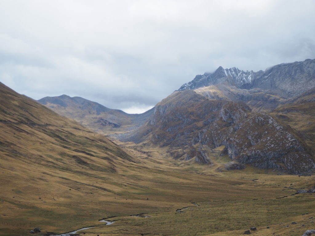
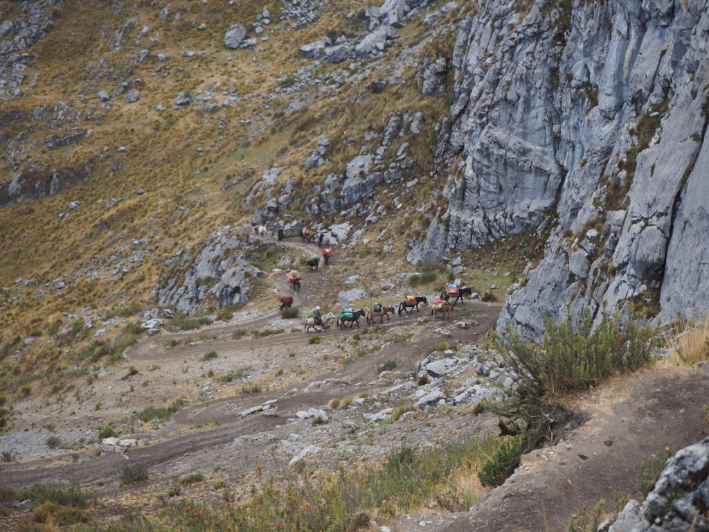
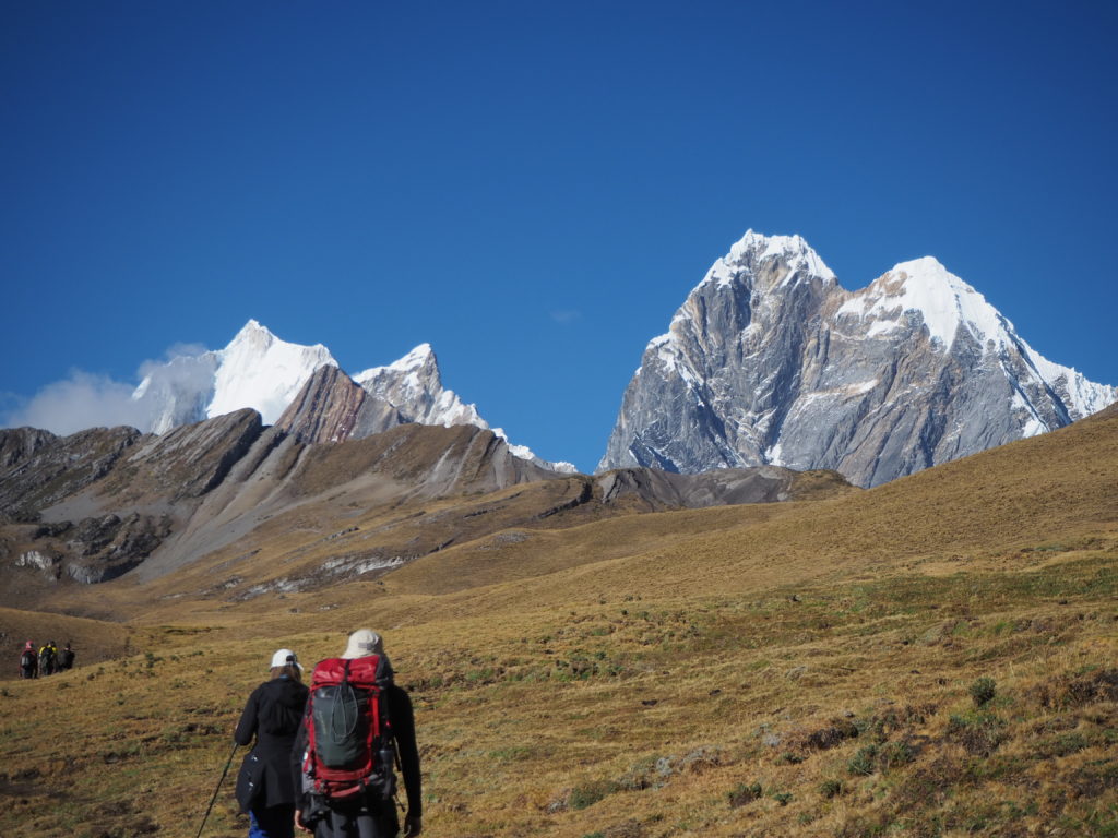
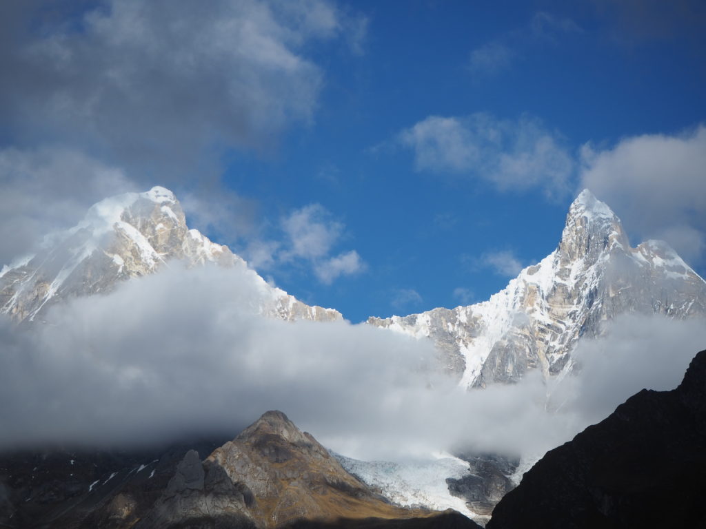
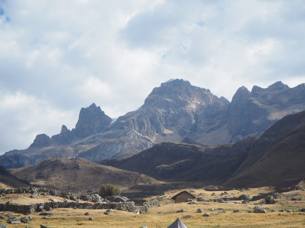
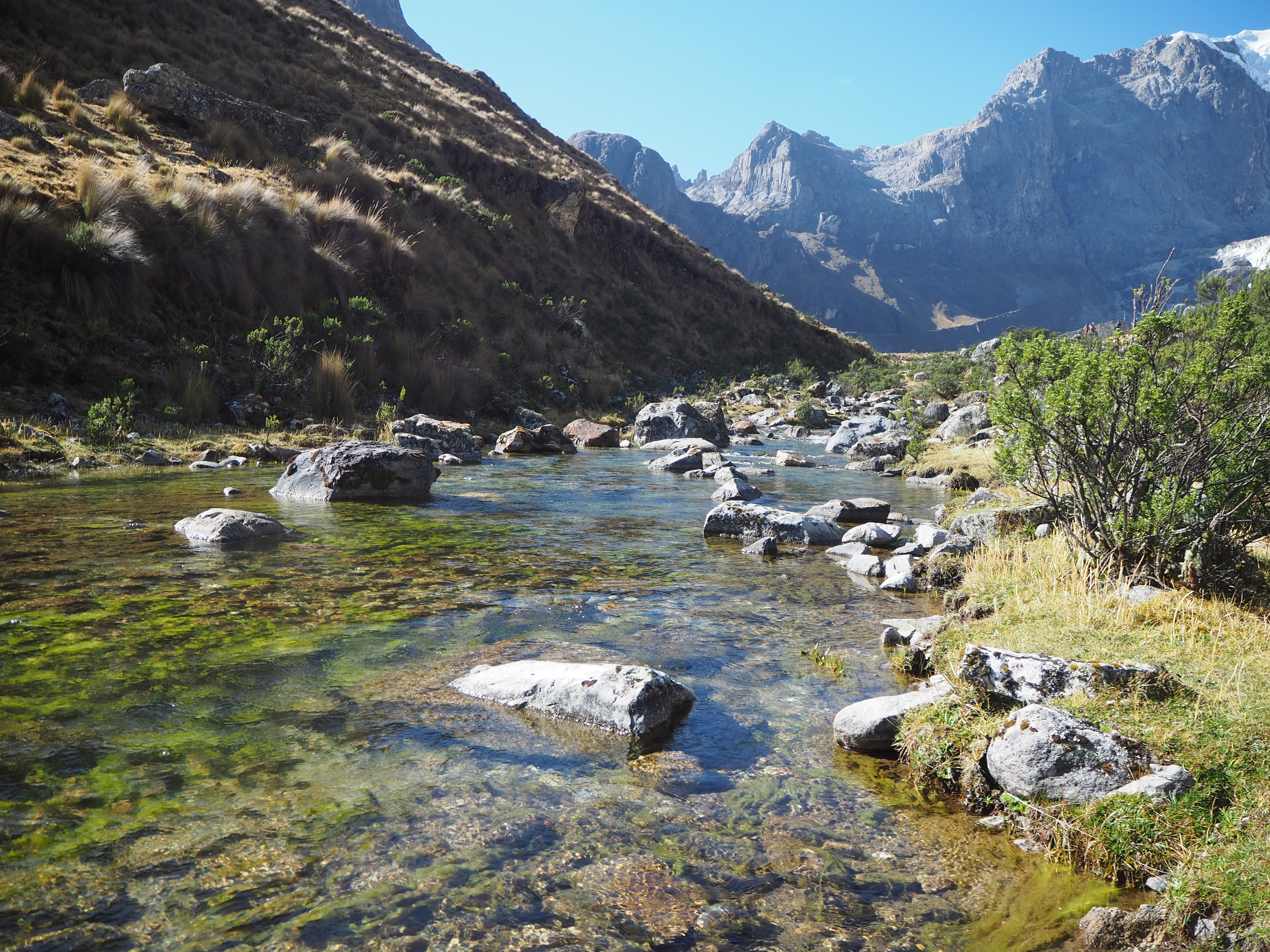
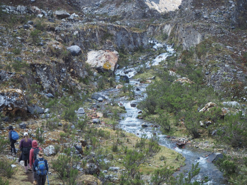
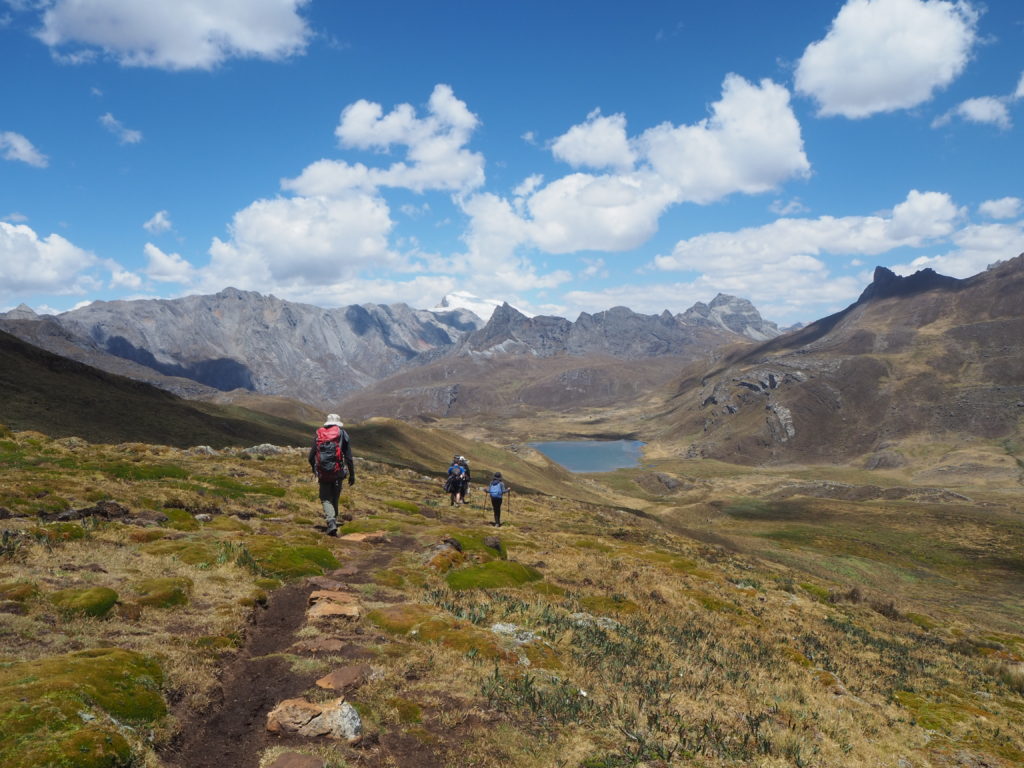
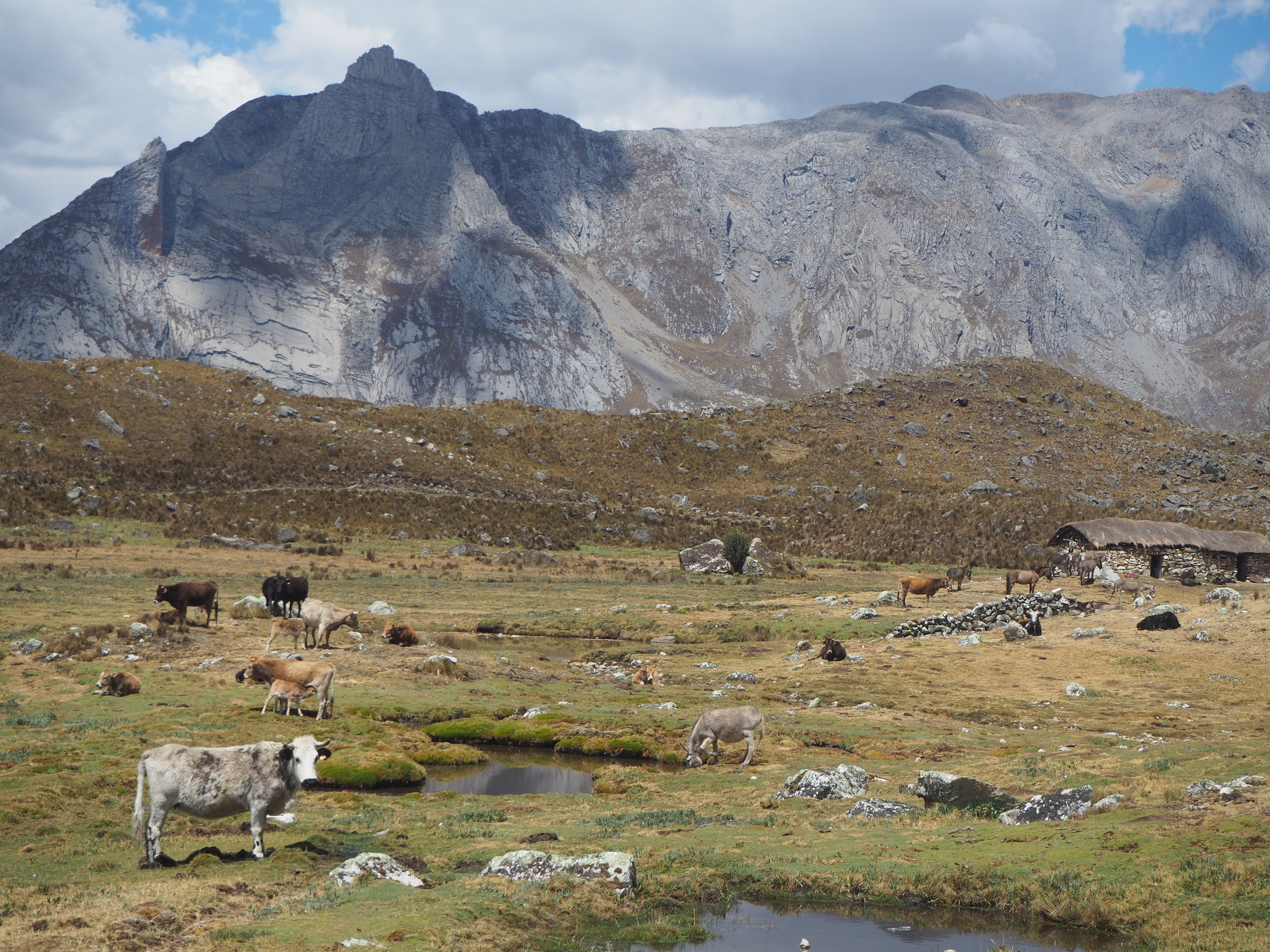
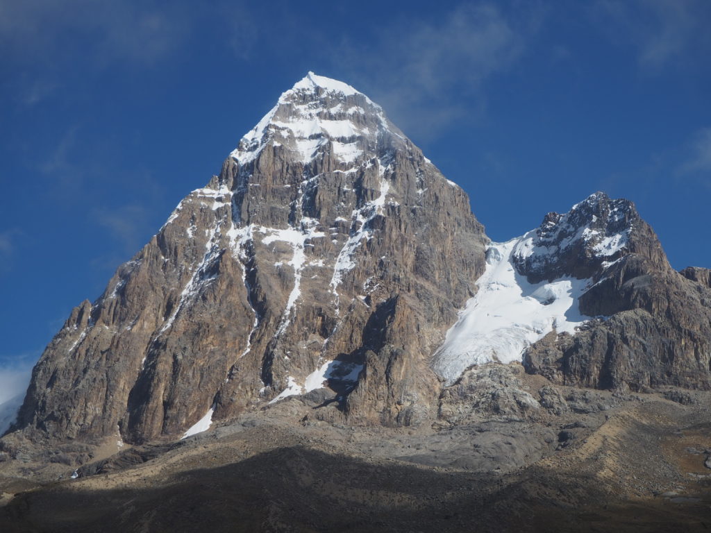
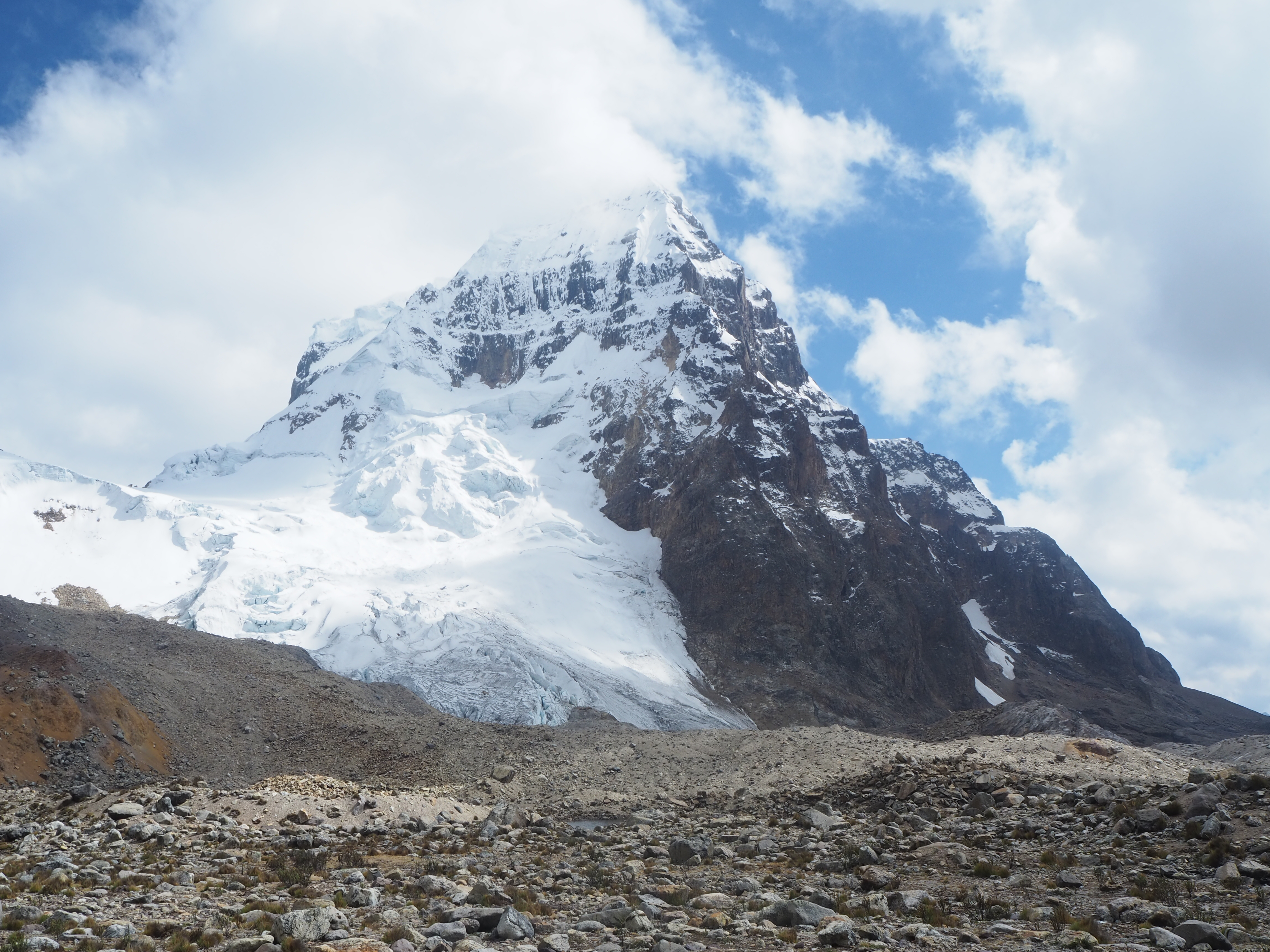
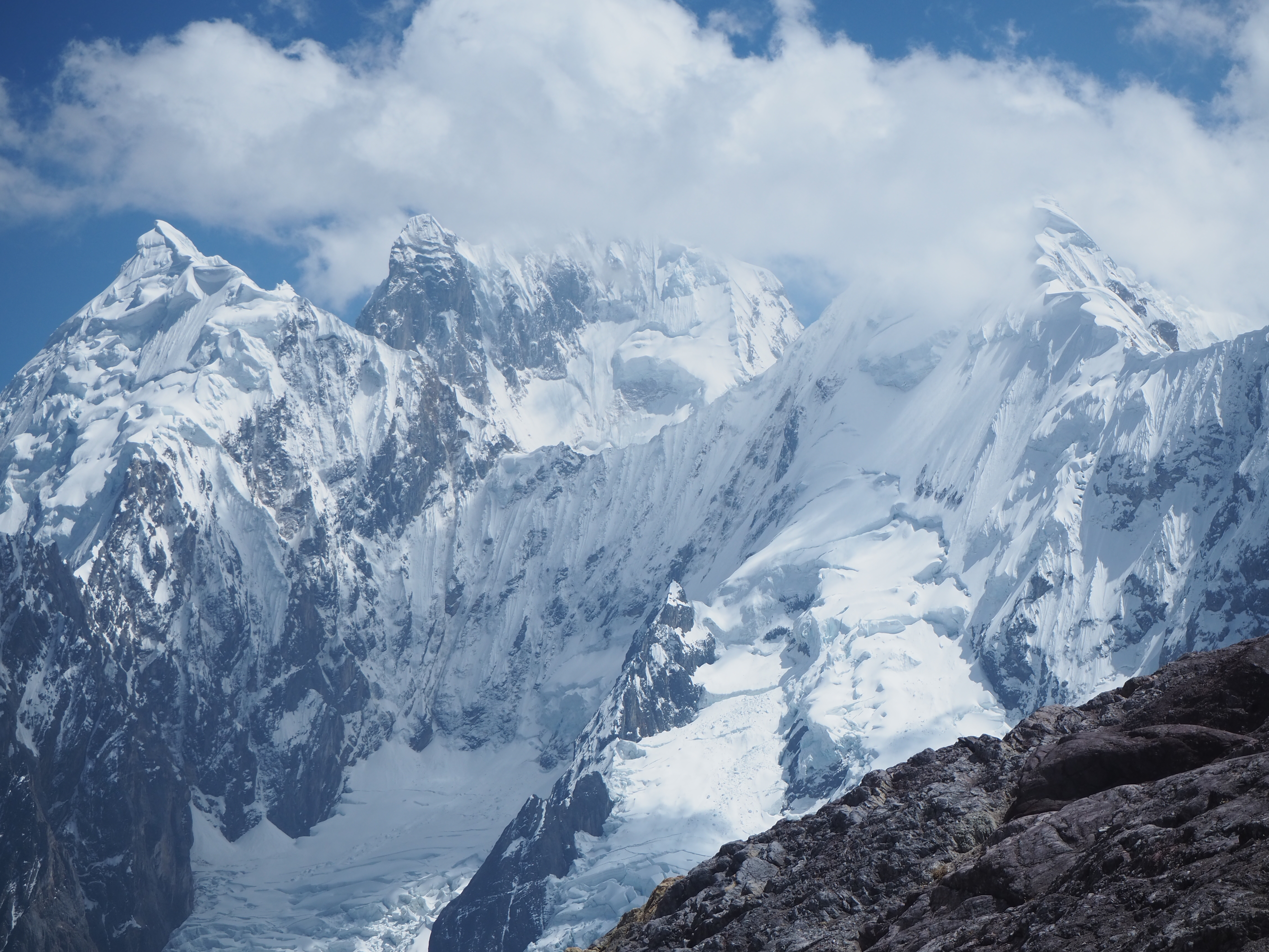
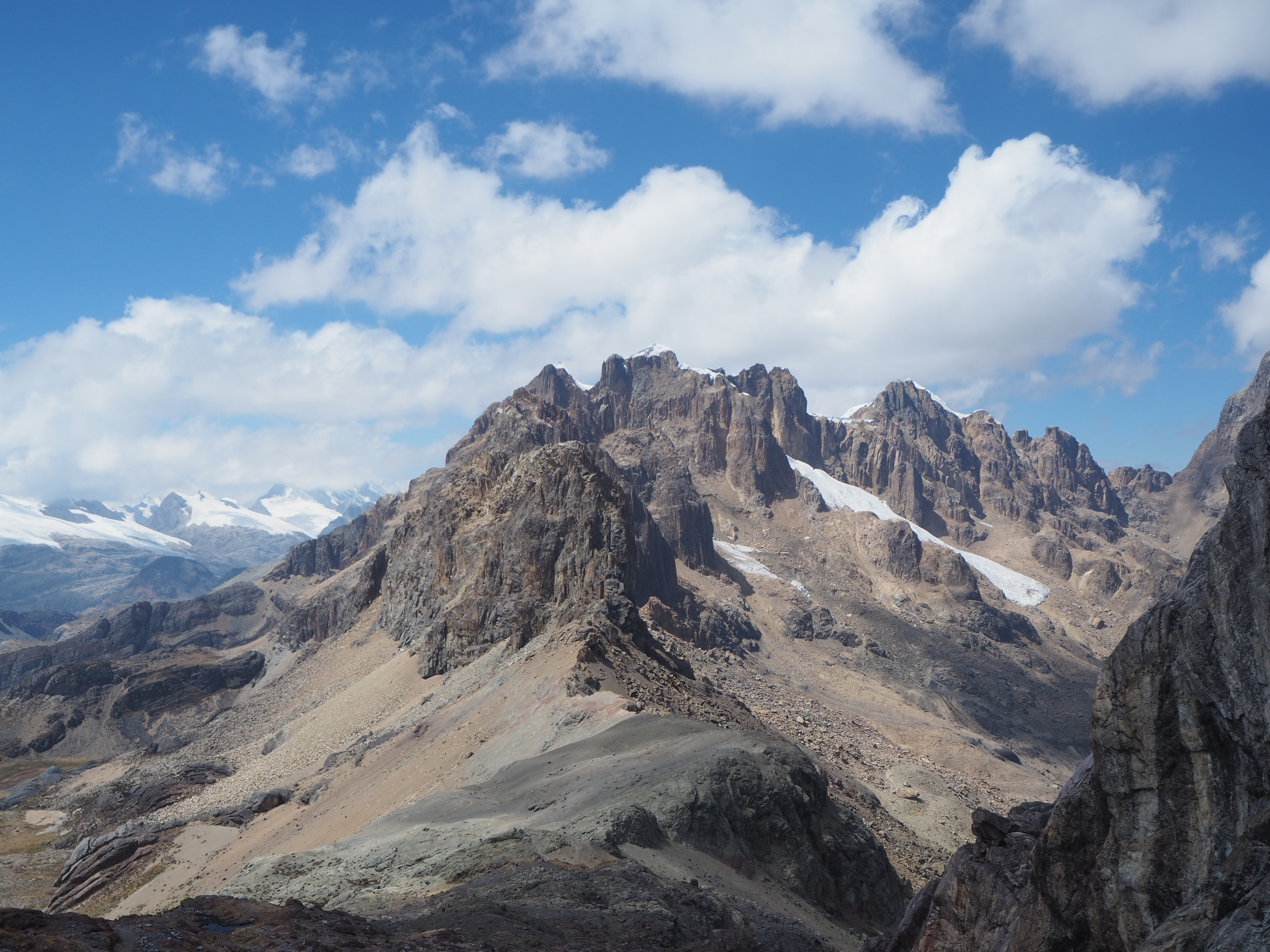
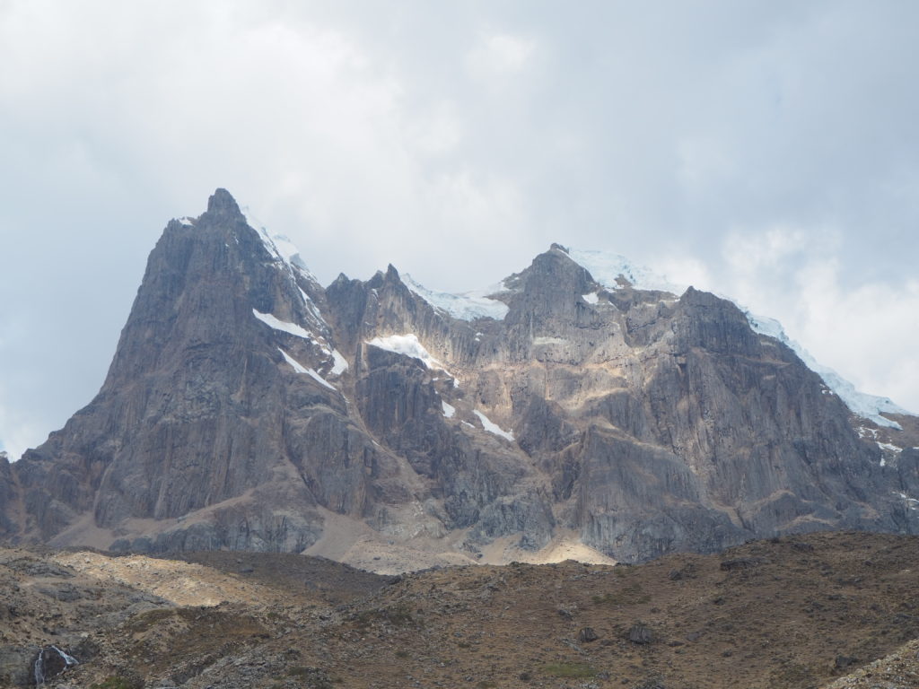
The Huayhuash circuit is a famous 8-12 day hike around the Cordillera Huayhuash mountain range in northern Peru, a subset of the Andes. The peaks of these mountains reach over 6300m into the sky. They are always covered in snow and glaciers, and it is that water that gives life to the area around it. The land is sparsely populated with a few small villages, and nearby farms. There are many cattle scattered throughout the various valleys in the region. Sheep herders will move through the region as well, with flocks in the hundreds. The trails we walk on are the only roads for locals, which are only maneuverable through foot or horseback.
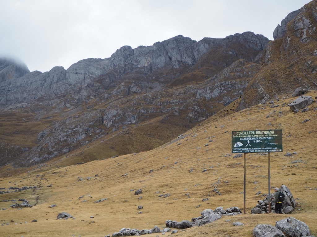
Huayhuash is generally done through a local guide with a tour, though it can be done independent. We saw a few solo hikers on our trek. They start and end out of the village of Llamac and head in a clockwise direction around the mountains. We started a little bit further down the road, and ended in the village of Pocpa.
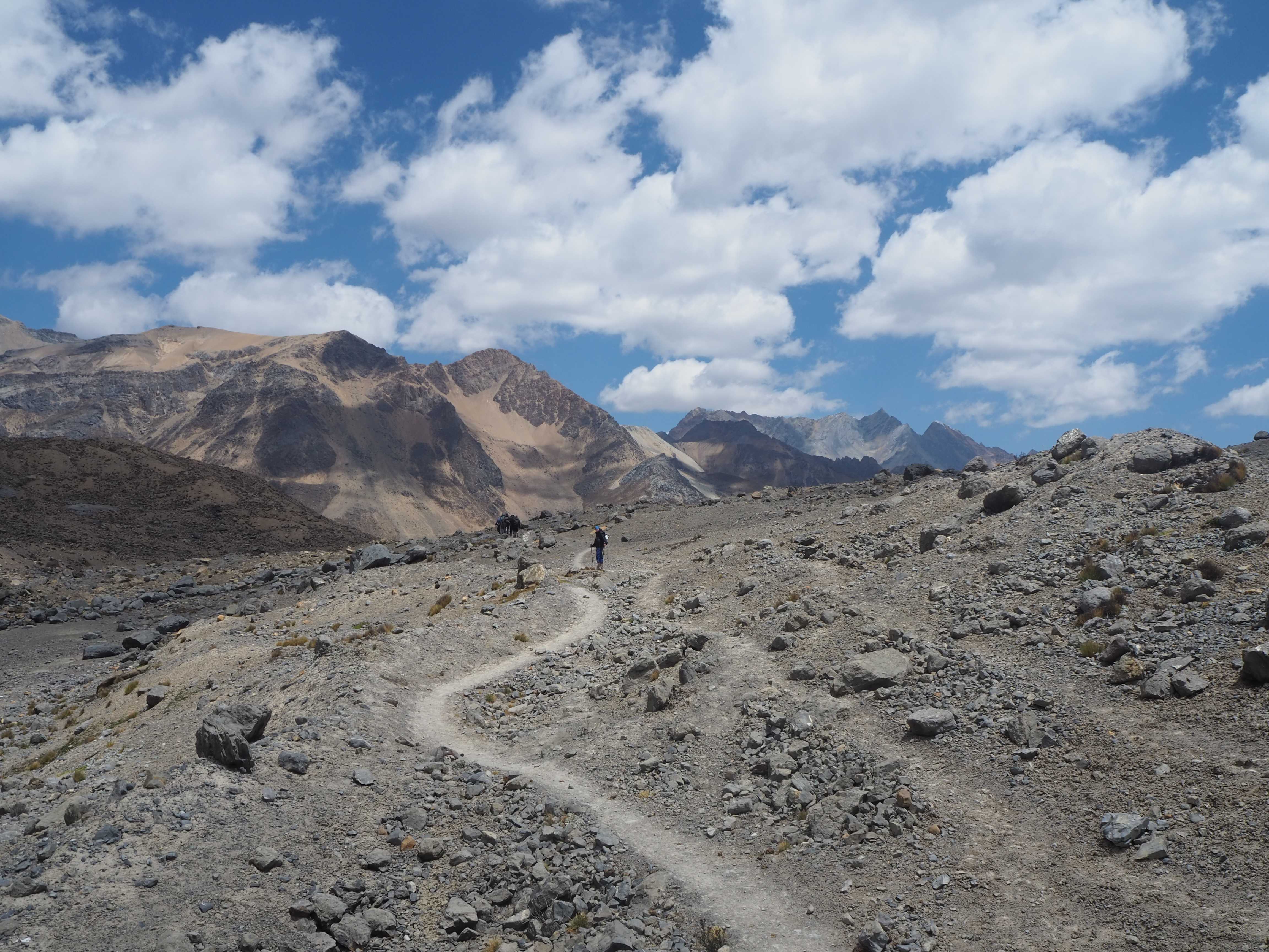
The hike is challenging. The elevation of camps vary between 4000m and 4600m above sea level, each a flat patch of grassland along a lagoon or stream. Every night it dipped below freezing. The loop walks clockwise around the mountain peaks, with each day providing a new mountain pass to overcome, as we move from valley to valley. The scenery is incredible. The hike is incredibly hard, and incredibly rewarding.
Day 1
8.4km, 543m elevation, 3:41
Starting Altitude: 4160m
Highest Altitude: 4675m
Camp Altitude: 4235m
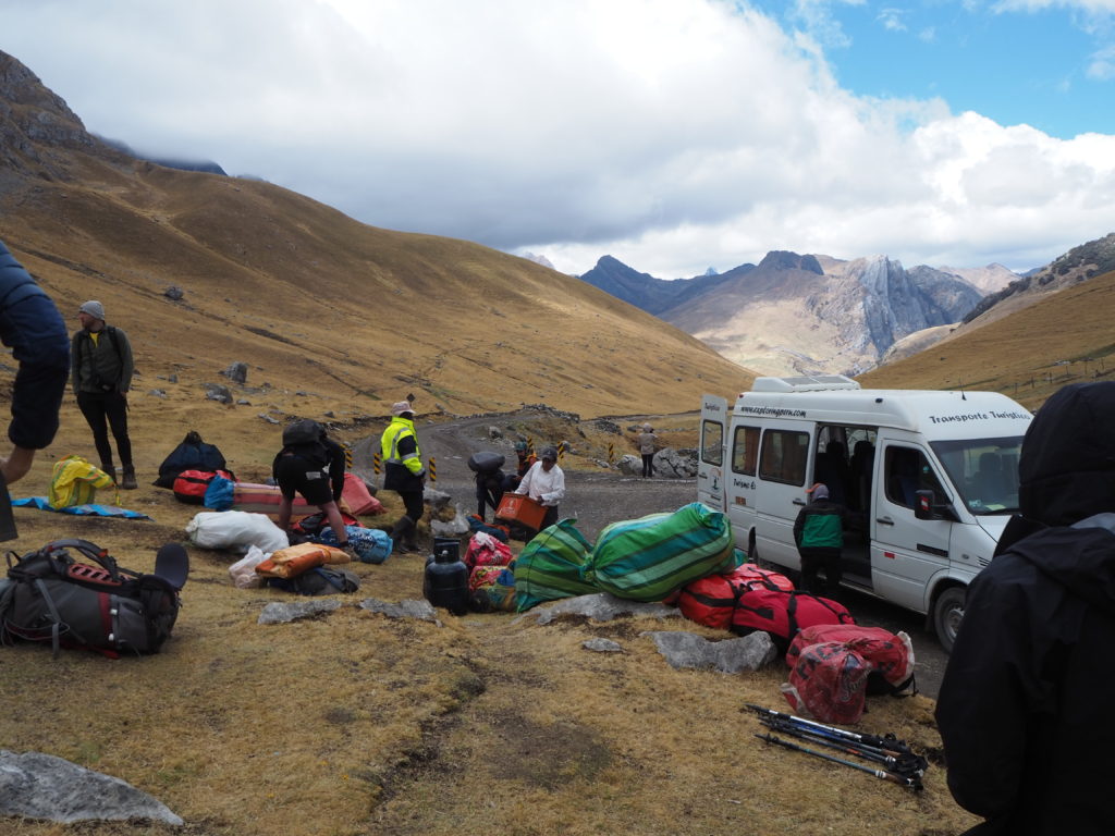
At 3:30AM we get up, get dressed, finish packing our stuff and head down to the lobby to wait for the van. Our van has four other hikers, all a similar age and build to us. Everyone is a early morning zombie, and we just all sit in silence and try to sleep through the bumpy ride. At 6:00 we stop at in a little town for breakfast (Chiquian) and meet four other hikers that are part of our group. There are 10 in our group in total. We got some tea, eggs, and bread for breakfast.
The second half of the drive out follows a dirt road that hugs a lot of hillsides. The driver’s honk before blind corners. Sometimes there’s room for vehicles to pass the other way, but there were maybe two coming back, so it wasn’t really an issue.
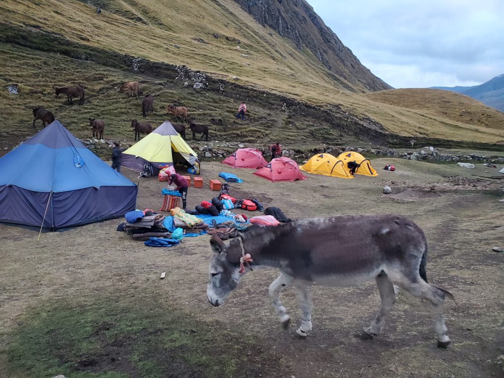
We got to the trail head around 7:00am, all a little more awake than before. We were here! We met our guide, Rosmel, our cook, Chiki, and the two donkey herders, who’s names we unfortunately cannot remember. Rosmel gave us the rundown of what to expect the first day, and we got our snack bags, filled with cookies and fruit. These snack bags would be filled for us every day with various sugary goodies.
Day 1 was a very good indication of who trained for this trek and who didn’t. There were a couple people at the back who didn’t do any preparation and got caught by the altitude. Our poor friend, Matheo, had just come from Australia, and while he shines positivity, he was doing his best to hide his negativity during the first day. He eventually got sorted out by Day 4, and at the end was one of the strongest hikers.
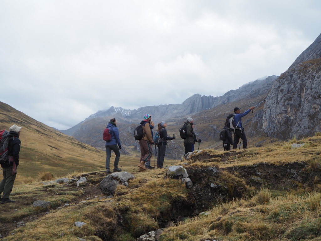
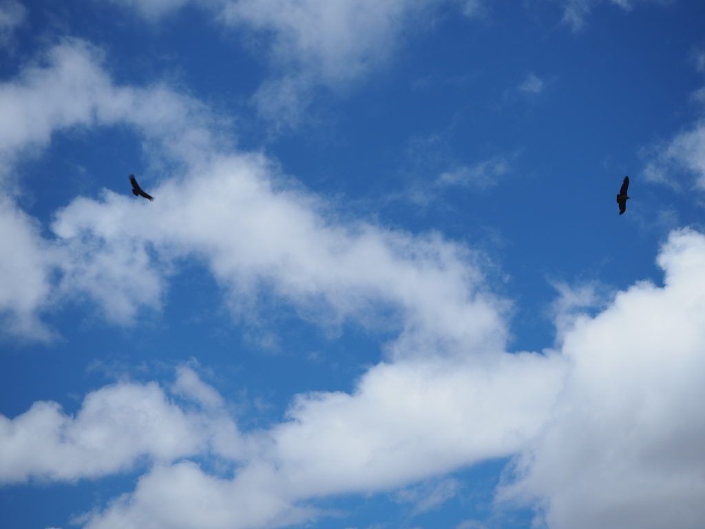
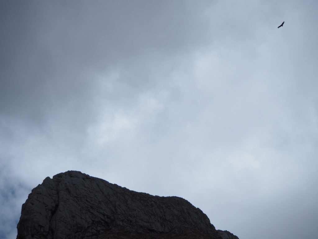
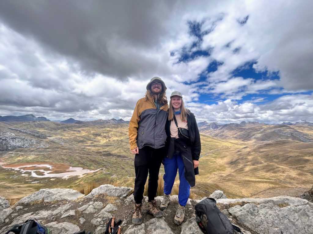
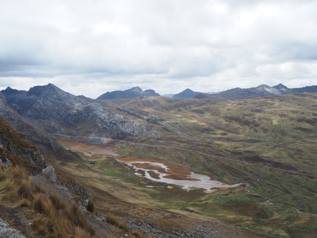
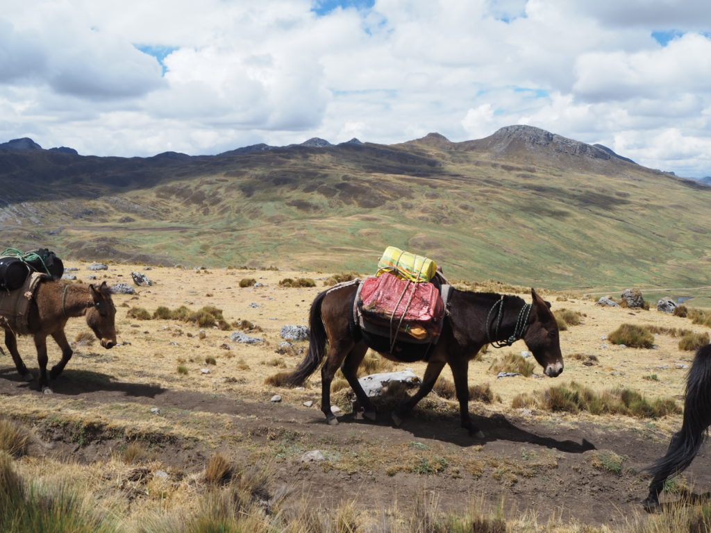
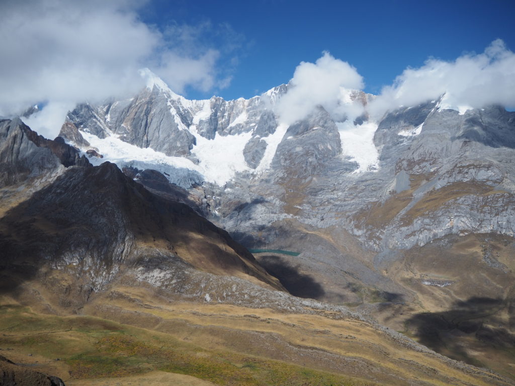
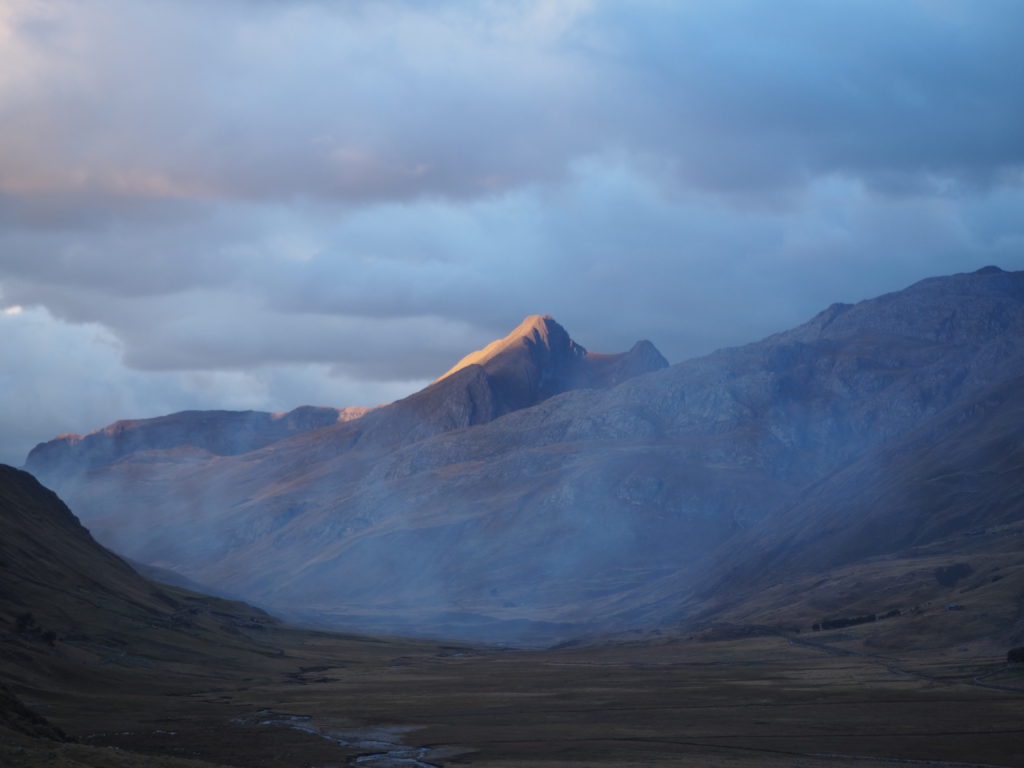
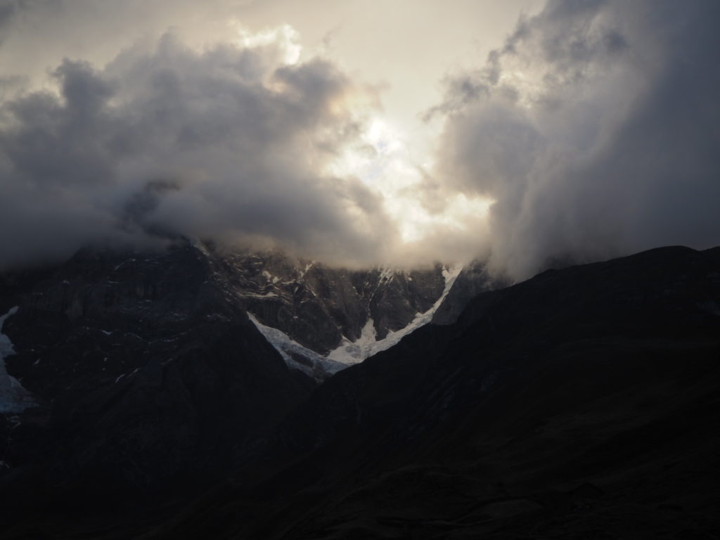
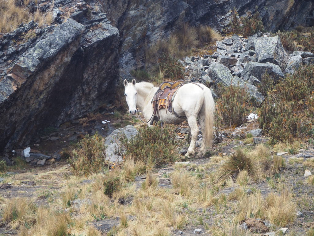
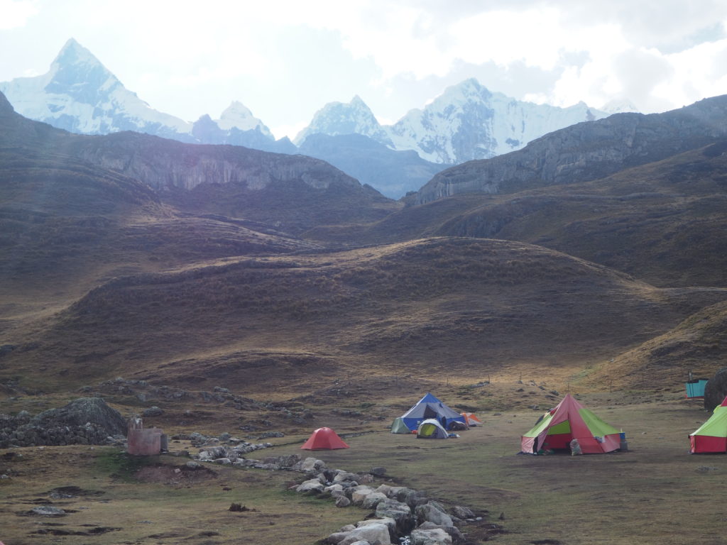
We hiked over a mountain pass that acted as the continental divide. There were condors (massive birds that are considered sacred in the Andes) flying overhead, and we took that as a good omen for the trek. The views off the hop were spectacular, with the Cordillera Blanca to our north. The donkeys carrying our tents and camp gear passed us at the top of the pass. They were generally shy for the whole hike, and didn’t like strangers much.
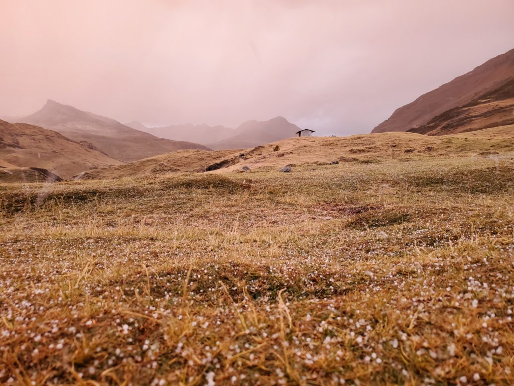
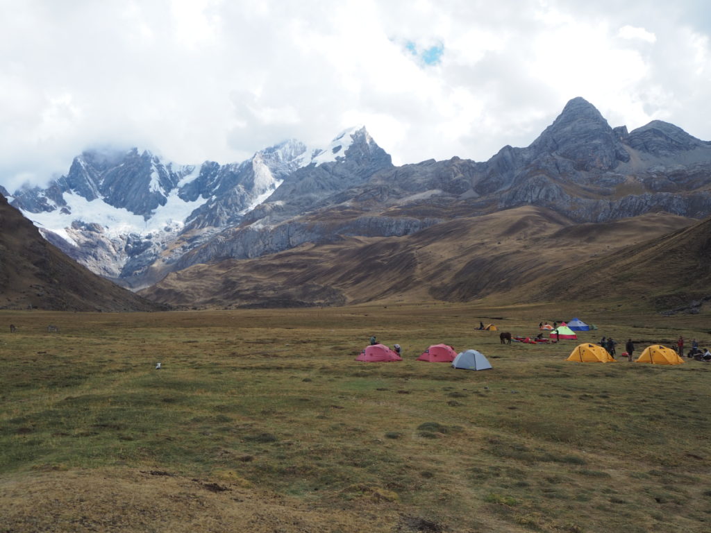
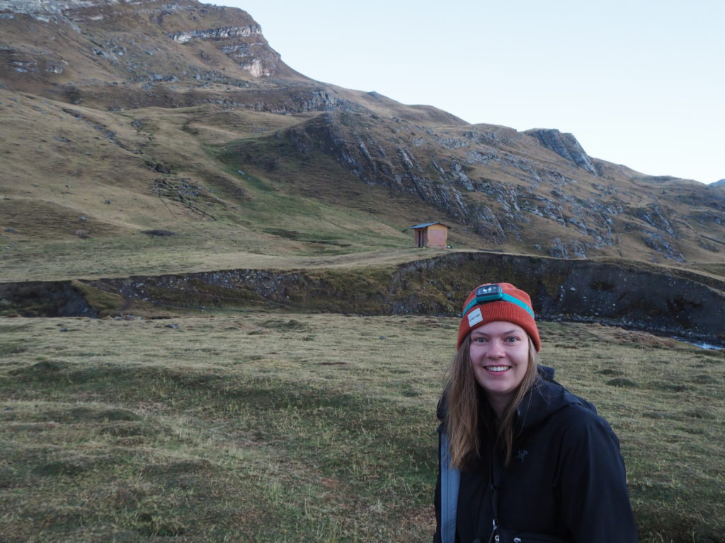
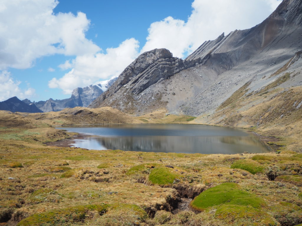
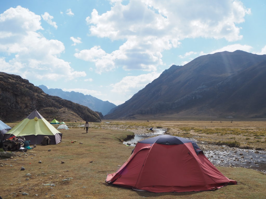
We made it to camp and set up our tent just in time for tea time! The camp was nestled in a valley, with hills (the Andean version) on either side, and a massive front of the Cordillera Huayhuash in front of us. This was our first view of the imposing mountain range that we would spend the next week walking around. There were flushing toilets at the camp, a welcome surprise, though they didn’t have toilet seats or toilet paper. Poor JB, a hiker with us, didn’t get that memo, so he had to borrow from everyone when he had to go. He also didn’t realize that there were donkeys to carry our stuff, so he hauled most of his stuff on his back for the trip (no more room on the donkeys).
We got hot water, some tea (coca, manzanilla, or black) and a snack for tea time. The first tea time snack was crackers and guacamole (the best guacamole ever). Chiki, the chef, did a very good job with all the meals. After tea time the weather turned, hailing for the rest of the evening, but clearing when the sun went down. This was one of two precipitation events we dealt with the whole trip, we had another hailstorm on Day 5. Very little rain throughout the whole thing.
Dinner was two hours later, which consisted of fish, rice, and more tea.
Dinner wraps up around 7:30PM, which is also known as Huayhuash midnight, or time for bed. It is very dark and cold out. We have to walk 100m to the bathroom in the cold, wet mist and then sleep and get ready for the next days ahead.

Day 2
11.3km, 592m elevation, 5:40
Starting Altitude: 4235m
Highest Altitude: 4760m
Camp Altitude: 4175m
Buenas dias time is every day at 5:30am. Breakfast is at 6:00am. The night was very cold. We were tired. We packed up our tent, got dressed and headed to the dining tent for breakfast. Breakfast was tea, bread, and eggs.
The was a pretty easy day as there was an easy option. I (Cam) was feeling very sluggish so I took the short route (9km) and Graham took the longer route. JB came with me and it was a very comfortable hike. We met a super stoned solo hiker that did not look prepared but I think we was fine. He said he did a lot of hiking but his sneakers were falling apart and looked miserable as he had to eat the same thing for every meal.
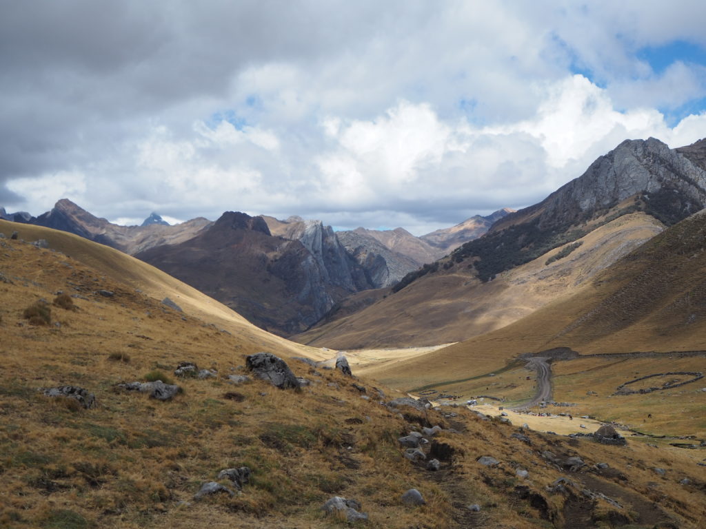
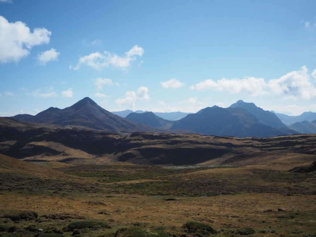
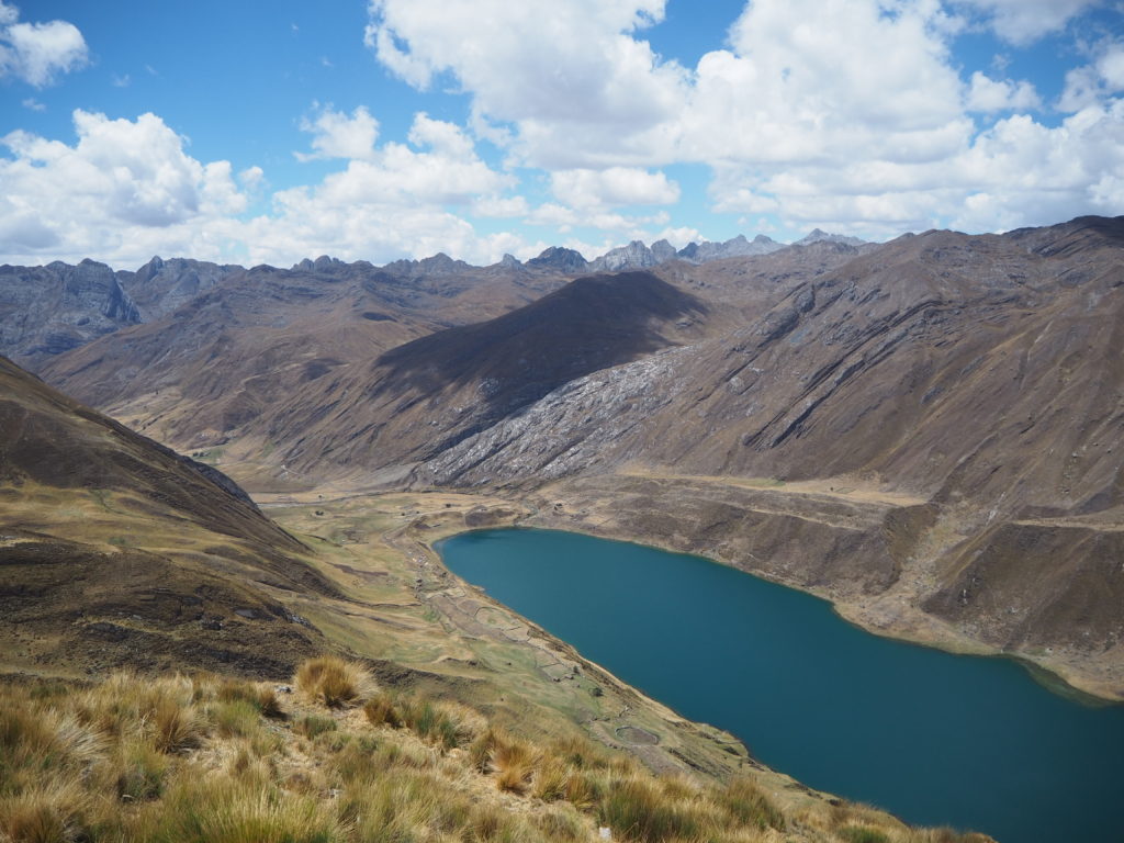
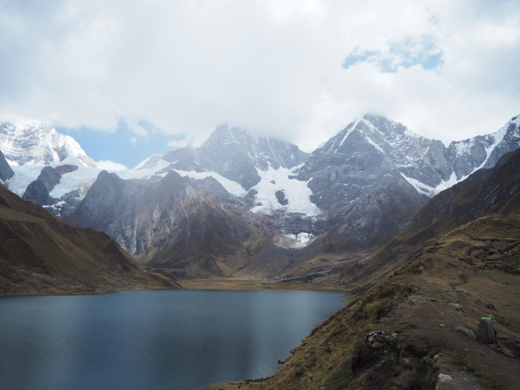
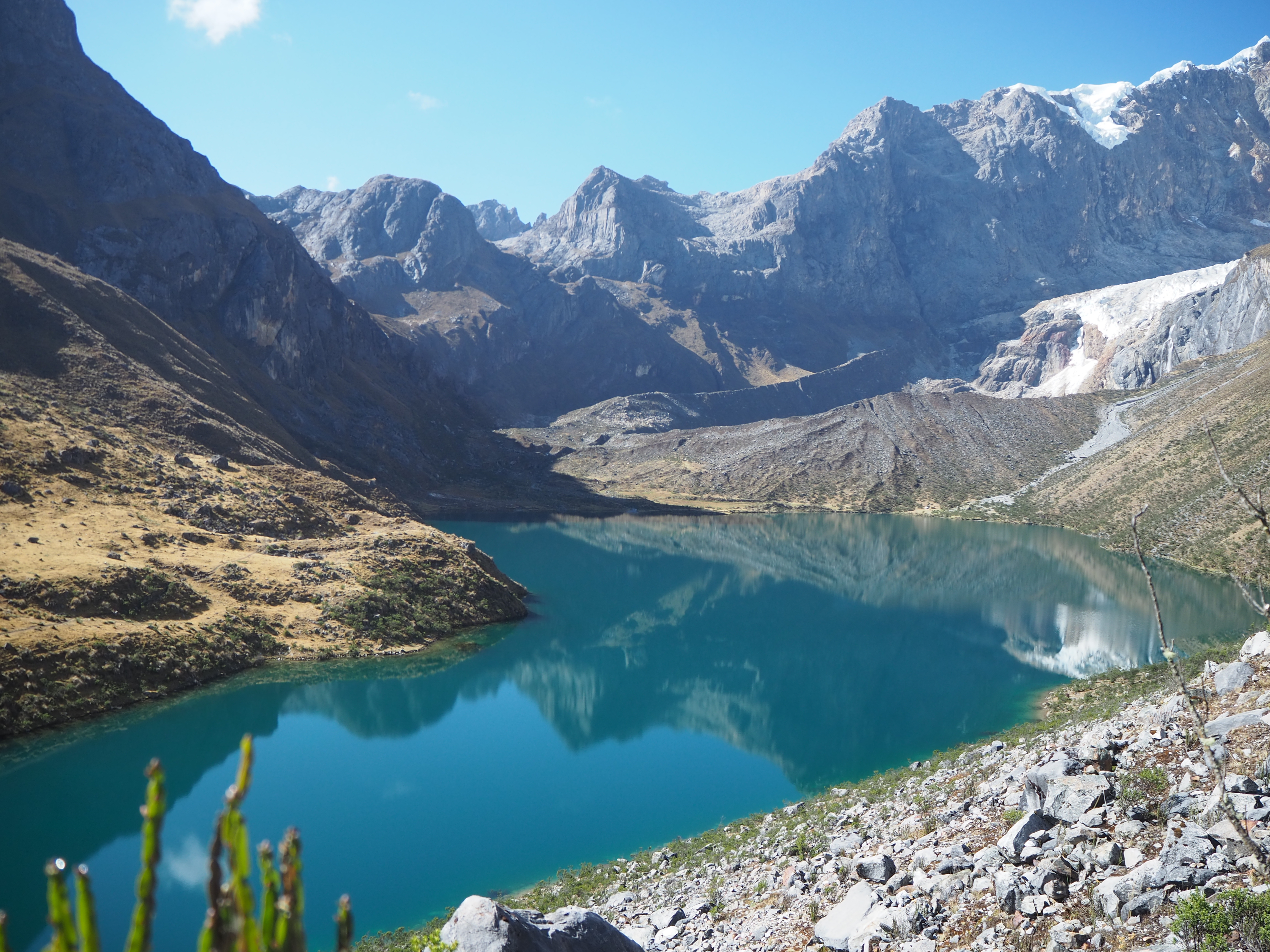
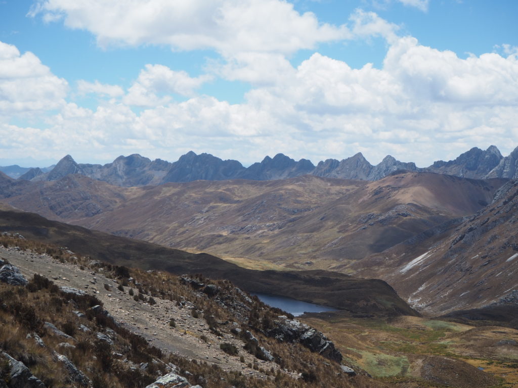
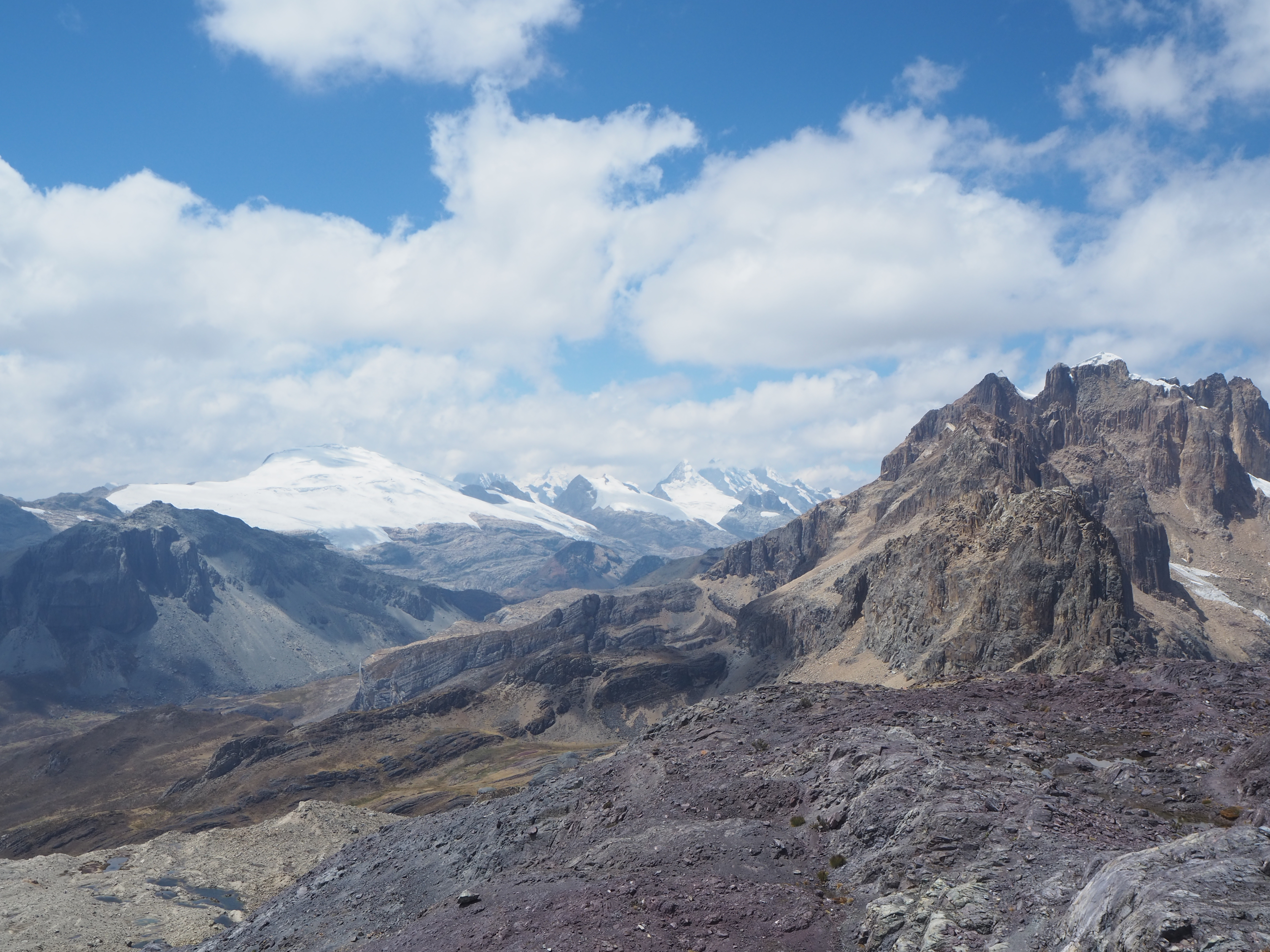
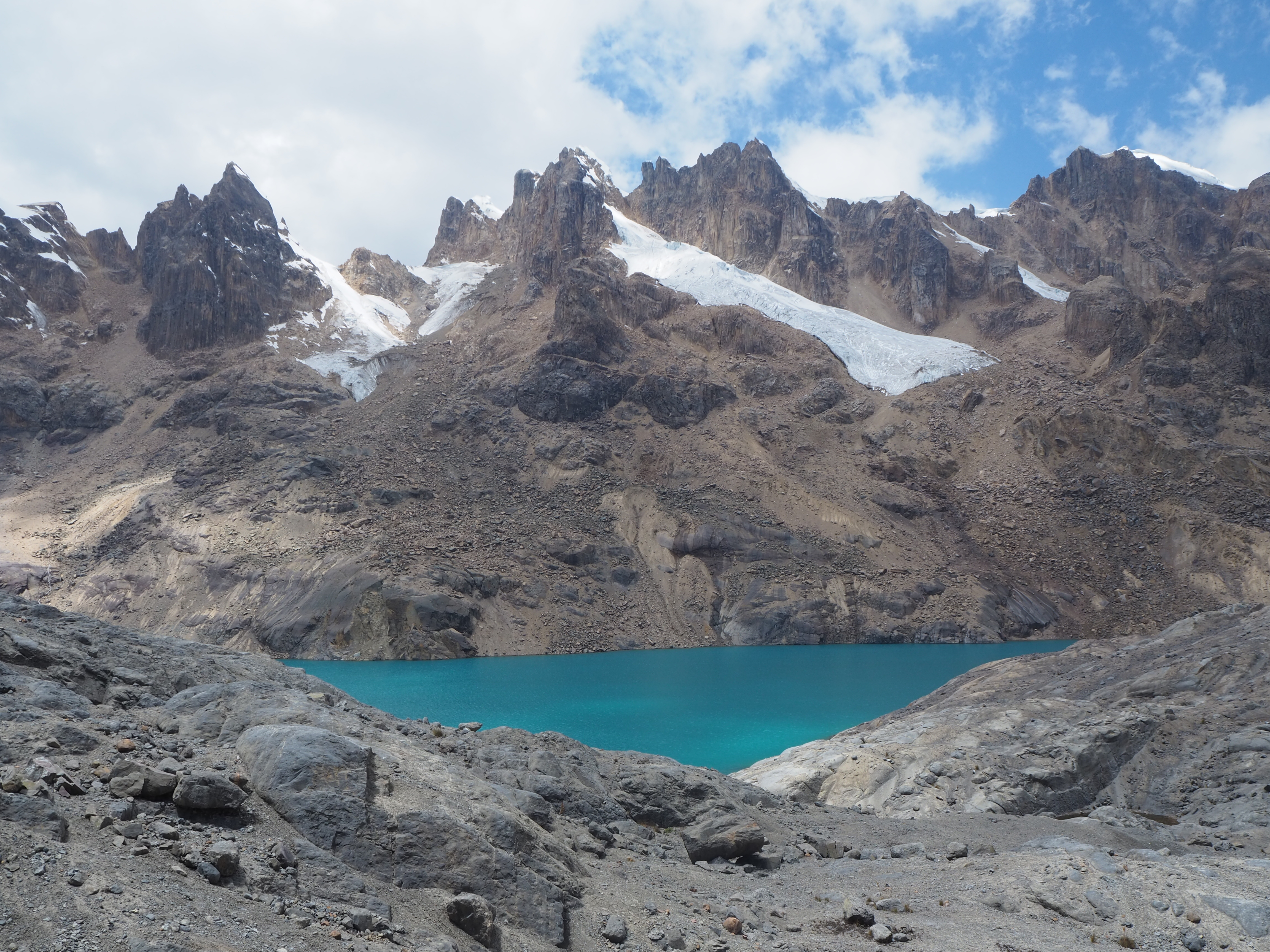
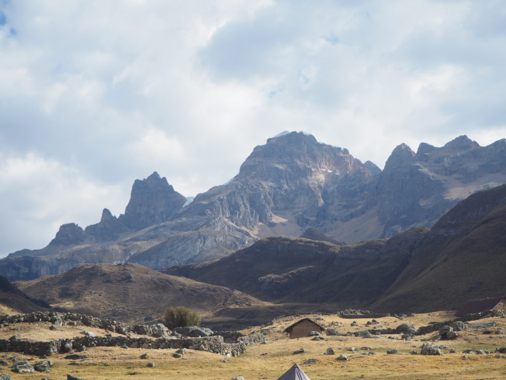
The long route was spectacular. After a small climb, we reached a viewpoint that allowed us to see all of the endless rolling peaks across the Peruvian Andes. We walked along a ridge until another viewpoint, where we could see a second Cordillera Huayhuash peak peeking through, and the lagoon and camp where we would be staying. There was a mad decent down the side of a hill, which was basically a straight shot down to the lagoon.
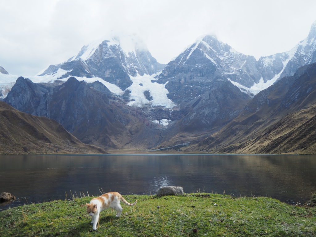
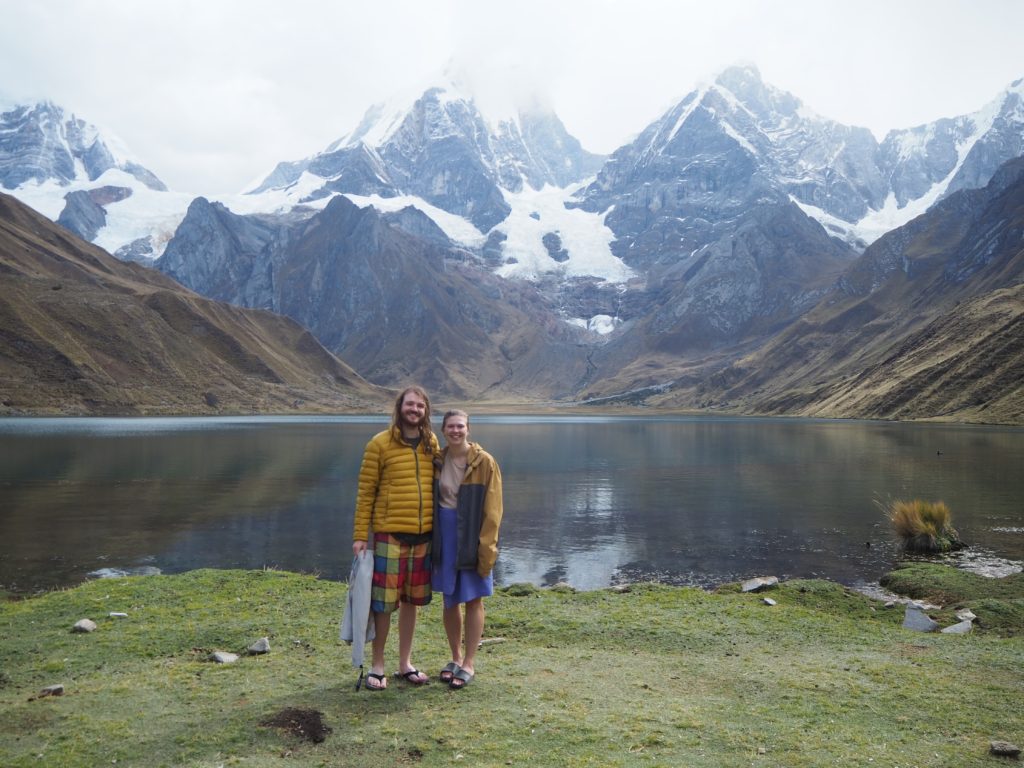
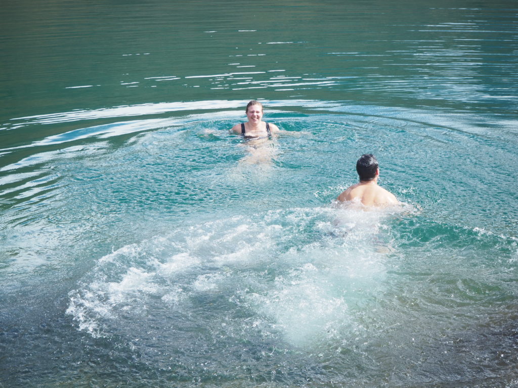
I got to the camp site in three hours, set up the tent and had some tea with Chiki while we waited for everyone else. Once everyone got back to camp, we had some lunch. We had pasta with a carrot ginger garlic sauce and vegetables, which was delicious. The weather was very sunny and warm. We all decided to go for a swim in the lagoon.
Since I am missing the cold plunge at thanksgiving, this is the next best thing. It was a chilly dip, but most of the group did it. It’s probably the prettiest swim any of us will ever have.
After the swim, I taught the group 7-up, 7-down, and other card games until tea time (I think we had popcorn with our tea). We all just hung out and played cards while we waited for dinner. Then we had some tea before our guide, Rosmel, comes into the tent to explain “mañana mañana,” the plan for the next day, and then we go to bed.
Day 3
14.5km, 725m elevation, 7:03
Starting Altitude: 4175m
Highest Altitude: 4805m
Camp Altitude: 4340m
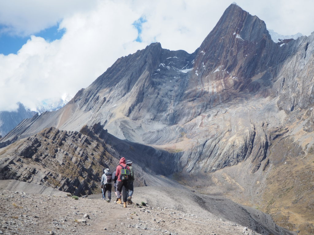
Day 3 was a brilliant day. The morning was exactly the same, a cold frantic rush to take down our tent and get in the dining tent for some warm tea and breakfast. But it only got better from there.
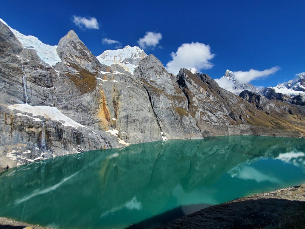
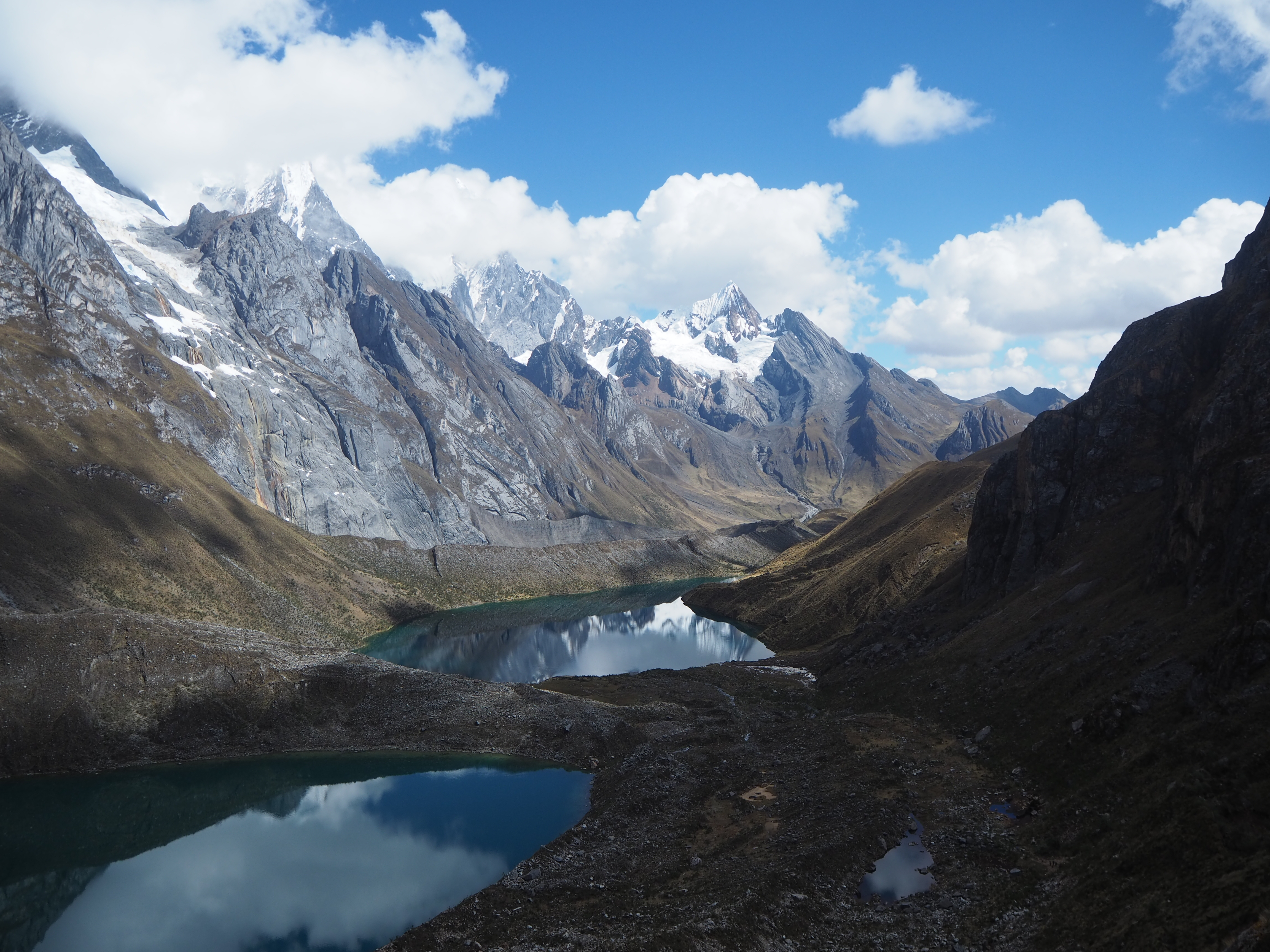
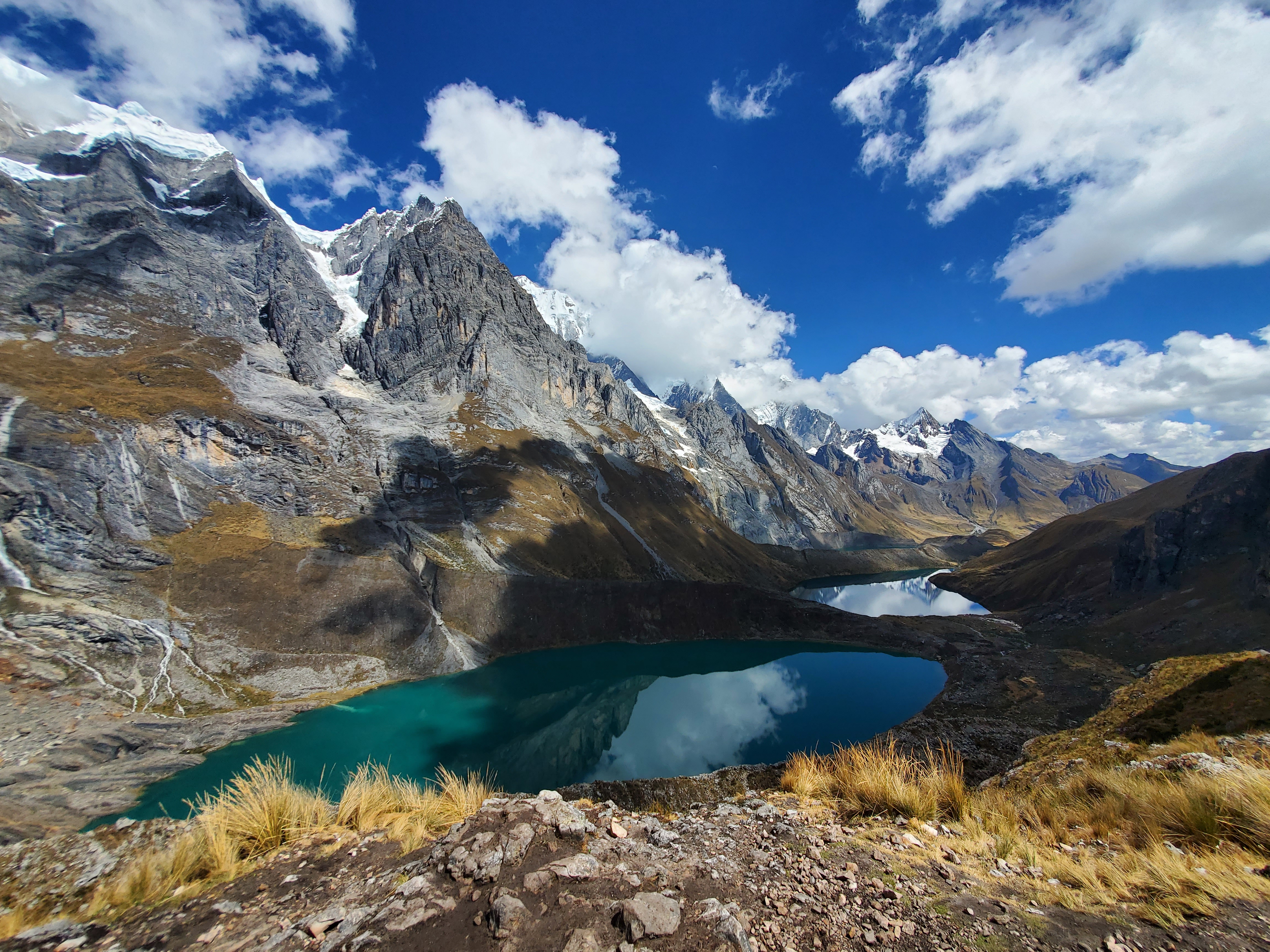
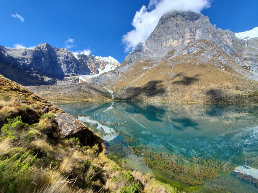
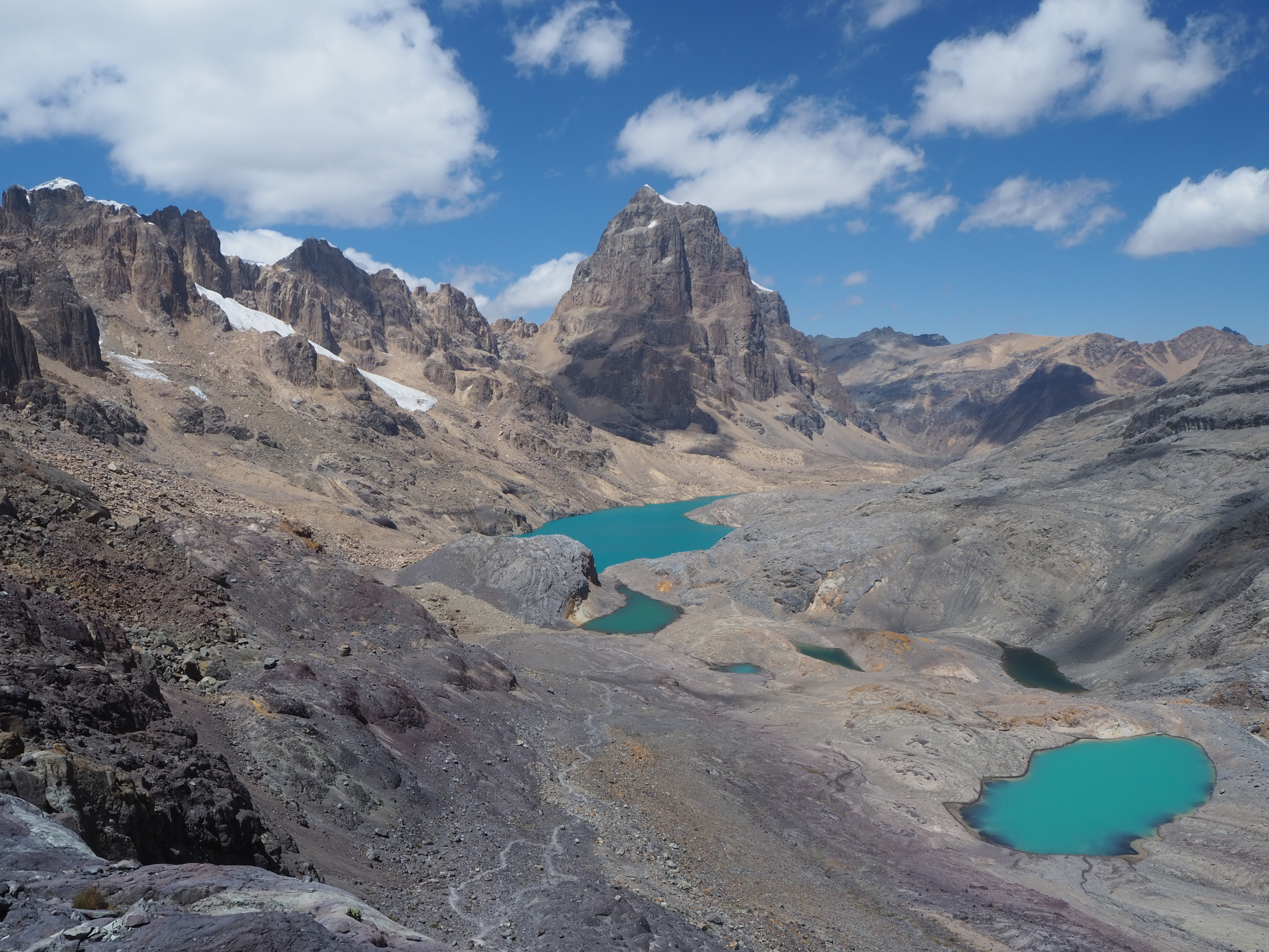
We walked around the lagoon from camp, and began our slow ascent to the mirador Tres Laguna’s, a viewpoint of three lagoons, and the most famous photo from the trek. Before we got there though, we took a quick detour to another mirador, where we witnessed some avalanches crash into a deep blue lagoon.
Mirador Tres Laguna’s was quite lovely. We crushed our snacks, including an granadilla (fruit similar to passion fruit), and saw three lagoons laid our wonderfully before us. A decent amount of time was spent here, before departing for another pass to meet with Chiki for lunch. A nice lunch of chicken rice was served. Our outdoor meal had the viewpoint of layers of mountains disappearing into the horizon. We began the long and flat decent to the camp, which went on a little longer than we would have liked. But the ground was incredibly soft, covered in moss and peat.
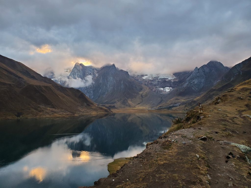
Camp 3 was a nice camp, and our last calm night for a bit. We were slightly removed from the direct views of Huayhuash, in a long and flat valley. Streams crisscrossed the landscape. Plenty of moss on the ground. The group has somewhat settled into an evening routine at this point. We all take some downtime between when we arrive to camp and tea time, and then play various card games (7s, president, spit) until dinnertime. Rosmel gives us our pep talk for the next day, they we immediately get ready for bed. Our card group would always have our friends George, Ruby and Senon, and occasionally JB and Matheo.
Day 4
13.2km, 790m elevation (Estimated. Phone ran out of battery)
Starting Altitude: 4340m
Highest Altitude: 5150m (Est)
Camp Altitude: 4500m
This was a tough day. But a fantastic day. The views and vibes were brilliant. Everyone was still chipper in the morning, at least as much as you can be at 6:00AM in the mountains. George was falling into a bad habit of sleeping in and missing much of breakfast. Breakfasts always varied between pancakes, or eggs and bread. There was always tea.
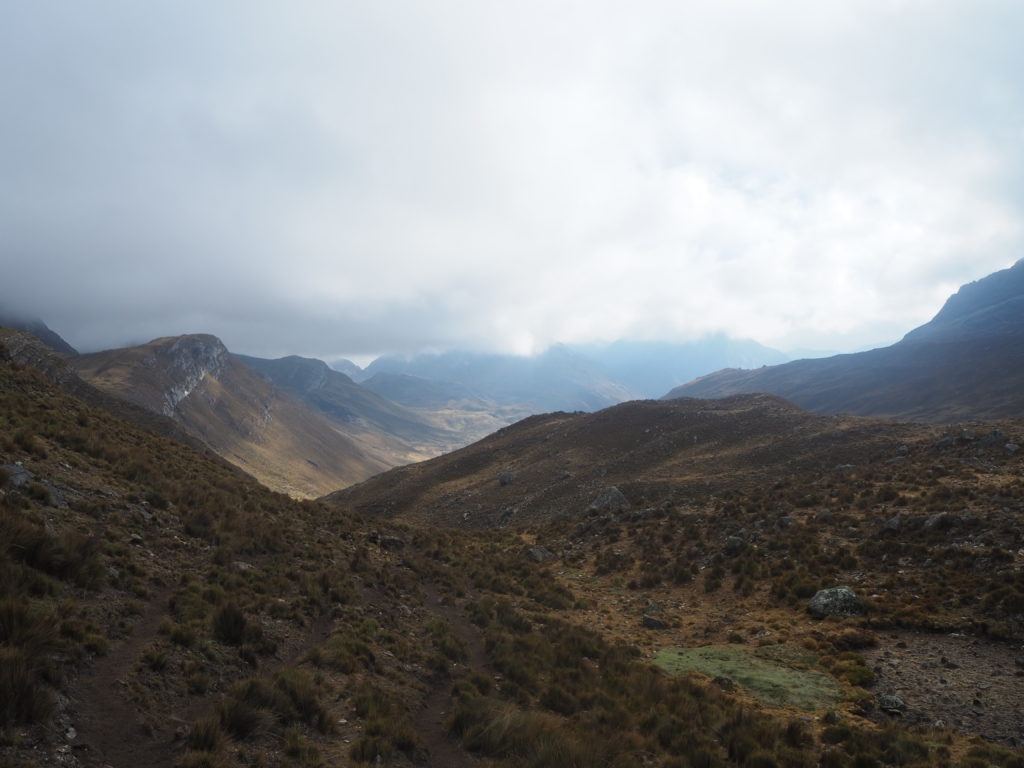
We loosely followed our camp creek upstream to start the morning. It was quite a foggy morning. Everything was wet from the dew. Our sightlines to the mountaintops were greatly reduced. This had the group nervous, as today was going to be the high point of the hike, and its only worth it if we can actually see the mountains.
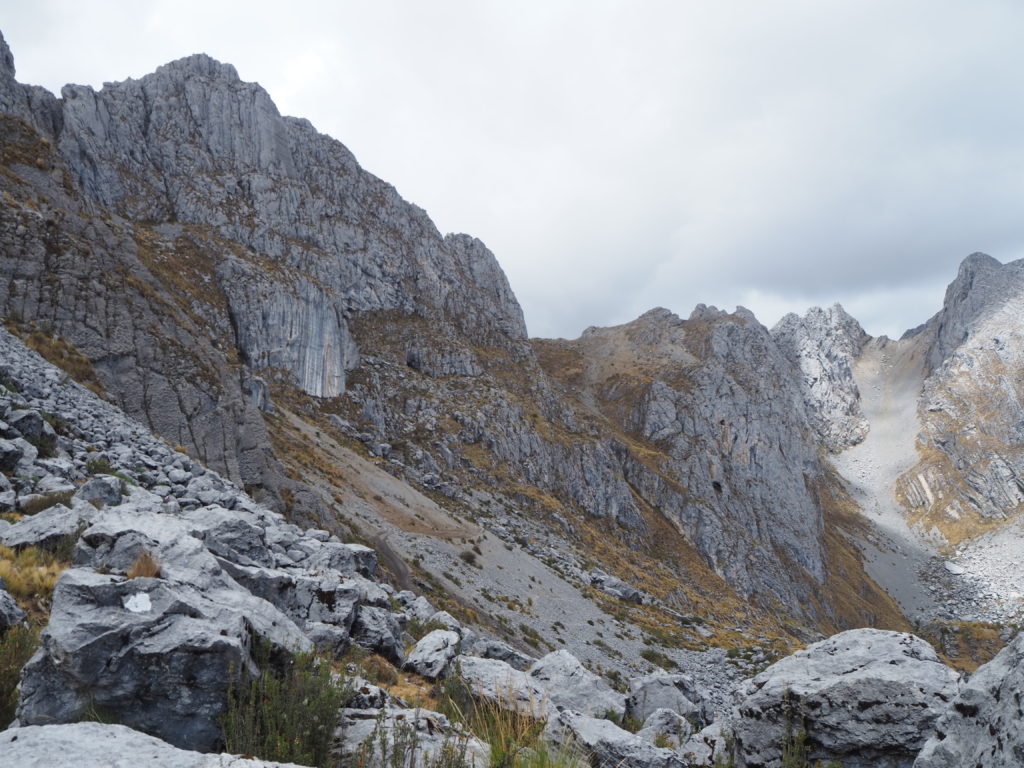
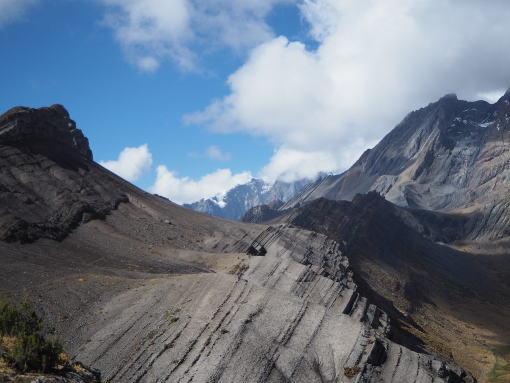
As we kept climbing, both the fog and the vegetation began to clear up. On the ground, the small grasses, shrubs, and cow patties were replaced by rocks and stones of various sizes. In the sky, the grey mist was being replaced by a magnificent partly cloudy sky.
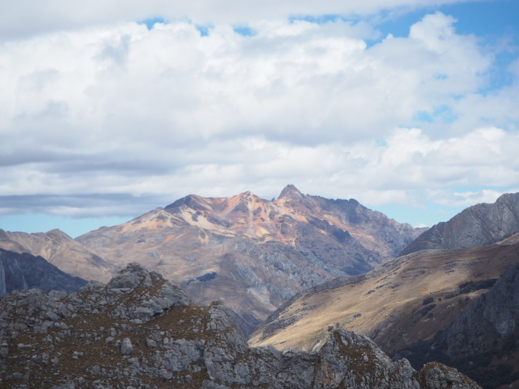
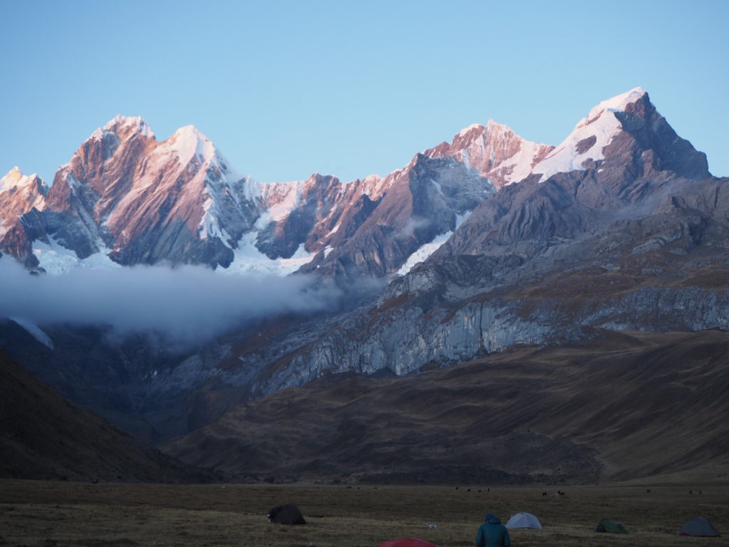
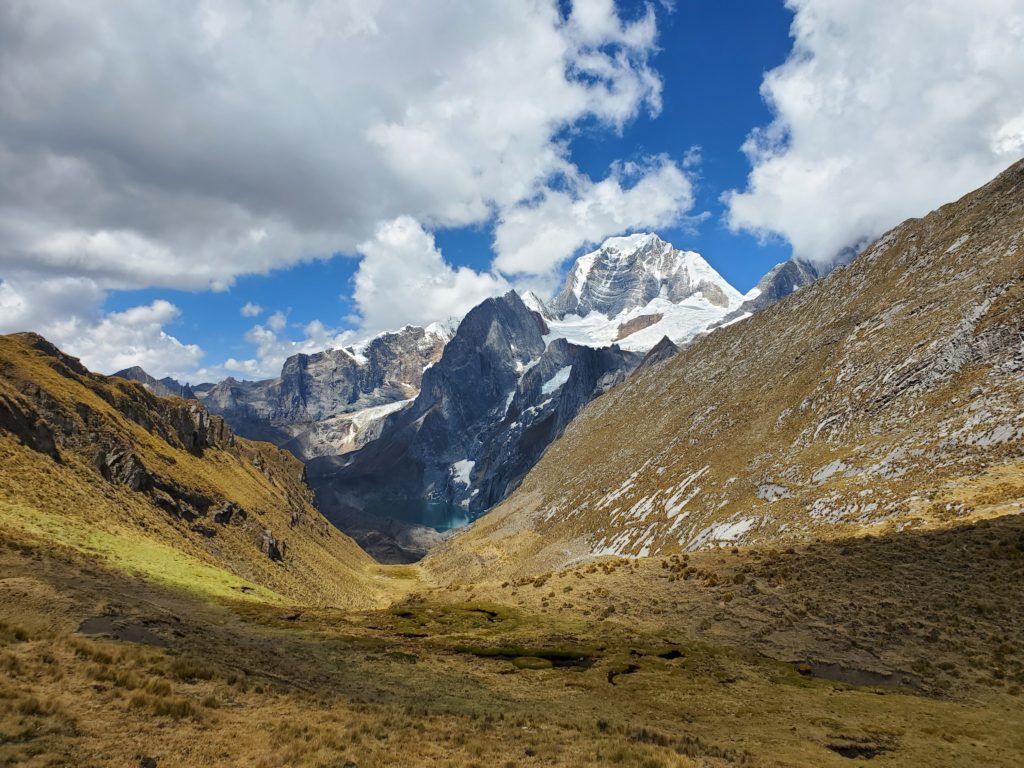
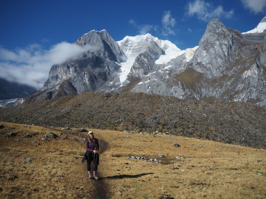
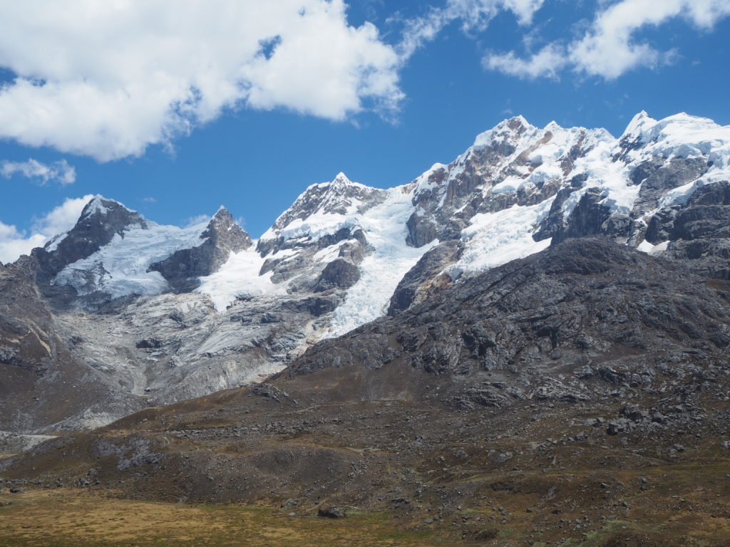
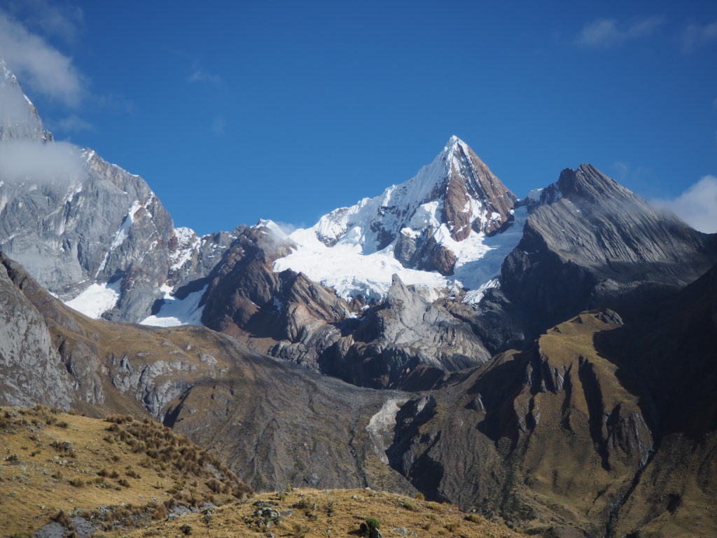
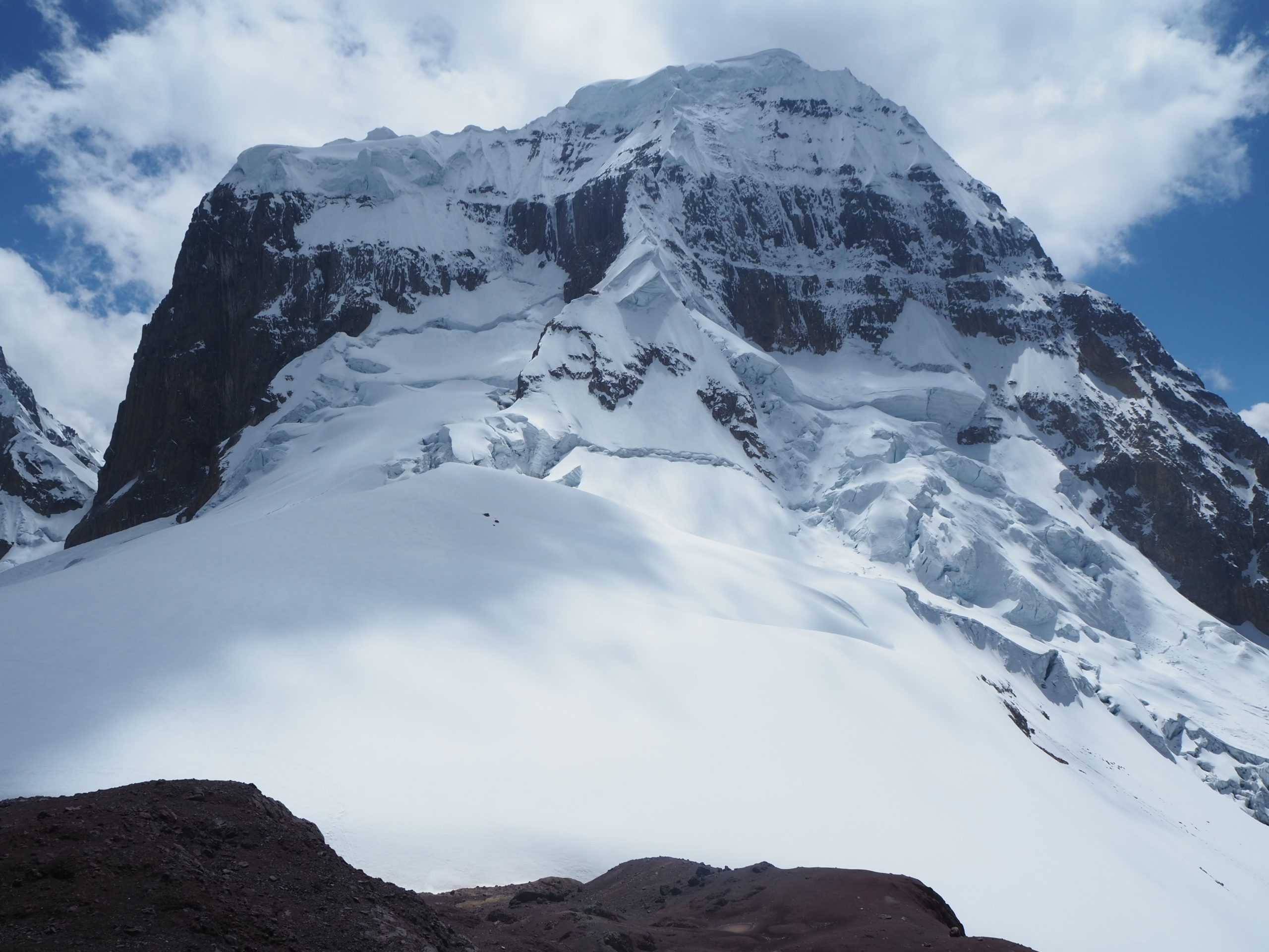
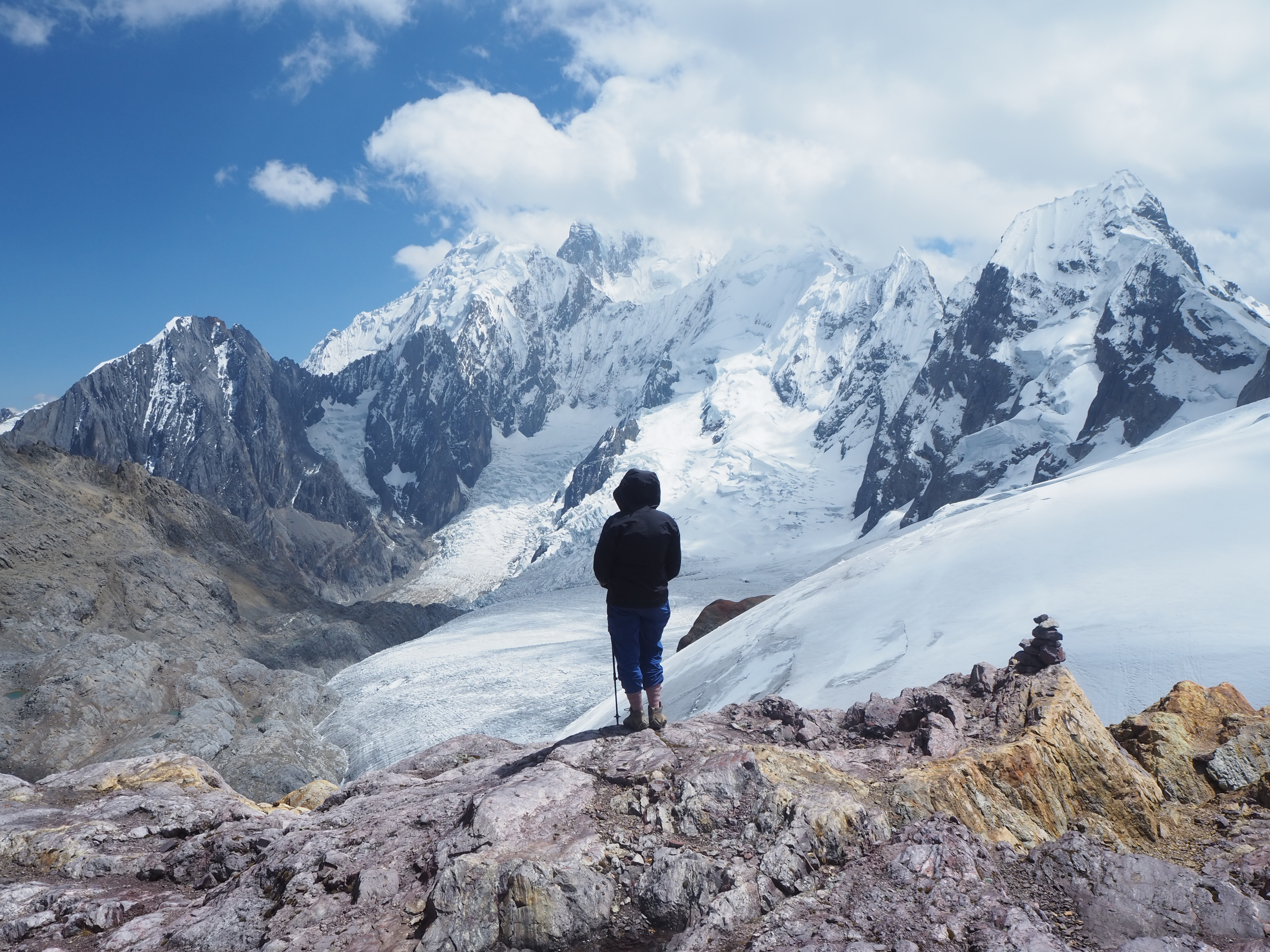
Finally, we could see the ridge we needed to summit. The mountains began changing colour, the greys replaced with reds and purples. To our right was a glacier within walking distance, and a peak almost in view above it. The whole day was coming together.
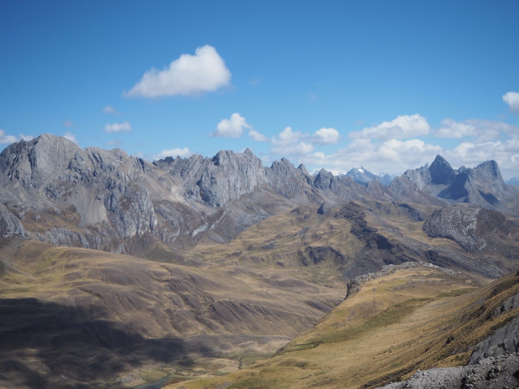
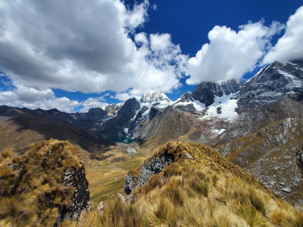
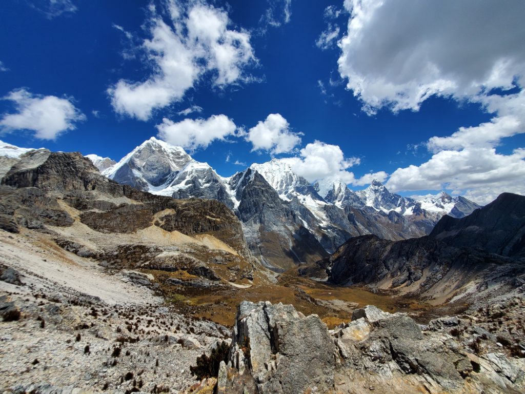
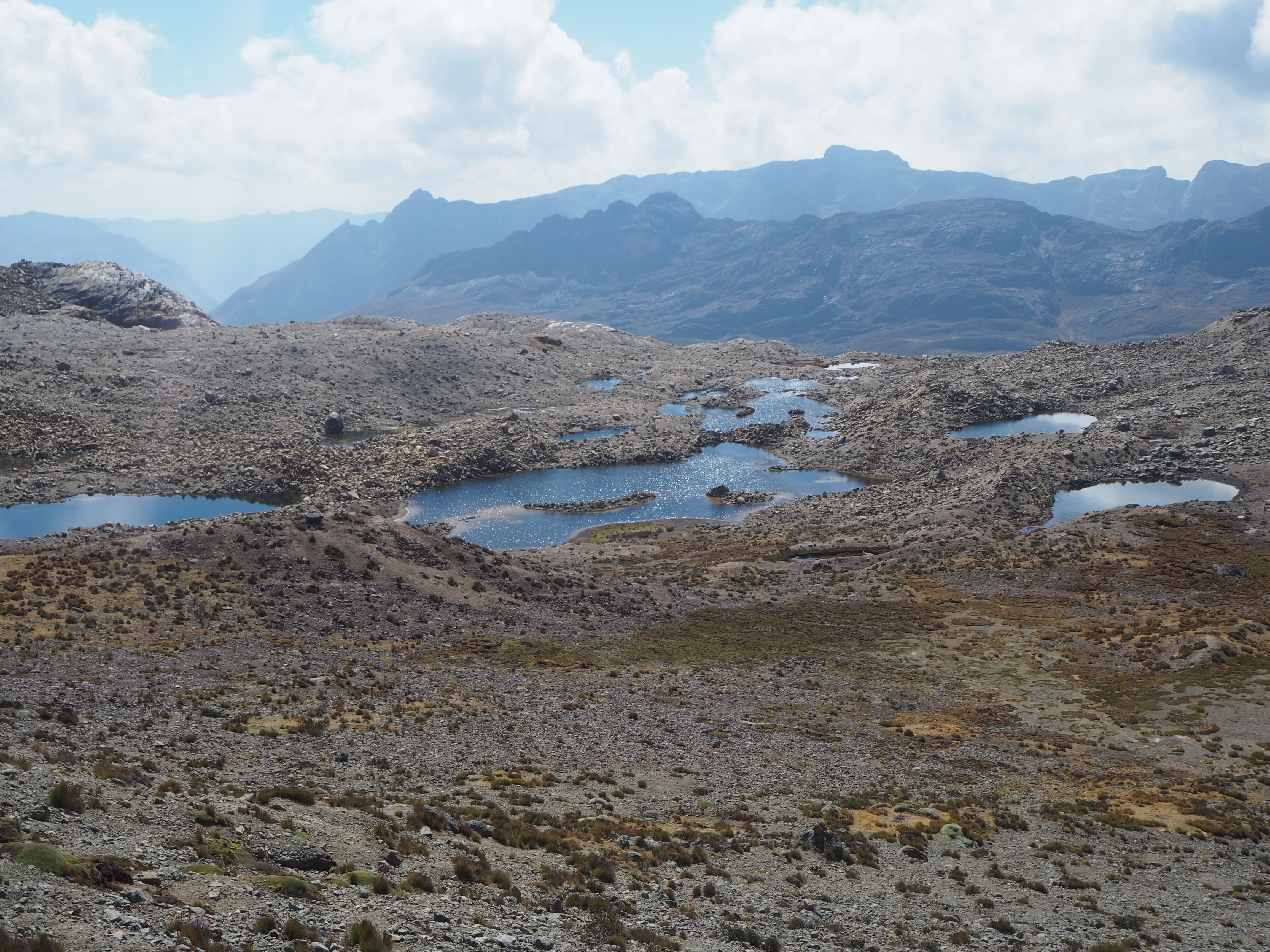
As we made it to our ridge, the mood was the best of the hike. Behind us were endless mountains stretching out to the horizon. To our right was another face of the glacier mountain, this time with no clouds around us. And in front was what can only be described as a moon valley. A completely different type of rock stuck vertically up out of the ground in large mounds. Stark blue lagoons imprinted themselves on this otherwise sepia tone landscape. There was no vegetation in sight. Before we could head down moon valley though, we had another summit to climb.
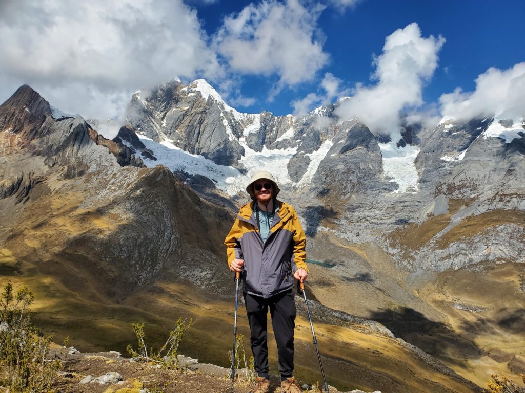
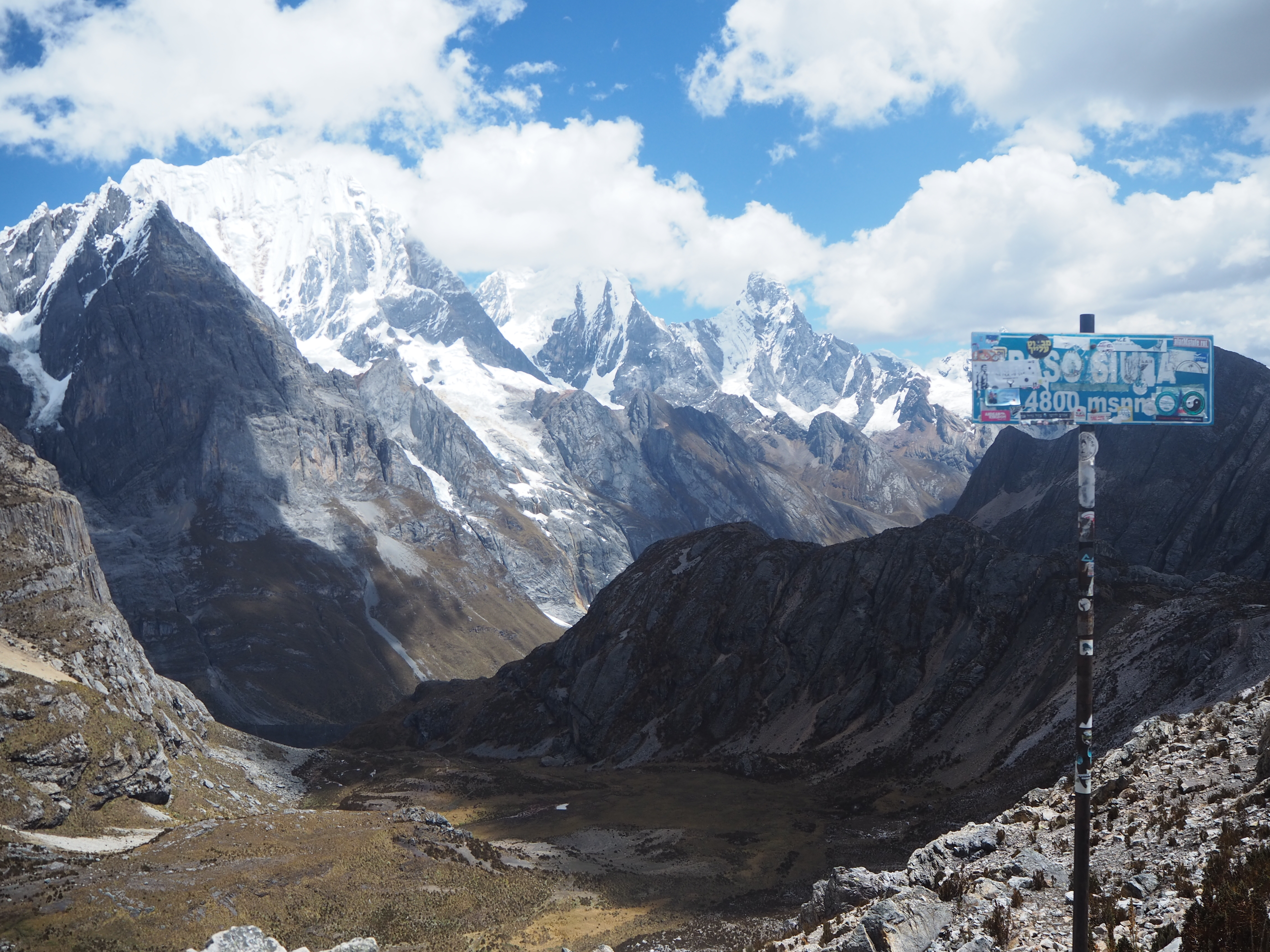
We spent half an hour climbing up the purple rock to a peak, which would end up being the high point of the entire journey. On the other side of this peak was the glacier we saw earlier. But the full version of it, not just the arm we had seen before. With the glacier was every other peak in the Cordillera Huayhuash, all surrounding a large ice filled bowl. The clouds had all but disappeared for the moment, as if nature was lifting the curtains on a Broadway show just for us. We celebrated this summit with many cheers, before we all got too cold from the altitude and wind. We then descended into moon valley towards our camp.
This valley is a unique landscape. There is no vegetation anywhere. The rocks have been clearly weathered by massive glaciers that used to live in the Andes. The trail was mostly up and down, before a small but steep descent towards our camp. We had a really good view of a towering half glaciated mountain behind us, and a long valley in front of us. To our right was a steep pass, which we would cross tomorrow.
It was this evening that a dog came to our camp. We had this before, there are strays that live on this circuit, scavenging food from the dining tents. But this dog was different. We unlovingly called her F***off, but we will call her Effo in this blog. Effo initially warmed our hearts. We fed her the chicken bone scraps from the evening. She was always good for a scratch and a pet. But then the sun set and we went to bed. Effo didn’t really like that. She got scared easily. Or she was cold. But whatever it was, she wouldn’t shut up. Battles of barking from her and swearing from us rang throughout the night. Until, out of nowhere, they fell silent.
That’s all we have in us writing for now! We will share the last four days of this hike, and our remaining time in Huaraz, in the next blog. The second half of this hike features the hardest hiking days, the best views, sicknesses, injury, and much more adventure. We will see you there!
Amazing journey. Certainly not for the faint-of-heart or weak-kneed (which I probably am. I get winded walking up the 130 steps from Whitemud Creek to Lansdowne)! Beautiful photos. Great stories.
(I am nervous to read your next blog – illness and injury – oh my! But knowing that you are well enough to tell us you will be writing about that give us some relief).
We will miss you with the polar bear dip in Cold Lake this year. Glad you could take a substitute plunge – and in daylight too!
Su
What an interesting bedtime story! It is past midnight and I was concerned today as I had not seen a written blog from you in some time -it just didn’t show up for me but talking to Susan at our evening 10 pm call she said she had read your blogs so I finally was able to find and open your writings, of which you do a fantastic job. Do you write it all after each daily experience ? The scenery is breathtaking in the pictures. Looking forward to your next writing! Hugs!
we try and write about our travels as soon as we can. We did not bring the laptop hiking so we write after we get back so we dont forget too much.
Also nervous… do share. Spectacular stories and photos.
Stunning landscapes, an odyssey of alpine struggle and beauty, the yin and yang of up and down. Be proud of yourselves, my vicarious envy doesn’t extend to the early a.m. starts. Look forward to next installment!
What a journey! Your photos are so beautiful. Thanks for sharing.